Yemen Control Map & Report – June 2018 (Subscription)

SUBSCRIBERS CLICK HERE TO PROCEED TO ARTICLE AND MAP

(To see other maps in this series, view all Yemen articles on PolGeoNow.)

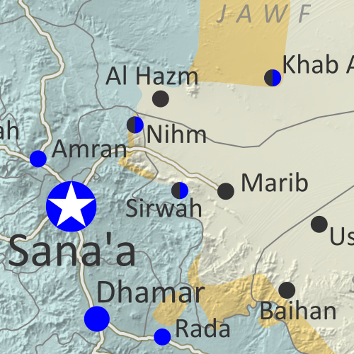
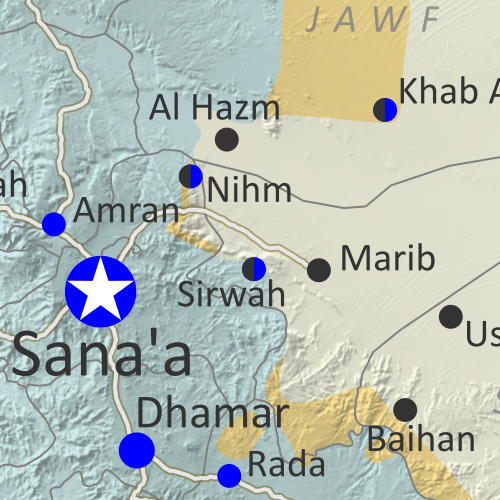
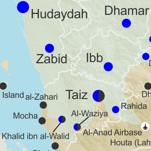
Map of what is happening in Yemen as of June 16, 2018, including territorial control for the unrecognized Houthi government and former president Saleh's forces, president-in-exile Hadi and his allies in the Saudi-led coalition and Southern Movement, Al Qaeda in the Arabian Peninsula (AQAP), and the so-called Islamic State (ISIS/ISIL). Includes recent locations of fighting, including Hodeida, Al Faza, Al Tuhayata, and more. Colorblind accessible.

Subscribe for full access to all conflict map reports!

Timeline by Djordje Djukic. Map by Evan Centanni, Djordje Djukic, and onestopmap.com

Since April, Yemen’s Saudi-led coalition has resisted increasing internal divisions to gain some ground against the rival Houthi government, as well as Al Qaeda forces in the east. Now, the coalition is making a concerted push to capture the Houthi-held city of Hodeida, Yemen’s main port on the Red Sea.

See all this and more on the newest update to PolGeoNow’s Yemen territorial control map, which includes a timeline of changes and important events since our previous Yemen map report in April.

This map and report are premium content available to paid subscribers of the PolGeoNow Conflict Mapping Service.

Want to see before you buy? Check out our most recent FREE SAMPLE Yemen map report!

Exclusive report includes:

  • Up-to-date map of current territorial control in Yemen, color-coded for the pro-Hadi coalition, Houthi/Saleh forces, Al Qaeda in the Arabian Peninsula (AQAP), and the so-called “Islamic State” (ISIS/ISIL).
  • Detailed indication of town-by-town control, including provincial boundaries, all major cities, and many smaller ones
  • Markers for recent areas of fighting, including Hodeida, Al Faza, Al Tuhayata, and more
  • Timeline of changes to the situation since April 14, 2018, with links to sources

SUBSCRIBERS CLICK HERE TO PROCEED TO ARTICLE AND MAP

Not a member yet? Click here to learn more about our professional subscription service!

Can I purchase just this map?
This map and report are not available for automated purchase to non-subscribers. If you need access or republication rights for only this map report, contact service@polgeonow.com for options.

Yemen Control Map & Report – April 2018 (Subscription)

SUBSCRIBERS CLICK HERE TO PROCEED TO ARTICLE AND MAP

There are newer versions of this map available. To see them, view all Yemen articles on PolGeoNow.
 
Map of what is happening in Yemen as of May 21, 2017, including territorial control for the unrecognized Houthi government and former president Saleh's forces, president-in-exile Hadi and his allies in the Saudi-led coalition and Southern Movement, Al Qaeda in the Arabian Peninsula (AQAP), and the so-called Islamic State (ISIS/ISIL). Includes recent locations of fighting, including Azzan, Habban, Maydee, Nihm, and more.

Subscribe for full access to all conflict map reports!

Timeline by Djordje Djukic. Map by Evan Centanni, Djordje Djukic, and onestopmap.com

In the past three months, the civil war in Yemen has been marked by infighting within the Saudi-led coalition, while those forces have made only small progress against the Houthis and Al Qaeda.

See all this and more on the newest update to PolGeoNow’s Yemen territorial control map, which includes a timeline of changes and important events since our previous Yemen map report in January.

This map and report are premium content available to paid subscribers of the PolGeoNow Conflict Mapping Service.

Want to see before you buy? Check out our most recent FREE SAMPLE Yemen map report!

Exclusive report includes:

  • Up-to-date map of current territorial control in Yemen, color-coded for the pro-Hadi coalition, Houthi/Saleh forces, Al Qaeda in the Arabian Peninsula (AQAP), and the so-called “Islamic State” (ISIS/ISIL).
  • Detailed indication of town-by-town control, including provincial boundaries, all major cities, and many smaller ones
  • Markers for recent areas of fighting, including Hays, Kirsh, Nihm, Ketaf, and more
  • Timeline of changes to the situation since January 6, 2018, with links to sources

SUBSCRIBERS CLICK HERE TO PROCEED TO ARTICLE AND MAP

Not a member yet? Click here to learn more about our professional subscription service!

Can I purchase just this map?
This map and report are not available for automated purchase to non-subscribers. If you need access or republication rights for only this map report, contact service@polgeonow.com for options.

Yemen Control Map & Report – January 2018

There are newer versions of this map available. To see them, view all Yemen articles on PolGeoNow. 

This is the first edition of our newly-redesigned Yemen control map, which has been optimized to match our maps of control in Syria, Iraq, Libya, and Somalia.
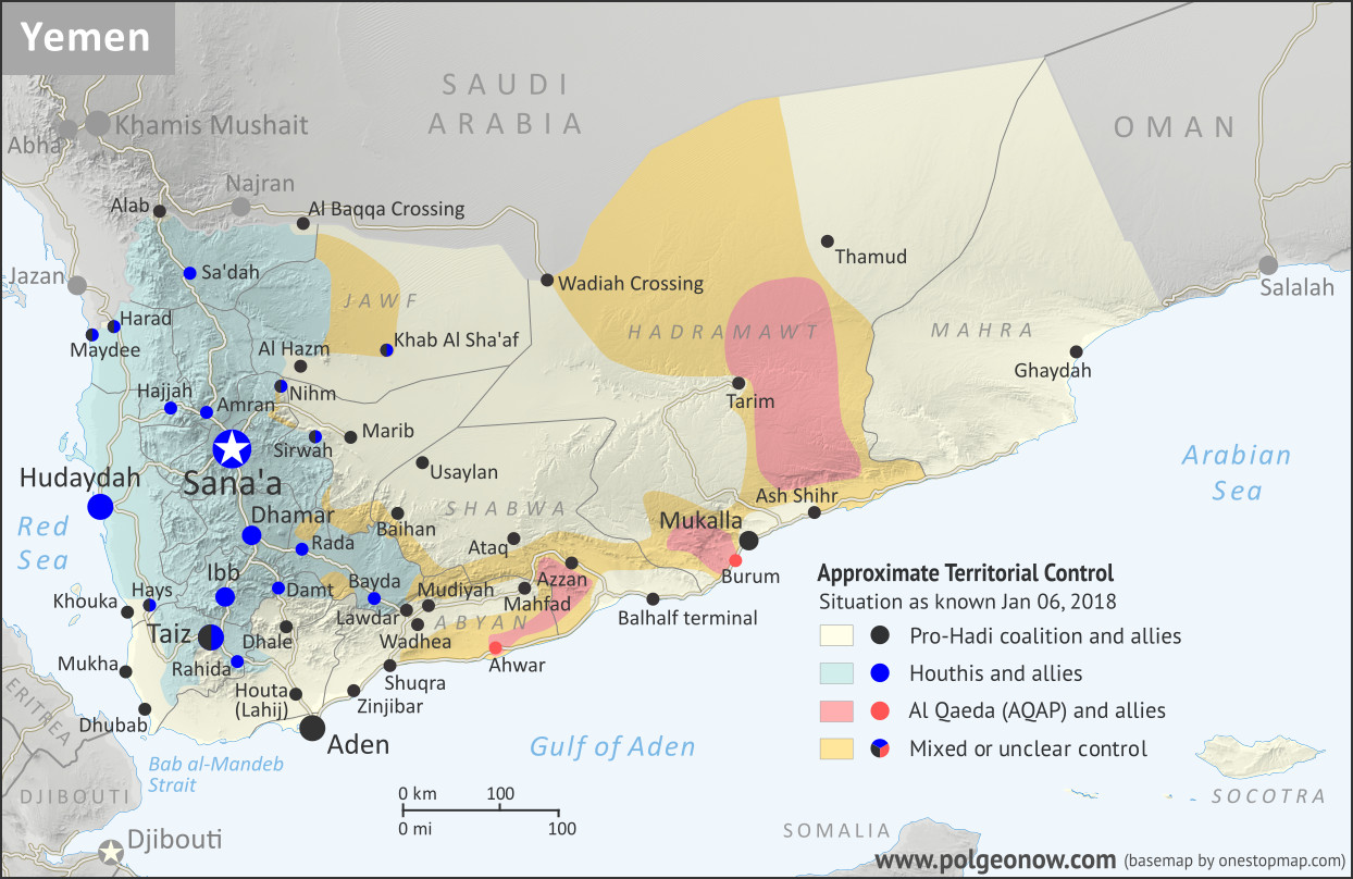
Map of what is happening in Yemen as of January 6, 2018, including territorial control for the unrecognized Houthi government and former president Saleh's forces, president-in-exile Hadi and his allies in the Saudi-led coalition and Southern Movement, Al Qaeda in the Arabian Peninsula (AQAP), and the so-called Islamic State (ISIS/ISIL). Includes recent locations of fighting, including Mudiyah, Khoukha, Hays, Khab Al Sha'af, and more. Colorblind accessible.
Map by Evan Centanni and Djordje Djukic, from base map by Koen Adams of onestopmap.com. All rights reserved.

(Subscribers click here to view this article in the member area)

Timeline by Djordje Djukic, with additional reporting by Evan Centanni

Yemen: Who Controls What?
As we enter 2018, Yemen continues to be divided between two rival governments – the Saudi-backed administration of President Abdrabbuh Mansour Hadi, and the allegedly Iran-backed “Houthi” group that controls the capital – even while remote areas remain within the sphere of Al Qaeda in the Arabian Peninsula (AQAP). The so-called “Islamic State” (IS; formerly ISIS/ISIL) is not believed to control any towns, but is probably still present in the rural border areas between Bayda and Abyan provinces, near Lawdar.

Since our previous Yemen map report four months ago, the pro-Hadi coalition has made modest progress against both the Houthis and AQAP, though the Houthis remain firmly entrenched in their core area of control. Meanwhile, the alliance between the Houthi organization and forces loyal to former president Ali Abdullah Saleh disintegrated over the past several months. The conflict between the one-time allies culminated in open battles that brought the southern Sana’a area briefly outside of Houthi military control, ending with the death of Saleh and the rapid defeat of his faction.
Flag of YemenCountry Name:  
• Yemen (English)
• Al-Yaman (Arabic)
Official Name:  
• Republic of Yemen (English)
al-Jumhūriyyah al-Yamaniyyah (Arabic) 
Capital:  
Sana’a (official)
Aden (seat of internationally-recognized government)

Chronology of Events
The following is a timeline of major events and changes to territorial control since PolGeoNow’s previous Yemen control map report of August 21, 2017.

August 23-24, 2017
A rift emerged in the Houthi-Saleh alliance, with the Houthis accusing their ally Ali Abdullah Saleh, Yemen’s former president, of conducting secret negotiations with the United Arab Emirates (UAE), a member of the Saudi-led coalition supporting the rival Hadi government in Aden.

The Houthis also denounced Saleh’s description of them as a “militia”, the same term Saudi Arabia uses to challenge their legitimacy. Saleh rebuked the Houthi government on television after it called his party traitors, urging them to “hold back your crazy people”, while also appealing for calm among his supporters.

The next day, a pro-Saleh rally was held in the capital, Sana’a.

August 25, 2017
A US military helicopter crashed off the coast of Yemen. All five crewmembers were rescued.

August 26, 2017
Clashes erupted in Sana’a between Houthi and Saleh supporters at a Houthi checkpoint near Saleh’s media office and the home of his son. Two Houthi fighters and a pro-Saleh colonel were killed.

August 28, 2017
Pro-Hadi forces captured a mountain northeast of Sa’dah and west of Al Baqqa border crossing. They had previously seized it early in 2017, but since lost it.

September 1, 2017
Seven pro-Hadi soldiers were killed and 11 wounded when the Houthis shelled their camp in Marib province during Eid prayers.

September 10, 2017
Pro-Hadi sources claimed 145 Houthi fighters had been killed in fighting since the start of the month.

September 11, 2017
A pilot from the UAE died when his plane crashed due to a technical failure. Another Emirati soldier also died of wounds received earlier in the conflict. Over 100 Emirati soldiers had died in the conflict by this point.

September 13, 2017
A Saudi pilot died when his plane crashed due to a technical failure during an operation against Al Qaeda fighters in the Abyan region.

September 14, 2017
Pro-Hadi forces captured the Wadhea district of Abyan from Al Qaeda after pushing the group out from several villages.

September 19, 2017
Pro-Hadi security forces conducted a raid against Al Qaeda in Mudiyah district of Abyan province. Later, it was reported that security forces had managed to capture the district, which had been a stronghold of Al Qaeda in the Arabian Peninsula (AQAP).

September 21, 2017
The Houthis staged a rally in Sana’a for the third anniversary of their takeover of the capital.

September 24, 2017
While speaking at the 72nd United Nations General Assembly in New York, Yemen’s Saudi-backed president, Abdrabbuh Mansour Hadi, stated that a military solution was more likely for Yemen’s civil war than a political one.

September 27, 2017
In a recorded speech broadcast on his TV station, Saleh attacked Saudi Arabia and said he would obstruct the return of Hadi to power, a move the pro-Hadi Gulf News reported was made under pressure from his Houthi allies. Meanwhile, Sudanese Lieutenant General Mohammed Hamdan Hamidati, commander of the Sudanese Army Rapid Support Forces, reported that 412 Sudanese soldiers, including 14 officers, had been killed so far in the conflict in Yemen. The general also stated that the Sudanese military had participated in fighting against the Houthis on 40 different fronts.

October 1, 2017
Houthi forces shot down a US surveillance drone in western Yemen.

October 2, 2017
The death toll from an ongoing cholera outbreak in Yemen reached 2,134.

October 9, 2017
Al Qaeda fighters who had withdrawn from Azzan in August were said to be hiding in an area about 80 kilometers (50 miles) to the west of the town.

October 14, 2017
Aidarus al-Zoubaidi, a former governor of Aden and current leader of the separatist Southern Movement, announced that an independence referendum was to be held for the separation of southern Yemen from the north. Al-Zoubaidi had previously been sacked from his governor position by President Hadi, and in May 2017 subsequently announced the formation of a new council composed of senior tribal, military, and political figures seeking secession for the south. The formation of the council was rejected by Hadi. Yemeni fighters of the Southern Movement have fought alongside pro-Hadi forces against the Houthis through much of the war, and have allegedly received political and financial support from the UAE.

October 16, 2017
About 50 fighters belonging to the so-called “Islamic State” organization (IS; formerly ISIS/ISIL) were killed in US airstrikes on two training camps in Bayda province.

October 17, 2017
Two UAE pilots were killed when their military aircraft crashed 110 kilometers (70 miles) north of Sana’a.

October 29, 2017
Three members of the Iranian Revolutionary Guard Corps (IRGC) were reportedly killed in Yemen while assisting the Houthis.

October 30, 2017
Pro-Hadi forces captured the Al Qaeda stronghold of Mahfad in Abyan province and secured the highway between Aden and Azzan.

October 30 – November 1, 2017
More than 100 fighters on both sides were killed in fighting east of Sana’a, in the Nihm area, during which pro-Hadi forces claimed to have advanced, while the Houthis stated they were holding onto their positions. Additionally, more than 80 fighters on both sides died during clashes in the area of Taiz where, according to pro-Hadi sources, the internationally-backed government regained positions on a mountain that had been taken by the Houthis earlier in the week.

November 1, 2017
A Saudi-led coalition airstrike on a hotel in the north of the country left 29 people dead, including children. Meanwhile, the UN put the total death toll from the Yemen conflict at more than 8,670, of whom 60% were civilians. In addition, another 2,184 people had reportedly died due to the cholera outbreak caused by the war. In contrast, the UN previously estimated in January 2017 that at least 10,000 people had already been killed in the conflict at that point.

November 4, 2017
The Houthis launched a ballistic missile towards the Saudi capital, Riyadh, with the city’s international airport as its main target. The missile was intercepted and destroyed, with debris landing inside the airport.

November 5-6, 2017
Two IS suicide bombers attacked the Hadi government’s security headquarters in Aden, as well as the building hosting the criminal investigations unit, after which other fighters seized the latter building and took hostages. The hostage crisis continued until the following day, with two more suicide bombers triggering their explosives as security forces attempted to retake the building. In the end, 29 members of the security forces and six civilians were left dead.

November 6-11, 2017
The Saudi-led coalition shut down air, land, and sea routes into Yemen following the Houthi ballistic missile attack on Riyadh. Saudi Arabia asserted that blockade was necessary to stop Iran from sending additional weapons to the Houthis. Three days later, a senior UN official warned that Yemen faced the world’s largest famine in decades, “with millions of victims”, if the coalition’s blockade was not lifted. The same day, the coalition opened the Wadiah border crossing with Yemen, partly easing the blockade (the Hadi-administered port of Aden had also been re-opened the previous day). On November 11, the coalition announced it would allow the resumption of international commercial flights to Yemen.

November 7, 2017
Coalition airstrikes against a village in the northwestern province of Hajjah left 50 people dead, including civilians. Meanwhile, pro-Hadi forces reportedly captured four positions in the province of Taiz.

November 12, 2017
Pro-Hadi forces reportedly seized several positions southeast of Taiz from the Houthis, as well as others northwest of Houta.

November 14, 2017
An IS suicide bomber attacked a security post in Aden, killing eight security forces members and two civilians.

November 13-17, 2017
The Saudi-led coalition won control of an airport in eastern Yemen’s Mahra province through negotiations with local authorities, after initially being rebuffed by a Yemeni army brigade stationed there. The coalition is reportedly in control of Ghaydah town, while local authorities still control several ports in the province.
November 22, 2018
The Saudi-led coalition announced that it would further ease the blockade by allowing aid shipments to enter via the Houthi-held Hudaydah port and Sana’a airport. 

November 29 – December 3, 2017
Houthi and pro-Saleh forces clashed with each other in the capital city of Sana’a, with pro-Saleh fighters securing the southern part of the city, specifically the Hadda district. The city’s northern part remained under Houthi control. Saleh then declared that a “new page” would be turned with the Saudi-led coalition if it stopped its attacks on Yemen and lifted the blockade of the country. The Houthis called Saleh’s overture to the Saudis “a coup”, while the coalition praised him. The Guardian described the fighting as the disintegration of the Houthi-Saleh alliance.

On December 3, the Saudi-led coalition conducted airstrikes in Sana’a in support of Saleh loyalists. Meanwhile, an airstrike in the province of Sa’dah left 12 civilians dead. At this point, the Houthis claimed to have secured control over most of Sana’a, something that Saleh loyalists denied. The Houthis also said they had seized the city of Dhamar south of Sana’a from pro-Saleh forces.

December 4, 2017
Former president Ali Abdullah Saleh was killed, along with the assistant secretary-general of his party, Yasser al-Awadi. They died in an RPG and gun attack by Houthi fighters on their armored vehicle. According to one report, they were killed outside Sana’a, while another report said they died in the eastern province of Marib while Saleh was attempting to flee to Saudi Arabia.

December 5, 2017
Following the death of Saleh, the Houthis moved to tighten their grip on Sana’a, setting up new checkpoints and reportedly arresting Saleh supporters. Overall, it was reported that the pro-Saleh uprising in the capital had been crushed. By this point, the death toll from the fighting in Sana’a had reached 234. Also among the dead was General Tareq Mohammed Abdullah Saleh, Saleh’s nephew and commander of the Saleh loyalists. He reportedly had died in the same attack that killed Saleh.

December 7, 2017
Pro-Hadi forces captured the Khoukha district, site of a small port south of Hudaydah.

December 9-10, 2017
Pro-Hadi forces captured the Hays district, just inland from Khoukha, after which they entered a third district of Hudaydah province and reportedly seized it the following day. However, it was reported on the same day that the Houthis had cut off the road between Mukha (Mocha) and Khoukha, forcing pro-Hadi troops to retreat from Hays.

December 15, 2017
Pro-Hadi forces captured the Usaylan district of Shabwa province, on the eastern front with the Houthis, after which fighting moved to the outskirts of Baihan. Later, some pro-Hadi sources claimed their forces captured the Baihan district, while others reported they had seized several areas but that the district was still contested. It was subsequently confirmed that the town of Baihan had been captured by pro-Hadi forces.

December 20, 2017
For a second time, the Houthis launched a ballistic missile towards the Saudi capital Riyadh, with the main target being the royal Yamama Palace. The missile was intercepted and destroyed.

December 25, 2017
Pro-Hadi forces reportedly pushed into Bayda province and claimed to have captured two districts there.

December 28, 2017
A top UN official reported that the Saudi-led coalition had killed 109 civilians in airstrikes over the previous ten days, including 54 at a market and 14 members of one family. The coalition denied this, asserting that the official’s information was not credible, and accusing him of siding with the Houthis.

December 31, 2017
Pro-Hadi troops reportedly captured most of the Khab Al Sha’af district, the largest in Jawf province. Meanwhile, fighting was ongoing in the two districts of Bayda province that pro-Hadi forces had earlier claimed to have seized.

January 3, 2018
Fighting took place in the agricultural areas of Hays at the town’s entrances. Meanwhile, a Houthi attack on pro-Hadi positions in the coastal areas of Hudaydah was repelled.

January 5, 2018
The chief of staff of Yemen’s pro-Hadi army was injured in a land mine explosion in the Khab Al Sha’af area of Jawf province, while state-run media claimed that government fighters with Saudi air support had captured a mountain north of Al Hazm. The same day, Houthi forces fired another ballistic missile, this time at a military camp on the Saudi side of the border in the city of Najran. Houthi media claimed the missile hit its target, while Saudi Arabia claimed to have intercepted the missile in mid-air.

What happens next? Check for updates to this map by viewing all Yemen reports on PolGeoNow!

[Editor’s note: The timeline entry for November 13-17, 2017 was added on January 8, 2018.]

Graphic of the Yemeni flag is in the public domain (source).

Yemen Control Map & Report: August 2017 (Subscription)

SUBSCRIBERS CLICK HERE TO PROCEED TO ARTICLE AND MAP

Map of what is happening in Yemen as of May 21, 2017, including territorial control for the unrecognized Houthi government and former president Saleh's forces, president-in-exile Hadi and his allies in the Saudi-led coalition and Southern Movement, Al Qaeda in the Arabian Peninsula (AQAP), and the so-called Islamic State (ISIS/ISIL). Includes recent locations of fighting, including Azzan, Habban, Maydee, Nihm, and more.

Subscribe for full access to all conflict map reports!

Timeline by Djordje Djukic. Map by Louis Martin-Vézian, Evan Centanni, and Djordje Djukic.

In the past three months, fighting in Yemen has continued, with small changes of territorial control along the front lines between Yemen’s two rival governments. Meanwhile, a US-assisted campaign against Al Qaeda in the Arabian Peninsula (AQAP) has removed some of the group’s last remaining towns from its control.


See all this and more on the newest update to PolGeoNow’s Yemen territorial control map, which includes a timeline of changes and important events since our previous Yemen map report in late February.

This map and report are premium professional content, available to paid subscribers of the PolGeoNow Conflict Mapping Service.

Want to see before you buy? Check out our most recent FREE SAMPLE Yemen map report!

Exclusive report includes:

  • Up-to-date map of current territorial control in Yemen, color-coded for the pro-Hadi coalition, Houthi/Saleh forces, Al Qaeda in the Arabian Peninsula (AQAP), and the so-called “Islamic State” (ISIS/ISIL).
  • Detailed indication of town-by-town control, including provincial boundaries, all major cities, and many smaller ones
  • Markers for recent areas of fighting, including Azzan, Habban, Maydee, Nihm, and more
  • Timeline of changes to the situation since May 18, 2017, with links to sources

SUBSCRIBERS CLICK HERE TO PROCEED TO ARTICLE AND MAP

Not a member yet? Click here to learn more about our professional subscription service!

Can I purchase just this map?
This map and report are not available for automated purchase to non-subscribers. If you need access or republication rights for only this map report, contact service@polgeonow.com for options.

Yemen Control Map & Report: May 2017 (Subscription)

SUBSCRIBERS CLICK HERE TO PROCEED TO ARTICLE AND MAP

There are newer versions of this map available. To see them, view all Yemen updates. 

Map of what is happening in Yemen as of May 18, 2017, including territorial control for the Houthi rebels and former president Saleh's forces, president-in-exile Hadi and his allies in the Saudi-led coalition and Southern Movement, Al Qaeda in the Arabian Peninsula (AQAP), and the so-called Islamic State (ISIS/ISIL). Includes recent locations of fighting, including Mocha, Maydee, al-Zahari, Nihm, and others, including areas along the Yemen border with Saudi Arabia.

Subscribe for full access to all conflict map reports!

Timeline by Djordje Djukic. Map by Louis Martin-Vézian, Evan Centanni, and Djordje Djukic.

Since February, the Saudi-backed coalition supporting Yemen’s internationally-recognized government  has made some modest territorial gains against the Houthi government in two different areas, while Al Qaeda fighters still hold much of the country’s east.


See all this and more on the newest update to PolGeoNow’s Yemen territorial control map, which includes a timeline of changes and important events since our previous Yemen map report in late February.

This map and report are premium professional content, available to paid subscribers of the PolGeoNow Conflict Mapping Service.

Want to see before you buy? Check out our most recent FREE SAMPLE Yemen map report!

Exclusive report includes:

  • Up-to-date map of current territorial control in Yemen, color-coded for the pro-Hadi coalition, Houthi/Saleh forces, Al Qaeda in the Arabian Peninsula (AQAP), and the so-called “Islamic State” (ISIS/ISIL).
  • Detailed indication of town-by-town control, including provincial boundaries, all major cities, and many smaller ones
  • Markers for recent areas of fighting, including Mocha, Maydee, al-Zahari, Nihm, and others
  • Timeline of changes to the situation since February 22, 2017, with links to sources

SUBSCRIBERS CLICK HERE TO PROCEED TO ARTICLE AND MAP

Not a member yet? Click here to learn more about our professional subscription service!

Can I purchase just this map?
This map and report are not available for automated purchase to non-subscribers. If you need access or republication rights for only this map report, contact service@polgeonow.com for options.

2016 Year in Review: Rebel Control Around the World

The rebel control maps in this article were produced for PolGeoNow’s professional conflict map subscription service. Full-size versions of all PolGeoNow conflict maps, along with territorial control timelines, are accessible to subscribers. You can learn more about our map subscriptions here. Non-subscribers can also view our collection of free sample control map reports.

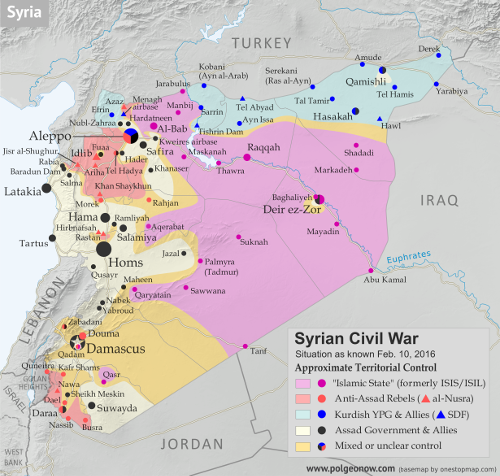
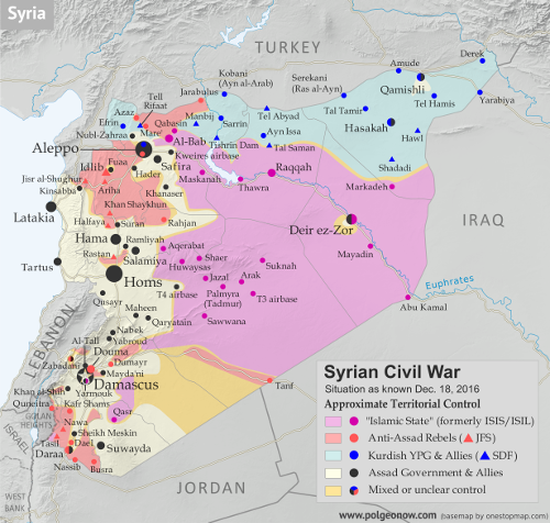
Map of fighting and territorial control in Syria's Civil War (Free Syrian Army rebels, Kurdish YPG, Syrian Democratic Forces (SDF), Al-Nusra Front, Islamic State (ISIS/ISIL), and others), updated for February 2016. Now includes terrain and major roads (highways). Highlights recent locations of conflict and territorial control changes, such as Menagh airbase, northern Aleppo, Salma, Rabia, Nubl, Baghaliya, Tishrin Dam, and more.
Syria in February 2016
Map of fighting and territorial control in Syria's Civil War (Free Syrian Army rebels, Kurdish YPG, Syrian Democratic Forces (SDF), Jabhat Fateh al-Sham (Al-Nusra Front), Islamic State (ISIS/ISIL), and others), updated to December 18, 2016. Now includes terrain and major roads (highways). Includes recent locations of conflict and territorial control changes, such as Aleppo, Palmyra, Khan al-Shih, Mayda'ani, and more. Colorblind accessible.
Syria in December 2016

The Year in Territorial Control Changes

For the past three years, PolGeoNow has published a “Year in Review” article to summarize all the political geography news that’s happened in the past 12 months. The 2014 and 2015 articles included news about changing territorial control in conflict zones, but because this is a major topic of its own, we’ve chosen to split these events into a separate article for 2016. So read on for a concise summary of last year’s rebel control changes…

See Also: 2016 Year in Review: Country & Border Changes 
 

Syria, Iraq, and the “Islamic State”

The Syrian Civil War continued to be the biggest armed conflict in the world through 2016, as well as a prominent example of a country whose territory isn’t all controlled by the recognized government. During the past year, pro-government forces scored some major victories against the rebels, recapturing the country’s second largest city and gradually increasing control in areas around the capital.

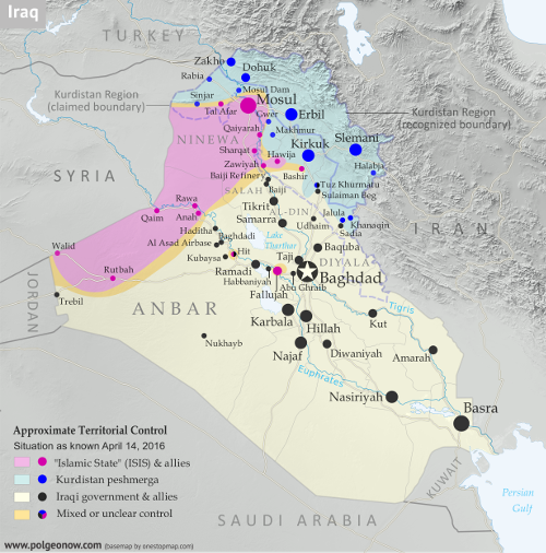
Detailed map of territorial control in Iraq's ongoing war as of April 14, 2016, including territory held by the so-called Islamic State (ISIS, ISIL), the Baghdad government, and the Kurdistan Peshmerga. Includes recent flashpoints including Ramadi, Hit, Bashir, and more.
Iraq in April 2016
Detailed map of territorial control in Iraq as of January 10, 2016, including territory held by the so-called Islamic State (ISIS, ISIL), the Baghdad government, and the Kurdistan Peshmerga. Shows developments in the ongoing coalition battle to recapture the city of Mosul. Includes key locations from recent events, such as Mosul, Al-Sagra, and Hamam al-Alil. Colorblind accessible.
Iraq in January 2017

Meanwhile, the so-called “Islamic State” (IS; formerly ISIS/ISIL) lost ground in Syria throughout the year, getting cut off from its border with Turkey by Turkish-backed rebels, and driven from important northern towns like Manbij and Shadaddi by the US-backed Syrian Democratic Forces (SDF), a coalition led by Syrian Kurdish militias. IS also lost the southern desert town of Palmyra to government forces, but recaptured it again before the end of the year.

At the other end of IS territory, in Iraq, the group also suffered territorial losses, being driven from its earliest Iraqi strongholds in Fallujah and Ramadi, while losing nearly half of its biggest city, Mosul. IS also had a disastrous year in Libya, where it fell from its greatest extent of control in early 2016 to holding no territory at all by the end of the year.

Elsewhere in the world, IS struggled to gain territorial footholds in Somalia and Yemen, but had little to show for it at the end of the year, while Nigeria’s IS affiliate – commonly known as “Boko Haram” – spent 2016 with little to no territorial control, after being decisively driven out of most of its possessions in 2015. And while IS was beginning to accumulate territory in Afghanistan a year ago, by mid-2016 it lost most of it again to government offensives and conflicts with the Taliban rebels.

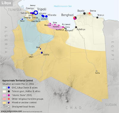
Libya control map: Shows detailed territorial control in Libya's civil war as of March 2016, including all major parties (Tobruk government, General Haftar's Operation Dignity forces, and Zintan militias; Tripoli GNC government, Libya Dawn, and Libya Shield Force; Shura Council of Benghazi Revolutionaries and other hardline Islamist groups; and the so-called Islamic State (ISIS/ISIL)). Also file under: Map of Islamic State (ISIS) control in Libya. Now includes terrain and major roads. Color blind accessible.
Libya in March 2016
Libya control map: Shows detailed territorial control in Libya's civil war as of December 2016, including all major parties (Government of National Accord (GNA); Tobruk House of Representatives, General Haftar's Libyan National Army, Zintan militias, Petroleum Facilities Guard (PFG); Tripoli GNC government, Libya Dawn, and Libya Shield Force; Shura Council of Benghazi Revolutionaries and other hardline Islamist groups; and National Salvation Government). Also file under: Map of Islamic State (ISIS or ISIL) control in Libya. Now includes terrain and major roads. Colorblind accessible.
Libya in December 2016

Other Major Conflict Zones

Meanwhile, all of the countries where IS struggled to hold ground – except for Nigeria, where other rebels’ attempts to capture land fizzled out – had bigger territorial control issues.

Libya saw a major political realignment between its two rival governments, as the internationally unrecognized administration in the west joined a new UN-backed unity government, leaving its rival in the east to lose much of its international support. Control on the ground also changed late in 2016 after a power struggle over independently-guarded oil ports on the country’s central coast.

In Afghanistan, the Taliban continued consolidating their control of rural areas, while briefly overrunning or besieging three provincial capital cities. Around the middle of the year, 20% of Afghanistan was reportedly under Taliban control.

At the same time, Somalia continued to struggle against Al Shabaab, an affiliate of Al Qaeda, which continued to control a large portion of the country’s rural south, and briefly overran some major towns in 2016.

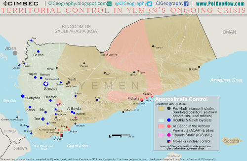
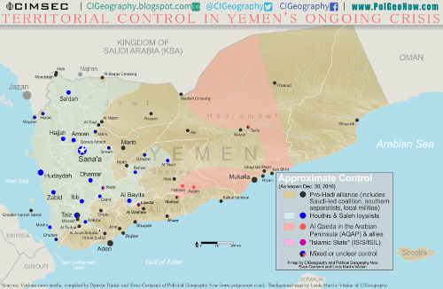
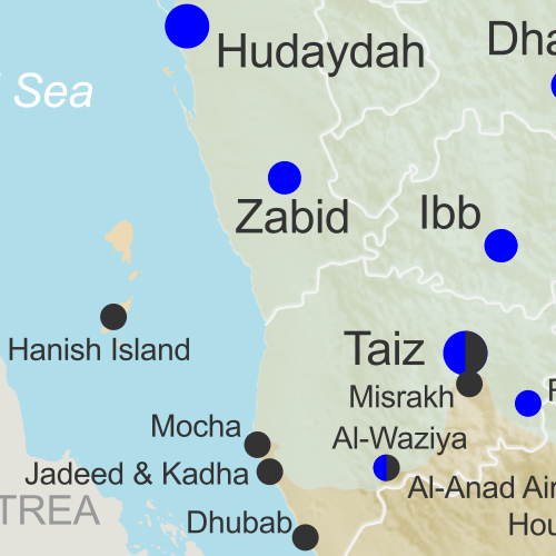
Map of territorial control in Yemen as of January 31, 2016, including territory held by the Houthi rebels and former president Saleh's forces, president-in-exile Hadi and his allies in the Saudi-led coalition and Southern Movement, Al Qaeda in the Arabian Peninsula (AQAP), and the so-called Islamic State (ISIS/ISIL). Includes recent areas of fighting, such as Aden, the Bab al-Mandeb Strait, Dhubab, Hanish Island, Harad, Maydee, Mukallah, and more.
Yemen in January 2016
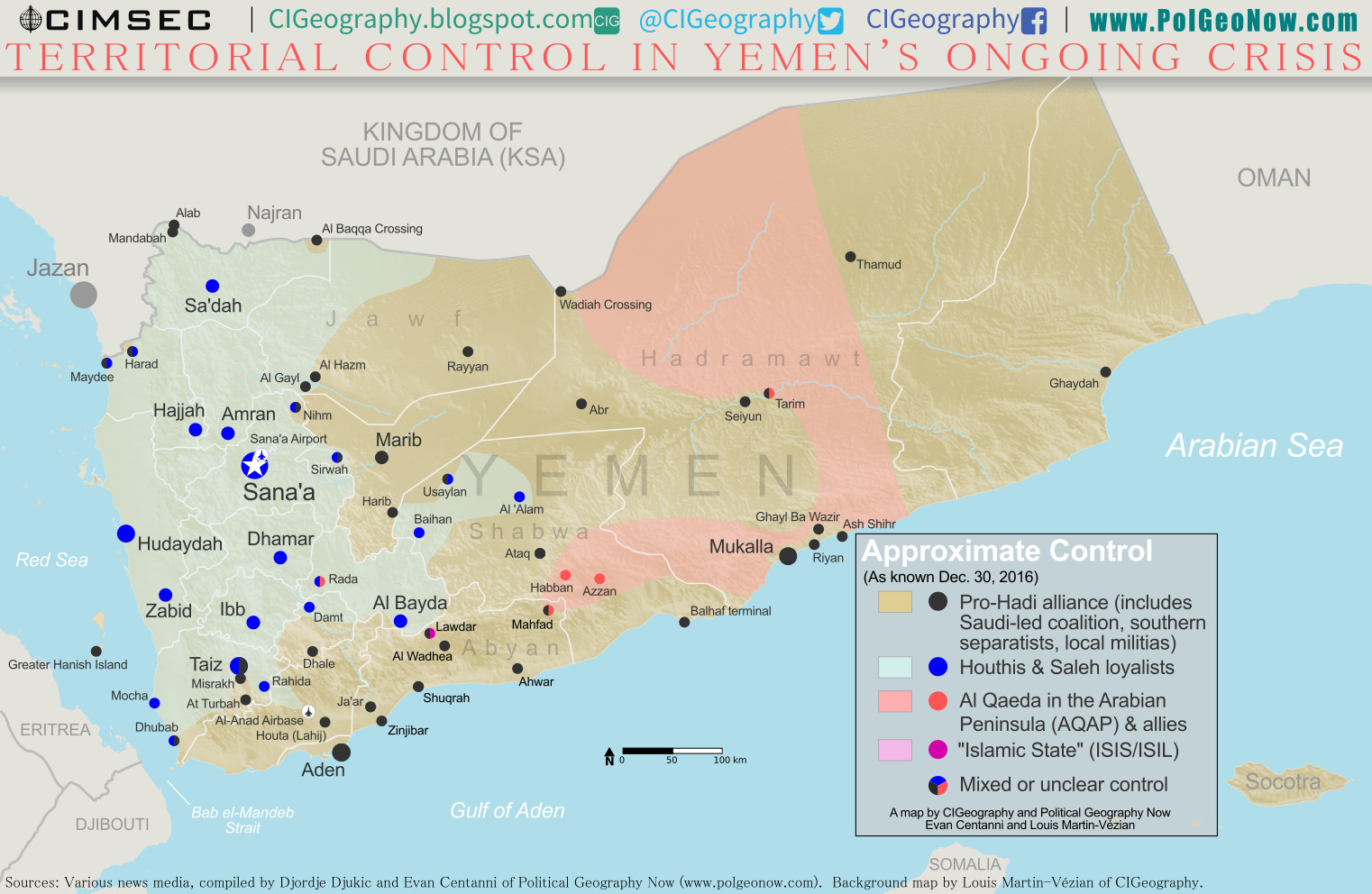
Map of what is happening in Yemen as of December 30, 2016, including territorial control for the Houthi rebels and former president Saleh's forces, president-in-exile Hadi and his allies in the Saudi-led coalition and Southern Movement, Al Qaeda in the Arabian Peninsula (AQAP), and the so-called Islamic State (ISIS/ISIL). Includes recent locations of fighting, including Al Gail, Sirwah, Usaylan, and areas long the Yemen border with Saudi Arabia. Colorblind accessible.
Yemen in December 2016

In Yemen, meanwhile, a Saudi-backed coalition nibbled slowly at the edges of the territory of the Houthi rebels now in control of the country’s capital, finding more success driving Al Qaeda forces out of several cities and towns along the country’s southern coast.

Smaller Territorial Control Changes

The ACLED conflict database catalogued heavy ongoing territorial struggles in South Sudan, Sudan, and the Democratic Republic of the Congo, a handful of small rebel seizures or losses in Mali, Myanmar, Thailand, and Mozambique, and possible incidents of rebels capturing bits of territory in Ethiopia, Uganda, and Kenya (where Al Shabaab violence sometimes spills over from neighboring Somalia). Pakistan also reportedly cleared one of its last areas thought to be held by religious hardline rebels near the border with Afghanistan.

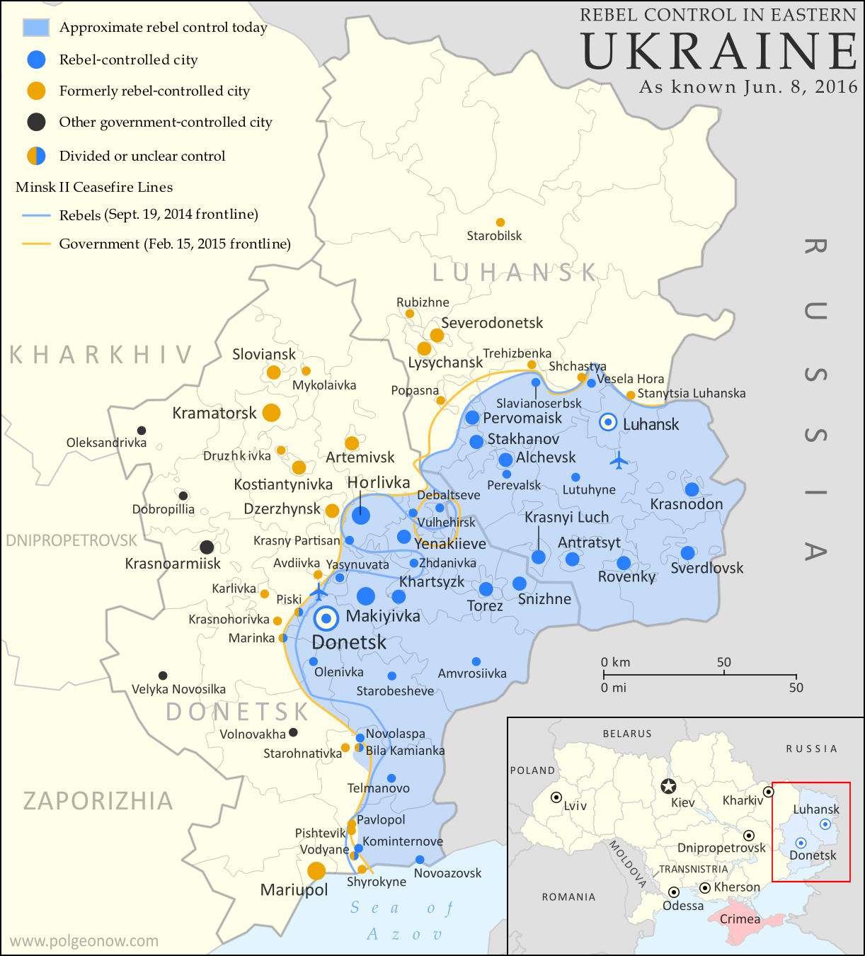
Map of rebel territorial control in Ukraine's eastern provinces of Donetsk and Luhansk, claimed by the breakaway Donetsk People's Republic and Lugansk People's Republic. Updated for June 2016, with Minsk ceasefire lines shown.

PolGeoNow also reported on some small changes to territorial control in the nearly-frozen conflict between Ukraine and the breakaway Donetsk People’s Republic. Meanwhile, news reports indicated that rebels briefly stormed an Indian military base in the disputed Kashmir region, while a blossoming insurgency in Nigeria’s Niger Delta region (far away and separate from the war with “Boko Haram”) saw rebels allegedly attempt to capture a town near the country’s largest city.

Late in 2016, Colombia’s FARC rebels began laying down their weapons after a peace deal was reached to end the country’s 50-year civil war. PolGeoNow hasn’t been able to find proof of exclusive FARC control of territory in recent years, but reporting on the deal did make reference to FARC-controlled areas.

Though not exactly rebels in the usual sense, other armed protesters used small territorial occupations to express their grievances in 2016. One group took over a police station in Armenia’s capital for two weeks, while another seized a wildlife facility in the US state of Oregon for over a month.

Want to Know More?
See all articles on countries with divided territorial control
View all FREE territorial control maps on PolGeoNow
Read PolGeoNow’s Article on 2016 Country and Border Changes

Yemen Control Map & Report: February 2017 (Subscription)

SUBSCRIBERS CLICK HERE TO PROCEED TO ARTICLE AND MAP

There are newer versions of this map available. To see them, view all Yemen updates.

Map of what is happening in Yemen as of February 22, 2017, including territorial control for the Houthi rebels and former president Saleh's forces, president-in-exile Hadi and his allies in the Saudi-led coalition and Southern Movement, Al Qaeda in the Arabian Peninsula (AQAP), and the so-called Islamic State (ISIS/ISIL). Includes recent locations of fighting, including Mocha, Dhubab, Awhar, Lawdar, Shuqrah, and areas long the Yemen border with Saudi Arabia.

Subscribe for full access to all conflict map reports!

Timeline by Djordje Djukic. Map by Louis Martin-Vézian, Evan Centanni, and Djordje Djukic.

Since the beginning of 2017, forces loyal to the Yemen’s Saudi-backed President Hadi have gained ground against the Houthi government along the Red Sea coast, while fighters of Al Qaeda in the Arabian Peninsula (AQAP) have once again taken over parts of southern Yemen’s Abyan province.


See all this and more on the newest update to PolGeoNow’s Yemen territorial control map, which includes a timeline of changes and important events since our previous Yemen map report in late December.

This map and report are premium professional content, available to paid subscribers of the PolGeoNow Conflict Mapping Service.

Want to see before you buy? Check out our most recent FREE SAMPLE Yemen map report!

Exclusive report includes:

  • Up-to-date map of current territorial control in Yemen, color-coded for the pro-Hadi coalition, Houthi/Saleh forces, Al Qaeda in the Arabian Peninsula (AQAP), and the so-called “Islamic State” (ISIS/ISIL).
  • Detailed indication of town-by-town control, including provincial boundaries, all major cities, and many smaller ones
  • Markers for recent areas of fighting, including Mocha, Dhubab, Awhar, Lawdar, Shuqrah, and areas long the Yemen border with Saudi Arabia
  • Timeline of changes to the situation since December 30, 2016, with links to sources

SUBSCRIBERS CLICK HERE TO PROCEED TO ARTICLE AND MAP

Not a member yet? Click here to learn more about our professional subscription service!

Can I purchase just this map?
This map and report are not available for automated purchase to non-subscribers. If you need access or republication rights for only this map report, contact service@polgeonow.com for options.

Yemen Control Map & Report: December 2016

There are newer versions of this map available. To see them, view all Yemen updates.

This is part of a series of Yemen maps and infographics created in collaboration between PolGeoNow and CIGeography.

Map of what is happening in Yemen as of December 30, 2016, including territorial control for the Houthi rebels and former president Saleh's forces, president-in-exile Hadi and his allies in the Saudi-led coalition and Southern Movement, Al Qaeda in the Arabian Peninsula (AQAP), and the so-called Islamic State (ISIS/ISIL). Includes recent locations of fighting, including Al Gail, Sirwah, Usaylan, and areas long the Yemen border with Saudi Arabia.
Click to enlarge. Map by Louis Martin-Vézian, Evan Centanni, and Djordje Djukic. All rights reserved.

(Subscribers click here to view this article in the members area.)

Timeline by Djordje Djukic

Situation Summary
In the past three months since our previous Yemen control map report, fighting has continued between Houthi rebels and forces loyal to the Saudi-backed government of President Hadi, with small changes to territorial control on the eastern and northern fringes of Houthi territory, including along Yemen’s border with Saudi Arabia. Meanwhile, Al Qaeda in the Arabian Peninsula (AQAP) has remained entrenched in parts of the east, while allegedly capturing an area near its one-time stronghold of Rada in the country’s west.

Flag of YemenCountry Name:  
• Yemen (English)
• Al-Yaman (Arabic)
Official Name:  
• Republic of Yemen (English)
al-Jumhūriyyah al-Yamaniyyah (Arabic) 
Capital: Sana’a (official); Aden (seat of internationally-recognized government)

Chronology of Events
The following is a timeline of major events and changes to territorial control since PolGeoNow’s previous Yemen control map report of September 23, 2016.

October 1, 2016
Pro-Hadi forces captured the the village of Al Gayl, which they claimed to be the last Houthi stronghold in Jawf province. Meanwhile, the Houthis claimed they hit a UAE military ship in the Bab al-Mandeb Strait, while according to the UAE the vessel that was hit was an aid ship en route to Aden.

October 8, 2016
At least 140 people were killed and more than 500 wounded in several airstrikes on a funeral reception in Sana’a which was attended by military and intelligence officials of the Houthi-led government.

October 9, 2016
The US Navy guided missile destroyer Mason was targeted in a failed missile attack from Houthi-held territory in Yemen.

October 12, 2016
The USS Mason was targeted in a second failed missile attack off the coast of Yemen.

October 13, 2016
In retaliation for the two missile attacks, the USS Mason targeted and destroyed three coastal radar sites in Houthi-held areas, using cruise missiles.

November 2, 2016
Twenty-eight Houthi and six pro-Hadi fighters were reportedly killed in fighting in Taiz.

November 7, 2016
The WHO announced that at least 7,070 people had been killed and 36,818 injured in the conflict in Yemen since the start of the Saudi-led intervention in March 2015.

November 15-16, 2016
Fighting in Maydee and Harad on the border between Yemen and Saudi Arabia, as well as in Taiz, left 46 pro-Houthi and 39 pro-Hadi fighters dead, in addition to five civilians. During the clashes in Taiz, pro-Hadi forces managed to advance towards the Houthi-held presidential residence and police headquarters.

November 17-18, 2016
Twenty-four Houthi and 14 pro-Hadi fighters were reportedly killed in Taiz, as well as two civilians, dashing any hopes of a ceasefire that had been announced by US Secretary of State John Kerry, which was supposed to start on November 17. Instead, a 48-hour ceasefire began on November 19.

November 21-22, 2016
Following the fragile two-day ceasefire, heavy fighting in Taiz and Maydee left a reported 29 Houthi and 12 pro-Hadi fighters dead.

November 24, 2016
More fighting in Taiz killed 10 Houthi fighters.

November 28, 2016
The Houthis and their political allies formed a new government. A Hadi spokesman deemed the move “a disregard not just for the Yemeni people, but also for the international community”.

December 2, 2016
The Saudi-led coalition claimed that 172 people were killed and 686 wounded due to indiscriminate shelling in Taiz by pro-Houthi forces during the month of November.

December 4-5, 2016
Pro-Hadi troops captured the Alab border crossing, which is one of two border crossings between Saudi Arabia and Yemen’s Sa’dah province. The second crossing, Al Baqqa, had already been taken by pro-Hadi troops previously. The fighting spread the following day to the nearby Mandabah mountain. Pro-Hadi forces also claimed that the Houthis had withdrawn from the port town of Maydee. However, fighting was still being reported around the town 15 days later.

December 10, 2016
An IS suicide bomber killed between 48 and 50 soldiers and wounded around 70 at a base in Aden.

December 12-15, 2016
Al-Qaeda captured a mountain in Bayda province and claimed to have also seized an area of the Rada district from pro-Houthi forces.

December 13, 2016
Eighteen Houthi fighters were reportedly killed in fighting in Taiz, while Houthi forces attempted to recapture a hill overlooking the Sirwah airport in Marib province, which they had recently lost.

December 18, 2016
An IS suicide bomber killed between 49 and 52 soldiers and wounded between 34 and 60 in Aden while they were collecting their salaries.

December 18-19, 2016
Houthi fighters managed to temporarily capture a hilly air-defense base on the western edge of Taiz, before they were forced to retreat the following morning. Pro-Hadi forces claimed 41 Houthi fighters were killed, while they lost nine. Meanwhile, pro-Hadi forces reportedly captured Mandabah mountain on the Yemeni-Saudi border.

December 22, 2016
Seven Pakistani crew members of an Iranian cargo ship were killed when their ship was sunk in a rocket attack off the coast of Yemen.

December 23, 2016
Saudi artillery and helicopter strikes on the Saudi-Yemeni border reportedly killed at least 30 pro-Houthi fighters, while the US military reported 28 Al Qaeda militants were killed in nine strikes between September 23 and December 13 in Yemen.

December 24, 2016
Pro-Hadi forces captured several areas in the Nihm district northeast of Sana’a.

December 27, 2016
Twenty-eight Houthi and 12 pro-Hadi fighters were reportedly killed in fighting in the southern province of Shabwa when pro-Hadi forces launched an offensive against Baihan. Fighting also took place at nearby Usaylan. Pro-Hadi forces claimed to have made advances during the offensive.

December 29, 2016
Pro-Hadi troops reportedly captured three regions of the Usaylan district in Shabwa province and were trying to push towards Baihan. At least 10 Houthi fighters were killed in the fighting.

CHECK FOR UPDATES: View all Yemen maps on PolGeoNow

Graphic of Yemeni flag is in the public domain (source).

Yemen Control Map & Report: September 2016 (Subscription)

SUBSCRIBERS CLICK HERE TO PROCEED TO ARTICLE AND MAP

There are newer versions of this map available. To see them, view all Yemen updates.

Map of territorial control in Yemen as of September 23, 2016, including territory held by the Houthi rebels and former president Saleh's forces, president-in-exile Hadi and his allies in the Saudi-led coalition and Southern Movement, Al Qaeda in the Arabian Peninsula (AQAP), and the so-called Islamic State (ISIS/ISIL). Includes recent locations of fighting, such as Taiz, Jaar, Zinjibar, Ahwar, and more.

Subscribe for full access to all conflict map reports!

Timeline by Djordje Djukic. Map by Louis Martin-Vézian, Evan Centanni, and Djordje Djukic.

Since our last Yemen control map update almost two months ago, Al Qaeda has lost a large part of its territory in Yemen, even as fighting continues between the Houthis and the Saudi-backed Hadi government.


See all this and more on the newest update to PolGeoNow’s Yemen territorial control map, which includes a timeline of changes and important events since our previous Yemen map report in early August.

This map and report are premium professional content, available to paid subscribers of the PolGeoNow Conflict Mapping Service.

Want to see before you buy? Check out our most recent FREE SAMPLE Yemen map report!

Exclusive report includes:

  • Up-to-date map of current territorial control in Yemen, color-coded for the pro-Hadi coalition, Houthi/Saleh forces, Al Qaeda in the Arabian Peninsula (AQAP), and the so-called “Islamic State” (ISIS/ISIL).
  • Color scheme now consistent with Syria, Iraq, and Libya map series
  • Detailed indication of town-by-town control, including provincial boundaries, all major cities, and many smaller ones
  • Markers for recent areas of fighting, including Taiz, Jaar, Zinjibar, Ahwar, and more
  • Timeline of changes to the situation since August 2, 2016, with links to sources

SUBSCRIBERS CLICK HERE TO PROCEED TO ARTICLE AND MAP

Not a member yet? Click here to learn more about our professional subscription service!

Can I purchase just this map?
This map and report are not available for automated purchase to non-subscribers. If you need access or republication rights for only this map report, contact service@polgeonow.com for options.

Yemen Control Map & Report: August 2016 (Subscription)

MEMBERS CLICK HERE TO PROCEED TO ARTICLE AND MAP

There are newer versions of this map available. To see them, view all Yemen updates.

Map of territorial control in Yemen as of August 2, 2016, including territory held by the Houthi rebels and former president Saleh's forces, president-in-exile Hadi and his allies in the Saudi-led coalition and Southern Movement, Al Qaeda in the Arabian Peninsula (AQAP), and the so-called Islamic State (ISIS/ISIL). Includes recent locations of fighting, such as Taiz, Mukalla, Bayhan, Harad, and more.

Subscribe for full access to all conflict map reports!

Timeline by Djordje Djukic. Map by Louis Martin-Vézian, Evan Centanni, and Djordje Djukic.

In the three months since our previous Yemen map update, Houthi and pro-Hadi forces have continued to trade blows in the south and east, as well as along the border with Saudi Arabia. Meanwhile, Al Qaeda and the so-called “Islamic State” (ISIS/ISIL) have launched attacks in southern cities.


See all this and more on the newest update to PolGeoNow’s Yemen territorial control map, which includes a timeline of changes and important events since our previous Yemen map report in February.

This map and report are premium professional content, available to paid subscribers of the PolGeoNow Conflict Mapping Service.

Want to see before you buy? Check out our most recent FREE SAMPLE Yemen map report!

Exclusive report includes:

  • Up-to-date map of current territorial control in Yemen, color-coded for the pro-Hadi coalition, Houthi/Saleh forces, Al Qaeda in the Arabian Peninsula (AQAP), and the so-called “Islamic State” (ISIS/ISIL).
  • Color scheme now consistent with Syria, Iraq, and Libya map series
  • Detailed indication of town-by-town control, including provincial boundaries, all major cities, and many smaller ones
  • Markers for recent areas of fighting, including Taiz, Mukalla, Bayhan, Harad, and more
  • Timeline of changes to the situation since May 1, 2016, with links to sources

MEMBERS CLICK HERE TO PROCEED TO ARTICLE AND MAP

Not a member yet? Click here to learn more about our professional subscription service!

Can I purchase just this map?
This map and report are not available for automated purchase to non-subscribers. If you need access or republication rights for only this map report, contact service@polgeonow.com for options.