Yemen Control Map & Report: May 2016 (Subscription)

MEMBERS CLICK HERE TO PROCEED TO ARTICLE AND MAP

There are newer versions of this map available. To see them, view all Yemen updates.

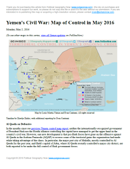
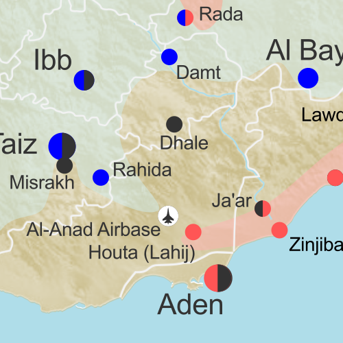
Map of territorial control in Yemen as of May 1, 2016, including territory held by the Houthi rebels and former president Saleh's forces, president-in-exile Hadi and his allies in the Saudi-led coalition and Southern Movement, Al Qaeda in the Arabian Peninsula (AQAP), and the so-called Islamic State (ISIS/ISIL). Includes recent locations of fighting, such as Taiz, Aden, Houta, Mukalla, and more.

Subscribe for full access to all conflict map reports!

Download PDF:
Buy now
New discounted price!

Timeline by Djordje Djukic. Map by Louis Martin-Vézian, Evan Centanni, and Djordje Djukic

In the months since our previous Yemen control map report, Al Qaeda has lost some of its most important territory in Yemen, including a major city it’s held for the past year. Fighting has also continued between the Hadi government and the Houthi alliance, despite attempts at a ceasefire. 


See all this and more on the newest update to PolGeoNow’s Yemen territorial control map, which includes a timeline of changes and important events since our previous Yemen map report in February.

This map and report are exclusive premium content, available to paid subscribers or for individual purchase. Download PDF (US$14.99) New discounted price!

Want to see before you buy? Check out our most recent FREE SAMPLE Yemen map report!

Exclusive report includes:

Map of territorial control in Yemen as of May 1, 2016, including territory held by the Houthi rebels and former president Saleh's forces, president-in-exile Hadi and his allies in the Saudi-led coalition and Southern Movement, Al Qaeda in the Arabian Peninsula (AQAP), and the so-called Islamic State (ISIS/ISIL). Includes recent locations of fighting, such as Taiz, Aden, Houta, Mukalla, and more.
  • Up-to-date map of current territorial control in Yemen, color-coded for the pro-Hadi coalition, Houthi/Saleh forces, Al Qaeda in the Arabian Peninsula (AQAP), and the so-called “Islamic State” (ISIS/ISIL).
  • Color scheme recently updated for consistency with Syria, Iraq, and Libya map series
  • Detailed indication of town-by-town control, including provincial boundaries, all major cities, and many smaller ones
  • Markers for recent areas of fighting, including Taiz, Mukalla, Harib, Ghayl Ba Wazir, and more
  • Timeline of changes to the situation since February 19, 2016, with links to sources

MEMBERS CLICK HERE TO PROCEED TO ARTICLE AND MAP

Not a member yet? Learn more about our professional subscription service!

Map of Control in Yemen’s Civil War: February 2016 (Subscription)

MEMBERS CLICK HERE TO PROCEED TO ARTICLE AND MAP

There are newer versions of this map available. To see them, view all Yemen updates.

Map of territorial control in Yemen as of February 19, 2016, including territory held by the Houthi rebels and former president Saleh's forces, president-in-exile Hadi and his allies in the Saudi-led coalition and Southern Movement, Al Qaeda in the Arabian Peninsula (AQAP), and the so-called Islamic State (ISIS/ISIL). Includes recent areas of Al Qaeda takeovers and locations of other fighting, such as Shuqrah, Azzan, Habban, Ahwar, Misrakh, Fardat Nahm, and more.

Subscribe for full access to all conflict map reports!

Download PDF:
Buy now
New discounted price!

Timeline by Djordje Djukic, with additional reporting by Evan Centanni; map by Louis Martin-Vézian and Evan Centanni

Though it’s been less than three weeks since our last Yemen control map update, there have already been several changes to territorial control. Most notably, Al Qaeda in the Arabian Peninsula (AQAP) has rapidly expanded its territory, recapturing most of the towns it held from 2011 to 2012.

Meanwhile, the Saudi-led coalition supporting President Hadi has also made progress against the Houthi rebels over the past weeks.

See all this and more on the newest update to PolGeoNow’s Yemen territorial control map, which includes a timeline of changes and important events since our previous Yemen map report at the end of January.

This map and report are exclusive premium content, available to paid subscribers or for individual purchase. Download PDF (US$14.99) New discounted price!

Want to see before you buy? Check out our most recent FREE SAMPLE Yemen map report!

Exclusive map report includes:

Map of territorial control in Yemen as of February 19, 2016, including territory held by the Houthi rebels and former president Saleh's forces, president-in-exile Hadi and his allies in the Saudi-led coalition and Southern Movement, Al Qaeda in the Arabian Peninsula (AQAP), and the so-called Islamic State (ISIS/ISIL). Includes recent areas of Al Qaeda takeovers and locations of other fighting, such as Shuqrah, Azzan, Habban, Ahwar, Misrakh, Fardat Nahm, and more.
  • Up-to-date map of current territorial control in Yemen, color-coded for the pro-Hadi coalition, Houthi/Saleh forces, Al Qaeda in the Arabian Peninsula (AQAP), and “Islamic State” (ISIS/ISIL).
  • Color scheme recently updated for consistency with Syria, Iraq, and Libya map series
  • Detailed indication of town-by-town control, including provincial boundaries, all major cities, and many smaller ones
  • Markers for recent areas of Al Qaeda takeovers and locations of other fighting, such as Shuqrah, Azzan, Habban, Ahwar, Misrakh, Fardat Nahm, and more
  • Timeline of changes to the situation since January 31 2016, with links to sources

MEMBERS CLICK HERE TO PROCEED TO ARTICLE AND MAP

Not a member yet? Click here to learn more about our professional subscription service!

Yemen Civil War Control Map: January 2016 (Subscription)

MEMBERS CLICK HERE TO PROCEED TO ARTICLE AND MAP

There are newer versions of this map available. To see them, view all Yemen updates.

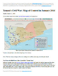
Map of territorial control in Yemen as of January 31, 2016, including territory held by the Houthi rebels and former president Saleh's forces, president-in-exile Hadi and his allies in the Saudi-led coalition and Southern Movement, Al Qaeda in the Arabian Peninsula (AQAP), and the so-called Islamic State (ISIS/ISIL). Includes recent areas of fighting, such as Aden, the Bab al-Mandeb Strait, Dhubab, Hanish Island, Harad, Maydee, Mukallah, and more.

Subscribe for full access to all conflict map reports!

Download PDF:
Buy now

Timeline by Djordje Djukic, with additional reporting by Evan Centanni; map by Louis Martin-Vézian and Evan Centanni

In the two months since our previous Yemen control map update, the Saudi-led coalition supporting President Hadi has opened new fronts against both the rival Houthis and Al Qaeda, using its naval forces to capture islands and seaports along Yemen’s coast while also advancing across the border from Saudi Arabia for the first time. 

Meanwhile, the so-called “Islamic State” organization (formerly ISIS/ISIL), based in Iraq and Syria, has for the first time been alleged to control territory in Yemen.

See all this and more on the newest update to PolGeoNow’s Yemen territorial control map, which includes a timeline of changes and important events since our previous Yemen map report in November.

This map and report are exclusive premium content, available to paid subscribers or for individual purchase. Download PDF (US$19.99)

Want to see before you buy? Check out our most recent FREE SAMPLE Yemen map report!

Exclusive map report includes:

  • Up-to-date map of current territorial control in Yemen, color-coded for the pro-Hadi coalition, Houthi/Saleh forces, Al Qaeda in the Arabian Peninsula (AQAP), and “Islamic State” (ISIS/ISIL).
  • Color scheme newly updated for consistency with Syria, Iraq, and Libya map series
  • Detailed indication of town-by-town control, including provincial boundaries, all major cities, and many smaller ones
  • Markers for key areas of recent fighting such as Aden, the Bab al-Mandeb Strait, Dhubab, Hanish Island, Harad, Maydee, Mukallah, and more
  • Timeline of changes to the situation since November 2015, with links to sources

MEMBERS CLICK HERE TO PROCEED TO ARTICLE AND MAP

Not a member yet? Click here to learn more about our professional subscription service!

Yemen’s Civil War: Map of Control in November 2015 (Subscription)

There are newer versions of this map available. To see them, view all Yemen updates.

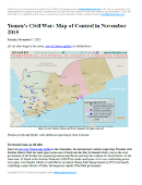
Map of territorial control in Yemen as of November 17, 2015, including territory held by the Houthi rebels and former president Saleh's forces, president-in-exile Hadi and his allies in the Saudi-led coalition and Southern Movement, and Al Qaeda in the Arabian Peninsula (AQAP). Includes recent areas of fighting, such as Taiz, Wadiah, Bayda, Marib, Mukayras, Mocha, Dhubab, and the Bab al-Mandeb Strait.

Subscribe for full access to all conflict map reports!

Download PDF:
Buy now

Timeline by Djordje Djukic, with additional reporting by Evan Centanni; map by Louis Martin-Vézian and Evan Centanni

Over the past month and a half, all sides in Yemen’s civil war have achieved territorial gains. The international coalition backing President Hadi – now including troops from Sudan, as well as Saudi Arabia, the UAE, and Qatar – has made gains against the Houthis, even as the Houthis have recaptured other areas. Meanwhile, Al Qaeda has taken advantage of the chaos to continue continued its gradual expansion of power.

See all this and more on the newest update to PolGeoNow’s Yemen territorial control map, which includes a timeline of changes and important events since our previous Yemen map report in September.

This map and report are exclusive premium content, available to paid subscribers or for individual purchase. Download PDF (US$19.99)

Want to see before you buy? Check out our most recent FREE SAMPLE Yemen map report!

Exclusive map report includes:

  • Up-to-date map of current territorial control in Yemen, color-coded for the pro-Hadi coalition, Houthi/Saleh forces, and Al Qaeda in the Arabian Peninsula (AQAP).
  • Detailed indication of town-by-town control, including provincial boundaries, all major cities, and many smaller ones
  • Markers for key areas of recent fighting such as Taiz, Marib, Bayda, Mukayras, the Bab al-Mandeb Strait, and more
  • Timeline of changes to the situation since late September, with links to sources

MEMBERS CLICK HERE TO PROCEED TO ARTICLE AND MAP

Not a member yet? Click here to learn more about our professional subscription service!

Yemen’s Civil War: Map of Control in September 2015 (Subscription)

There are newer versions of this map available. To see them, view all Yemen updates.

Map of territorial control in Yemen as of September 25, 2015, including territory held by the Houthi rebels and former president Saleh's forces, president-in-exile Hadi and his allies in the Saudi-led coalition and Southern Movement, and Al Qaeda in the Arabian Peninsula (AQAP). Includes recent areas of fighting, such as Aden, Ibb, Taiz, Bayda, Marib, Mukayras, and more.

Subscribe for full access to all conflict map reports!

Download PDF:
Buy now

Timeline by Djordje Djukic, with additional reporting by Evan Centanni; map by Louis Martin-Vézian and Evan Centanni

Forces loyal to Yemen’s exiled President Hadi, backed by troops from Saudi Arabia, the UAE, and now Qatar, have advanced rapidly against the Houthi rebels over the summer. However, with the offensive now losing momentum, battle lines are solidifying and groups such as Al Qaeda are moving to fill in the power vacuum left in the coalition’s wake.

See all this and more on the newest update to PolGeoNow’s Yemen territorial control map, which includes a timeline of changes and important events since our previous Yemen map report in August.

This map and report are exclusive premium content, available to paid subscribers or for individual purchase.
Download PDF (US$19.99)

Want to see before you buy? Check out our most recent FREE SAMPLE Yemen map report!

Exclusive map report includes:

  • Up-to-date map of current territorial control in Yemen, color-coded for the pro-Hadi coalition, Houthi/Saleh forces, and Al Qaeda in the Arabian Peninsula (AQAP).
  • Detailed indication of town-by-town control, including provincial boundaries, all major cities, and many smaller ones
  • Markers for key areas of recent fighting such as Marib, Aden, Ibb, Bayda, Mukayras, and more
  • Timeline of changes to the situation since mid-August, with links to sources

MEMBERS CLICK HERE TO PROCEED TO ARTICLE AND MAP

Not a member yet? Click here to learn more about our professional subscription service!

Yemen’s Civil War: Map of Control in August 2015 (Subscription)

There are newer versions of this map available. To see them, view all Yemen updates.

Map of territorial control in Yemen as of August 14, 2015, during Saudi Arabia's military intervention, including territory held by the Houthi rebels and former president Saleh's forces, president-in-exile Hadi and the Southern Movement, and Al Qaeda in the Arabian Peninsula (AQAP). Includes recent areas of fighting, such as Houta, Al-Anad Airbase, Dhale, Ibb, Ataq, and more.

Download PDF:
Buy now

(Subscribe via Paypal to view all premium content online)

Timeline by Djordje Djukic, with additional reporting by Evan Centanni; map by Louis Martin-Vézian and Evan Centanni

Yemen’s Houthi revolutionary government, despite support from Iran, is rapidly losing ground against the fighters aligned to President Hadi, and supporting forces from Saudi Arabia and the United Arab Emirates. 

A long list of towns have changed hands just within the last two weeks, and Al Qaeda is on the move as well. See all this and more on the newest update to PolGeoNow’s Yemen territorial control map, which includes a timeline of changes since our previous Yemen map report in July.

This map and report are exclusive premium content, available to paid subscribers or for individual purchase.
Download PDF (US$14.99)

Want to see before you buy? Check out our most recent FREE SAMPLE Yemen map report!

Exclusive map report includes:

  • Up-to-date map of current territorial control in Yemen, color-coded for the Hadi coalition, Houthi/Saleh forces, and Al Qaeda in the Arabian Peninsula (AQAP).
  • Detailed indication of town-by-town control, including provincial boundaries, all major cities, and many smaller ones
  • Markers for key areas of recent fighting such as Houta, Al-Anad Airbase, Utmah, Ibb, Rabat, Lawdar, Bayda, Ataq, and more
  • Timeline of changes to the situation since the end of July, with links to sources

MEMBERS CLICK HERE TO PROCEED TO ARTICLE AND MAP

NOT A MEMBER YET? SUBSCRIBE NOW!

Yemen’s Civil War: Map of Control in July 2015 (Subscription)

There are newer versions of this map available. To see them, view all Yemen updates.

Map of territorial control in Yemen as of July 29, 2015, during Saudi Arabia's military intervention, including territory held by the Houthi rebels and former president Saleh's forces, president-in-exile Hadi and the Southern Movement, and Al Qaeda in the Arabian Peninsula (AQAP). Includes recent areas of fighting, such as Aden, Sabr, Al-Anad Airbase, Wadiah crossing, Marib, and more.

Download PDF:
Buy now

(Subscribe via Paypal to view all premium content online)

Timeline by Djordje Djukic, with additional reporting by Evan Centanni; map by Louis Martin-Vézian and Evan Centanni

In the past month, Yemen’s Saudi-backed resistance forces have finally begun making inroads against the Houthis, capturing a major southern city while also extending their control to the northern border with Saudi Arabia.

See all this and more on the newest update to PolGeoNow’s Yemen territorial control map, which includes a timeline of changes since our previous Yemen map report in June.

This map and report are exclusive premium content, available to paid subscribers or for individual purchase.
Download PDF (US$14.99)

Want to see before you buy? Check out our most recent FREE SAMPLE Yemen map report!

Exclusive map report includes:

  • Up-to-date map of current territorial control in Yemen, color-coded for the Hadi government, Houthi/Saleh forces, and Al Qaeda in the Arabian Peninsula (AQAP).
  • Detailed indication of town-by-town control, including provincial boundaries, all major cities, and many smaller ones
  • Markers for key areas of recent fighting such as Aden, Al-Anad, Sabr, Marib, Wadiah border crossing, and more
  • Timeline of changes to the situation since July, compiled by our Yemen specialist, with links to sources

MEMBERS CLICK HERE TO PROCEED TO ARTICLE AND MAP

NOT A MEMBER YET? SUBSCRIBE NOW!

Yemen’s Civil War: Map of Control in June 2015

There are newer versions of this map available. To see them, view all Yemen updates.

This is part of a series of Yemen maps and infographics created in collaboration between PolGeoNow and CIGeography. Part 1 was the Map & Infographic of Foreign Military Deployments in Yemen, and Part 2 was War in Yemen: Map of Territorial Control (April 2015).
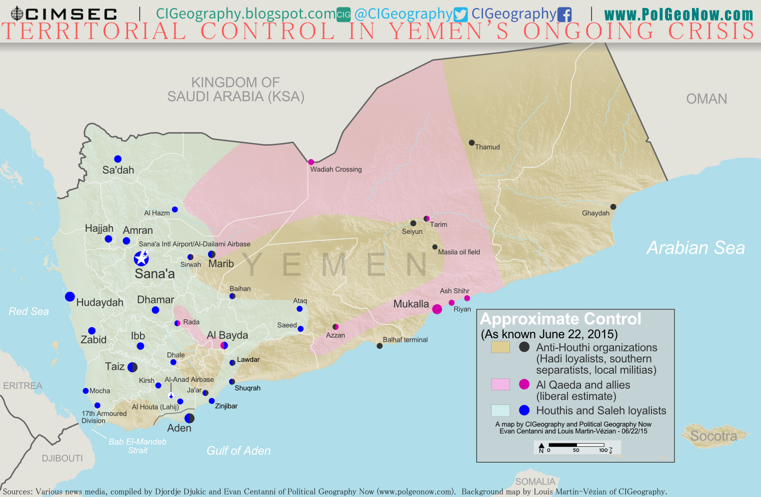
Map of territorial control in Yemen as of June 22, 2015, about two months into Saudi Arabia's military intervention, including territory held by the Houthi rebels and former president Saleh's forces, president-in-exile Hadi and the Southern Movement, and Al Qaeda in the Arabian Peninsula (AQAP).
Map by Louis Martin-Vézian and Evan Centanni (click to enlarge). All rights reserved.

Subscribers click here to view this article in the ad-free members area. Not a member yet? Subscribe now!

Timeline by Djordje Djukic, with additional reporting by Evan Centanni

Houthi Control Spreading Despite Saudi Airstrikes
Since our previous Yemen control map update in early April, Saudi Arabia and its coalition partners have continued their air and sea campaign in support of the ousted Yemeni government of President Abd Rabbuh Mansur Hadi, supported by parts of the Yemeni military and allied local and southern forces. But two months into the intervention, their opponents, the northern Houthi rebels and forces loyal to former president Ali Abdullah Saleh, have continued to expand eastward. Meanwhile, Al Qaeda fighters have consolidated their control in parts of eastern Yemen, and the port city of Aden is still divided by frequent battles.

See Also: CIGeography infographic on foreign military activity in Yemen 

Flag of YemenCountry Name:  
• Yemen (English)
• Al-Yaman (Arabic)
Official Name:  
• Republic of Yemen (English)
al-Jumhūriyyah al-Yamaniyyah (Arabic) 
Capital: Sana’a

Chronology of Events
The following is a timeline of major political events and changes to territorial control since PolGeoNow’s April 3 Yemen control map report.

April 4, 2015
Hadi troops, reinforced by Saudi weapons drops, pushed back the Houthis from the Crater district in Aden.

April 5, 2015
The Houthis advanced into the central Mualla district of Aden, capturing the provincial headquarters. Also, fighting in the Houthi-held city of Lawdar (Loder) left 24 people dead, including 21 Shiite militiamen.

April 7, 2015
The Hadhramout Tribal Alliance and pro-Hadi militiamen claimed to recapture Mukalla from Al Qaeda in the Arabian Peninsula (AQAP), but residents reported Al Qaeda was still in control of around half of the town. In addition, AQAP militants captured Wadiah border crossing with Saudi Arabia, killing two soldiers.

April 9, 2015
Houthi and allied forces captured Ataq, the provincial capital of Shabwah Governorate, after a deal was reached with local leaders and security officials

April 14, 2015
The UN Security Council passed a resolution for an arms embargo to be applied to the Houthis and their allies, with 14 in favor and Russia abstaining, after its request for the embargo to include all parties to the conflict was refused. The same day, the Houthis retreated from Aden’s Khor Maksar district after prolonged street fighting.

April 16, 2015
Al Qaeda sized the Riyan airport and Mukalla’s seaport and oil terminal, with the main government brigade responsible for security fleeing after a brief clash with the militants outside the city. In addition, the fighters captured a massive weapons depot that contained dozens of tanks, Katyusha rocket launchers and small arms. With this advance, Al Qaeda consolidated its hold on Hadhramaut province, and is believed to be back in control of most of Mukalla.

April 17-18, 2015
Houthi and allied forces attacked the base of the 35th Armored Brigade in Taiz, Yemen’s third largest city, after the brigade announced its loyalty to Hadi.

April 21, 2015
Saudi Arabia declared an end to its “Decisive Storm” air campaign, saying it would scale down the airstrikes at the request of President Hadi, but not claiming it would stop them altogether. Instead, a more limited military campaign was announced and named  “Renewal of Hope”, with the stated aim of preventing the Houthis from targeting civilians or making any territorial gains.

April 22, 2015
The Houthis captured the military base in Taiz.

April 23, 2015
The Saudi-led Coalition conducted 20 air-strikes against Houthi targets, despite saying earlier that it was winding down the campaign.

April 25, 2015
Heavy fighting took place in Marib province as pro-Houthi forces attempted to advance into the Sirwah district. Four days earlier, a local pro-Hadi official claimed that between April 2 and 22, 150 pro-Houthi and 27 anti-Houthi fighters had been killed in clashes in the province.

April 26, 2015
Pro-Hadi forces reportedly captured “several districts” in Taiz, despite losing the military base a few days earlier.

April 27, 2015
According to the Hadi government, 1,000 civilians had been killed since the start of the conflict.

April 28, 2015
A Houthi counter-attack resulted in the recapture of the Russian and German consulates and Hadi’s residence in Aden, after advances in the Khor Maksar district, and pro-Houthi forces to the north of the city made a push to the west in an attempt to recapture territory previously lost.

April 29, 2015
Houthi fighters advanced into the center of Aden, taking territory from the Russian consulate to the Crater business district, and were once again largely in control of the city’s airport. Houthi forces also repelled pro-Hadi counterattacks in the Khor Maksar and Mualla districts of the city. According to Aden’s health ministry, 375 civilians had been killed and 2,500 wounded since the battle began.

May 3, 2015
Twenty soldiers, initially described as members of the Saudi-led coalition, reportedly landed in Aden on a reconnaissance mission. Another account put the number of soldiers at 50, while Saudi Arabia denied any ground troops were sent to Yemen. The next day, the unidentified soldiers reportedly took part in fighting near the Aden airport, with pro-Hadi forces storming parts of the facility, while a spokesman for the allied Southern Popular Resistance retracted an earlier statement that the soldiers were part of the coalition, instead saying they were homegrown special forces from the south. Later, the pro-Hadi Yemeni foreign minister stated the soldiers were members of the pro-Hadi government forces who had been sent to Gulf countries to be trained before returning to Yemen.

May 6, 2015
Fighters associated with Al Qaeda captured Ash Shihr, a port east of Mukalla. 

May 7, 2015
Saudi Arabia and the United States declared a five-day ceasefire to allow aid to enter Yemen, while the UN humanitarian coordinator stated more than 1,400 people had been killed and 6,000 injured in the conflict since March 26.

May 10, 2015
The Yemeni Army accepted the proposed five-day ceasefire, and the Houthis welcomed any form of a truce. However, the same day, two coalition airstrikes hit former president Ali Abdullah Saleh’s home in Sana’a. Saleh was not there at the time, and in response to the attack openly declared his alliance with the Houthis. (Saleh had already been apparently allied with the Houthis for some time before this.)

May 11, 2015
A Moroccan fighter jet belonging to the Saudi-led coalition went missing, along with its pilot, in Yemen, and was possibly shot down by Houthi forces. At the same time, one person was killed in a Saudi town, close to the Yemeni border, by Houthi shelling. This brought the overall death toll from Houthi cross-border rocket and mortar attacks, which started the previous week, to 11.

May 12, 2015
The five-day ceasefire commenced in the evening, but some ground fighting continued.

May 13, 2015
Ceasefire violations reported in the first 24 hours included: a coalition airstrike, shelling by coalition warships on an area west of Aden, and fighting during a Houthi attempt to storm Dhale.

May 17, 2015
The five-day ceasefire ended and the Saudi-led coalition immediately resumed its airstrikes.

May 26, 2015
Pro-Hadi fighters captured Dhale and the command center of the pro-Houthi 33rd Armoured Brigade after expelling Houthi fighters from the town.

May 28, 2015
The pro-Hadi governor of Sana’a, Abdulghani Jamil, was killed along with his nephew in a shootout when Houthi fighters attempted to detain him.

May 30, 2015
The Houthis took over the city of Saeed in Shabwah province, after local leaders changed their allegiance.

June 4, 2015
According to the United Nations, the death toll from the conflict since March 19, up to May 31, reached 2,288. Another 9,755 people were wounded. Of the casualties, 1,160 of the dead were civilians, as were over 2,800 of those injured.

June 5, 2015
The Houthis and the Hadi government agreed to attend UN-brokered peace talks in Geneva.

June 6, 2015
Saudi Arabia shot down a Scud missile fired from Yemen toward a military base in southwestern Saudi Arabia. The Scud was brought down using a US-supplied Patriot surface-to-air missile defense system.

June 12, 2015
UNESCO condemned a Saudi airstrike on the old quarter of Yemen’s capital, a centuries-old heritage site considered a “jewel” of Islamic culture. The attack killed five people and destroyed several homes.

June 13, 2015
The Houthi rebel delegation, which was supposed to attend peace talks with the Hadi government, refused to board the plane for Geneva. The reason given was that the Houthis objected to there being two separate delegations in Geneva – one representing the Hadi government and the second (the Houthis) being seen as representing a “coup”. According to a Houthi representative, this was meant to pressure the Houthis to withdraw from Sana’a and did not foster an environment suitable for the continuation of broader multi-party talks.

June 14, 2015
Houthi and pro-Saleh Army forces captured Al Hazm, the capital of Jawf province, which includes much of the border with Saudi Arabia.

June 16, 2015
The Houthi delegation left for the Geneva peace talks after the United Nations agreed to broaden the negotiations to include the Socialist and Haqq parties.

June 19, 2015
The peace negotiations in Geneva ended without an agreement, but UN envoy Ismail Ould Cheikh Ahmed was optimistic that in a matter of time a ceasefire could be reached under which the rebels would withdraw from towns they had seized in the previous months, with both sides seeming supportive of the plan.

Following this story? View all Yemen maps on PolGeoNow.

Graphic of Yemeni flag is in the public domain (source).

War in Yemen: Map of Territorial Control (April 2015)

Note: There are newer versions of this map available.

This is the second in a two-part report on the ongoing crisis in Yemen, a collaboration between PolGeoNow and CIGeography. Part 1 was the Map & Infographic of Foreign Military Deployments in Yemen.

The below article summarizes the political situation and presents a detailed chronicle of  events over the past several months. The map has been updated since Wednesday’s infographic.

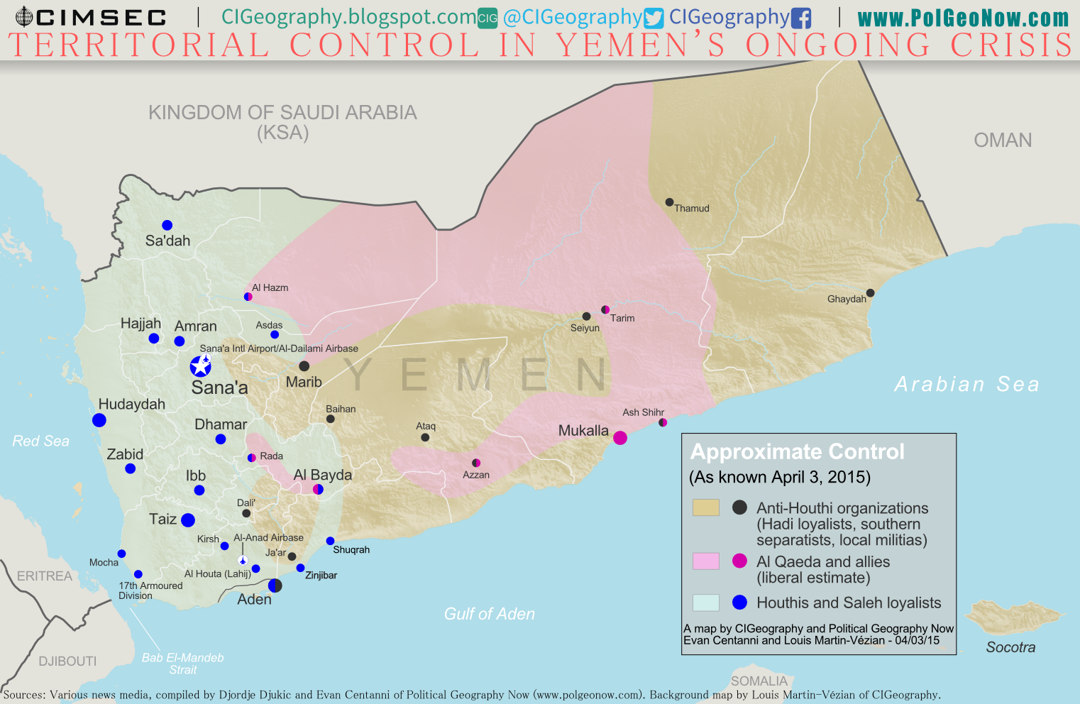
Map of territorial control in Yemen at the beginning of April 2015, at the time of Saudi Arabia's military intervention, including territory held by the Houthi rebels and former president Saleh's forces, president-in-exile Hadi and the Southern Movement, and Al Qaeda in the Arabian Peninsula (AQAP).
Map by Louis Martin-Vézian and Evan Centanni (click to enlarge). All rights reserved.

Subscribers click here to view this article in the ad-free members area. Not a member yet? Subscribe now!

Timeline by Djordje Djukic, with additional reporting by Evan Centanni

The Disintegration of Yemen
When PolGeoNow published our last Yemen control map two and a half years ago, the country appeared to be holding together, if only barely. Authoritarian president Ali Abdullah Saleh had stepped down in an internationally-backed political compromise to end the country’s Arab Spring uprising, and the northern Houthi rebels had halted their advances after promises of political involvement.

Al Qaeda was on the run from its claimed emirates in the south after a military campaign overseen by the new President Abdurabuh Mansur Hadi, Saleh’s former vice president. A movement for southern independence remained outspoken, but wasn’t taking up arms in large numbers against the government.

Now, everything has turned upside-down. The Houthis control most of the country’s populated area, and Al Qaeda is resurgent. Now bitter enemies, the former president and vice president have each joined with opposing rebel groups: Saleh with the Houthis, and Hadi with the southern separatists (though he is not himself a separatist).

Military Intervention
Bent on propping up Hadi and preventing Yemen from falling under the influence of the Houthis, Saudi Arabia and a coalition of Sunni Arab countries has seized Yemen’s waters and airspace and begun a military intervention. Saudi Arabia is joined by forces from its Gulf neighbors Bahrain, Kuwait, Qatar, and the UAE, as well as Egypt, Sudan, Jordan, and Morocco, with support from the U.S. and Somalia.

What brings all these countries together in war? It’s partly about supporting the transitional government they backed, but the real issue is a fear of growing Iranian influence, especially over the sea route connecting Europe and Asia.

However, Iran’s actual role in Yemen’s predicament is unclear: Saudi Arabia claims the Houthis receive military backing from Iran, but so far little evidence has emerged of that, other than the Iranian government’s public verbal support for the rebels’ government. Countering Al Qaeda is also a priority for many countries, but the Houthis are just as fiercely against Al Qaeda as Hadi is (perhaps even more; Al Qaeda is a hateful enemy of all Shiites).

Stay tuned to PolGeoNow and CIGeography for updates to the turbulent situation in Yemen!

See Also: Infographic on Foreign Military Activity in Yemen’s Crisis 

Flag of YemenCountry Name:  
• Yemen (English)
• Al-Yaman (Arabic)
Official Name:  
• Republic of Yemen (English)
al-Jumhūriyyah al-Yamaniyyah (Arabic) 
Capital: Sana’a

Chronology of Events
The following is a timeline of major political events and changes to territorial control in Yemen’s current crisis so far.

September 16, 2014
Houthi rebels attacked the Yemeni capital Sana’a and heavy fighting ensued.

September 21, 2014
After five days of fighting during which hundreds of people were killed, the Houthis took full control of the Yemeni capital of Sana’a.

January 18-22, 2015
Violent clashes erupt in Sana’a, and two days later the Houthis stormed the presidential palace. On January 22, Yemeni president Abdurabuh Mansur Hadi resigned.

February 6, 2015
The rebels dissolved the parliament and set up an interim Revolutionary Committee.

February 21, 2015
Hadi fled house arrest in Sana’a, arriving in the southern port city of Aden and declaring he was still the president.

February 25, 2015
A UN report found that former Yemeni president Ali Abdullah Saleh, who had been pushed out in 2012 after the Arab Spring protests, was actively aiding the Houthis in their advance. He allegedly funded them, ordered his supporters not to obstruct them, and directed an army unit previously commanded by his son to assist them.

March 19, 2015
Forces loyal to Saleh attacked the Aden international airport and carried out airstrikes on Hadi’s new presidential palace in the city. The attack on the airport was repelled and the airstrikes missed the palace. The clashes killed 13 people.

March 20, 2015
Five suicide bombers, allegedly representing a branch of the Islamic State (ISIS/ISIL), conducted coordinated attacks against mosques in Sana’a during Friday prayers, leaving 142 people dead and 345 wounded. Meanwhile, fighters of Al Qaeda – which rejected any blame for the mosque bombings – reportedly captured the Lahij provincial capital of Al Houta, but were pushed out by the army several hours later.

March 21, 2015
Some 100 U.S. special forces members were evacuated from al-Anad airbase and left the country, following the departure of 16 British military and security personnel earlier. The airbase is located close to al-Houta, the city briefly seized by Al Qaeda the previous day.

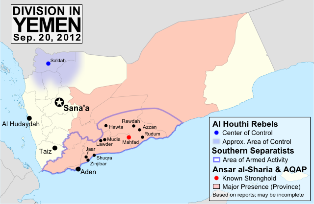
Map of territorial control in Yemen in September 2012, including Houthi rebels, government, and Al Qaeda (AQAP)
Sept. 2012 Yemen Control Map
(click for full-sized map).

March 22, 2015
Houthi fighters and military elements loyal to Saleh captured Taiz, Yemen’s third largest city.

March 24, 2015
The Houthis captured Dali’, Kirsh, and the port of Mocha.

March 25, 2015
Houthi forces and Army units loyal to Saleh seized Al Anad airbase and Aden’s airport. Hadi fled Aden, while his Defense Minister was captured. The Houthis had captured much of Lahij province by this time.

Overnight, a Saudi-led Arab Coalition began airstrikes against Houthi and Saleh forces, with Saudi Arabia claiming full control of Yemeni airspace. 

March 26, 2015
Hadi arrived in the Saudi capital of Riyadh, while his forces shelled the Al Anad airbase, forcing some Houthis to flee.

March 27, 2015
Houthi and Saleh army forces completed the land encirclement of Aden following the capture of the port town of Shuqrah. During the day, a Saudi F-15 fighter jet crashed in the Gulf of Aden and its two pilots were rescued by the U.S. Air Force and Navy. By the end of the day, the death toll from the airstrikes was reported to be 80 anti-Hadi fighters and at least 18 civilians.

March 28, 2015
The Houthis continued their advance in Aden as Houthi tanks near the airport shelled the city and the president’s residence was looted. A weapons storage facility also exploded. An NGO worker in the city reported “Aden is falling apart”.

March 29, 2015
The death toll from the weapons depot explosion in Aden reached 52, while a landmine explosion in Lahij province left 25 Houthi rebels dead. The same day, Houthis advanced west from Shuqrah port, capturing Zinjibar on their way to Aden. The center of a claimed Al Qaeda emirate three years ago, Zinjibar is now a center for pro-Hadi forces.

March 30, 2015
Artillery and rocket fire struck a roundabout in Aden after the Houthis advanced on the city from the east. Hadi troops claimed to have recaptured the Aden airport, while a source in Sana’a reported the Houthis were once again in control hours later. Meanwhile, Saleh Army forces were 30 kilometers from Aden and attempting to approach the city. The fighting for the city had left 100 people dead by this point. The city of Dali’ was also split by fighting between Houthi/Saleh forces and Hadi fighters.

March 31, 2015
Houthi rebels reportedly controlled parts of Aden, also capturing a coastal military base overlooking the strategic Bab El-Mandeb Strait after soldiers of the army’s 17th Armored Division opened the gates for them.

April 1, 2015
A Houthi/Saleh tank column pushed into central Aden, as the death toll from the battle for the city reached at least 103. Meanwhile, the U.N. had reported the previous day that 93 civilians had been killed and 364 injured in the Saudi-led bombing campaign since it started. Later, new reports said at least 23 more civilians were killed in an airstrike on a dairy factory in Hudaydah.

A local militia leader said the Houthis had been pushed out of Baihan, one of their easternmost footholds. 

April 2, 2015
Armed guards from a Chinese ship landed by sea in Aden to provide aid and evacuate civilians, while the Houthis captured another central district of the city.

At the same time, Al Qaeda militants captured the eastern port of Mukalla, Yemen’s fourth biggest city, and freed 300 prisoners from its central prison. Southern militias also reportedly captured Dali’ from the Houthis. During the day, the first Saudi soldier was killed in a firefight on the border.

April 3, 2015
Houthi forces abandoned Hadi’s temporary presidential palace in Aden, after holding it for one day.

Following this story? View all Yemen maps on PolGeoNow.

Graphic of Yemeni flag is in the public domain (source).
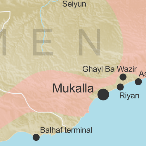
War in Yemen: Map & Infographic of Foreign Military Deployments

This infographic map is a collaboration between PolGeoNow and CIGeography, a site focusing on infographics of military operations related to current events. For details on recent changes to territorial control and the political situation in Yemen, see our companion article, War in Yemen: Map of Territorial Control.

Map of territorial control in Yemen at the beginning of April 2015, with infographic on foreign military deployments to the country.
Map graphic by Louis Martin-Vézian and Evan Centanni (click to enlarge). All rights reserved.

Subscribers click here to view this article in the ad-free members area. Not a member yet? Subscribe now!

This map has also been posted at CIGeography and CIMSEC.

Following this story? View all Yemen maps on PolGeoNow.