Taiwan Loses “Recognition” from El Salvador (Map)

You can always find the latest version of this map, and a list of all related articles, on our Which Countries Recognize Taiwan? page.
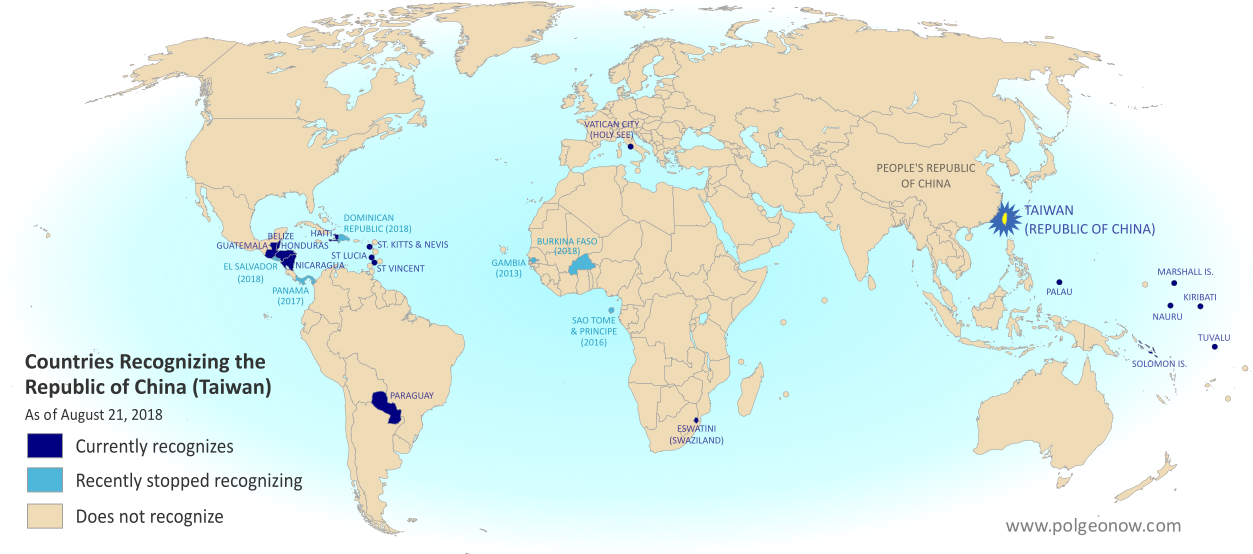
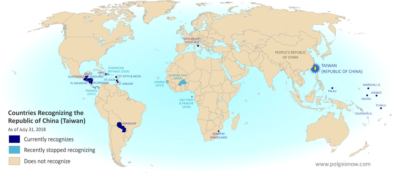
Map of who recognizes Taiwan (what countries recognize the Republic of China) in August 2018. Marks countries that have cut diplomatic ties with Taiwan (withdrawn recognition) in the last ten years: El Salvador, Burkina Faso, the Dominican Republic, Panama, Sao Tome and Principe, and the Gambia. Also answers question: Where is Republic of China located? (Colorblind accessible)
Click to enlarge. By Evan Centanni, modified from public domain blank world map.
Contact us for permission to use this map.

Article by Evan Centanni

El Salvador Drops Taiwan

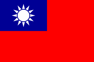
Flag of the Republic of China (Taiwan) Short Name (informal):  
• Taiwan (English)
• ROC (English)
• Táiwān (Chinese)
Official Name (in constitution):  
• Republic of China (English)
• Zhōnghuá Mínguó (Chinese)
Other names used officially:  
• “Republic of China (Taiwan)” (government offices)
• Chinese Taipei (international sports)
• Taiwan, Province of China (used by UN without Taiwan’s input)   
Capital: 
Taipei (de facto)
Claimed by: People’s Republic of China 

Disputed Taiwan lost its official endorsement from the Republic of El Salvador today. The small but densely-populated Central American country is cutting ties with Taiwan’s government in favor of setting up relations with Mainland China, becoming the latest to endorse the Mainland’s claim that Taiwan is part of China.

In a novel twist, reports said Taiwan’s government “pre-emptively” cut ties with El Salvador just hours before the Salvadoran government publicly announced the switch. But the move was still based on a decision by El Salvador, which Taiwan officials said had been holding talks on the possibility since June.

Is Taiwan a Country?

The islands of Taiwan operate like an independent country today, but are governed under the constitution of the “Republic of China” (ROC), the government that ruled Mainland China before the country’s communist revolution (the administration that now rules the Mainland is called the People’s Republic of China, or PRC).

Since 1991, Taiwan’s government has sought recognition separate from Mainland China in the UN, without challenging the PRC’s right to the Mainland. But because the Mainland government insists Taiwan can’t be separate, it cuts ties with any countries that set up relations with Taiwan, even if they want to stay friends with China too.

“Economic Reasons”

El Salvador’s government is calling its shift away from Taiwan the only reasonable choice in a world where China is one of the most powerful economies, saying that it will bring more opportunities in the future. El Salvador has never before had diplomatic relations with the PRC. Alluding to the fact that the ROC no longer governs most of China, a Salvadoran spokesman was quoted as saying, “El Salvador can’t turn its back on international reality.”

Taiwan’s government, on the other hand, described more specific motivations. The disputed country’s foreign minister accused El Salvador’s president of asking Taiwan to fund his re-election campaign, and said the Salvadoran government had also backing for an expensive port construction project that would have left both countries in debt. (Some speculate that if China steps in to fund the port, it could eventually host the first Chinese military base in the Americas.)

Though Taiwan’s dwindling list of diplomatic contacts may not be a critical threat to its self-governing status, these changes are not merely symbolic. Even aside form the economic ramifications for El Salvador, many average people on both sides may be affected. For example, Salvadoran students in Taiwan are about to see their studies cut short, being forced to either transfer to Mainland China or return home.

Learn More: What Exactly is Taiwan, and Do Countries Really “Recognize” It?

Republic of China: Shrinking Recognition

Today, only 17 countries in the world (about 9%) still have formal diplomatic relations with the Taiwan-based “Republic of China” government – the closest equivalent to officially “recognizing” Taiwan as a country. That includes 16 United Nations (UN) member countries plus UN observer state Vatican City.

El Salvador is the fifth country to drop Taiwan since the current ROC president, whose platform involves resisting Mainland Chinese influence, took office in 2016. Before El Salvador, the last four countries to switch to China were the Dominican Republic and Burkina Faso this May, Panama in June 2017, and São Tomé and Príncipe in December 2016.

Only one country, the Gambia, abandoned Taiwan between 2008 and 2016, during a “diplomatic truce” initiated by Taiwan’s most Mainland-friendly president (even then, the PRC waited until Taiwan elected its current president before restoring its own relations with the Gambia).

Graphic of the Republic of China (Taiwan) flag is in the public domain (source).

Map: Which Countries “Recognize” Taiwan?

This map and explainer will be updated whenever there’s a change to the list of Taiwan’s “diplomatic allies”. You can find articles on each change by scrolling to the bottom of this page, or by viewing all Taiwan articles on PolGeoNow.

Map of who recognizes Taiwan (what countries recognize the Republic of China) in August 2018. Marks countries that have cut diplomatic ties with Taiwan (withdrawn recognition) in the last ten years: El Salvador, Burkina Faso, the Dominican Republic, Panama, Sao Tome and Principe, and the Gambia. Also answers question: Where is Republic of China located? (Colorblind accessible)
Click to enlarge. By Evan Centanni, modified from public domain blank world map.
Contact us for permission to use this map.

Is Taiwan a Country?

At PolGeoNow we frequently report on self-proclaimed, unrecognized or partially-recognized countries – but Taiwan is a special case. It operates like an independent country today, but has never formally declared independence. Instead, Taiwan and its surrounding islands govern themselves as the “Republic of China” (ROC), under a constitution brought there by a former government of the Chinese mainland.

Flag of the Republic of China (Taiwan) Short Name (informal):  
• Taiwan (English)
• ROC (English)
• Táiwān (Chinese)
Official Name (in constitution):  
• Republic of China (English)
• Zhōnghuá Mínguó (Chinese)
Other names used officially:  
• “Republic of China (Taiwan)” (government offices)
• Chinese Taipei (international sports)
• Taiwan, Province of China (used by UN without Taiwan’s input)   
Capital: 
Taipei (de facto)
Claimed by: People’s Republic of China

Taiwan (ROC) vs. Mainland China (PRC)

Taiwan’s ROC government stands in contrast to the People’s Republic of China (PRC), which took the Mainland from the ROC in the Chinese Communist Revolution of the 1940s. The PRC government in Bejing never managed to take over Taiwan, but still insists that it will someday, saying the island is an inseparable part of China. It maintains delicate, semi-official relations with the ROC government in Taipei, but fiercely opposes any move toward formal Taiwanese independence.

Taiwan’s ROC government also claimed ownership of all China at one time, when it was ruled under martial law by Chiang Kai-shek‘s Chinese Nationalist Party (Kuomintang, or KMT). But with democracy now in place, and fewer and fewer Taiwanese people thinking of themselves as Chinese, recent administrations have backed off from those claims.

In fact, many of Taiwan’s politicians support increased acknowledgement of independence, but so far no administration has been willing to risk war with Mainland China by issuing a full-on independence declaration.

Who “Recognizes” Taiwan?

Until the 1970s, the Taiwan’s ROC government held onto China’s seat in the United Nations (UN), and was considered China’s rightful government by the majority of the world’s countries. But after the UN General Assembly deposed it and replaced it with the PRC in 1971, the tables turned quickly.

Today, only 17 countries in the world (about 9%) still have formal diplomatic relations with the Taiwan-based ROC government, including 16 UN member countries plus UN observer state Vatican City. All of them are marked on the map above, along with all countries that have cut diplomatic ties with the ROC within the last ten years.
 
Now, recognizing a government doesn’t technically have the same legal meaning as recognizing a country. Officially, everyone recognizes China as a country, but they disagree over whether the ROC or PRC administration is China’s government. That means that when we talk about countries “recognizing” Taiwan, it’s not technically the same thing as when countries recognize Kosovo or Palestine.

To illustrate that point: A country that recognizes Kosovo as a country independent from Serbia normally continues to recognize Serbia as a country too. But in the case of China and Taiwan, countries are forced to pick one or the other. Because the Mainland government insists Taiwan can’t be separate, it cuts ties with any countries that set up relations with Taiwan, even if they want to stay friends with China too.

Still, saying that a country with diplomatic ties to the ROC “recognizes Taiwan” is a useful practical analogy, since Taiwan now strives to be something more like a self-declared country than a rival government of China. In fact, after 1991 Taiwan’s government requested a seat separate from Mainland China in the UN, accepting the PRC’s right to rule the Mainland even while making sure not to declare outright independence.

North and South Korea have an arrangement just like that, both technically claiming to be governments of Korea while still allowing each other to have separate recognition and UN seats. But because the PRC sees Taiwan its subordinate, not its equal, it has blocked any similar deal from happening.

Taiwan Recognition News on PolGeoNow

Since 2017, PolGeoNow has been bringing you ongoing coverage of all events effecting the recognition of Taiwan. News articles about these changes are listed here:

Map of who recognizes Taiwan (what countries recognize the Republic of China) in August 2018. Marks countries that have cut diplomatic ties with Taiwan (withdrawn recognition) in the last ten years: El Salvador, Burkina Faso, the Dominican Republic, Panama, Sao Tome and Principe, and the Gambia. Also answers question: Where is Republic of China located? (Colorblind accessible)El Salvador Switches Recognition from Taiwan to China
Taiwan and El Salvador cut ties in August 2018, amid accusations of unreasonable Salvadoran financial demands.

Full map and article

Map of who recognizes Taiwan (what countries recognize the Republic of China) in June 2018. Marks countries that have cut diplomatic ties with Taiwan (withdrawn recognition) in the last ten years: Burkina Faso, the Dominican Republic, Panama, Sao Tome and Principe, and the Gambia. Also answers question: Where is Republic of China located? (Colorblind accessible)Taiwan Loses Dominican Republic, Burkina Faso Recognition
In May 2018, two more countries cut ties with Taiwan in favor of relations with Mainland China, both under financial pressure.

Full map and article

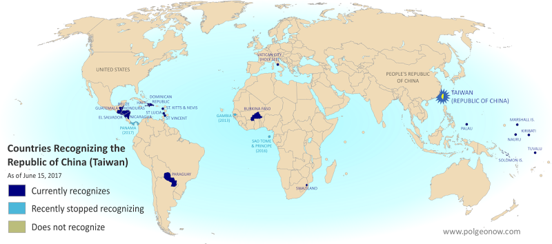
Map of who recognizes Taiwan (what countries recognize the Republic of China) in June 2017. Marks countries that have cut diplomatic ties with Taiwan (withdrawn recognition) in the last ten years: Panama, Sao Tome and Principe, and the Gambia. Also answers question: Where is Republic of China located? (Colorblind accessible)Panama Recognizes China, Stops Recognizing Taiwan
In 2017, the Central American republic of Panama became the second country to cut ties with Taiwan since an eight-year “diplomatic truce” between the ROC and PRC ended in 2016.

Full map and article


Graphic of the Commonwealth flag is displayed under fair use principles (source).

Taiwan Loses Recognition from Dominican Republic, Burkina Faso (Map)

You can always find the latest version of this map, and a list of all related articles, on our Which Countries Recognize Taiwan? page.

Map of who recognizes Taiwan (what countries recognize the Republic of China) in July 2018. Marks countries that have cut diplomatic ties with Taiwan (withdrawn recognition) in the last ten years: Burkina Faso, the Dominican Republic, Panama, Sao Tome and Principe, and the Gambia. Also answers question: Where is Republic of China located? (Colorblind accessible)
Click to enlarge. By Evan Centanni, modified from public domain blank world map.

Article by Evan Centanni

Dominican Republic, Burkina Faso Drop Taiwan

Flag of the Republic of China (Taiwan) Short Name (informal):  
• Taiwan (English)
• ROC (English)
• Táiwān (Chinese)
Official Name (in constitution):  
• Republic of China (English)
• Zhōnghuá Mínguó (Chinese)
Other names used officially:  
• “Republic of China (Taiwan)” (government offices)
• Chinese Taipei (international sports)
• Taiwan, Province of China (used by UN without Taiwan’s input)   
Capital: 
Taipei (de facto)
Claimed by: People’s Republic of China 

This past May, disputed Taiwan lost its official endorsements from both the Dominican Republic in the Caribbean, and Burkina Faso in West Africa. The two countries have cut ties with Taiwan in favor of setting up official relations with Mainland China, endorsing the Mainland’s claim that Taiwan is part of China.

The islands of Taiwan operate like an independent country today, but are governed under the constitution of the “Republic of China” (ROC), the government that ruled Mainland China before the country’s communist revolution (the administration that now rules the Mainland is called the People’s Republic of China, or PRC).

Since 1991, Taiwan’s government has sought recognition separate from Mainland China in the UN, without challenging the PRC’s right to the Mainland. But because the Mainland government insists Taiwan can’t be separate, it cuts ties with any countries that set up relations with Taiwan, even if they want to stay friends with China too.

The Dominican Republic announced it was cutting ties with Taiwan on May 1, 2018, saying the reason was “history and socioeconomic reality”. This reality allegedly includes the equivalent of $3.1 billion US dollars in investments and loans from China, though the Dominican government only mentioned future tourism opportunities as an example.

Burkina Faso followed on May 24, even though it had just co-sponsored Taiwan’s bid to become an observer at World Health Organization (WHO) meetings. The Burkinabe government also cited “socio-economic challenges” and the “evolution of the world” as the reasons for its switch.

Learn More: What Exactly is Taiwan, and Do Countries Really “Recognize” It?

Republic of China: Shrinking Recognition

Today, only 18 countries in the world (about 9%) still have formal diplomatic relations with the Taiwan-based “Republic of China” government – the closest equivalent to officially “recognizing” Taiwan as a country. Before the Dominican Republic and Burkina Faso cut ties in May, the last two countries to drop Taiwan in favor of the PRC were Panama in June 2017 and São Tomé and Príncipe in December 2016.

Only one country, the Gambia, abandoned Taiwan between 2008 and 2016, during a “diplomatic truce” initiated by Taiwan’s most Mainland-friendly president (even then, the PRC waited until Taiwan elected a more independence-leaning president before restoring its own relations with the Gambia).

Taiwan’s last remaining “diplomatic ally” in Africa is tiny Eswatini (Swaziland), whose king recently promised not to follow Burkina Faso in switching to the PRC. Supporters of a separate Taiwan worry their next loss might be the Holy See, government of the Catholic Church’s independent Vatican City in Rome. The Vatican has recently been working to patch up its bad relationship with the Mainland Chinese government.

Learn More: What’s the difference between Vatican City and the Holy See?

Graphic of the Republic of China (Taiwan) flag is in the public domain (source).
Syrian Civil War Map & Timeline: Rebels Lose Daraa Province – July 2018 (Subscription)

SUBSCRIBERS CLICK HERE TO PROCEED TO ARTICLE AND MAP

(To see other maps in this series, view all Syria updates.)

Research by Djordje Djukic. Map by onestopmap.com, Evan Centanni, and Djordje Djukic

Subscribe for full access to all conflict map reports!


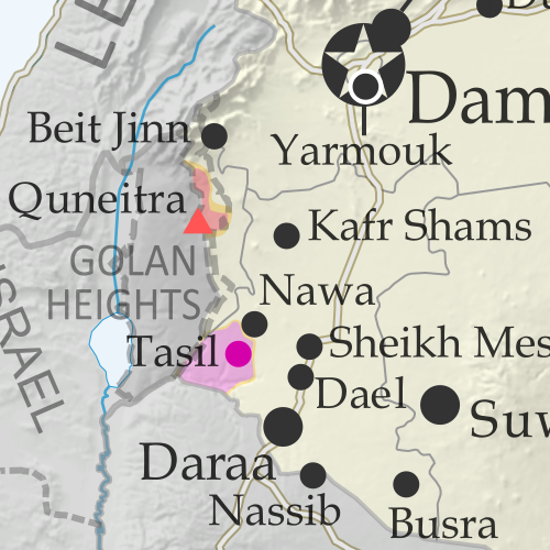
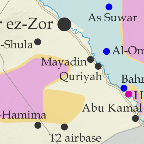
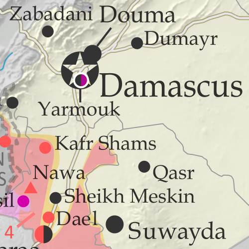
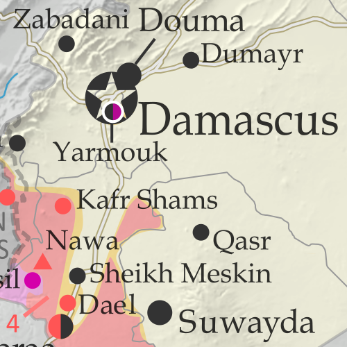
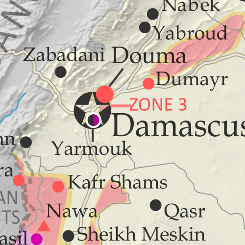
Map of Syrian Civil War (Syria control map): Fighting and territorial control in Syria in June 2018 (Free Syrian Army rebels, Kurdish YPG, Syrian Democratic Forces (SDF), Hayat Tahrir al-Sham (HTS / Al-Nusra Front), Islamic State (ISIS/ISIL), and others). Includes Russia-Turkey-Iran agreed de-escalation zones and US deconfliction zone, plus recent locations of conflict and territorial control changes, such as Daraa, the Golan Heights, Busra, Nawa, Fuaa, and more. Colorblind accessible.Since late June, a rapid government offensive has completely driven rebels out of southwestern Syria’s Daraa province, which they had controlled about half of. 

Meanwhile, the government has surrendered an enclave of control within rebel-held northwestern Syria, and the so-called “Islamic State” (ISIS/ISIL) is struggling to hold onto pockets of territory both east and west.

See all this and more on the latest update to PolGeoNow’s concise, professional Syrian Civil War control map, which includes a timeline of changes since our previous Syria map report in June, with sources cited.

This map and report are premium content, available to paid subscribers of the PolGeoNow Conflict Mapping Service.

Want to see before you subscribe? Check out our most recent FREE SAMPLE Syria map!

Exclusive map report includes:

  • Up-to-date illustration of current territorial control in Syria, color-coded for the Assad government, rebel groups, “Islamic State” (ISIS/ISIL) fighters, and the Kurdish-led Syrian Democratic Forces (SDF). Colorblind accessible.
  • Markers showing the approximate locations of Russian-Turkish-Iranian “de-escalation zones” and the one known US “deconfliction zone”.
  • Special symbols indicating towns dominated by rebels of the former Al Qaeda Nusra Front (now Hayat Tahrir al-Sham or HTS) and by the Kurdish YPG militia (part of the US-backed SDF).
  • Detailed indication of city-by-city control, including key towns and other locations important to current events.
  • Locations of recent control changes and other important events, including Daraa, the Golan Heights, Busra, Nawa, Fuaa, and more.
  • Detailed timeline of important events and changes to territorial control since June 21, 2018, compiled by our Syria-Iraq expert, with links to sources. 
  • Brief summary of the current situation and of major changes to the configuration of territorial boundaries and de facto enclaves and exclaves.

SUBSCRIBERS CLICK HERE TO PROCEED TO ARTICLE AND MAP

Not signed up yet? Click here to learn more about our professional subscription service!

Can I purchase just this map?
This map and report are not available for automated purchase to non-subscribers. If you need access or republication rights for only this map report, contact service@polgeonow.com for options.

Syrian Civil War Map & Timeline: June 2018 (Subscription)

SUBSCRIBERS CLICK HERE TO PROCEED TO ARTICLE AND MAP

There are newer versions of this map available. To see them, view all Syria updates.

Research by Djordje Djukic. Map by onestopmap.com, Evan Centanni, and Djordje Djukic

Subscribe for full access to all conflict map reports!


Map of Syrian Civil War (Syria control map): Fighting and territorial control in Syria in June 2018 (Free Syrian Army rebels, Kurdish YPG, Syrian Democratic Forces (SDF), Hayat Tahrir al-Sham (HTS / Al-Nusra Front), Islamic State (ISIS/ISIL), and others). Includes Russia-Turkey-Iran agreed de-escalation zones and US deconfliction zone, plus recent locations of conflict and territorial control changes, such as Dashishah, Al Kara'a, and more. Colorblind accessible.Since late May, fighting between government and rebel forces in Syria has subsided, but battles against the so-called Islamic State (ISIS/ISIL) have continued in both eastern and western parts of the country.

See all this and more on the latest update to PolGeoNow’s concise, professional Syrian Civil War control map, which includes a timeline of changes since our previous Syria map report in May, with sources cited.

This map and report are premium content, available to paid subscribers of the PolGeoNow Conflict Mapping Service.

Want to see before you subscribe? Check out our most recent FREE SAMPLE Syria map!

Exclusive map report includes:

  • Up-to-date illustration of current territorial control in Syria, color-coded for the Assad government, rebel groups, “Islamic State” (ISIS/ISIL) fighters, and the Kurdish-led Syrian Democratic Forces (SDF). Colorblind accessible.
  • Markers showing the approximate locations of Russian-Turkish-Iranian “de-escalation zones” and the one known US “deconfliction zone”.
  • Special symbols indicating towns dominated by rebels of the former Al Qaeda Nusra Front (now Hayat Tahrir al-Sham or HTS) and by the Kurdish YPG militia (part of the US-backed SDF).
  • Detailed indication of city-by-city control, including key towns and other locations important to current events.
  • Locations of recent control changes and other important events, including Dashishah, Al Kara’a, Manbij, and more.
  • Detailed timeline of important events and changes to territorial control since May 23, 2018, compiled by our Syria-Iraq expert, with links to sources. 
  • Brief summary of the current situation and of major changes to the configuration of territorial boundaries and de facto enclaves and exclaves.

SUBSCRIBERS CLICK HERE TO PROCEED TO ARTICLE AND MAP

Not signed up yet? Click here to learn more about our professional subscription service!

Can I purchase just this map?
This map and report are not available for automated purchase to non-subscribers. If you need access or republication rights for only this map report, contact service@polgeonow.com for options.

Yemen Control Map & Report – June 2018 (Subscription)

SUBSCRIBERS CLICK HERE TO PROCEED TO ARTICLE AND MAP

(To see other maps in this series, view all Yemen articles on PolGeoNow.)

Map of what is happening in Yemen as of June 16, 2018, including territorial control for the unrecognized Houthi government and former president Saleh's forces, president-in-exile Hadi and his allies in the Saudi-led coalition and Southern Movement, Al Qaeda in the Arabian Peninsula (AQAP), and the so-called Islamic State (ISIS/ISIL). Includes recent locations of fighting, including Hodeida, Al Faza, Al Tuhayata, and more. Colorblind accessible.

Subscribe for full access to all conflict map reports!

Timeline by Djordje Djukic. Map by Evan Centanni, Djordje Djukic, and onestopmap.com

Since April, Yemen’s Saudi-led coalition has resisted increasing internal divisions to gain some ground against the rival Houthi government, as well as Al Qaeda forces in the east. Now, the coalition is making a concerted push to capture the Houthi-held city of Hodeida, Yemen’s main port on the Red Sea.

See all this and more on the newest update to PolGeoNow’s Yemen territorial control map, which includes a timeline of changes and important events since our previous Yemen map report in April.

This map and report are premium content available to paid subscribers of the PolGeoNow Conflict Mapping Service.

Want to see before you buy? Check out our most recent FREE SAMPLE Yemen map report!

Exclusive report includes:

  • Up-to-date map of current territorial control in Yemen, color-coded for the pro-Hadi coalition, Houthi/Saleh forces, Al Qaeda in the Arabian Peninsula (AQAP), and the so-called “Islamic State” (ISIS/ISIL).
  • Detailed indication of town-by-town control, including provincial boundaries, all major cities, and many smaller ones
  • Markers for recent areas of fighting, including Hodeida, Al Faza, Al Tuhayata, and more
  • Timeline of changes to the situation since April 14, 2018, with links to sources

SUBSCRIBERS CLICK HERE TO PROCEED TO ARTICLE AND MAP

Not a member yet? Click here to learn more about our professional subscription service!

Can I purchase just this map?
This map and report are not available for automated purchase to non-subscribers. If you need access or republication rights for only this map report, contact service@polgeonow.com for options.

Syrian Civil War Map & Timeline: Rebels Lose Rastan Enclave – May 2018 (Subscription)

SUBSCRIBERS CLICK HERE TO PROCEED TO ARTICLE AND MAP

There are newer versions of this map available. To see them, view all Syria updates.

Research by Djordje Djukic. Map by onestopmap.com, Evan Centanni, and Djordje Djukic

Subscribe for full access to all conflict map reports!


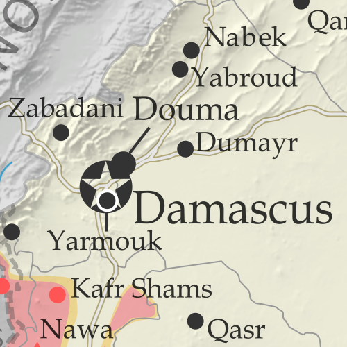
Map of Syrian Civil War (Syria control map): Fighting and territorial control in Syria in May 2018 (Free Syrian Army rebels, Kurdish YPG, Syrian Democratic Forces (SDF), Hayat Tahrir al-Sham (HTS / Al-Nusra Front), Islamic State (ISIS/ISIL), and others). Includes Russia-Turkey-Iran agreed de-escalation zones and US deconfliction zone, plus recent locations of conflict and territorial control changes, such as Rastan, Yarmouk, Baghuz, and more. Colorblind accessible.
In the past month, Syria’s rebels have lost one of their biggest enclaves of control – “Zone 2” near the city of Homs, including their oldest stronghold in Rastan. Meanwhile, the national capital has been completely cleared of rebel and “Islamic State” control pockets.

See all this and more on the latest update to PolGeoNow’s concise, professional Syrian Civil War control map, which includes a timeline of changes since our previous Syria map report in April, with sources cited.

This map and report are premium content, available to paid subscribers of the PolGeoNow Conflict Mapping Service.

Want to see before you subscribe? Check out our most recent FREE SAMPLE Syria map!

Exclusive map report includes:

  • Up-to-date illustration of current territorial control in Syria, color-coded for the Assad government, rebel groups, “Islamic State” (ISIS/ISIL) fighters, and the Kurdish-led Syrian Democratic Forces (SDF). Colorblind accessible.
  • Markers showing the approximate locations of Russian-Turkish-Iranian “de-escalation zones” and the one known US “deconfliction zone”.
  • Special symbols indicating towns dominated by rebels of the former Al Qaeda Nusra Front (now Hayat Tahrir al-Sham or HTS) and by the Kurdish YPG militia (part of the US-backed SDF).
  • Detailed indication of city-by-city control, including key towns and other locations important to current events.
  • Locations of recent control changes and other important events, including Rastan, Yarmouk, Baghuz, and more.
  • Detailed timeline of important events and changes to territorial control since April 25, 2018, compiled by our Syria-Iraq expert, with links to sources. 
  • Brief summary of the current situation and of major changes to the configuration of territorial boundaries and de facto enclaves and exclaves.

SUBSCRIBERS CLICK HERE TO PROCEED TO ARTICLE AND MAP

Not signed up yet? Click here to learn more about our professional subscription service!

Can I purchase just this map?
This map and report are not available for automated purchase to non-subscribers. If you need access or republication rights for only this map report, contact service@polgeonow.com for options.

Syrian Civil War Map & Timeline: Kurdish, Rebel Enclaves Evaporate – April 2018 (Subscription)

SUBSCRIBERS CLICK HERE TO PROCEED TO ARTICLE AND MAP

There are newer versions of this map available. To see them, view all Syria updates.

Research by Djordje Djukic. Map by onestopmap.com, Evan Centanni, and Djordje Djukic

Subscribe for full access to all conflict map reports!


Map of Syrian Civil War (Syria control map): Fighting and territorial control in Syria in April 2018 (Free Syrian Army rebels, Kurdish YPG, Syrian Democratic Forces (SDF), Hayat Tahrir al-Sham (HTS / Al-Nusra Front), Islamic State (ISIS/ISIL), and others). Includes Russia-Turkey-Iran agreed de-escalation zones and US deconfliction zone, plus recent locations of conflict and territorial control changes, such as Afrin, Douma, Dumayr, Sabaa Biyar, and more. Colorblind accessible.
In the last six weeks, Turkey-led forces have expelled the Kurdish YPG from its stronghold in Afrin, while the three major pockets of rebel control near Damascus have all been wiped off the map.

See all this and more on the latest update to PolGeoNow’s concise, professional Syrian Civil War control map, which includes a timeline of changes since our previous Syria map report in March, with sources cited.

This map and report are premium content, available to paid subscribers of the PolGeoNow Conflict Mapping Service.

Want to see before you subscribe? Check out our most recent FREE SAMPLE Syria map!

Exclusive map report includes:

  • Up-to-date illustration of current territorial control in Syria, color-coded for the Assad government, rebel groups, “Islamic State” (ISIS/ISIL) fighters, and the Kurdish-led Syrian Democratic Forces (SDF). Colorblind accessible.
  • Markers showing the approximate locations of Russian-Turkish-Iranian “de-escalation zones” and the one known US “deconfliction zone”.
  • Special symbols indicating towns dominated by rebels of the former Al Qaeda Nusra Front (now Hayat Tahrir al-Sham or HTS) and by the Kurdish YPG militia (part of the US-backed SDF).
  • Detailed indication of city-by-city control, including key towns and other locations important to current events.
  • Locations of recent fighting and other important events, including Afrin, Douma, Dumayr, Sabaa Biyar, and more.
  • Detailed timeline of important events and changes to territorial control since March 16, 2018, compiled by our Syria-Iraq expert, with links to sources. 
  • Brief summary of current situation, as well as major changes to the configuration of territorial boundaries and de facto enclaves and exclaves.

SUBSCRIBERS CLICK HERE TO PROCEED TO ARTICLE AND MAP

Not signed up yet? Click here to learn more about our professional subscription service!

Can I purchase just this map?
This map and report are not available for automated purchase to non-subscribers. If you need access or republication rights for only this map report, contact service@polgeonow.com for options.

Yemen Control Map & Report – April 2018 (Subscription)

SUBSCRIBERS CLICK HERE TO PROCEED TO ARTICLE AND MAP

There are newer versions of this map available. To see them, view all Yemen articles on PolGeoNow.
 
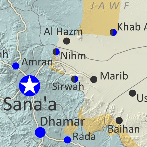
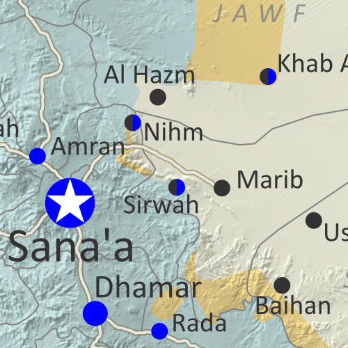
Map of what is happening in Yemen as of May 21, 2017, including territorial control for the unrecognized Houthi government and former president Saleh's forces, president-in-exile Hadi and his allies in the Saudi-led coalition and Southern Movement, Al Qaeda in the Arabian Peninsula (AQAP), and the so-called Islamic State (ISIS/ISIL). Includes recent locations of fighting, including Azzan, Habban, Maydee, Nihm, and more.

Subscribe for full access to all conflict map reports!

Timeline by Djordje Djukic. Map by Evan Centanni, Djordje Djukic, and onestopmap.com

In the past three months, the civil war in Yemen has been marked by infighting within the Saudi-led coalition, while those forces have made only small progress against the Houthis and Al Qaeda.

See all this and more on the newest update to PolGeoNow’s Yemen territorial control map, which includes a timeline of changes and important events since our previous Yemen map report in January.

This map and report are premium content available to paid subscribers of the PolGeoNow Conflict Mapping Service.

Want to see before you buy? Check out our most recent FREE SAMPLE Yemen map report!

Exclusive report includes:

  • Up-to-date map of current territorial control in Yemen, color-coded for the pro-Hadi coalition, Houthi/Saleh forces, Al Qaeda in the Arabian Peninsula (AQAP), and the so-called “Islamic State” (ISIS/ISIL).
  • Detailed indication of town-by-town control, including provincial boundaries, all major cities, and many smaller ones
  • Markers for recent areas of fighting, including Hays, Kirsh, Nihm, Ketaf, and more
  • Timeline of changes to the situation since January 6, 2018, with links to sources

SUBSCRIBERS CLICK HERE TO PROCEED TO ARTICLE AND MAP

Not a member yet? Click here to learn more about our professional subscription service!

Can I purchase just this map?
This map and report are not available for automated purchase to non-subscribers. If you need access or republication rights for only this map report, contact service@polgeonow.com for options.

Syrian Civil War Map & Timeline: Afrin Separated from Turkey – March 2018 (Subscription)

SUBSCRIBERS CLICK HERE TO PROCEED TO ARTICLE AND MAP

There are newer versions of this map available. To see them, view all Syria updates.

Research by Djordje Djukic. Map by onestopmap.com, Evan Centanni, and Djordje Djukic

Subscribe for full access to all conflict map reports!


Map of Syrian Civil War (Syria control map): Fighting and territorial control in Syria in March 2018 (Free Syrian Army rebels, Kurdish YPG, Syrian Democratic Forces (SDF), Hayat Tahrir al-Sham (HTS / Al-Nusra Front), Islamic State (ISIS/ISIL), and others). Includes Russia-Turkey-Iran agreed de-escalation zones and US deconfliction zone, plus recent locations of conflict and territorial control changes, such as Afrin, the Eastern Ghouta rebel zone, and more. Colorblind accessible.
Over the past month, fighting has raged in three major flashpoints in Syria, with the Turkish invasion of Afrin, Assad’s new ground war against rebels near Damascus, and heavy infighting between rebel groups in the north.

See all this and more on the latest update to PolGeoNow’s concise, professional Syrian Civil War control map, which includes a timeline of changes since our previous Syria map report in February, with sources cited.

This map and report are premium content, available to paid subscribers of the PolGeoNow Conflict Mapping Service.

Want to see before you subscribe? Check out our most recent FREE SAMPLE Syria map!

Exclusive map report includes:

  • Up-to-date illustration of current territorial control in Syria, color-coded for the Assad government, rebel groups, “Islamic State” (ISIS/ISIL) fighters, and Kurdish/SDF forces. Colorblind accessible.
  • Markers showing the approximate locations of Russian-Turkish-Iranian “de-escalation zones” and the one known US “deconfliction zone”.
  • Special symbols indicating towns dominated by rebels of the former Al Qaeda Nusra Front (now Hayat Tahrir al-Sham or HTS) and by the US-backed Syrian Democratic Forces (SDF).
  • Detailed indication of city-by-city control, including key towns and other locations important to current events.
  • Locations of recent fighting and other important events, including Kurdish Afrin, the Eastern Ghouta rebel zone near Damascus, and more.
  • Detailed timeline of important events and changes to territorial control since February 13, 2018, compiled by our Syria-Iraq expert, with links to sources. 
  • Brief summary of current situation, as well as major changes to the configuration of territorial boundaries and de facto enclaves and exclaves.

SUBSCRIBERS CLICK HERE TO PROCEED TO ARTICLE AND MAP

Not signed up yet? Click here to learn more about our professional subscription service!

Can I purchase just this map?
This map and report are not available for automated purchase to non-subscribers. If you need access or republication rights for only this map report, contact service@polgeonow.com for options.