Syrian Civil War Map & Timeline: Rebels Lose Daraa Province – July 2018 (Subscription)

SUBSCRIBERS CLICK HERE TO PROCEED TO ARTICLE AND MAP

(To see other maps in this series, view all Syria updates.)

Research by Djordje Djukic. Map by onestopmap.com, Evan Centanni, and Djordje Djukic

Subscribe for full access to all conflict map reports!


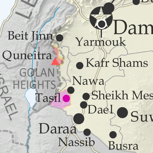
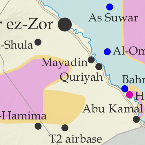
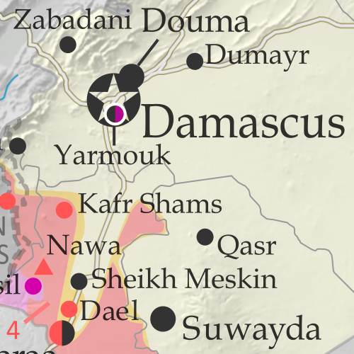
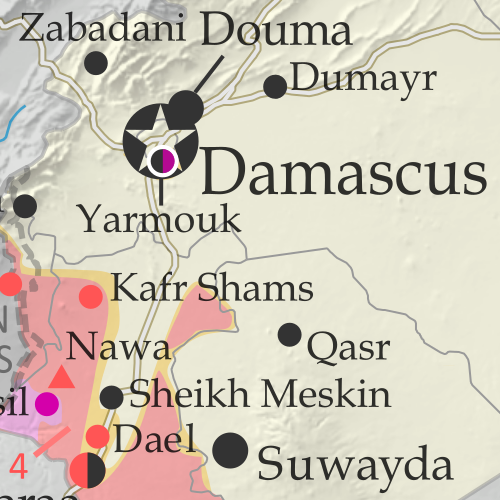
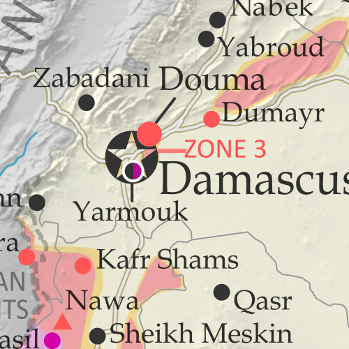
Map of Syrian Civil War (Syria control map): Fighting and territorial control in Syria in June 2018 (Free Syrian Army rebels, Kurdish YPG, Syrian Democratic Forces (SDF), Hayat Tahrir al-Sham (HTS / Al-Nusra Front), Islamic State (ISIS/ISIL), and others). Includes Russia-Turkey-Iran agreed de-escalation zones and US deconfliction zone, plus recent locations of conflict and territorial control changes, such as Daraa, the Golan Heights, Busra, Nawa, Fuaa, and more. Colorblind accessible.Since late June, a rapid government offensive has completely driven rebels out of southwestern Syria’s Daraa province, which they had controlled about half of. 

Meanwhile, the government has surrendered an enclave of control within rebel-held northwestern Syria, and the so-called “Islamic State” (ISIS/ISIL) is struggling to hold onto pockets of territory both east and west.

See all this and more on the latest update to PolGeoNow’s concise, professional Syrian Civil War control map, which includes a timeline of changes since our previous Syria map report in June, with sources cited.

This map and report are premium content, available to paid subscribers of the PolGeoNow Conflict Mapping Service.

Want to see before you subscribe? Check out our most recent FREE SAMPLE Syria map!

Exclusive map report includes:

  • Up-to-date illustration of current territorial control in Syria, color-coded for the Assad government, rebel groups, “Islamic State” (ISIS/ISIL) fighters, and the Kurdish-led Syrian Democratic Forces (SDF). Colorblind accessible.
  • Markers showing the approximate locations of Russian-Turkish-Iranian “de-escalation zones” and the one known US “deconfliction zone”.
  • Special symbols indicating towns dominated by rebels of the former Al Qaeda Nusra Front (now Hayat Tahrir al-Sham or HTS) and by the Kurdish YPG militia (part of the US-backed SDF).
  • Detailed indication of city-by-city control, including key towns and other locations important to current events.
  • Locations of recent control changes and other important events, including Daraa, the Golan Heights, Busra, Nawa, Fuaa, and more.
  • Detailed timeline of important events and changes to territorial control since June 21, 2018, compiled by our Syria-Iraq expert, with links to sources. 
  • Brief summary of the current situation and of major changes to the configuration of territorial boundaries and de facto enclaves and exclaves.

SUBSCRIBERS CLICK HERE TO PROCEED TO ARTICLE AND MAP

Not signed up yet? Click here to learn more about our professional subscription service!

Can I purchase just this map?
This map and report are not available for automated purchase to non-subscribers. If you need access or republication rights for only this map report, contact service@polgeonow.com for options.

Libyan Civil War Map & Timeline – July 2018

To see more maps in this series, view all Libya articles.
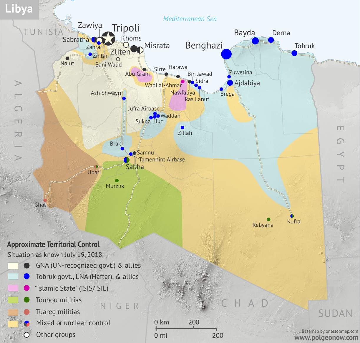
Libya: Who controls what? A concise, professional map of of who controls Libya now (July 2018). Shows detailed territorial control in the Libyan Civil War as of July 19, 2018, including all major parties (Government of National Accord (GNA); Tobruk House of Representatives, General Haftar's Libyan National Army (LNA), and allies; Tuareg and Toubou (Tebu) militias in the south; the so-called Islamic State (ISIS/ISIL); and other groups such as the National Salvation Government(NSG) and religious hardline groups). Includes terrain and major roads. Colorblind accessible.
Base map by Koen Adams of onestopmap.com, with territorial control by Evan Centanni. All rights reserved.

(Subscribers click here to view this article on the member site)

Timeline by Djordje Djukic

Libya: Who Controls What?

Ten months after our previous Libya control map and report, the country remains divided between two major rival governments and several smaller groups, but there have been a few changes to their areas of control. This is the first free edition of our map that also shows the territories of the Toubou and Tuareg militias in Libya’s south, which align on and off with the country’s two major governments.

(Toubou and Tuareg are two non-Arab ethnic groups residing in southern Libya and neighboring parts of the Sahara Desert – the armed coalitions shown on the maps are formed by and for members of those peoples, but not all Toubou and Tuareg people are affiliated with them.)

Maybe the biggest change to Libya’s political geography situation since last year has been the Toubou militias’ realignment. Until this May, they were loosely allied with the eastern government’s “Libyan National Army” (LNA), but after the LNA began supporting their opponents in the city of Sabha, they turned against the eastern government and have leaned more towards the western government in Tripoli.

Also, just last month, the LNA eliminated an enclave of rival control in eastern city of Derna, which had been controlled by an independent armed group often accused of having ties to Al Qaeda.

For a full explanation of Libya’s rival governments and major armed groups, including the history of the current civil war since the fall of Muammar Gaddafi in 2011, see our detailed Libya background article and timeline from August 2015. You can see subsequent updates from 2015 to present by viewing all Libya articles.
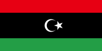
Flag of Libya (2011-present)Country Name:  
• Libya (English)
• Lībyā (Arabic)
Official Name:  
• State of Libya (English)
Dawlat Lībyā (Arabic) 
Capital: Tripoli

Timeline of Events

The following is a detailed timeline of major political events and changes to territorial control since our previous Libya map report of September 20, 2017.

September 21 – October 6, 2017
Clashes resumed between two opposing groups in Sabratha, west of Tripoli, after negotiations collapsed. The fighting pitted a group called the Anti-ISIS Operations Room (AIOR) and its allies on one side, against the Anas al-Dabbashi brigade, which had been called major facilitator of migrant smuggling, but recently said it had reached a deal with the UN-backed Government of National Accord (GNA) in Tripoli to stop boats from leaving to Europe across the Mediterranean sea.

The al-Dabbashi brigade said it was targeted by opponents who wanted to continue smuggling, while the AIOR claimed its rivals were “jihadists”. Some reports said the fighting came as a result of an Italian-backed deal to fund militias as police forces against migrants. On 23 September, the AOIR captured the downtown Qamar Hotel, while on 28 September, it seized the famous Sabratha Roman ruins, a UNESCO world heritage site. On October 6, the AOIR took full control of Sabratha.

Both the GNA and the Benghazi-based Libyan National Army (LNA) have claimed links to the AOIR and both welcomed the group’s capture of the city. The three weeks of fighting left at least 43 people dead and 340 wounded.

November 5, 2017
After holding out for four months in Benghazi, the last fighters of the religious hardline Benghazi Revolutionaries’ Shura Council (BRSC) in the city came under renewed attack from the LNA. Airstrikes were carried out against the fighters for the first time in weeks, along with a ground assault, after the LNA abandoned its attempts to starve them out. It was said only a few buildings remained under BRSC control. However, the LNA’s assault met with stiff resistance.

November 5-8, 2017
Brigades loyal to both the GNA and the LNA started a joint operation in a western district of Tripoli against alleged criminal elements, as well as a militia loyal to deceased Libyan leader Muammar Gaddafi. The district was seized three days later.

November 11, 2017
It was reported that the Sidi Akribesh neighborhood of Benghazi, the location of the BRSC holdouts, had come under control of the LNA. However, two days later, it was confirmed that fighting in the neighborhood was still continuing.

December 15, 2017
It was reported that 10 BRSC fighters and 7 LNA soldiers had been killed in fighting in Benghazi in November.

December 28-30, 2017
The LNA announced it had taken full control of Benghazi’s Sidi Akribesh neighborhood from the hardline fighters. However, the following day, it was said that clearing operations were still continuing in the area. The area was secured and the operations concluded on December 30, after five hardline fighters were killed. Overall, 17 LNA soldiers had been killed throughout December in the clashes, while another 76 had been wounded. Some reported that remaining BRSC fighters managed to retreat to Derna, the LNA denied this.

January 15, 2018
The Mitiga airport in Tripoli was shut down after a GNA-allied group repelled an attack by a rival militia. Several planes at the airport were damaged in the fighting, which left at least 20 people dead.

January 23, 2018
Twin car bombings targeting the Bayaat al-Radwan mosque in Benghazi left 35 people dead. Senior security officers were among the casualties, including Ahmed al-Feitouri, head of the LNA’s investigations and arrests unit.

February 4-March 2, 2018
Fighting erupted in the southern city of Sabha between the Sixth Brigade, composed of members of the Awlad Suleiman tribe, and Toubou militias. The Sixth Brigade had up to then supported the GNA, while the Toubous were nominally linked to the LNA. However, the GNA-loyal commander of the Sixth Brigade was eventually replaced by an LNA commander, after which eastern tribal elders tasked with mediating a truce in Sabha declared the Sixth to be a LNA unit.

The LNA then began providing support to the Sixth Brigade, which the GNA had not previously delivered, and the brigade used this to press its advantage against the Toubou militias. The walls of the historic Sabha castle were severely damaged by missile fire during the fighting.

February 24, 2018
A reconciliation agreement was reached between the Toubou and the Zawia tribe in Kufra. The two groups had previously clashed in late 2015. The agreement called for the establishment of a neutral security force in the town.

March 6, 2018
Fighting was temporarily renewed in Sabha, before the situation calmed down again.

March 15, 2018
The first LNA units from Benghazi arrived in Kufra to secure the town. The local LNA unit was mostly made up of members of the Zawia tribe, which had previously been involved in fighting against the Toubou.

April 2, 2018
Sabha’s castle was once again hit by rocket fire.

May 2, 2018
Suicide bombers loyal to the so-called “Islamic State” (IS; formerly ISIS/ISIL) attacked the High National Elections Commission in Tripoli, killing 16 people. Meanwhile, Kufra’s tribes vowed support for the LNA.

May 5, 2018
Fighting was renewed in Sabha. Overall, 18 people had been killed and 86 injured, mostly civilians, since the clashes in the city began in February.

May 7-8, 2018
The LNA launched an assault on the city of Derna, held by the allegedly religious-hardline Derna Mujahideen Shura Council (DMSC), with clashes erupting in the eastern Fatayeh district. The next day, the LNA captured a point of high ground outside Derna.

May 11, 2018
The DMSC dissolved itself and announced the creation of the Derna Protection Force (DPF), which it said would a moderate group under the command of anti-LNA Libyan army officers. The DMSC was widely considered a religious hardline group with links to Al Qaeda, but its leaders claimed this was a lie spread by the LNA’s General Haftar.

May 12-13, 2018
After a new LNA governor arrived in Sabha, he declared a ceasefire between the Sixth Brigade and the Toubou. At this point the Toubou coalition, which had been drifting away from the LNA, demanded that the new governor say whether the Sixth was an LNA unit. After he confirmed that it was, the Toubou declared war on the LNA and launched a large attack, capturing the Sabha castle.

The castle was temporarily recaptured by the Sixth Brigade before the Toubou fighters once again seized it, along with the Sixth’s headquarters, the next day. The Toubou coalition also reopened the road to northern Libya and called on the GNA to secure the city. Since the beginning of May, 31 people had been killed in the fighting in Sabha.

May 15, 2018
The DPF withdrew from the Heela district of Derna.

May 28, 2018
The LNA captured two southwestern suburbs of Derna.

May 31, 2018
It was reported that since the start of the battle for Derna, 20 LNA soldiers had been killed and 35 wounded. The LNA also estimated that more than 100 DMSC/DPF fighters had died and another 100 had surrendered.

Meanwhile, an armed group attacked and briefly captured Tamenhint Airbase, northeast of Sabha. The attack was reportedly conducted by either the Benghazi Defence Brigades (BDB), a religious hardline militia, or the Toubou militias.

June 5, 2018
The LNA reached 75 percent control of Derna.

June 9-10, 2018
The LNA advanced in Derna’s Sheiha district up to the edge of the central Al-Maghar area after multiple airstrikes. This left less than 10 square kilometers remaining under DPF control.

June 14, 2018
A UK-based Arab human rights organization reported that since the start of the battle for Derna, 17 civilians had been killed and about 30 wounded.

June 14-16, 2018
The hardline Beghazi Defense Brigades (BDB) attacked and captured the Sidra and Ras Lanuf oil ports from the LNA. The LNA conducted a counterattack two days later, reporting that at least 20 BDB fighters and 14 LNA soldiers had been killed in the two-day clashes.

June 21-25, 2018
The LNA recaptured Sidra and Ras Lanuf. However, the BDB soon launched a counterattack. The BDB, which is said to have links with Al Qaeda, was also supported by mercenaries from the neighboring country of Chad. Four days later, the LNA fully secured the two oil terminals.

June 28, 2018
The LNA assumed full control of Derna after capturing the Al-Maghar district from the DPF. LNA sources said their next target would be gangs and foreign mercenaries in the southern city of Sabha.

Following this story? View all Libya maps on PolGeoNow.

Graphic of the Libyan flag is in the public domain (source).

Syrian Civil War Map & Timeline: June 2018 (Subscription)

SUBSCRIBERS CLICK HERE TO PROCEED TO ARTICLE AND MAP

There are newer versions of this map available. To see them, view all Syria updates.

Research by Djordje Djukic. Map by onestopmap.com, Evan Centanni, and Djordje Djukic

Subscribe for full access to all conflict map reports!


Map of Syrian Civil War (Syria control map): Fighting and territorial control in Syria in June 2018 (Free Syrian Army rebels, Kurdish YPG, Syrian Democratic Forces (SDF), Hayat Tahrir al-Sham (HTS / Al-Nusra Front), Islamic State (ISIS/ISIL), and others). Includes Russia-Turkey-Iran agreed de-escalation zones and US deconfliction zone, plus recent locations of conflict and territorial control changes, such as Dashishah, Al Kara'a, and more. Colorblind accessible.Since late May, fighting between government and rebel forces in Syria has subsided, but battles against the so-called Islamic State (ISIS/ISIL) have continued in both eastern and western parts of the country.

See all this and more on the latest update to PolGeoNow’s concise, professional Syrian Civil War control map, which includes a timeline of changes since our previous Syria map report in May, with sources cited.

This map and report are premium content, available to paid subscribers of the PolGeoNow Conflict Mapping Service.

Want to see before you subscribe? Check out our most recent FREE SAMPLE Syria map!

Exclusive map report includes:

  • Up-to-date illustration of current territorial control in Syria, color-coded for the Assad government, rebel groups, “Islamic State” (ISIS/ISIL) fighters, and the Kurdish-led Syrian Democratic Forces (SDF). Colorblind accessible.
  • Markers showing the approximate locations of Russian-Turkish-Iranian “de-escalation zones” and the one known US “deconfliction zone”.
  • Special symbols indicating towns dominated by rebels of the former Al Qaeda Nusra Front (now Hayat Tahrir al-Sham or HTS) and by the Kurdish YPG militia (part of the US-backed SDF).
  • Detailed indication of city-by-city control, including key towns and other locations important to current events.
  • Locations of recent control changes and other important events, including Dashishah, Al Kara’a, Manbij, and more.
  • Detailed timeline of important events and changes to territorial control since May 23, 2018, compiled by our Syria-Iraq expert, with links to sources. 
  • Brief summary of the current situation and of major changes to the configuration of territorial boundaries and de facto enclaves and exclaves.

SUBSCRIBERS CLICK HERE TO PROCEED TO ARTICLE AND MAP

Not signed up yet? Click here to learn more about our professional subscription service!

Can I purchase just this map?
This map and report are not available for automated purchase to non-subscribers. If you need access or republication rights for only this map report, contact service@polgeonow.com for options.

Yemen Control Map & Report – June 2018 (Subscription)

SUBSCRIBERS CLICK HERE TO PROCEED TO ARTICLE AND MAP

(To see other maps in this series, view all Yemen articles on PolGeoNow.)

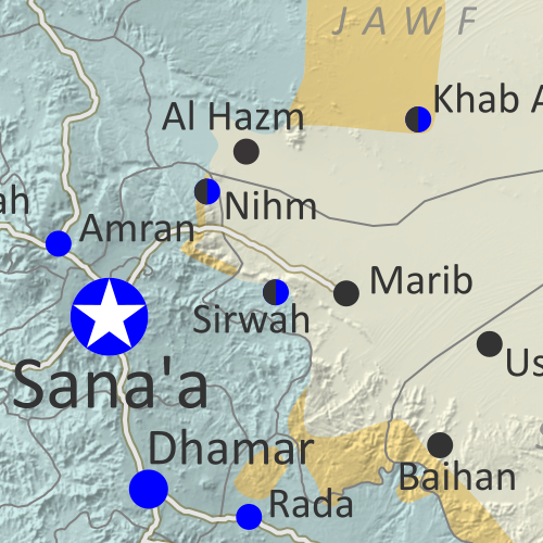
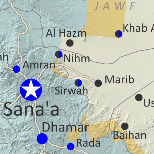
Map of what is happening in Yemen as of June 16, 2018, including territorial control for the unrecognized Houthi government and former president Saleh's forces, president-in-exile Hadi and his allies in the Saudi-led coalition and Southern Movement, Al Qaeda in the Arabian Peninsula (AQAP), and the so-called Islamic State (ISIS/ISIL). Includes recent locations of fighting, including Hodeida, Al Faza, Al Tuhayata, and more. Colorblind accessible.

Subscribe for full access to all conflict map reports!

Timeline by Djordje Djukic. Map by Evan Centanni, Djordje Djukic, and onestopmap.com

Since April, Yemen’s Saudi-led coalition has resisted increasing internal divisions to gain some ground against the rival Houthi government, as well as Al Qaeda forces in the east. Now, the coalition is making a concerted push to capture the Houthi-held city of Hodeida, Yemen’s main port on the Red Sea.

See all this and more on the newest update to PolGeoNow’s Yemen territorial control map, which includes a timeline of changes and important events since our previous Yemen map report in April.

This map and report are premium content available to paid subscribers of the PolGeoNow Conflict Mapping Service.

Want to see before you buy? Check out our most recent FREE SAMPLE Yemen map report!

Exclusive report includes:

  • Up-to-date map of current territorial control in Yemen, color-coded for the pro-Hadi coalition, Houthi/Saleh forces, Al Qaeda in the Arabian Peninsula (AQAP), and the so-called “Islamic State” (ISIS/ISIL).
  • Detailed indication of town-by-town control, including provincial boundaries, all major cities, and many smaller ones
  • Markers for recent areas of fighting, including Hodeida, Al Faza, Al Tuhayata, and more
  • Timeline of changes to the situation since April 14, 2018, with links to sources

SUBSCRIBERS CLICK HERE TO PROCEED TO ARTICLE AND MAP

Not a member yet? Click here to learn more about our professional subscription service!

Can I purchase just this map?
This map and report are not available for automated purchase to non-subscribers. If you need access or republication rights for only this map report, contact service@polgeonow.com for options.

Somalia Control Map & Timeline – June 2018 (Subscription)

SUBSCRIBERS CLICK HERE TO PROCEED TO ARTICLE AND MAP

(To see other maps in this series, view all Somalia updates.)

Map by onestopmap.com, Evan Centanni, and Djordje Djukic

Subscribe for full access to all conflict map reports!


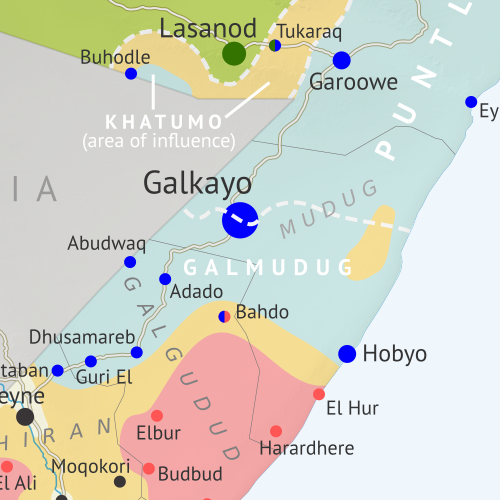
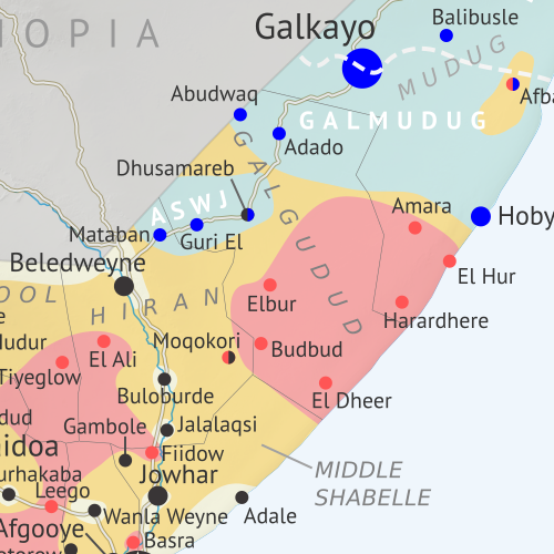
Who controls Somalia? Map (2018). With states, regions, and territorial control. Best Somalia control map online, thoroughly researched and detailed but concise. Shows territorial control by Federal Government of Somalia (FGS), Al Shabaab, so-called Islamic State (ISIS/ISIL), separatist Somaliland, and autonomous states Puntland, Galmudug, and Khatumo (the ASWJ Sufi militia has merged with Galmudug state). Updated to June 2, 2018. Colorblind accessible.
In the last two months, several towns in southern Somalia have changed hands between Al Shabaab and government-allied forces, while political realignments have continued to change the country’s map of autonomous states.

See all this and more on the latest update to PolGeoNow’s concise, professional Somalia control map, which includes a timeline of changes since our previous Somalia map report of March 2018, with sources cited.

This map and report are premium content, available to paid subscribers of the PolGeoNow Conflict Mapping Service.

Want to see before you subscribe? Check out our most recent FREE SAMPLE Somalia map!

Exclusive map report includes:

  • Up-to-date illustration of current territorial control in Somalia, color-coded for the federal government coalition (including AMISOM peacekeepers), autonomous unionist forces, separatist Somaliland, Al Qaeda affiliate Al Shabaab, and fighters aligned to the so-called “Islamic State” (ISIS/ISIL). Areas of lawlessness or unclear control indicated separately. Colorblind accessible.
  • Boundaries and labels for Somalia’s official regions, plus control lines for the autonomous administrations of Somaliland, Puntland, Galmudug, and Khatumo.
  • Detailed indication of city-by-city control, including many relevant smaller towns and villages.
  • Locations of recent fighting and other important events, including Tukaraq, Moqokori, Bulo Haji, Bali Khadar, and more.
  • Detailed timeline of territorial control changes and key political developments since March 28, 2018, with sources indicated. 
  • Brief summary of the conflict situation, as well as major changes to the alignment of autonomous administrations, over the past seven months.

SUBSCRIBERS CLICK HERE TO PROCEED TO ARTICLE AND MAP

Not signed up yet? Click here to learn more about our professional subscription service!

Syrian Civil War Map & Timeline: Rebels Lose Rastan Enclave – May 2018 (Subscription)

SUBSCRIBERS CLICK HERE TO PROCEED TO ARTICLE AND MAP

There are newer versions of this map available. To see them, view all Syria updates.

Research by Djordje Djukic. Map by onestopmap.com, Evan Centanni, and Djordje Djukic

Subscribe for full access to all conflict map reports!


Map of Syrian Civil War (Syria control map): Fighting and territorial control in Syria in May 2018 (Free Syrian Army rebels, Kurdish YPG, Syrian Democratic Forces (SDF), Hayat Tahrir al-Sham (HTS / Al-Nusra Front), Islamic State (ISIS/ISIL), and others). Includes Russia-Turkey-Iran agreed de-escalation zones and US deconfliction zone, plus recent locations of conflict and territorial control changes, such as Rastan, Yarmouk, Baghuz, and more. Colorblind accessible.
In the past month, Syria’s rebels have lost one of their biggest enclaves of control – “Zone 2” near the city of Homs, including their oldest stronghold in Rastan. Meanwhile, the national capital has been completely cleared of rebel and “Islamic State” control pockets.

See all this and more on the latest update to PolGeoNow’s concise, professional Syrian Civil War control map, which includes a timeline of changes since our previous Syria map report in April, with sources cited.

This map and report are premium content, available to paid subscribers of the PolGeoNow Conflict Mapping Service.

Want to see before you subscribe? Check out our most recent FREE SAMPLE Syria map!

Exclusive map report includes:

  • Up-to-date illustration of current territorial control in Syria, color-coded for the Assad government, rebel groups, “Islamic State” (ISIS/ISIL) fighters, and the Kurdish-led Syrian Democratic Forces (SDF). Colorblind accessible.
  • Markers showing the approximate locations of Russian-Turkish-Iranian “de-escalation zones” and the one known US “deconfliction zone”.
  • Special symbols indicating towns dominated by rebels of the former Al Qaeda Nusra Front (now Hayat Tahrir al-Sham or HTS) and by the Kurdish YPG militia (part of the US-backed SDF).
  • Detailed indication of city-by-city control, including key towns and other locations important to current events.
  • Locations of recent control changes and other important events, including Rastan, Yarmouk, Baghuz, and more.
  • Detailed timeline of important events and changes to territorial control since April 25, 2018, compiled by our Syria-Iraq expert, with links to sources. 
  • Brief summary of the current situation and of major changes to the configuration of territorial boundaries and de facto enclaves and exclaves.

SUBSCRIBERS CLICK HERE TO PROCEED TO ARTICLE AND MAP

Not signed up yet? Click here to learn more about our professional subscription service!

Can I purchase just this map?
This map and report are not available for automated purchase to non-subscribers. If you need access or republication rights for only this map report, contact service@polgeonow.com for options.

Syrian Civil War Map & Timeline: Kurdish, Rebel Enclaves Evaporate – April 2018 (Subscription)

SUBSCRIBERS CLICK HERE TO PROCEED TO ARTICLE AND MAP

There are newer versions of this map available. To see them, view all Syria updates.

Research by Djordje Djukic. Map by onestopmap.com, Evan Centanni, and Djordje Djukic

Subscribe for full access to all conflict map reports!


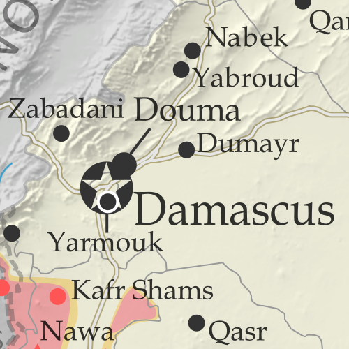
Map of Syrian Civil War (Syria control map): Fighting and territorial control in Syria in April 2018 (Free Syrian Army rebels, Kurdish YPG, Syrian Democratic Forces (SDF), Hayat Tahrir al-Sham (HTS / Al-Nusra Front), Islamic State (ISIS/ISIL), and others). Includes Russia-Turkey-Iran agreed de-escalation zones and US deconfliction zone, plus recent locations of conflict and territorial control changes, such as Afrin, Douma, Dumayr, Sabaa Biyar, and more. Colorblind accessible.
In the last six weeks, Turkey-led forces have expelled the Kurdish YPG from its stronghold in Afrin, while the three major pockets of rebel control near Damascus have all been wiped off the map.

See all this and more on the latest update to PolGeoNow’s concise, professional Syrian Civil War control map, which includes a timeline of changes since our previous Syria map report in March, with sources cited.

This map and report are premium content, available to paid subscribers of the PolGeoNow Conflict Mapping Service.

Want to see before you subscribe? Check out our most recent FREE SAMPLE Syria map!

Exclusive map report includes:

  • Up-to-date illustration of current territorial control in Syria, color-coded for the Assad government, rebel groups, “Islamic State” (ISIS/ISIL) fighters, and the Kurdish-led Syrian Democratic Forces (SDF). Colorblind accessible.
  • Markers showing the approximate locations of Russian-Turkish-Iranian “de-escalation zones” and the one known US “deconfliction zone”.
  • Special symbols indicating towns dominated by rebels of the former Al Qaeda Nusra Front (now Hayat Tahrir al-Sham or HTS) and by the Kurdish YPG militia (part of the US-backed SDF).
  • Detailed indication of city-by-city control, including key towns and other locations important to current events.
  • Locations of recent fighting and other important events, including Afrin, Douma, Dumayr, Sabaa Biyar, and more.
  • Detailed timeline of important events and changes to territorial control since March 16, 2018, compiled by our Syria-Iraq expert, with links to sources. 
  • Brief summary of current situation, as well as major changes to the configuration of territorial boundaries and de facto enclaves and exclaves.

SUBSCRIBERS CLICK HERE TO PROCEED TO ARTICLE AND MAP

Not signed up yet? Click here to learn more about our professional subscription service!

Can I purchase just this map?
This map and report are not available for automated purchase to non-subscribers. If you need access or republication rights for only this map report, contact service@polgeonow.com for options.

Yemen Control Map & Report – April 2018 (Subscription)

SUBSCRIBERS CLICK HERE TO PROCEED TO ARTICLE AND MAP

There are newer versions of this map available. To see them, view all Yemen articles on PolGeoNow.
 
Map of what is happening in Yemen as of May 21, 2017, including territorial control for the unrecognized Houthi government and former president Saleh's forces, president-in-exile Hadi and his allies in the Saudi-led coalition and Southern Movement, Al Qaeda in the Arabian Peninsula (AQAP), and the so-called Islamic State (ISIS/ISIL). Includes recent locations of fighting, including Azzan, Habban, Maydee, Nihm, and more.

Subscribe for full access to all conflict map reports!

Timeline by Djordje Djukic. Map by Evan Centanni, Djordje Djukic, and onestopmap.com

In the past three months, the civil war in Yemen has been marked by infighting within the Saudi-led coalition, while those forces have made only small progress against the Houthis and Al Qaeda.

See all this and more on the newest update to PolGeoNow’s Yemen territorial control map, which includes a timeline of changes and important events since our previous Yemen map report in January.

This map and report are premium content available to paid subscribers of the PolGeoNow Conflict Mapping Service.

Want to see before you buy? Check out our most recent FREE SAMPLE Yemen map report!

Exclusive report includes:

  • Up-to-date map of current territorial control in Yemen, color-coded for the pro-Hadi coalition, Houthi/Saleh forces, Al Qaeda in the Arabian Peninsula (AQAP), and the so-called “Islamic State” (ISIS/ISIL).
  • Detailed indication of town-by-town control, including provincial boundaries, all major cities, and many smaller ones
  • Markers for recent areas of fighting, including Hays, Kirsh, Nihm, Ketaf, and more
  • Timeline of changes to the situation since January 6, 2018, with links to sources

SUBSCRIBERS CLICK HERE TO PROCEED TO ARTICLE AND MAP

Not a member yet? Click here to learn more about our professional subscription service!

Can I purchase just this map?
This map and report are not available for automated purchase to non-subscribers. If you need access or republication rights for only this map report, contact service@polgeonow.com for options.

Somalia Control Map & Timeline – March 2018 (Subscription)

SUBSCRIBERS CLICK HERE TO PROCEED TO ARTICLE AND MAP

There are newer version of this map available. To see them, view all Somalia articles on PolGeoNow.

Map by onestopmap.com, Evan Centanni, and Djordje Djukic

Subscribe for full access to all conflict map reports!


Who controls Somalia? Map (2018). With states, regions, and territorial control. Best Somalia control map online, thoroughly researched and detailed but concise. Shows territorial control by Federal Government of Somalia (FGS), Al Shabaab, so-called Islamic State (ISIS/ISIL), separatist Somaliland, and autonomous states Puntland, Galmudug, Khatumo, and the ASWJ Sufi militia. Updated to March 28, 2018. Colorblind accessible.
Since last summer, Al Qaeda’s Al Shabaab affiliate has lost some key towns in Somalia, but also had some victories – all this amid increasing US military involvement. Meanwhile, two pairs of rival governments farther north are moving towards unification.

See all this and more on the latest update to PolGeoNow’s concise, professional Somalia control map, which includes a timeline of changes since our previous Somalia map report of August 2017, with sources cited.

This map and report are premium content, available to paid subscribers of the PolGeoNow Conflict Mapping Service.

Want to see before you subscribe? Check out our most recent FREE SAMPLE Somalia map!

Exclusive map report includes:

  • Up-to-date illustration of current territorial control in Somalia, color-coded for the federal government coalition (including AMISOM peacekeepers), autonomous unionist forces, separatist Somaliland, Al Qaeda affiliate Al Shabaab, and fighters aligned to the so-called “Islamic State” (ISIS/ISIL). Areas of lawlessness and unclear control also clearly marked. Colorblind accessible.
  • Boundaries and labels for Somalia’s official regions, plus control lines for the autonomous administrations of Somaliland, Puntland, Galmudug, ASWJ, and Khatumo.
  • Detailed indication of city-by-city control, including many relevant smaller towns and villages.
  • Locations of recent fighting and other important events, including Bariire, Basra, Sablale, Torotorow, Tukaraq, and more.
  • Detailed timeline of territorial control changes and key political developments since August 25, 2017, with sources indicated. 
  • Brief summary of the conflict situation, as well as major changes to the alignment of autonomous administrations, over the past seven months.

SUBSCRIBERS CLICK HERE TO PROCEED TO ARTICLE AND MAP

Not signed up yet? Click here to learn more about our professional subscription service!

Syrian Civil War Map & Timeline: Afrin Separated from Turkey – March 2018 (Subscription)

SUBSCRIBERS CLICK HERE TO PROCEED TO ARTICLE AND MAP

There are newer versions of this map available. To see them, view all Syria updates.

Research by Djordje Djukic. Map by onestopmap.com, Evan Centanni, and Djordje Djukic

Subscribe for full access to all conflict map reports!


Map of Syrian Civil War (Syria control map): Fighting and territorial control in Syria in March 2018 (Free Syrian Army rebels, Kurdish YPG, Syrian Democratic Forces (SDF), Hayat Tahrir al-Sham (HTS / Al-Nusra Front), Islamic State (ISIS/ISIL), and others). Includes Russia-Turkey-Iran agreed de-escalation zones and US deconfliction zone, plus recent locations of conflict and territorial control changes, such as Afrin, the Eastern Ghouta rebel zone, and more. Colorblind accessible.
Over the past month, fighting has raged in three major flashpoints in Syria, with the Turkish invasion of Afrin, Assad’s new ground war against rebels near Damascus, and heavy infighting between rebel groups in the north.

See all this and more on the latest update to PolGeoNow’s concise, professional Syrian Civil War control map, which includes a timeline of changes since our previous Syria map report in February, with sources cited.

This map and report are premium content, available to paid subscribers of the PolGeoNow Conflict Mapping Service.

Want to see before you subscribe? Check out our most recent FREE SAMPLE Syria map!

Exclusive map report includes:

  • Up-to-date illustration of current territorial control in Syria, color-coded for the Assad government, rebel groups, “Islamic State” (ISIS/ISIL) fighters, and Kurdish/SDF forces. Colorblind accessible.
  • Markers showing the approximate locations of Russian-Turkish-Iranian “de-escalation zones” and the one known US “deconfliction zone”.
  • Special symbols indicating towns dominated by rebels of the former Al Qaeda Nusra Front (now Hayat Tahrir al-Sham or HTS) and by the US-backed Syrian Democratic Forces (SDF).
  • Detailed indication of city-by-city control, including key towns and other locations important to current events.
  • Locations of recent fighting and other important events, including Kurdish Afrin, the Eastern Ghouta rebel zone near Damascus, and more.
  • Detailed timeline of important events and changes to territorial control since February 13, 2018, compiled by our Syria-Iraq expert, with links to sources. 
  • Brief summary of current situation, as well as major changes to the configuration of territorial boundaries and de facto enclaves and exclaves.

SUBSCRIBERS CLICK HERE TO PROCEED TO ARTICLE AND MAP

Not signed up yet? Click here to learn more about our professional subscription service!

Can I purchase just this map?
This map and report are not available for automated purchase to non-subscribers. If you need access or republication rights for only this map report, contact service@polgeonow.com for options.