The Gambia’s Name Change

(Subscribers click here to view this article in the members area.)
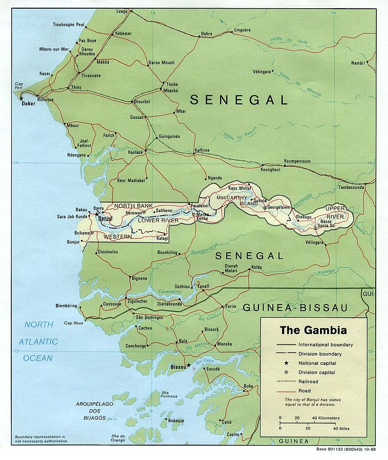
US government map of the Gambia (source)

The Gambia Changes Official Name
If you read our review of world political geography changes in 2015, you might remember a brief note on the official name of the Gambia, a tiny country located along the banks of a river in West Africa. Last December, the Gambia’s maverick dictator decided to declare the country an “Islamic republic”, a designation that can have various meanings and is used by four other countries in the world.

At the time, at least one regional news source claimed that the country’s official name had indeed been changed from “Republic of The Gambia” to “Islamic Republic of The Gambia”. But for a country’s name to be formally changed, its government normally has to pass a law or at least issue some kind of proclamation, and at the time it wasn’t clear whether that had actually  happened.
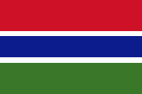
Flag of the Gambia Country Name:  
• The Gambia
Official Name:  
• Islamic Republic of the Gambia
Capital: Banjul

New Name Registered with UN and ISO
Since most of the world’s countries, including the Gambia, are part of the United Nations (UN), it’s expected that if the country’s name changes, the change will be filed with the administrative offices of the UN so world organizations and other countries will know to start using the new one.

And earlier this year, that finally happened, with the UN updating its terminology database to show that the Gambia’s official long-form English name had been changed to “the Islamic Republic of the Gambia”.

This confirmed the name change, and soon led to the same modification being made to ISO 3166, the international standard list of countries and country codes that’s used by organizations and companies all around the world.

How Often Do Countries Change Their Names?
Out of the world’s nearly 200 countries, there’s an average of about one official country name change each year, most of them involving changes to the country’s full name or preferred English name. Besides the Gambia, no countries changed their names in 2014 or 2015, with the last country to do so being Cape Verde in late 2013. That African island country changed its preferred English name at the UN to Cabo Verde, the same as its native Portuguese-language name; the same year, war-torn Libya clarified its new long-form name as “State of Libya”. The year before, Somalia’s 2012 constitution changed the country’s full name to the Federal Republic of Somalia, and a new Hungarian constitution traded “Republic of Hungary” for just “Hungary”.

More substantial changes to countries’ names, involving more than just translation decisions or adjustments to full names, are much less common. The best recent examples are Yugoslavia’s name change to “Serbia and Montenegro” in 2003, Western Samoa’s change to just “Samoa” in 1997, and Zaire’s reversion to its previous name of “Democratic Republic of the Congo”, also in 1997.

Name Changed in Other Languages
Unlike some countries that have only changed their name for foreign language speakers, English is actually the official language of the Gambia. The UN, on the other hand, has six official languages, so the country’s new name also had to be translated and made official in each of those languages:

Language Before After
English the Republic of the Gambia the Islamic Republic of the Gambia
French la République de Gambie la République islamique de Gambie
Spanish la República de Gambia la República Islámica de Gambia
Russian Республика Гамбия Исламская Республика Гамбия
Chinese 冈比亚共和国 冈比亚伊斯兰共和国
Arabic جمهورية غامبيا جمهورية غامبيا الإسلامية

Islam in the Gambia
Although the country’s name change might seem to suggest that the Islamic religion will be playing a larger role in the government, this doesn’t seem to be the case. Ninety percent of Gambians are Muslims, and there is not complete separation between church and state. But the Gambian constitution does protect freedom of religion, and there’s little sign anything is changing in that area.

Graphic of the flag of the Gambia is in the public domain (source).
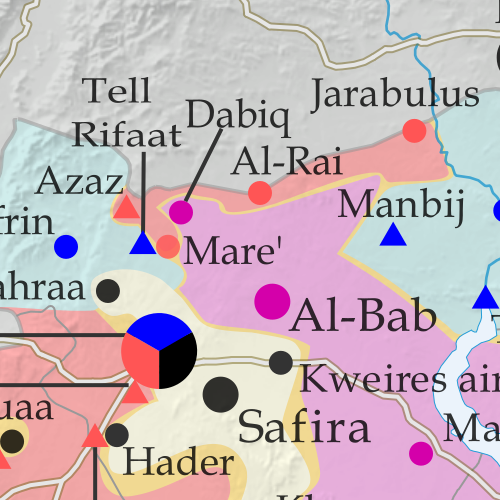
Syrian Civil War Control Map & Report: October 23, 2016 (Subscription)

SUBSCRIBERS CLICK HERE TO PROCEED TO ARTICLE AND MAP

There are newer versions of this map available. To see them, view all Syria updates.

Research by Djordje Djukic. Map by onestopmap.com, Evan Centanni, and Djordje Djukic

Subscribe for full access to all conflict map reports!


Map of fighting and territorial control in Syria's Civil War (Free Syrian Army rebels, Kurdish YPG, Syrian Democratic Forces (SDF), Jabhat Fateh al-Sham (Al-Nusra Front), Islamic State (ISIS/ISIL), and others), updated to October 25, 2016. Now includes terrain and major roads (highways). Includes recent locations of conflict and territorial control changes, such as Dabiq, Tell Rifaat, Moadamiya, and more (colorblind accessible). Since earlier this month, rebels in Syria have scored an important victory against the so-called “Islamic State” (ISIS/ISIL), even while losing ground to the government – and fighting amongst themselves – in other areas.
 
See all this and more on the latest update to PolGeoNow’s concise, professional Syrian Civil War control map, which includes a timeline of changes since our previous Syria map report in early October, with sources cited.

This map and report are premium professional content, available to paid subscribers of the PolGeoNow Conflict Mapping Service.

Want to see before you subscribe? Check out our most recent FREE SAMPLE Syria map!

Exclusive report includes:

  • Up-to-date map of current territorial control in Syria, color-coded for the Assad government, rebel groups, “Islamic State” (ISIS/ISIL) fighters, and Kurdish/SDF forces. Colorblind accessible.
  • Special symbols indicating towns dominated by rebels of the former Nusra Front (now Jabhat Fateh al-Sham) and US-backed Syrian Democratic Forces (SDF).
  • Detailed indication of city-by-city control, including key towns and other locations important to current events.
  • Locations of recent fighting and other important events, including Dabiq, Tell Rifaat, Moadamiya, and more.
  • Detailed timeline of important events and changes to territorial control since October 2, 2016, compiled by our Syria-Iraq expert, with links to sources.

SUBSCRIBERS CLICK HERE TO PROCEED TO ARTICLE AND MAP

Not signed up yet? Click here to learn more about our professional subscription service!

Can I purchase just this map?
This map and report are not available for automated purchase to non-subscribers. If you need access or republication rights for only this map report, contact service@polgeonow.com for options.

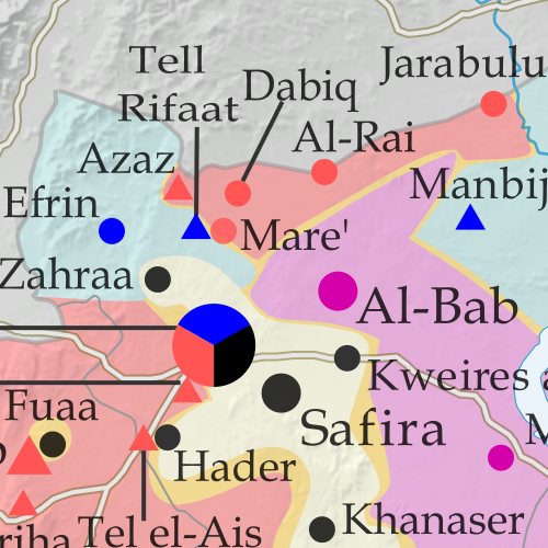
Syrian Civil War Control Map & Report: October 2, 2016 (Subscription)

SUBSCRIBERS CLICK HERE TO PROCEED TO ARTICLE AND MAP

There are newer versions of this map available. To see them, view all Syria updates.

Research by Djordje Djukic. Map by onestopmap.com, Evan Centanni, and Djordje Djukic

Subscribe for full access to all conflict map reports!


Map of fighting and territorial control in Syria's Civil War (Free Syrian Army rebels, Kurdish YPG, Syrian Democratic Forces (SDF), Jabhat Fateh al-Sham (Al-Nusra Front), Islamic State (ISIS/ISIL), and others), updated for October 2016. Now includes terrain and major roads (highways). Includes recent locations of conflict and territorial control changes, such as Dabiq, Halfaya, Suran, Jarabulus, and more (colorblind accessible). During the past month, a continued Turkish military incursion into Syria completely cut off the so-called “Islamic State” from the self-proclaimed caliphate’s last international border in the region (other than its boundaries with Syrian and Iraqi territory).

Meanwhile, the Assad government and rebel groups have continued to take territory from each other despite a brief attempt at a country-wide ceasefire.
 
See all this and more on the latest update to PolGeoNow’s concise, professional Syrian Civil War control map, which includes a timeline of changes since our previous Syria map report in late August, with sources cited.

This map and report are premium professional content, available to paid subscribers of the PolGeoNow Conflict Mapping Service.

Want to see before you subscribe? Check out our most recent FREE SAMPLE Syria map!

Exclusive report includes:

  • Up-to-date map of current territorial control in Syria, color-coded for the Assad government, rebel groups, “Islamic State” (ISIS/ISIL) fighters, and Kurdish/SDF forces. Colorblind accessible.
  • Special symbols indicating towns dominated by rebels of the former Nusra Front (now Jabhat Fateh al-Sham) and US-backed Syrian Democratic Forces (SDF).
  • Detailed indication of city-by-city control, including key towns and other locations important to current events.
  • Locations of recent fighting and military operations, including Dabiq, Halfaya, Suran, Jarabulus, and more.
  • Detailed timeline of important events and changes to territorial control since August 27, 2016, compiled by our Syria-Iraq expert, with links to sources.

SUBSCRIBERS CLICK HERE TO PROCEED TO ARTICLE AND MAP

Not signed up yet? Click here to learn more about our professional subscription service!

Can I purchase just this map?
This map and report are not available for automated purchase to non-subscribers. If you need access or republication rights for only this map report, contact service@polgeonow.com for options.