Syrian Civil War Control Map & Report: August 2016 (Subscription)

SUBSCRIBERS CLICK HERE TO PROCEED TO ARTICLE AND MAP

There are newer versions of this map available. To see them, view all Syria updates.

Research by Djordje Djukic. Map by onestopmap.com, Evan Centanni, and Djordje Djukic

Subscribe for full access to all conflict map reports!


Map of fighting and territorial control in Syria's Civil War (Free Syrian Army rebels, Kurdish YPG, Syrian Democratic Forces (SDF), Al-Nusra Front, Islamic State (ISIS/ISIL), and others), updated for August 2016. Now includes terrain and major roads (highways). Includes recent locations of conflict and territorial control changes, such as Jarabulus, Manbij, Daraya, Hasakah, and more (color blind accessible). Syria’s war has seen several major territorial changes in the past month, with a Turkish military intervention bringing IS defeats even as the rival, Kurdish-led Syrian Democratic Forces have captured key territory from both IS and the Assad government. Meanwhile, the government has scored some major victories of its own against rebel forces.
 
See all this and more on the latest update to PolGeoNow’s concise, professional Syrian Civil War control map, which includes a timeline of changes since our previous Syria map report in late July, with sources cited.

This map and report are premium professional content, available to paid subscribers of the PolGeoNow Conflict Mapping Service.

Want to see before you subscribe? Check out our most recent FREE SAMPLE Syria map!

Exclusive report includes:

  • Up-to-date map of current territorial control in Syria, color-coded for the Assad government, rebel groups, “Islamic State” (ISIS/ISIL) fighters, and Kurdish/SDF forces. Color blind accessible.
  • Special symbols indicating towns dominated by rebels of the Nusra Front (now Jabhat Fateh al-Sham) and US-backed Syrian Democratic Forces (SDF).
  • Detailed indication of city-by-city control, including key towns and other locations important to current events.
  • Locations of recent fighting and military operations, including Jarabulus, Manbij, Daraya, Hasakah, and more.
  • Detailed timeline of important events and changes to territorial control since July 25, 2016, compiled by our Syria-Iraq expert, with links to sources.

SUBSCRIBERS CLICK HERE TO PROCEED TO ARTICLE AND MAP

Not signed up yet? Click here to learn more about our professional subscription service!

Can I purchase just this map?
This map and report are not available for automated purchase to non-subscribers. If you need access or republication rights for only this map report, contact service@polgeonow.com for options.

Map of Border Controls Inside Europe’s Schengen Area: August 2016

There are newer versions of this map available. To see them, view all Schengen Area articles.

Last March, we explained Europe’s Schengen free travel area in plain English, then published a map of which European countries had temporarily reintroduced border controls. We now present an updated and improved version of the border control map, reflecting several changes from the past five months.

Map of Temporarily Reintroduced Border Control in the Schengen Area (the European Union's border-free travel zone) in August 2016, color-coded for EU Schengen countries, non-EU Schengen countries, future Schengen countries, and Schengen-exempt EU countries, as well as microstates unofficially participating in the Schengen agreements (colorblind accessible).
Map by Evan Centanni, from blank map by Ssolbergj. License: CC BY-SA

(Subscribers click here to view this article in the members area.)

Article by Evan Centanni

Changes to Schengen Border Controls Since March

As anyone who’s visited Europe in recent decades knows, much of the continent is linked together as part of the “Schengen Area“, a collection of countries that don’t make travelers show any ID to cross back and forth across their borders (though this system is overseen by the European Union, the Schengen Area and the EU are not the same thing). But the system does allow countries to temporarily reintroduce border controls under certain circumstances.

With last year’s spike in numbers of refugees and other immigrants arriving in Europe, many Schengen countries have rushed to control the flow of people by using these special temporary border controls. When we published our previous map of temporary Schengen border controls back in March, there were seven countries policing their borders with fellow Schengen members. Today there are only six, and there have been major changes to which borders are controlled:

Belgium’s French Border Controls Expire

In February, Belgium controversially declared an emergency reintroduction of controls along part of its border with France, which it claimed was necessary to limit flows of displaced people caused by the forced closure of a major refugee camp in France. Normally, emergency border controls have to be renewed every ten days, though Belgium announced from the outset that it planned to keep them for a whole month. However, in the end the country did respect the two-month renewal limit on emergency controls, letting them expire in late April.

Denmark Border Controls Expire, then are Reintroduced

Map of the European Union (EU) and prospective member countries
The full EU and prospective members

Denmark declared emergency controls at all its borders in January, citing “unexpected migratory flow” as the reason. Like Belgium, it kept them in place for the full two months allowable, ending on March 4.

However, Denmark followed that expiration immediately with a normal, non-emergency reintroduction of border controls, which it said were to deal with a “big influx of persons seeking international protection”.

EU-brokered Compromise Aims to Stabilize Schengen

Amid fears that the Schengen Area’s dream of free travel was going down the drain, the foreign ministers of the EU’s member countries met up and hashed out a compromise solution, which they published as an EU “recommendation” document on May 12. Though a lot of their recommendations involved telling Greece to try harder not to let refugees into Europe, they also came up with a plan to reduce the scope of the border controls by refocusing them on high-priority areas.

In exchange for keeping their controls for another six months (more than the normal maximum), five of the six remaining countries agreed to limit which parts of their borders they would police:

  • Germany agreed to control only its border with Austria, ruling out border controls with Switzerland, the Czech Republic, Luxembourg, Belgium, the Netherlands, and Denmark.
  • Austria agreed to control only its borders with Slovenia and Hungary, ruling out border controls with Italy, Switzerland, Liechtenstein, the Czech Republic, and Slovakia.
  • Denmark agreed to control only its border with Germany (including land crossings and ferry connections), ruling out border control for arrivals from Sweden or Norway.
  • Sweden agreed to control only crossings over the bridge from Denmark and sea arrivals along its western and southern coastline, ruling out controls for land borders with Norway and Finland or arrivals by sea along its east-central and northern coasts.
  • Norway agreed to control only arrivals in ports with ferry connections to Sweden, Denmark, and Germany, ruling out controls along its land borders with Sweden and Finland.

All of these border controls will be up for renegotiation after November 11-12, 2016.

France’s Border Controls Continue

The sixth country, France, has continued to control all its borders – except, presumably, the boundary with tiny Monaco, which for immigration-control purposes is already treated as if it were within French borders. France has been policing all its borders since December 14, 2015, when it introduced border controls for security in the aftermath of the massive terror attacks in Paris.

In May 2016, when its border controls were nearing their six-month expiration date (the maximum allowed for any one purpose), France notified the EU that it was extending controls for two more months while it hosted the European soccer championship and the Tour de France cycling race (major sporting events are a normal reason for Schengen countries to temporarily reintroduce border controls).

Before the two months was up, France had experienced another episode of bloody terrorist violence, the July 14 attack in the city of Nice, and it used the resulting state of emergency as reasoning to declare another six months of border controls, to last until January 2017.

And One More: Temporary Border Controls in Poland

Although the number of Schengen countries with reintroduced border controls fell to six after Belgium’s expired, for one month since our last update there were again seven of them. Poland implemented a routine reintroduction of controls on all its borders from July 4 to August 2, for security during a NATO summit and a Catholic Church “World Youth Day” event that featured a visit from Pope Francis.

The EU’s official Temporary Introduction of Border Control page actually lists Poland’s controls as continuing until September 2, but this appears to be an error. Other sources, including the same site’s comprehensive PDF record of border control notifications, all say the controls ended on August 2.

Learn More:
Map of Temporary Schengen Border Controls in March 2016
Which Countries Are in the Schengen Area, and Which EU Countries Aren’t? 

Parade of Nations: Which Countries Are (and Aren’t) in the Olympics? (Rio 2016)

This is an older version of our Parade of Nations article. Click here to see the newest edition!

This is an updated version of an article first published in 2012. You can also read the London 2012 and Sochi 2014 versions.

World map showing the five continental associations of National Olympic Committees, including all nations eligible for the Rio 2016 Olympic games. Labels newly recognized nations Kosovo and South Sudan.
Map of all countries in the Olympics and their regional associations. Two newest Olympic Nations labeled.
(By Evan Centanni, starting from public domain blank map and modeled after this Wikipedia map)

The 2016 Summer Olympics in Rio de Janeiro, Brazil officially open tonight, Friday, August 5th! They’ll be the first Olympics ever to be held in South America, and also the first in any Portuguese-speaking country. If that wasn’t enough, they’re also the first Summer Olympics to be held entirely in the winter!

Of course, it wouldn’t be an Olympic opening ceremony without the Parade of Nations. But how many countries are there in the games, and is everyone included? Read on for an exclusive updated guide to the roster of Olympic Nations…

How many countries are in the Olympics?

There are currently 206 recognized Olympic Nations, represented by a National Olympic Committee (NOC) in each country. The International Olympic Committee (IOC) presides over the Olympic Games themselves, and the NOCs are divided between five continental associations (see map above).[1]

If 206 countries sounds like too many, don’t worry, you’re not going crazy. The UN only recognizes 195 countries worldwide (See: How Many Countries Are There in the World?). So what gives? Well, it turns out the IOC has historically been more lax than the UN about requirements for nationhood…

Dependent Territories that are Olympic Nations

Before 1995, some dependent territories were allowed to qualify for the Olympics, and were allowed to stay even after the rules changed. Today, ten of these territories hold Olympic Nation status:

World map marking dependent territories and partially recognized countries (de facto sovereign states) that have recognized National Olympic Committees and are allowed by the IOC to participate in the Olympic Games
Click to enlarge: Dependent territories and partially recognized countries admitted to the Olympics.
(By Evan Centanni, from public domain base map)

Americas
 Aruba (Netherlands)
 Bermuda (UK)
 British Virgin Islands (UK)
 Cayman Islands (UK)
 Puerto Rico (US)
 Virgin Islands (US)

Asia
 Hong Kong (China)

Oceania
 American Samoa (US)
 Guam (US)
 Cook Islands (New Zealand)

Unrecognized countries that are Olympic Nations

These days, to qualify as a new Olympic Nation you have to be an “independent State recognised by the international community“. The most obvious way to meet that is to be an official member or observer state in the United Nations (UN). However, there are three non-UN countries that also participate:

 Taiwan
 Palestine
 Kosovo

Taiwan– which is claimed by China but ruled as an independent country under a pre-Communist version of the Chinese constitution – was allowed to stay after the Communist government in Beijing took over representation of Mainland China in 1979. However, a compromise deal made at the time says Taiwan has to call itself “Chinese Taipei” in the games.[2]

Disputed Palestine, whose claimed territory is largely controlled by the military of Israel, was admitted in 1995 for the sake of athletes in Gaza and the West Bank, whose residents don’t have Israeli citizenship. Palestine has since been recognized as a UN observer state, but at the time it had no UN status. However, it had already been recognized individually by about 100 of the world’s countries (more than half of the UN’s members).

The third non-UN country in the Olympics, Kosovo, is a new addition. A separatist state that controversially declared independence from Serbia eight years ago, Kosovo has never been allowed into the UN due to objections from Serbia, Russia, and others. But the IOC decided to admit Kosovo as an Olympic Nation in 2014, after about 55% of UN member countries had recognized the breakaway state as independent.

Which countries are new to the Olympics?

There are two new Olympic Nations that have been approved since the last games: Kosovo, the disputed breakaway state mentioned above, and South Sudan, which became independent and joined the UN in 2011. At the time of the 2008 and 2014 Olympics, South Sudan’s sports world wasn’t organized enough to even apply to join the IOC, but it finally got things together and was approved as an Olympic Nation in summer of 2015.

Although not an actual “nation”, there will be one other new national-level team attending Rio 2016: the Refugee Olympic Team. This team was put together by the IOC in honor of the record-high number of people in the world who have been forced to leave their home countries to escape wars. Its 10 hand-selected athletes, all of whom are refugees themselves, will have their own place in the Parade of Nations at the opening ceremony.

The last Olympic Games that had new countries were the 2008 Summer Olympics in Beijing, where the Marshall Islands, Montenegro, and Tuvalu were added to the list. There were no new Olympic Nations approved between then and the 2012 Summer Olympics in London, nor in time for the 2014 Winter Games in Sochi, Russia.

Read more:
New Olympic Nation: South Sudan
Kosovo becomes an Olympic Nation

Which countries aren’t included in the Olympics?

Despite the inclusive and worldwide mission of the Olympic Games, not all applicant countries have been allowed in. In fact, one UN-recognized country still hasn’t joined: UN observer Vatican City, the independent Catholic Church headquarters in Rome, has never applied.

The ten dependent territories allowed to participate in the Olympics are only a select few, leaving most of the world’s overseas dependencies without their own teams (though athletes from the territories are allowed to apply for their patron countries’ teams). Meanwhile, partially recognized or unrecognized countries aren’t usually admitted either, even if they’re effectively independent. In fact, there are quite a few National Olympic Committees that have been created locally but not recognized by the IOC. Here’s a partial list:

World map marking independent countries (de facto sovereign states) and dependent territories that don't have IOC-recognized National Olympic Committees, and are thus not allowed to send their own teams to the Olympics
Click to enlarge: Territories and sovereign states not represented in the Olympics. Light Blue: No NOC; Dark Blue: NOC not recognized by IOC. Also shown in dark blue outlines: subnational regions with unrecognized NOCs. (By Evan Centanni, from public domain map)

Africa
 Somaliland (unrecognized country)

Americas
 Anguilla (UK territory)
 Montserrat (UK territory)
 Turks & Caicos (UK territory)

Asia
 Iraqi Kurdistan (autonomous region of Iraq)
 Macau (autonomous region of China)[3]

Europe
 Abkhazia (partially recognized country)
 Catalonia (region of Spain)
 Gibraltar (UK territory)
 Northern Cyprus (partially recognized country)

Oceania
 New Caledonia (territory of France) [4]
 Niue (associated state of New Zealand) [4]
 Norfolk Island (outlying island of Australia) [4]
 Northern Mariana Islands (US territory) [4]
 Tahiti (territory of France) [4]
 Tokelau (territory of New Zealand) [4]
 Wallis and Futuna (territory of France) [4]

Which countries are attending the Rio 2016 Olympic Games?

Being an Olympic Nation doesn’t mean you have to actually send athletes to the Olympics every time. For example, many tropical countries choose to just skip the Winter Olympics altogether. But this year, all the Olympic Nations will have athletes participating in Rio…except one.

Kuwait, which is in a drawn out dispute with the IOC over rules about government interference in sports, will not have an official team at the games. However, Kuwaiti athletes are being allowed to participate as “independent Olympic athletes”, using the Olympic flag instead of the flag of Kuwait.

That makes a total of 205 official Olympic Nations participating in the Rio 2016 games – a record high, since in London 2012 there were only 204 recognized Olympic nations in the world (and they all did attend). Add the independent Kuwaiti athletes and the new Refugee Olympic Team, and there will be a total of 207 delegations in the Parade of Nations tonight.

More Details: 2016 Parade of Nations: List of countries and flagbearers in order of entrance

Footnotes

[1] The five associations are based closely on the world’s continents, but with a few quirks: The Caucasus, Israel, and eastern Turkey are part of the European association despite geographers usually putting them in Asia; and the South American territory of French Guiana also falls under European jurisdiction, because it’s considered part of France and doesn’t have a separate team.

[2] “Chinese Taipei” is intended to be ambiguous, since most Taiwanese people consider themselves to be at least culturally Chinese. However, the use of “Taipei” is unfortunate for the two-thirds of Taiwan’s people who don’t live in or near the city of Taipei. This was especially awkward when the 2009 World Games (an Olympics-connected event) were held in Kaohsiung, Taiwan – something of a rival city to Taipei. 

[3] Although Macau’s NOC isn’t recognized by the IOC itself, it has been accepted as a member of its continental organization, the Olympic Council of Asia. Macau participates in the Asian Games and Paralympic Games, but not in the regular Olympics.

[4] Seven dependent territories in Oceania are associate members of the Oceania National Olympic Committees. They’re allowed to participate in some regionally-organized sporting events, but not in the Olympics.

Yemen Control Map & Report: August 2016 (Subscription)

MEMBERS CLICK HERE TO PROCEED TO ARTICLE AND MAP

There are newer versions of this map available. To see them, view all Yemen updates.

Map of territorial control in Yemen as of August 2, 2016, including territory held by the Houthi rebels and former president Saleh's forces, president-in-exile Hadi and his allies in the Saudi-led coalition and Southern Movement, Al Qaeda in the Arabian Peninsula (AQAP), and the so-called Islamic State (ISIS/ISIL). Includes recent locations of fighting, such as Taiz, Mukalla, Bayhan, Harad, and more.

Subscribe for full access to all conflict map reports!

Timeline by Djordje Djukic. Map by Louis Martin-Vézian, Evan Centanni, and Djordje Djukic.

In the three months since our previous Yemen map update, Houthi and pro-Hadi forces have continued to trade blows in the south and east, as well as along the border with Saudi Arabia. Meanwhile, Al Qaeda and the so-called “Islamic State” (ISIS/ISIL) have launched attacks in southern cities.


See all this and more on the newest update to PolGeoNow’s Yemen territorial control map, which includes a timeline of changes and important events since our previous Yemen map report in February.

This map and report are premium professional content, available to paid subscribers of the PolGeoNow Conflict Mapping Service.

Want to see before you buy? Check out our most recent FREE SAMPLE Yemen map report!

Exclusive report includes:

  • Up-to-date map of current territorial control in Yemen, color-coded for the pro-Hadi coalition, Houthi/Saleh forces, Al Qaeda in the Arabian Peninsula (AQAP), and the so-called “Islamic State” (ISIS/ISIL).
  • Color scheme now consistent with Syria, Iraq, and Libya map series
  • Detailed indication of town-by-town control, including provincial boundaries, all major cities, and many smaller ones
  • Markers for recent areas of fighting, including Taiz, Mukalla, Bayhan, Harad, and more
  • Timeline of changes to the situation since May 1, 2016, with links to sources

MEMBERS CLICK HERE TO PROCEED TO ARTICLE AND MAP

Not a member yet? Click here to learn more about our professional subscription service!

Can I purchase just this map?
This map and report are not available for automated purchase to non-subscribers. If you need access or republication rights for only this map report, contact service@polgeonow.com for options.

How Many Countries Are There in the World in 2016?

There are newer editions of this article available. To find the most recent, view all “How Many Countries in the World” updates!

This article, originally from 2011, has been revised and updated to August 2016. (Latest update: Gibraltar and Kosovo are now FIFA members.)

How many countries in the world?
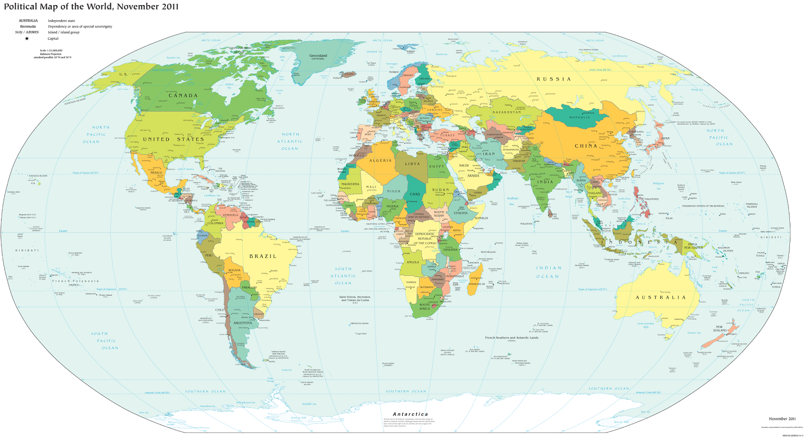
A world political map published by the US government (public domain)

One of the most basic questions for map-lovers is, “How many countries are there in the world?” But anyone who replies with a simple number is leaving out part of the story. It actually depends a lot on how you define a “country”.

Here are six of the most common answers, each correct in its own way:

195 Sovereign States According to the UN
“Country” and “nation” are casual words for what political scientists call a “sovereign state”, meaning a place with its own borders and completely independent government. The question of which places count as sovereign states can be controversial, but for starters we can count all the member and observer countries of the United Nations (UN):

UN Members: 193
UN Observer States: 2
Total: 195

These countries mostly all accept each other as sovereign states, and they’re the ones you’ll see on most world maps and many lists of the world’s countries. Almost every country you’ve ever heard of is probably a member of the UN, and the two UN Observer States are Vatican City (represented by the Holy See) and Palestine. If you want to know the names of all 195, Wikipedia has a complete list.

The last addition to the list was in 2012, when Palestine became a UN Observer State, and the last time the number of full UN members changed was when South Sudan was admitted in 2011.

Note: Palestine’s status as a UN Observer State is controversial, so some lists may still only include 194 countries.

201 States With At Least Partial Recognition
Several more country candidates are left out of the UN itself, but are still officially acknowledged by at least one UN member (this kind of official acceptance is called “diplomatic recognition“). These controversial countries are usually labeled on world maps as disputed territories or special cases, if they’re on the map at all.

Map of Serbia, Kosovo, and North Kosovo
Kosovo is claimed by Serbia, but recognized as independent by over 100 countries.

UN Members: 193
UN Observer States: 2
States With Partial Recognition:
Total: 201

The six non-UN states with partial recognition are Taiwan, Western Sahara, Kosovo, South Ossetia, Abkhazia, and Northern Cyprus. All of these are claimed as parts of other countries, but aren’t actually controlled by them (at least not completely). The number of UN members recognizing them varies, from just one for Northern Cyprus to over 100 for Kosovo.

A few lists also include the Cook Islands and Niue as partially-recognized states. These two places sometimes act like independent countries, but they’re usually considered overseas territories of New Zealand, because they’ve never actually declared independence or tried to join the UN. 

204-207 De Facto Sovereign States
But wait, there’s more! Those six partially recognized countries aren’t the only breakaway states with full self-governance. There are at least three more self-declared countries that aren’t recognized by any UN members at all, but still operate independently from the countries that claim them. These are often called “de facto” sovereign states, a fancy Latin way of saying they’re independent countries in actual fact, even if not on paper.

UN Members: 193
UN Observer States: 2
States With Partial Recognition:
Unrecognized de facto Sovereign States: 3 to 6 (see below)
Total: 204 to 207

The three places most often considered de facto independent countries are Nagorno-Karabakh, Transnistria, and Somaliland. And since 2014 there are three more contenders for the list: the Islamic State, the Donetsk People’s Republic, and the Lugansk People’s Republic. But because those last three are located in active war zones and have only limited government structures, there’s some debate over whether they count even as de facto countries.

Tiny “micronations” declared by individual people usually aren’t taken seriously enough to count on the list. The closest contender would be Sealand, but it’s debatable whether this tiny “nation” really counts as having a territory, population, or government, all key ingredients for a sovereign state.

There are also many rebel-held territories (and fully self-governing areas like Puntland) that aren’t controlled by any country, but are left off the list because they don’t claim to be independent countries. They agree in principle that they’re part of another country, even though they might disagree about who should be in charge, or how the country should be governed.

206 Olympic Nations
Lots of people learn about the world’s list of countries by watching the Olympic Games every two years. If you’re one of them, you might be confused at why the Olympic Parade of Nations claims over 200 members, even though your atlas only has 195.

This is because the Olympics didn’t always require applicants to be independent countries. Dependent territories with partial self-government have sometimes been approved by the International Olympic Committee (IOC), and a couple of the partially-recognized states mentioned above have also managed this.

Olympic Nations that are UN Member States: 193
Olympic Nations that are UN Observer States: 1
Olympic Nations that are Partially-recognized States: 2
Olympic Nations that are Dependent Territories: 10
Total IOC-Recognized Olympic Nations: 206

World map showing the five continental associations of National Olympic Committees, including all nations eligible for the Olympic games
The Olympics include most of the world’s independent countries, and some dependent territories too.

About half of the dependent territories in the Olympics are overseas possessions of the US (such as Puerto Rico) and of the UK (such as Bermuda). Some nearly-independent “countries” such as the Cook Islands (New Zealand) and Aruba (the Netherlands) are included as well.

Every UN member country is also in the Olympics, with the latest addition, South Sudan, joining in August 2015.  The one UN Observer State in the Olympics is Palestine; Vatican City isn’t interested. As for the two partially-recognized countries in the games, Kosovo just became an Olympic Nation in 2014, and Taiwan has been a member for some time, but has to call itself  “Chinese Taipei” after a deal struck with China in the 1980s.

See Also: Parade of Nations: Which Countries Are (and Aren’t) in the Olympics

211 FIFA Countries Eligible for the World Cup
Soccer, or football as it’s known in much of the world, is the world’s most popular sport, and most international matches all the way up to the World Cup are regulated by an organization called FIFA. If you’re a soccer superfan, you might know that until recently there were 209 member countries that compete in FIFA matches (though most don’t make it to the World Cup). This is already more than the number of Olympic Nations, and certainly more than the number of independent countries on most world maps.

Like the Olympics, FIFA didn’t always require independence or international recognition of its member states. Now it’s a bit stricter, but any team that’s already a member is allowed to stay. And since May 2016, there are now two more FIFA members: Kosovo, a partially-recognized country that was voted in after being recognized by more than half of the UN’s members; and Gibraltar, an overseas territory of the UK that recently got a court order allowing it in despite not being independent.

Based on European tradition, FIFA also allows England, Scotland, Wales, and Northern Ireland to compete as separate teams, even though they’re all part of the UK.

World map marking dependent territories, partially recognized sovereign states, and subnational entities that have national football (soccer) teams recognized by FIFA, making them eligible for the World Cup.
Map from 2014 of FIFA members that aren’t recognized as independent countries by the UN

Teams of UN Member States: 186
Teams of UN Observer States: 1
Teams of Partially Recognized States: 2
Teams of UK Constituent Countries: 4
Teams of Dependent Territories: 18
Total FIFA Member Associations: 211

You might notice that not all the 193 UN member states are included. That’s because several very small countries aren’t members, plus the UK is replaced by its four “constituent countries”, which aren’t UN members on their own.

See Also: Which Countries Are (and Aren’t) Part of FIFA? (2014)

249 Country Codes in the ISO Standard List
Have you ever been filling out an internet form, and had to choose from a surprisingly long list of countries? You were probably looking at the international standard “country code” list, officially known as ISO 3166-1. Many companies and other organizations adopt this standard list rather than spending their own time compiling one. The standard also includes convenient two-letter codes for each country, like us for the United States, de for Germany, and jp for Japan, which you might recognize from web addresses specific to those countries.

This ISO standard is based on an official list kept by the UN….but then why on Earth are there 249 country codes? That’s way more than the total number of UN member and observer countries! Well, the standard list does leave out some breakaway states not recognized by the UN, but makes up for it by listing dependent territories separately from their parent countries. So there are country codes not only for actual countries, but also for nearly-independent states, overseas territories, uninhabited islands, and even Antarctica! This is important because organizations might need an option for every place that any person can be located, and dependent territories often aren’t technically part of the countries they belong to.

UN Members: 193
UN Observer States: 2
States With Partial Recognition:
Inhabited Dependent Territories: 45
Uninhabited Territories: 6
Antarctica: 1
Total: 249

So there you have it! Next time someone tells you “There are X countries in the world,” remember that the real answer isn’t so simple!