Syrian Civil War Map & Timeline: Rebels Lose Daraa Province – July 2018 (Subscription)

SUBSCRIBERS CLICK HERE TO PROCEED TO ARTICLE AND MAP

(To see other maps in this series, view all Syria updates.)

Research by Djordje Djukic. Map by onestopmap.com, Evan Centanni, and Djordje Djukic

Subscribe for full access to all conflict map reports!


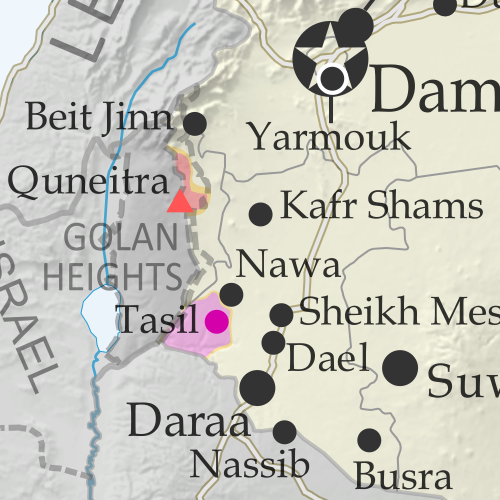
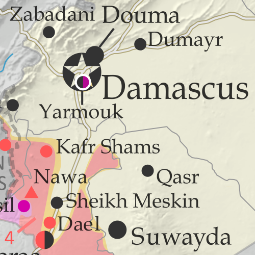
Map of Syrian Civil War (Syria control map): Fighting and territorial control in Syria in June 2018 (Free Syrian Army rebels, Kurdish YPG, Syrian Democratic Forces (SDF), Hayat Tahrir al-Sham (HTS / Al-Nusra Front), Islamic State (ISIS/ISIL), and others). Includes Russia-Turkey-Iran agreed de-escalation zones and US deconfliction zone, plus recent locations of conflict and territorial control changes, such as Daraa, the Golan Heights, Busra, Nawa, Fuaa, and more. Colorblind accessible.Since late June, a rapid government offensive has completely driven rebels out of southwestern Syria’s Daraa province, which they had controlled about half of. 

Meanwhile, the government has surrendered an enclave of control within rebel-held northwestern Syria, and the so-called “Islamic State” (ISIS/ISIL) is struggling to hold onto pockets of territory both east and west.

See all this and more on the latest update to PolGeoNow’s concise, professional Syrian Civil War control map, which includes a timeline of changes since our previous Syria map report in June, with sources cited.

This map and report are premium content, available to paid subscribers of the PolGeoNow Conflict Mapping Service.

Want to see before you subscribe? Check out our most recent FREE SAMPLE Syria map!

Exclusive map report includes:

  • Up-to-date illustration of current territorial control in Syria, color-coded for the Assad government, rebel groups, “Islamic State” (ISIS/ISIL) fighters, and the Kurdish-led Syrian Democratic Forces (SDF). Colorblind accessible.
  • Markers showing the approximate locations of Russian-Turkish-Iranian “de-escalation zones” and the one known US “deconfliction zone”.
  • Special symbols indicating towns dominated by rebels of the former Al Qaeda Nusra Front (now Hayat Tahrir al-Sham or HTS) and by the Kurdish YPG militia (part of the US-backed SDF).
  • Detailed indication of city-by-city control, including key towns and other locations important to current events.
  • Locations of recent control changes and other important events, including Daraa, the Golan Heights, Busra, Nawa, Fuaa, and more.
  • Detailed timeline of important events and changes to territorial control since June 21, 2018, compiled by our Syria-Iraq expert, with links to sources. 
  • Brief summary of the current situation and of major changes to the configuration of territorial boundaries and de facto enclaves and exclaves.

SUBSCRIBERS CLICK HERE TO PROCEED TO ARTICLE AND MAP

Not signed up yet? Click here to learn more about our professional subscription service!

Can I purchase just this map?
This map and report are not available for automated purchase to non-subscribers. If you need access or republication rights for only this map report, contact service@polgeonow.com for options.

Syrian Civil War Map & Timeline: June 2018 (Subscription)

SUBSCRIBERS CLICK HERE TO PROCEED TO ARTICLE AND MAP

There are newer versions of this map available. To see them, view all Syria updates.

Research by Djordje Djukic. Map by onestopmap.com, Evan Centanni, and Djordje Djukic

Subscribe for full access to all conflict map reports!


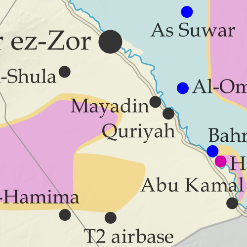
Map of Syrian Civil War (Syria control map): Fighting and territorial control in Syria in June 2018 (Free Syrian Army rebels, Kurdish YPG, Syrian Democratic Forces (SDF), Hayat Tahrir al-Sham (HTS / Al-Nusra Front), Islamic State (ISIS/ISIL), and others). Includes Russia-Turkey-Iran agreed de-escalation zones and US deconfliction zone, plus recent locations of conflict and territorial control changes, such as Dashishah, Al Kara'a, and more. Colorblind accessible.Since late May, fighting between government and rebel forces in Syria has subsided, but battles against the so-called Islamic State (ISIS/ISIL) have continued in both eastern and western parts of the country.

See all this and more on the latest update to PolGeoNow’s concise, professional Syrian Civil War control map, which includes a timeline of changes since our previous Syria map report in May, with sources cited.

This map and report are premium content, available to paid subscribers of the PolGeoNow Conflict Mapping Service.

Want to see before you subscribe? Check out our most recent FREE SAMPLE Syria map!

Exclusive map report includes:

  • Up-to-date illustration of current territorial control in Syria, color-coded for the Assad government, rebel groups, “Islamic State” (ISIS/ISIL) fighters, and the Kurdish-led Syrian Democratic Forces (SDF). Colorblind accessible.
  • Markers showing the approximate locations of Russian-Turkish-Iranian “de-escalation zones” and the one known US “deconfliction zone”.
  • Special symbols indicating towns dominated by rebels of the former Al Qaeda Nusra Front (now Hayat Tahrir al-Sham or HTS) and by the Kurdish YPG militia (part of the US-backed SDF).
  • Detailed indication of city-by-city control, including key towns and other locations important to current events.
  • Locations of recent control changes and other important events, including Dashishah, Al Kara’a, Manbij, and more.
  • Detailed timeline of important events and changes to territorial control since May 23, 2018, compiled by our Syria-Iraq expert, with links to sources. 
  • Brief summary of the current situation and of major changes to the configuration of territorial boundaries and de facto enclaves and exclaves.

SUBSCRIBERS CLICK HERE TO PROCEED TO ARTICLE AND MAP

Not signed up yet? Click here to learn more about our professional subscription service!

Can I purchase just this map?
This map and report are not available for automated purchase to non-subscribers. If you need access or republication rights for only this map report, contact service@polgeonow.com for options.

Yemen Control Map & Report – June 2018 (Subscription)

SUBSCRIBERS CLICK HERE TO PROCEED TO ARTICLE AND MAP

(To see other maps in this series, view all Yemen articles on PolGeoNow.)

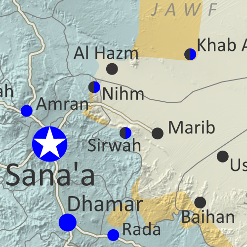
Map of what is happening in Yemen as of June 16, 2018, including territorial control for the unrecognized Houthi government and former president Saleh's forces, president-in-exile Hadi and his allies in the Saudi-led coalition and Southern Movement, Al Qaeda in the Arabian Peninsula (AQAP), and the so-called Islamic State (ISIS/ISIL). Includes recent locations of fighting, including Hodeida, Al Faza, Al Tuhayata, and more. Colorblind accessible.

Subscribe for full access to all conflict map reports!

Timeline by Djordje Djukic. Map by Evan Centanni, Djordje Djukic, and onestopmap.com

Since April, Yemen’s Saudi-led coalition has resisted increasing internal divisions to gain some ground against the rival Houthi government, as well as Al Qaeda forces in the east. Now, the coalition is making a concerted push to capture the Houthi-held city of Hodeida, Yemen’s main port on the Red Sea.

See all this and more on the newest update to PolGeoNow’s Yemen territorial control map, which includes a timeline of changes and important events since our previous Yemen map report in April.

This map and report are premium content available to paid subscribers of the PolGeoNow Conflict Mapping Service.

Want to see before you buy? Check out our most recent FREE SAMPLE Yemen map report!

Exclusive report includes:

  • Up-to-date map of current territorial control in Yemen, color-coded for the pro-Hadi coalition, Houthi/Saleh forces, Al Qaeda in the Arabian Peninsula (AQAP), and the so-called “Islamic State” (ISIS/ISIL).
  • Detailed indication of town-by-town control, including provincial boundaries, all major cities, and many smaller ones
  • Markers for recent areas of fighting, including Hodeida, Al Faza, Al Tuhayata, and more
  • Timeline of changes to the situation since April 14, 2018, with links to sources

SUBSCRIBERS CLICK HERE TO PROCEED TO ARTICLE AND MAP

Not a member yet? Click here to learn more about our professional subscription service!

Can I purchase just this map?
This map and report are not available for automated purchase to non-subscribers. If you need access or republication rights for only this map report, contact service@polgeonow.com for options.

Syrian Civil War Map & Timeline: Rebels Lose Rastan Enclave – May 2018 (Subscription)

SUBSCRIBERS CLICK HERE TO PROCEED TO ARTICLE AND MAP

There are newer versions of this map available. To see them, view all Syria updates.

Research by Djordje Djukic. Map by onestopmap.com, Evan Centanni, and Djordje Djukic

Subscribe for full access to all conflict map reports!


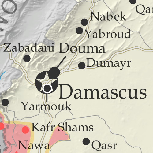
Map of Syrian Civil War (Syria control map): Fighting and territorial control in Syria in May 2018 (Free Syrian Army rebels, Kurdish YPG, Syrian Democratic Forces (SDF), Hayat Tahrir al-Sham (HTS / Al-Nusra Front), Islamic State (ISIS/ISIL), and others). Includes Russia-Turkey-Iran agreed de-escalation zones and US deconfliction zone, plus recent locations of conflict and territorial control changes, such as Rastan, Yarmouk, Baghuz, and more. Colorblind accessible.
In the past month, Syria’s rebels have lost one of their biggest enclaves of control – “Zone 2” near the city of Homs, including their oldest stronghold in Rastan. Meanwhile, the national capital has been completely cleared of rebel and “Islamic State” control pockets.

See all this and more on the latest update to PolGeoNow’s concise, professional Syrian Civil War control map, which includes a timeline of changes since our previous Syria map report in April, with sources cited.

This map and report are premium content, available to paid subscribers of the PolGeoNow Conflict Mapping Service.

Want to see before you subscribe? Check out our most recent FREE SAMPLE Syria map!

Exclusive map report includes:

  • Up-to-date illustration of current territorial control in Syria, color-coded for the Assad government, rebel groups, “Islamic State” (ISIS/ISIL) fighters, and the Kurdish-led Syrian Democratic Forces (SDF). Colorblind accessible.
  • Markers showing the approximate locations of Russian-Turkish-Iranian “de-escalation zones” and the one known US “deconfliction zone”.
  • Special symbols indicating towns dominated by rebels of the former Al Qaeda Nusra Front (now Hayat Tahrir al-Sham or HTS) and by the Kurdish YPG militia (part of the US-backed SDF).
  • Detailed indication of city-by-city control, including key towns and other locations important to current events.
  • Locations of recent control changes and other important events, including Rastan, Yarmouk, Baghuz, and more.
  • Detailed timeline of important events and changes to territorial control since April 25, 2018, compiled by our Syria-Iraq expert, with links to sources. 
  • Brief summary of the current situation and of major changes to the configuration of territorial boundaries and de facto enclaves and exclaves.

SUBSCRIBERS CLICK HERE TO PROCEED TO ARTICLE AND MAP

Not signed up yet? Click here to learn more about our professional subscription service!

Can I purchase just this map?
This map and report are not available for automated purchase to non-subscribers. If you need access or republication rights for only this map report, contact service@polgeonow.com for options.

Syrian Civil War Map & Timeline: Kurdish, Rebel Enclaves Evaporate – April 2018 (Subscription)

SUBSCRIBERS CLICK HERE TO PROCEED TO ARTICLE AND MAP

There are newer versions of this map available. To see them, view all Syria updates.

Research by Djordje Djukic. Map by onestopmap.com, Evan Centanni, and Djordje Djukic

Subscribe for full access to all conflict map reports!


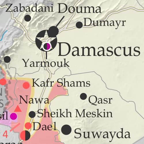
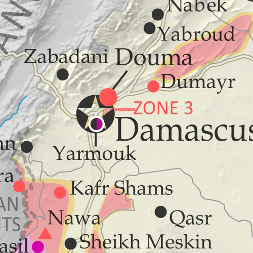
Map of Syrian Civil War (Syria control map): Fighting and territorial control in Syria in April 2018 (Free Syrian Army rebels, Kurdish YPG, Syrian Democratic Forces (SDF), Hayat Tahrir al-Sham (HTS / Al-Nusra Front), Islamic State (ISIS/ISIL), and others). Includes Russia-Turkey-Iran agreed de-escalation zones and US deconfliction zone, plus recent locations of conflict and territorial control changes, such as Afrin, Douma, Dumayr, Sabaa Biyar, and more. Colorblind accessible.
In the last six weeks, Turkey-led forces have expelled the Kurdish YPG from its stronghold in Afrin, while the three major pockets of rebel control near Damascus have all been wiped off the map.

See all this and more on the latest update to PolGeoNow’s concise, professional Syrian Civil War control map, which includes a timeline of changes since our previous Syria map report in March, with sources cited.

This map and report are premium content, available to paid subscribers of the PolGeoNow Conflict Mapping Service.

Want to see before you subscribe? Check out our most recent FREE SAMPLE Syria map!

Exclusive map report includes:

  • Up-to-date illustration of current territorial control in Syria, color-coded for the Assad government, rebel groups, “Islamic State” (ISIS/ISIL) fighters, and the Kurdish-led Syrian Democratic Forces (SDF). Colorblind accessible.
  • Markers showing the approximate locations of Russian-Turkish-Iranian “de-escalation zones” and the one known US “deconfliction zone”.
  • Special symbols indicating towns dominated by rebels of the former Al Qaeda Nusra Front (now Hayat Tahrir al-Sham or HTS) and by the Kurdish YPG militia (part of the US-backed SDF).
  • Detailed indication of city-by-city control, including key towns and other locations important to current events.
  • Locations of recent fighting and other important events, including Afrin, Douma, Dumayr, Sabaa Biyar, and more.
  • Detailed timeline of important events and changes to territorial control since March 16, 2018, compiled by our Syria-Iraq expert, with links to sources. 
  • Brief summary of current situation, as well as major changes to the configuration of territorial boundaries and de facto enclaves and exclaves.

SUBSCRIBERS CLICK HERE TO PROCEED TO ARTICLE AND MAP

Not signed up yet? Click here to learn more about our professional subscription service!

Can I purchase just this map?
This map and report are not available for automated purchase to non-subscribers. If you need access or republication rights for only this map report, contact service@polgeonow.com for options.

Yemen Control Map & Report – April 2018 (Subscription)

SUBSCRIBERS CLICK HERE TO PROCEED TO ARTICLE AND MAP

There are newer versions of this map available. To see them, view all Yemen articles on PolGeoNow.
 
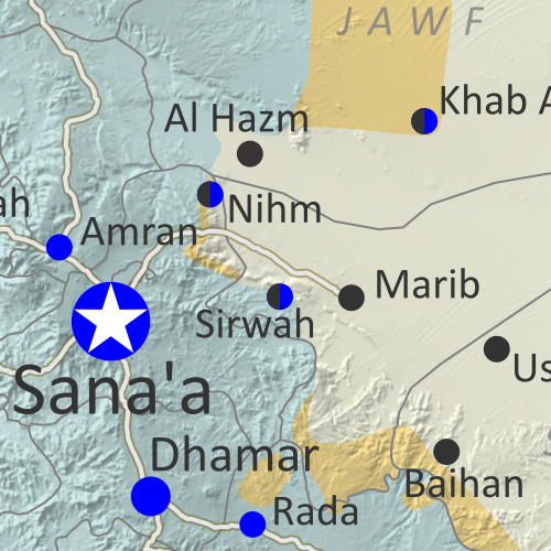
Map of what is happening in Yemen as of May 21, 2017, including territorial control for the unrecognized Houthi government and former president Saleh's forces, president-in-exile Hadi and his allies in the Saudi-led coalition and Southern Movement, Al Qaeda in the Arabian Peninsula (AQAP), and the so-called Islamic State (ISIS/ISIL). Includes recent locations of fighting, including Azzan, Habban, Maydee, Nihm, and more.

Subscribe for full access to all conflict map reports!

Timeline by Djordje Djukic. Map by Evan Centanni, Djordje Djukic, and onestopmap.com

In the past three months, the civil war in Yemen has been marked by infighting within the Saudi-led coalition, while those forces have made only small progress against the Houthis and Al Qaeda.

See all this and more on the newest update to PolGeoNow’s Yemen territorial control map, which includes a timeline of changes and important events since our previous Yemen map report in January.

This map and report are premium content available to paid subscribers of the PolGeoNow Conflict Mapping Service.

Want to see before you buy? Check out our most recent FREE SAMPLE Yemen map report!

Exclusive report includes:

  • Up-to-date map of current territorial control in Yemen, color-coded for the pro-Hadi coalition, Houthi/Saleh forces, Al Qaeda in the Arabian Peninsula (AQAP), and the so-called “Islamic State” (ISIS/ISIL).
  • Detailed indication of town-by-town control, including provincial boundaries, all major cities, and many smaller ones
  • Markers for recent areas of fighting, including Hays, Kirsh, Nihm, Ketaf, and more
  • Timeline of changes to the situation since January 6, 2018, with links to sources

SUBSCRIBERS CLICK HERE TO PROCEED TO ARTICLE AND MAP

Not a member yet? Click here to learn more about our professional subscription service!

Can I purchase just this map?
This map and report are not available for automated purchase to non-subscribers. If you need access or republication rights for only this map report, contact service@polgeonow.com for options.

Syrian Civil War Map & Timeline: Afrin Separated from Turkey – March 2018 (Subscription)

SUBSCRIBERS CLICK HERE TO PROCEED TO ARTICLE AND MAP

There are newer versions of this map available. To see them, view all Syria updates.

Research by Djordje Djukic. Map by onestopmap.com, Evan Centanni, and Djordje Djukic

Subscribe for full access to all conflict map reports!


Map of Syrian Civil War (Syria control map): Fighting and territorial control in Syria in March 2018 (Free Syrian Army rebels, Kurdish YPG, Syrian Democratic Forces (SDF), Hayat Tahrir al-Sham (HTS / Al-Nusra Front), Islamic State (ISIS/ISIL), and others). Includes Russia-Turkey-Iran agreed de-escalation zones and US deconfliction zone, plus recent locations of conflict and territorial control changes, such as Afrin, the Eastern Ghouta rebel zone, and more. Colorblind accessible.
Over the past month, fighting has raged in three major flashpoints in Syria, with the Turkish invasion of Afrin, Assad’s new ground war against rebels near Damascus, and heavy infighting between rebel groups in the north.

See all this and more on the latest update to PolGeoNow’s concise, professional Syrian Civil War control map, which includes a timeline of changes since our previous Syria map report in February, with sources cited.

This map and report are premium content, available to paid subscribers of the PolGeoNow Conflict Mapping Service.

Want to see before you subscribe? Check out our most recent FREE SAMPLE Syria map!

Exclusive map report includes:

  • Up-to-date illustration of current territorial control in Syria, color-coded for the Assad government, rebel groups, “Islamic State” (ISIS/ISIL) fighters, and Kurdish/SDF forces. Colorblind accessible.
  • Markers showing the approximate locations of Russian-Turkish-Iranian “de-escalation zones” and the one known US “deconfliction zone”.
  • Special symbols indicating towns dominated by rebels of the former Al Qaeda Nusra Front (now Hayat Tahrir al-Sham or HTS) and by the US-backed Syrian Democratic Forces (SDF).
  • Detailed indication of city-by-city control, including key towns and other locations important to current events.
  • Locations of recent fighting and other important events, including Kurdish Afrin, the Eastern Ghouta rebel zone near Damascus, and more.
  • Detailed timeline of important events and changes to territorial control since February 13, 2018, compiled by our Syria-Iraq expert, with links to sources. 
  • Brief summary of current situation, as well as major changes to the configuration of territorial boundaries and de facto enclaves and exclaves.

SUBSCRIBERS CLICK HERE TO PROCEED TO ARTICLE AND MAP

Not signed up yet? Click here to learn more about our professional subscription service!

Can I purchase just this map?
This map and report are not available for automated purchase to non-subscribers. If you need access or republication rights for only this map report, contact service@polgeonow.com for options.

Iraq Control Map & Timeline – February 2018 (Subscription)

SUBSCRIBERS CLICK HERE TO PROCEED TO ARTICLE AND MAP

(To see other maps in this series, view all Iraq updates.)

Research by Djordje Djukic. Map by onestopmap.com, Evan Centanni, and Djordje Djukic

Subscribe for full access to all conflict map reports!


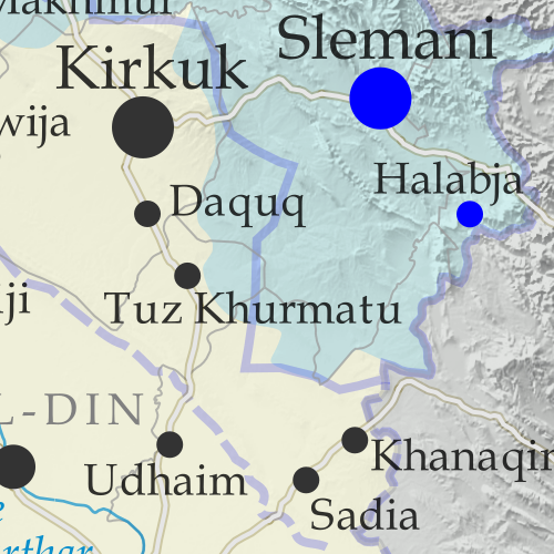
Detailed map of territorial control in Iraq as of February 22, 2018. Shows territory held by the so-called Islamic State (ISIS, ISIL), the Baghdad government, the Kurdistan Peshmerga, and the Yezidi Sinjar Alliance (YBS and YJE). Colorblind accessible.
Since November, pro-government forces in Iraq have nearly, but not entirely, cleared the country of control by the so-called “Islamic State” (ISIS/ISIL), with the group still reportedly holding out in parts of the western desert.

See all this and more on the latest update to PolGeoNow’s concise, professional map of control in Iraq’s civil war, including a timeline of changes since our previous Iraq map report of November 2017.

This map and report are premium content, available to paid subscribers of the PolGeoNow Conflict Mapping Service.

Want to see before you subscribe? Check out our most recent FREE SAMPLE Iraq map report!

Exclusive report includes:

  • Up-to-date map of current territorial control in Iraq, color-coded for the Iraqi government, “Islamic State” (ISIS/ISIL) fighters, Kurdistan’s Peshmerga forces, and Yezidi militias. Colorblind accessible.
  • Detailed indication of town-by-town control, including all major cities and many smaller ones, as well as terrain, major roads, and provincial boundaries
  • Timeline of changes to the situation since the end of November, compiled by our Iraq-Syria specialist, with links to sources.

SUBSCRIBERS CLICK HERE TO PROCEED TO ARTICLE AND MAP

Not signed up yet? Click here to learn more about our professional subscription service!

Can I purchase just this map?
This map and report are not available for automated purchase to non-subscribers. If you need access or republication rights for only this map report, contact service@polgeonow.com for options.

Syrian Civil War Map & Timeline – February 2018

There are newer versions of this map available. To see them, view all Syria updates.

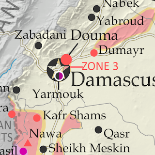
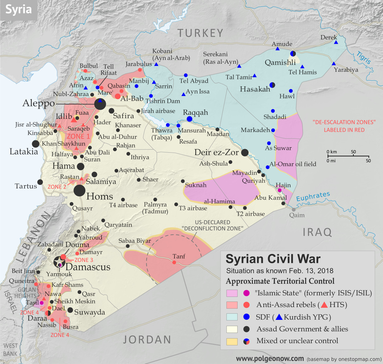
Who controls what in Syria? Rebel and ISIS control map of the Syrian Civil War. Shows territorial control as of February 2018 (Free Syrian Army rebels, Kurdish YPG, Syrian Democratic Forces (SDF), Jabhat Fateh al-Sham / Hayat Tahrir al-Sham (Al-Nusra Front), Islamic State (ISIS/ISIL), and others). Includes Russia-Turkey-Iran agreed de-escalation zones and US deconfliction zone, plus recent locations of conflict and territorial control changes, such as Abu al-Duhur, Bulbul, Saraqeb, and more. Colorblind accessible.
Base map by Koen Adams of onestopmap.com, with territorial control by Evan Centanni and Djordje Djukic.
Contact us for permission to use this map.

(Subscribers click here to view this article on the member site)

Timeline by Djordje Djukic

Situation Summary

The past few weeks since our previous Syria map update have been dominated by news from two main arenas of battle, both in the country’s northwest. In the most politically significant development, the Turkish military has entered the Kurdish-administrated Afrin region (also spelled “Efrin”) as part of a mission, alongside allied rebel fighters, to drive Kurdish militias out of the western border region. Meanwhile, forces loyal to Syria’s Assad government have made major advances in areas south of Aleppo, eliminating an enclave of the so-called “Islamic State” (IS; formerly ISIS/ISIL) and cutting into rebel control around the edges of Idlib province.

The main boundary-related milestones in this update involve the former side-by-side rebel and IS exclaves at the corner of Idlib, Aleppo, and Hama provinces, which were together already encircled by pro-government troops as of our January report. Since that was published, IS forces managed to take over the rebel-held parts of the pocket, simultaneously eliminating the rebel exclave, erasing one of only two IS borders with Syrian rebel territory, and making the IS territory into a proper enclave, fully surrounded by government forces. Not long afterwards, the IS enclave was itself eliminated by government forces, though a smaller, short-lived pocket of IS control briefly sprung up farther to the west.

Turkey’s incursion into the Afrin region has also created three or four new exclaves of rebel control wedged between the Kurdish-administered area and the Turkish border. However, because of the heavy involvement of Turkish troops, some observers might consider these mere extensions of Turkish territory. If the Turkish-led forces are able to continue their advance, we may also soon see the elimination of Kurdish Afrin’s border with Turkey.

See Also: Iraq Control Map for February 2018

Flag of Syria under the current governmentCountry Name:  
• Syria (English)
• Sūriyya/Sūryā (Arabic)
Official Name:  
• Syrian Arab Republic (English)
• al-Jumhūriyyah al-‘Arabīyah  as-Sūriyyah (Arabic)
Capital: Damascus

Note: Red triangles on the map represent towns where rebel group Hayat Tahrir al-Sham (HTS) – formerly known as Al Qaeda affiliate Jabhat al-Nusra (a.k.a. the Nusra Front), and later Jabhat Fateh al-Sham (JFS) – is thought to be in a dominant position among rebel forces, even if it doesn’t exercise exclusive control. This organization has at least some presence in most rebel-held areas of Syria.

Timeline of Events
The following is a timeline of changes to territorial control and other key events in Syria since our previous map update of January 20, 2018. Sources are provided as in-line links.

January 21, 2018
Turkey-supported Free Syrian Army (TFSA) rebels pushed into the Kurdish-administered Afrin region and captured four to nine villages. Later, the Kurdish-led Syrian Democratic Forces (SDF) recaptured two villages. Turkish military forces were fighting alongside the rebels, on a mission to establish a buffer zone between the border and the territory of the SDF, whose dominant Kurdish YPG militia Turkey considers to be terrorists because of links to rebels inside Turkey. (The Turkish government hopes to eventually create a Turkey-friendly buffer zone along Syria’s entire northern border.)

Meanwhile, the Syrian military continued its clean-up operations around the Abu al-Duhur airbase, while also attempting to capture the town of Abu al-Duhur itself, and was also advancing against a besieged rebel-controlled pocket at the intersection of Idlib, Hama and Aleppo provinces. In addition, the army captured two villages from IS in the group’s adjacent enclave. Later, the Syrian Ministry of Defense reported that the airbase had been secured.

January 22, 2018
Government forces seized Abu al-Duhur, and the number of villages captured by the military over the previous 12 hours in the Idlib-Hama-Aleppo pocket reached 30. Meanwhile, the TFSA captured a strategic mountain in the northeast of the Afrin region, as well as a hill to the north. However, the SDF later recaptured the mountain.

January 22-23, 2018
A two-day rebel attack on government positions in Latakia province was repelled, but 16 soldiers were killed during the attack.

January 23, 2018
The TFSA launched a new assault on a strategic mountain in the Afrin region, before Kurdish forces pushed it back. The mountain overlooks the eastern approach to Afrin city. Meanwhile, government forces captured a village west of Abu al-Duhur.

January 24, 2018
IS captured the remaining 17 villages in the government-besieged Idlib-Hama-Aleppo pocket from HTS rebels. Government forces also seized several villages in the enclave from HTS.

January 25, 2018
IS forces launched an assault across the Euphrates River, attacking the government-held western bank. The attack was eventually repelled. Between 18 and 25 IS fighters, as well as between a dozen and 26 pro-government fighters, were killed during the attack along a 32 kilometer front.

January 26, 2018
The town of Abu al-Duhur was reported to once again be contested between government and HTS forces. Meanwhile, the SDF recaptured a village in the Afrin region from pro-Turkish forces.

January 28, 2018
Pro-Turkish forces captured the strategic mountain in the Afrin region that they had been targeting for the past several days.

January 29, 2018
The army captured Abu al-Duhur, thus securing the western flank of the nearby airbase. Three other nearby villages were also captured. Meanwhile, the SDF captured an IS stronghold on the eastern bank of the Euphrates, about 15 km northwest of Hajin, for the fourth time following five weeks of back-and-forth fighting.

January 30, 2018
A civilian was killed when a Turkish military convoy was attacked by a car bomb in the Idlib countryside. A soldier and another civilian were wounded. The Turkish military stated that the convoy had been traveling as part of its mission to enforce a “de-escalation” zone in the province. According to pro-government sources, the convoy was attempting to block further Syrian Army advances in the Aleppo countryside, but that after the attack it had quickly returned to the border.

January 31-February 1, 2018
Government forces seized 100 square kilometers of territory, including 20 villages, in the eastern countryside of Idlib and the southern countryside of Aleppo, coming within 14 kilometers of Saraqeb, a major town at the junction of two key highways.

February 1, 2018
It was reported that since the start of the offensive against Afrin, pro-Turkish forces had advanced only seven kilometers and seized between 15 and 20 villages, about 4 percent of the total number in the region. Meanwhile, Syrian government troops launched an assault against the IS enclave in the northeastern countryside of Hama, capturing three villages and a hill.

February 1-3, 2018
On February 1, the TFSA reached Bulbul, 30 kilometers north of Afrin, and soon afterwards Turkish media claimed the pro-Turkish forces had captured the town. However, pro-opposition and Kurdish sources said the town was still contested. Two days later, the TFSA capture of Bulbul was confirmed.

February 2-3, 2018
Government forces advanced farther toward Saraqeb after capturing four more villages. The next day, the army reportedly seized one more village on the provincial border of of Idlib and Aleppo, as well as one in the southwestern countryside of Aleppo.

February 3, 2018
HTS rebel fighters shot down a Russian Sukhoi 25SM fighter jet over Idlib province with a shoulder-launched anti-aircraft MANPAD missile. It was the first case of a Russian jet being brought down by the rebels since the start of the Russian intervention in the civil war in 2015. The pilot ejected and was immediately fired upon by HTS fighters. He managed to land on the ground and returned fire, shooting two rebels, before he killed himself by detonating a grenade to avoid capture.

February 3-7, 2018
The army continued with an armored assault from multiple directions against the IS pocket in northeastern Hama province, taking control of up to 30 villages, reportedly representing 80 percent of the pocket.

February 5-7, 2018
The rebels launched a counterattack against government forces in the eastern countryside of Idlib, recapturing one village and advancing into a second. Two days later, two more villages were recaptured by the rebels, though it was later reported that one of them had once again come under army control.

February 8, 2018
The US reported that a force of about 500 pro-Syrian government soldiers, supported by artillery, tanks, multiple-launch rocket systems, and mortars, attacked the SDF and American military advisors east of the Euphrates River in Deir ez-Zor province. Coalition airstrikes were then launched against the pro-government forces, with the US claiming more than 100 pro-government fighters were killed, while only one SDF combatant was wounded during the fighting. In contrast, pro-opposition activists reported that 45 pro-government fighters were killed in the airstrikes, while Syrian military sources stated that 45 Syrian soldiers were killed.

Days later, reports emerged that Russian private military contractors (PMCs) supporting the pro-government forces had also died in coalition counterattack, with between 5 and 10 PMC deaths confirmed.

Meanwhile, the Syrian army renewed its attack against the encircled IS pocket in the northeast of Hama, reducing it to about a dozen towns and villages, while the majority of IS forces withdrew to just one town.

February 9, 2018
After one week of fighting, government forces cleared the whole IS enclave in the northeastern countryside of Hama, taking control of 80 villages and fully securing a key highway linking Hama and Aleppo. Opposition activists said that a corridor was opened by the government for the remaining 200 IS fighters to retreat towards rebel-held territory in Idlib province, with IS subsequently capturing three villages from the rebels. According to pro-government sources, the IS forces had instead conducted a surprise break-out towards rebel territory, advancing through over a dozen government-held villages before reaching it.

Meanwhile, the strip of territory that Turkey-backed forces had seized from the SDF along the border was estimated to have reached 15 kilometers in width.

February 10, 2018
An Israeli F-16 fighter jet crashed after coming under fire from Syrian anti-aircraft missiles during a raid against Iranian facilities in eastern Homs province that had earlier launched a drone into Israel. The drone had been intercepted and shot down by Israel. The F-16 crashed in northern Israel, with both pilots ejecting and then being evacuated to a hospital. Subsequently, Israel conducted a second raid against 12 Syrian and Iranian military targets southwest of Damascus. Later in the day, Israel also conducted a third raid near Damascus. Overall, six pro-government fighters, including non-Syrians, were reported killed in the airstrikes.

Meanwhile, a Turkish military attack helicopter was shot down by Kurdish forces in the Afrin region, with both crew members killed. During the day’s fighting in Afrin, the TFSA managed to make advances, linking up with rebel forces in Idlib province.

February 11, 2018
The TFSA advanced to within three kilometers of a strategic town in the Afrin region.

February 12, 2018
IS captured two villages from rebels in the southeastern Idlib countryside and was fighting for control of a third village. Elsewhere, the SDF captured one village from IS on the eastern bank of the Euphrates River, after which IS launched a counterattack in an attempt to retake it. Meanwhile, the TFSA managed to establish a buffer zone around its recent gains in the southern part of Afrin, while in the northern part a new TFSA attack was repelled by the YPG.

February 13, 2018
Four hundred IS fighters and their family members surrendered to rebels in the area they had captured the previous day in Idlib province. The IS fighters also gave up all of their positions in the area. Meanwhile, more advances by the TFSA brought a total of 8 percent of the Afrin region under its control. Overall, since the start of the Turkish-led operation in the area, between 453 and 456 people had been confirmed killed, including 177 TFSA and 163 SDF fighters, 75 civilians in Syria, 7 civilians in Turkey, and 31-34 Turkish soldiers.

Graphic of the Syrian flag is in the public domain (source).

Syrian Civil War Map & Timeline: Rebels Lose Major Ground – January 2018 (Subscription)

SUBSCRIBERS CLICK HERE TO PROCEED TO ARTICLE AND MAP

There are newer versions of this map available. To see them, view all Syria updates.

Research by Djordje Djukic. Map by onestopmap.com, Evan Centanni, and Djordje Djukic

Subscribe for full access to all conflict map reports!


Map of Syrian Civil War (Syria control map): Fighting and territorial control in Syria in January 2018 (Free Syrian Army rebels, Kurdish YPG, Syrian Democratic Forces (SDF), Jabhat Fateh al-Sham / Hayat Tahrir al-Sham (Al-Nusra Front), Islamic State (ISIS/ISIL), and others). Includes Russia-Turkey-Iran agreed de-escalation zones and US deconfliction zone, plus recent locations of conflict and territorial control changes, such as Abu al-Duhur, Beit Jinn, Rahjan, and more. Colorblind accessible.
The past month has seen major losses for hardline rebels in Syria’s northwest, excluded from the de-escalation agreements, even as the push against the so-called “Islamic State” (ISIS/ISIL) has slowed in the east.

See all this and more on the latest update to PolGeoNow’s concise, professional Syrian Civil War control map, which includes a timeline of changes since our previous Syria map report in November, with sources cited.

This map and report are premium content, available to paid subscribers of the PolGeoNow Conflict Mapping Service.

Want to see before you subscribe? Check out our most recent FREE SAMPLE Syria map!

Exclusive map report includes:

  • Up-to-date illustration of current territorial control in Syria, color-coded for the Assad government, rebel groups, “Islamic State” (ISIS/ISIL) fighters, and Kurdish/SDF forces. Colorblind accessible.
  • Markers showing the approximate locations of Russian-Turkish-Iranian “de-escalation zones” and the one known US “deconfliction zone”.
  • Special symbols indicating towns dominated by rebels of the former Al Qaeda Nusra Front (now Hayat Tahrir al-Sham) and US-backed Syrian Democratic Forces (SDF).
  • Detailed indication of city-by-city control, including key towns and other locations important to current events.
  • Locations of recent fighting and other important events, including Abu al-Duhur, Beit Jinn, Rahjan, and more.
  • Detailed timeline of important events and changes to territorial control since December 13, 2017, compiled by our Syria-Iraq expert, with links to sources.

SUBSCRIBERS CLICK HERE TO PROCEED TO ARTICLE AND MAP

Not signed up yet? Click here to learn more about our professional subscription service!

Can I purchase just this map?
This map and report are not available for automated purchase to non-subscribers. If you need access or republication rights for only this map report, contact service@polgeonow.com for options.