Syria Control Map & Timeline: January 2017 (Subscription)

SUBSCRIBERS CLICK HERE TO PROCEED TO ARTICLE AND MAP

There are newer versions of this map available. To see them, view all Syria updates.
Research by Djordje Djukic. Map by onestopmap.com, Evan Centanni, and Djordje Djukic

Subscribe for full access to all conflict map reports!


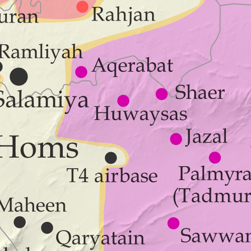
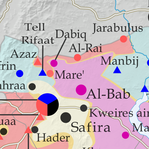
Map of fighting and territorial control in Syria's Civil War (Free Syrian Army rebels, Kurdish YPG, Syrian Democratic Forces (SDF), Jabhat Fateh al-Sham (Al-Nusra Front), Islamic State (ISIS/ISIL), and others), updated to January 20, 2017. Now includes terrain and major roads (highways). Includes recent locations of conflict and territorial control changes, such as the Barada Valley, Hazrama, Thawra, the T4 airbase, and more. Colorblind accessible. In the past month, Syria’s Assad government has continued to consolidate its power after a major victory over the rebels in the city of Aleppo. Meanwhile, forces of the so-called “Islamic State” (ISIS/ISIL) have lost ground to Kurdish-led militias even while holding their own against the Syrian Army.
 
See all this and more on the latest update to PolGeoNow’s concise, professional Syrian Civil War control map, which includes a timeline of changes since our previous Syria map report in December, with sources cited.

This map and report are premium professional content, available to paid subscribers of the PolGeoNow Conflict Mapping Service.

Want to see before you subscribe? Check out our most recent FREE SAMPLE Syria map!

Exclusive report includes:

  • Up-to-date map of current territorial control in Syria, color-coded for the Assad government, rebel groups, “Islamic State” (ISIS/ISIL) fighters, and Kurdish/SDF forces. Colorblind accessible.
  • Special symbols indicating towns dominated by rebels of the former Nusra Front (now Jabhat Fateh al-Sham) and US-backed Syrian Democratic Forces (SDF).
  • Detailed indication of city-by-city control, including key towns and other locations important to current events.
  • Locations of recent fighting and other important events, including the Barada Valley, Hazrama, Thawra, the T4 airbase, and more.
  • Detailed timeline of important events and changes to territorial control since December 18, 2016, compiled by our Syria-Iraq expert, with links to sources.

SUBSCRIBERS CLICK HERE TO PROCEED TO ARTICLE AND MAP

Not signed up yet? Click here to learn more about our professional subscription service!

Can I purchase just this map?
This map and report are not available for automated purchase to non-subscribers. If you need access or republication rights for only this map report, contact service@polgeonow.com for options.

Iraq Control Map & Timeline: The Battle for Mosul – January 2017 (Subscription)

SUBSCRIBERS CLICK HERE TO PROCEED TO ARTICLE AND MAP

There are newer versions of this map available. To see them, view all Iraq updates.

Research by Djordje Djukic. Map by onestopmap.com, Evan Centanni, and Djordje Djukic

Subscribe for full access to all conflict map reports!


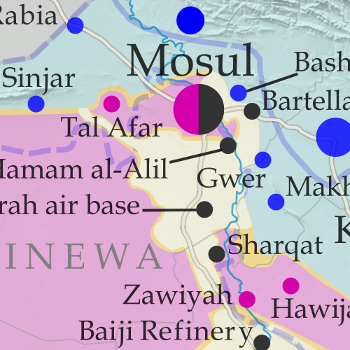
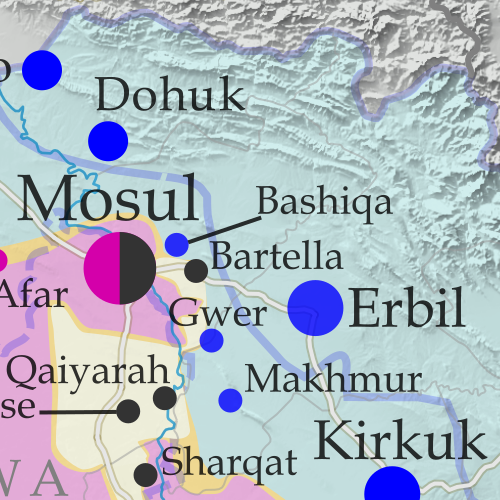
Detailed map of territorial control in Iraq as of January 10, 2016, including territory held by the so-called Islamic State (ISIS, ISIL), the Baghdad government, and the Kurdistan Peshmerga. Shows developments in the ongoing coalition battle to recapture the city of Mosul. Includes key locations from recent events, such as Mosul, Al-Sagra, and Hamam al-Alil. Colorblind accessible. Over the past two months, a battle has raged for control of Mosul, the second-largest city in Iraq and the largest controlled by the so-called “Islamic State” (ISIS/ISIL). Government and allied forces have made slow but steady progress in the city and nearby areas, even while advancing in western Iraq’s Anbar province at the same time.
 
See all this and more on the latest update to PolGeoNow’s concise, professional map of control in Iraq’s civil war, including a timeline of changes since our previous Iraq map report of November 2016.

This map and report are premium professional content, available to paid subscribers of the PolGeoNow Conflict Mapping Service.

Want to see before you subscribe? Check out our most recent FREE SAMPLE Iraq map report!

Exclusive report includes:

  • Up-to-date map of current territorial control in Iraq, color-coded for the Iraqi government, “Islamic State” (ISIS/ISIL) extremists, and Kurdistan’s Peshmerga forces. Colorblind accessible.
  • Detailed indication of town-by-town control, including provincial boundaries, all major cities, and many smaller ones
  • Markers for key areas of recent fighting such as Mosul, Tal Afar, Al-Sagra, and Hamam al-Alil
  • Timeline of changes to the situation since early November, compiled by our Iraq specialist, with links to sources

SUBSCRIBERS CLICK HERE TO PROCEED TO ARTICLE AND MAP

Not signed up yet? Click here to learn more about our professional subscription service!

Can I purchase just this map?
This map and report are not available for automated purchase to non-subscribers. If you need access or republication rights for only this map report, contact service@polgeonow.com for options.

Yemen Control Map & Report: December 2016

There are newer versions of this map available. To see them, view all Yemen updates.

This is part of a series of Yemen maps and infographics created in collaboration between PolGeoNow and CIGeography.

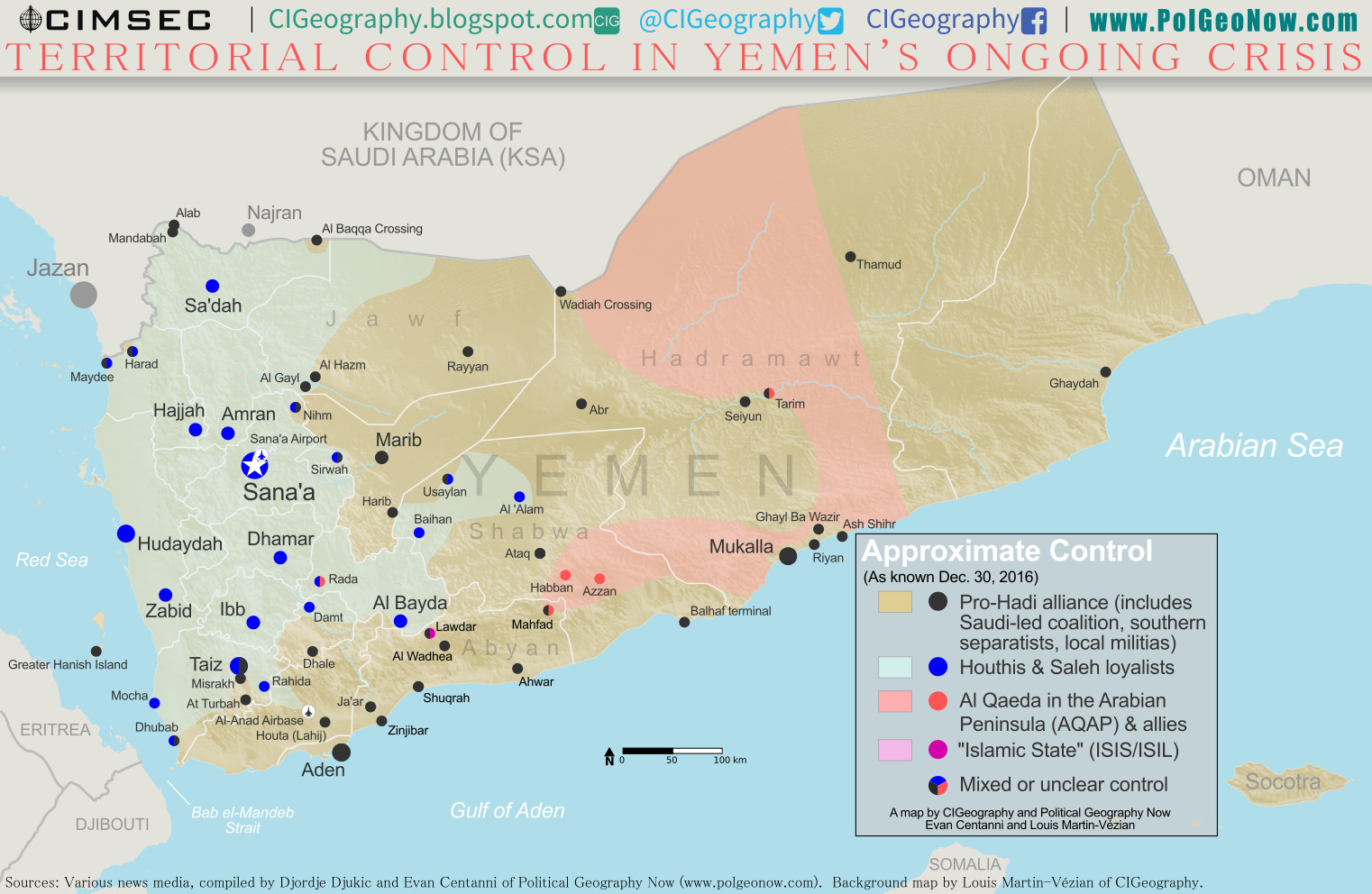
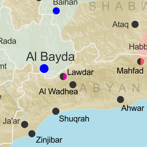
Map of what is happening in Yemen as of December 30, 2016, including territorial control for the Houthi rebels and former president Saleh's forces, president-in-exile Hadi and his allies in the Saudi-led coalition and Southern Movement, Al Qaeda in the Arabian Peninsula (AQAP), and the so-called Islamic State (ISIS/ISIL). Includes recent locations of fighting, including Al Gail, Sirwah, Usaylan, and areas long the Yemen border with Saudi Arabia.
Click to enlarge. Map by Louis Martin-Vézian, Evan Centanni, and Djordje Djukic. All rights reserved.

(Subscribers click here to view this article in the members area.)

Timeline by Djordje Djukic

Situation Summary
In the past three months since our previous Yemen control map report, fighting has continued between Houthi rebels and forces loyal to the Saudi-backed government of President Hadi, with small changes to territorial control on the eastern and northern fringes of Houthi territory, including along Yemen’s border with Saudi Arabia. Meanwhile, Al Qaeda in the Arabian Peninsula (AQAP) has remained entrenched in parts of the east, while allegedly capturing an area near its one-time stronghold of Rada in the country’s west.

Flag of YemenCountry Name:  
• Yemen (English)
• Al-Yaman (Arabic)
Official Name:  
• Republic of Yemen (English)
al-Jumhūriyyah al-Yamaniyyah (Arabic) 
Capital: Sana’a (official); Aden (seat of internationally-recognized government)

Chronology of Events
The following is a timeline of major events and changes to territorial control since PolGeoNow’s previous Yemen control map report of September 23, 2016.

October 1, 2016
Pro-Hadi forces captured the the village of Al Gayl, which they claimed to be the last Houthi stronghold in Jawf province. Meanwhile, the Houthis claimed they hit a UAE military ship in the Bab al-Mandeb Strait, while according to the UAE the vessel that was hit was an aid ship en route to Aden.

October 8, 2016
At least 140 people were killed and more than 500 wounded in several airstrikes on a funeral reception in Sana’a which was attended by military and intelligence officials of the Houthi-led government.

October 9, 2016
The US Navy guided missile destroyer Mason was targeted in a failed missile attack from Houthi-held territory in Yemen.

October 12, 2016
The USS Mason was targeted in a second failed missile attack off the coast of Yemen.

October 13, 2016
In retaliation for the two missile attacks, the USS Mason targeted and destroyed three coastal radar sites in Houthi-held areas, using cruise missiles.

November 2, 2016
Twenty-eight Houthi and six pro-Hadi fighters were reportedly killed in fighting in Taiz.

November 7, 2016
The WHO announced that at least 7,070 people had been killed and 36,818 injured in the conflict in Yemen since the start of the Saudi-led intervention in March 2015.

November 15-16, 2016
Fighting in Maydee and Harad on the border between Yemen and Saudi Arabia, as well as in Taiz, left 46 pro-Houthi and 39 pro-Hadi fighters dead, in addition to five civilians. During the clashes in Taiz, pro-Hadi forces managed to advance towards the Houthi-held presidential residence and police headquarters.

November 17-18, 2016
Twenty-four Houthi and 14 pro-Hadi fighters were reportedly killed in Taiz, as well as two civilians, dashing any hopes of a ceasefire that had been announced by US Secretary of State John Kerry, which was supposed to start on November 17. Instead, a 48-hour ceasefire began on November 19.

November 21-22, 2016
Following the fragile two-day ceasefire, heavy fighting in Taiz and Maydee left a reported 29 Houthi and 12 pro-Hadi fighters dead.

November 24, 2016
More fighting in Taiz killed 10 Houthi fighters.

November 28, 2016
The Houthis and their political allies formed a new government. A Hadi spokesman deemed the move “a disregard not just for the Yemeni people, but also for the international community”.

December 2, 2016
The Saudi-led coalition claimed that 172 people were killed and 686 wounded due to indiscriminate shelling in Taiz by pro-Houthi forces during the month of November.

December 4-5, 2016
Pro-Hadi troops captured the Alab border crossing, which is one of two border crossings between Saudi Arabia and Yemen’s Sa’dah province. The second crossing, Al Baqqa, had already been taken by pro-Hadi troops previously. The fighting spread the following day to the nearby Mandabah mountain. Pro-Hadi forces also claimed that the Houthis had withdrawn from the port town of Maydee. However, fighting was still being reported around the town 15 days later.

December 10, 2016
An IS suicide bomber killed between 48 and 50 soldiers and wounded around 70 at a base in Aden.

December 12-15, 2016
Al-Qaeda captured a mountain in Bayda province and claimed to have also seized an area of the Rada district from pro-Houthi forces.

December 13, 2016
Eighteen Houthi fighters were reportedly killed in fighting in Taiz, while Houthi forces attempted to recapture a hill overlooking the Sirwah airport in Marib province, which they had recently lost.

December 18, 2016
An IS suicide bomber killed between 49 and 52 soldiers and wounded between 34 and 60 in Aden while they were collecting their salaries.

December 18-19, 2016
Houthi fighters managed to temporarily capture a hilly air-defense base on the western edge of Taiz, before they were forced to retreat the following morning. Pro-Hadi forces claimed 41 Houthi fighters were killed, while they lost nine. Meanwhile, pro-Hadi forces reportedly captured Mandabah mountain on the Yemeni-Saudi border.

December 22, 2016
Seven Pakistani crew members of an Iranian cargo ship were killed when their ship was sunk in a rocket attack off the coast of Yemen.

December 23, 2016
Saudi artillery and helicopter strikes on the Saudi-Yemeni border reportedly killed at least 30 pro-Houthi fighters, while the US military reported 28 Al Qaeda militants were killed in nine strikes between September 23 and December 13 in Yemen.

December 24, 2016
Pro-Hadi forces captured several areas in the Nihm district northeast of Sana’a.

December 27, 2016
Twenty-eight Houthi and 12 pro-Hadi fighters were reportedly killed in fighting in the southern province of Shabwa when pro-Hadi forces launched an offensive against Baihan. Fighting also took place at nearby Usaylan. Pro-Hadi forces claimed to have made advances during the offensive.

December 29, 2016
Pro-Hadi troops reportedly captured three regions of the Usaylan district in Shabwa province and were trying to push towards Baihan. At least 10 Houthi fighters were killed in the fighting.

CHECK FOR UPDATES: View all Yemen maps on PolGeoNow

Graphic of Yemeni flag is in the public domain (source).

Syria Control Map & Timeline: Assad Retakes Aleppo – December 2016 (Subscription)

SUBSCRIBERS CLICK HERE TO PROCEED TO ARTICLE AND MAP

There are newer versions of this map available. To see them, view all Syria updates.

Research by Djordje Djukic. Map by onestopmap.com, Evan Centanni, and Djordje Djukic

Subscribe for full access to all conflict map reports!


Map of fighting and territorial control in Syria's Civil War (Free Syrian Army rebels, Kurdish YPG, Syrian Democratic Forces (SDF), Jabhat Fateh al-Sham (Al-Nusra Front), Islamic State (ISIS/ISIL), and others), updated to December 18, 2016. Now includes terrain and major roads (highways). Includes recent locations of conflict and territorial control changes, such as Aleppo, Palmyra, Khan al-Shih, Mayda'ani, and more. Colorblind accessible. There have been big and important changes to territorial control in Syria in the past month. The Assad government has retaken most of Syria’s second biggest city, as well as several other areas of the country, even as the so-called “Islamic State” (ISIS/ISIL) has recaptured the historic desert town of Palmyra.
 
See all this and more on the latest update to PolGeoNow’s concise, professional Syrian Civil War control map, which includes a timeline of changes since our previous Syria map report in November, with sources cited.

This map and report are premium professional content, available to paid subscribers of the PolGeoNow Conflict Mapping Service.

Want to see before you subscribe? Check out our most recent FREE SAMPLE Syria map!

Exclusive report includes:

  • Up-to-date map of current territorial control in Syria, color-coded for the Assad government, rebel groups, “Islamic State” (ISIS/ISIL) fighters, and Kurdish/SDF forces. Colorblind accessible.
  • Special symbols indicating towns dominated by rebels of the former Nusra Front (now Jabhat Fateh al-Sham) and US-backed Syrian Democratic Forces (SDF).
  • Detailed indication of city-by-city control, including key towns and other locations important to current events.
  • Locations of recent fighting and other important events, including Aleppo, Palmyra, Khan al-Shih, Mayda’ani, and more.
  • Detailed timeline of important events and changes to territorial control since November 23, 2016, compiled by our Syria-Iraq expert, with links to sources.

SUBSCRIBERS CLICK HERE TO PROCEED TO ARTICLE AND MAP

Not signed up yet? Click here to learn more about our professional subscription service!

Can I purchase just this map?
This map and report are not available for automated purchase to non-subscribers. If you need access or republication rights for only this map report, contact service@polgeonow.com for options.

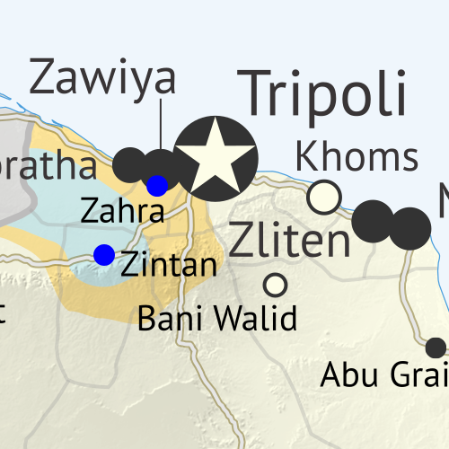
Libya’s “Islamic State” Loses Last City: Dec. 2016 Control Map & Timeline (Subscription)

SUBSCRIBERS CLICK HERE TO PROCEED TO ARTICLE AND MAP

There are newer versions of this map available. To see them, view all Libya updates.

Research by Djordje Djukic, with Evan Centanni. Map by onestopmap.com and Evan Centanni.

Subscribe for full access to all conflict map reports!

Libya control map: Shows detailed territorial control in Libya's civil war as of December 2016, including all major parties (Government of National Accord (GNA); Tobruk House of Representatives, General Haftar's Libyan National Army, Zintan militias, Petroleum Facilities Guard (PFG); Tripoli GNC government, Libya Dawn, and Libya Shield Force; Shura Council of Benghazi Revolutionaries and other hardline Islamist groups; and National Salvation Government). Also file under: Map of Islamic State (ISIS or ISIL) control in Libya. Now includes terrain and major roads. Colorblind accessible. In the past three months, a lot has changed in Libya, including the expulsion of the so-called “Islamic State” (ISIS/ISIL) from its last territory in North Africa. Meanwhile, Libya now has three competing governments, and key oil ports have changed hands.
 
See all this and more on the latest update to PolGeoNow’s concise, professional Libyan Civil War control map, which comes with a timeline of changes since our September 2016 Libya map report.

This map and report are premium content available to paid subscribers of the PolGeoNow Conflict Mapping Service.

Want to see before you subscribe? Check out our most recent FREE SAMPLE Libya map!

Exclusive report includes:

  • Up-to-date map of current territorial control in Libya, color-coded for the UN-backed Government of National Accord (GNA), the rival Tobruk parliament (supported by General Haftar’s Libyan National Army), religious hardline groups, and other actors such as the revived “National Salvation Government” and unaligned local councils.
  • Detailed indication of city-by-city control, including key towns and other locations important to current events.
  • Locations of recent fighting and military operations, including Sirte, Sidra, Ras Lanuf, Brega, and more.
  • Detailed timeline of important events and changes to territorial control since September 6, 2016, with all sources cited.
  • New since last year: Major roads are marked on the map for reference

SUBSCRIBERS CLICK HERE TO PROCEED TO ARTICLE AND MAP

Not signed up yet? Click here to learn more about our professional subscription service!

Can I purchase just this map?
This map and report are not available for automated purchase to non-subscribers. If you need access or republication rights for only this map report, contact service@polgeonow.com for options.

Syrian Civil War Control Map & Report: November 2016

There are newer versions of this map available. To see them, view all Syria updates.

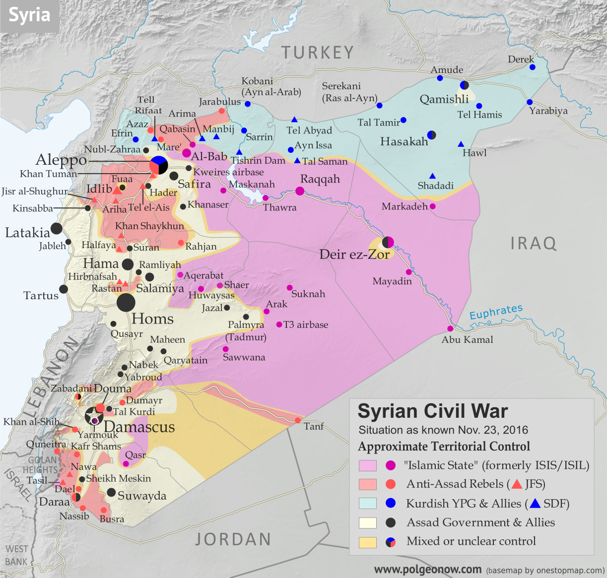
Map of fighting and territorial control in Syria's Civil War (Free Syrian Army rebels, Kurdish YPG, Syrian Democratic Forces (SDF), Jabhat Fateh al-Sham (Al-Nusra Front), Islamic State (ISIS/ISIL), and others), updated to November 23, 2016. Now includes terrain and major roads (highways). Includes recent locations of conflict and territorial control changes, such as Al-Bab, Khan al-Shih, Tal Saman, Qabasin, and more. Colorblind accessible.
Base map by Koen Adams of onestopmap.com, with territorial control by Evan Centanni and Djordje Djukic.
All rights reserved.

(Subscribers click here to view this article in the member area.)

Timeline by Djordje Djukic, with additional reporting by Evan Centanni

Situation Summary
In the past month since our previous Syrian Civil War map update, fighting has focused largely on the ongoing battle for the city of Aleppo, where rebels control a large enclave in the east, as well as a three-way fight for control of Al-Bab, the largest town in the countryside east of Aleppo (at least, according to pre-war census figures). Held for nearly three years by the so-called “Islamic State” (IS; formerly ISIS/ISIL), Al-Bab is now the target of both the Turkish-backed Free Syrian Army (FSA) rebels and the US-backed Syrian Democratic Forces (SDF) coalition led by Kurdish militias. The SDF has also made progress toward the IS capital of Raqqah in the east, while the Syrian Army of President Bashar al-Assad is making slow progress against rebels in the west of the country.

Flag of Syria under the current governmentCountry Name:  
• Syria (English)
• Sūriyya/Sūryā (Arabic)
Official Name:  
• Syrian Arab Republic (English)
• al-Jumhūriyyah al-‘Arabīyah  as-Sūriyyah (Arabic)
Capital: Damascus

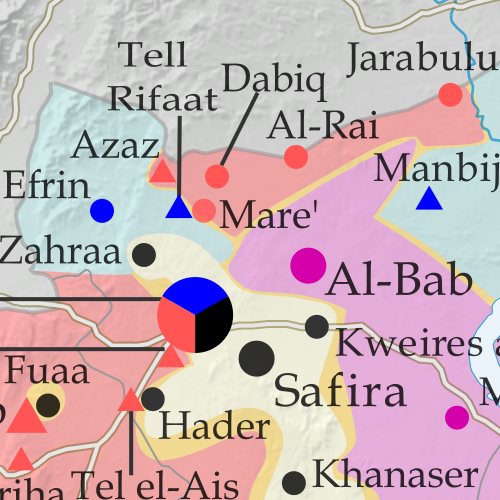
Note: Red triangles on the map represent towns where rebel group Jabhat Fateh al-Sham (JFS), formerly known as Al Qaeda affiliate Jabhat al-Nusra (a.k.a. the Nusra Front), is thought to be in a dominant position among rebel forces, even if it doesn’t exercise exclusive control. This organization has some presence in almost every rebel-held area in Syria.

Timeline of Events
The following is a timeline of changes to territorial control and other key events in Syria since our previous map update of October 23, 2016. Sources are provided in the form of links.

October 26-27, 2016
The race for control of IS-held Al-Bab continued as Turkish-backed Free Syrian Army (FSA) rebels seized three villages from the group north of the town, while the Kurdish-led SDF captured four villages from the rebels (two west and two east of Al-Bab). With the advances, the rebels were 13 kilometers from Al-Bab, while the SDF was positioned at a distance of18 kilometers..

October 27, 2016
The Syrian Army recaptured the town of Suran, north of Hama, which it had lost to rebels at the end of August. Meanwhile, northeast of Aleppo, the race to the IS-held town of Al-Bab continued. The Kurdish-led SDF captured several villages from the Turkish-backed rebels, while the rebels themselves took control of several villages from IS.

October 28, 2016
The SDF and the Syrian Army jointly seized half a dozen villages from IS, northeast of Aleppo, and a former Infantry College came under the control of the army. Elsewhere, the army surrounded the rebel-held town of Khan al-Shih, southwest of Damascus.

October 28-November 12, 2016
Rebels launched an offensive on the government-held western part of Aleppo city in an attempt to break the siege of the rebel-held eastern section. In the first two days of the operation, they managed to capture the Minyan Sawmills, most of the Dahiyat al-Assad district and half of the Minyan district. During this period, 12 suicide bombers were used against government positions.

On November 3, the rebels launched the second phase of their offensive, attacking the New Aleppo district, but the assault was ultimately repelled. At this point, the rebel offensive slowed and on November 6, government forces launched a counter-attack in the southwest of the city. By November 12, pro-government troops had managed to reverse all rebel gains and additionally retake territory they had lost in the rebels’ summer offensive.

Between October 28 and November 11, 291 rebels and 146 pro-government fighters were killed in the offensive, along with 96127 civilians who died due to rebel shelling. An additional 350-400 rebels and 200-300 pro-government fighters were wounded. Pro-rebel media also reported nearly 500 civilian deaths from government shelling in eastern Aleppo.

October 30, 2016
The army captured Tal Kurdi, as well as one other nearby town, east of Damascus, further shrinking the rebel pocket known as Eastern Ghouta and coming closer to the rebel stronghold of Douma.

November 1-2, 2016
IS managed to recapture 17 villages from the Turkish-backed rebels northeast of Aleppo.

November 4, 2016
The army captured a village near the town of Khan al-Shih. Thirty-three rebels were reported killed in the area the previous day.

November 5, 2016
A rebel assault north of Hama resulted in the capture of several positions. However, an army counter-attack subsequently regained all lost territory.

November 6-15, 2016
The Turkish-backed rebels captured 36 villages from IS north of Al-Bab, advancing to within two kilometers of the town. On November 14, the rebels managed to enter the northern outskirts of Al-Bab, but were forced to withdraw one kilometer to the north of the town the next day. Concurrently, between November 11 and 15, the SDF captured 15 villages east of Al-Bab from IS, besieging the town of Arima.

November 6-22, 2016
On November 6, the SDF announced the start of the offensive to reach the IS capital of Raqqah. Within 15 days, they managed to seize 48 villages and farms from IS, including the strategic hilltop village of Tal Saman, 26 kilometers north of Raqqah. Following these advances, the SDF said Phase One of their offensive (cutting of Raqqah from its northern countryside) had been completed. The aim of Phase Two was to enforce a full blockade of the city. By November 22, the SDF was 20 kilometers north of Raqqah. At this point, the SDF threatened to halt the offensive if the US-led coalition did not force Turkey to halt attacks on SDF forces in the Manbij area.

The previous day, Turkish-backed rebels attacked and temporarily captured a village northeast of Al-Bab from the SDF, before the Kurdish-led forces managed to retake it.

November 8-13, 2016
The Syrian Army took control of a strategic road southwest of Damascus, tightening the siege of Khan al-Shih. Over the next five days, the town was hit with more than 140 barrel bombs and ground-to-ground missiles.

November 12, 2016
Government forces captured two villages south of Aleppo.

November 15-23, 2016
A new Syrian-Russian offensive on the rebel-held eastern part of Aleppo city was announced with heavy Russian airstrikes. By November 22, the military managed to seize a strategic hill overlooking the rebel-held Hanano district, half of Hanano itself, and 75 percent of the central Bustan al-Basha district. Reports said 159 civilians had been killed in the first seven days of the offensive. Of these, 143 died due to pro-government shelling and airstrikes, while 16 were killed by rebel shelling.

November 15-23, 2016
On November 15, rebels attacked the IS-held town of Qabasin, northeast of Al-Bab, and over the next eight days the town changed hands six times, ending up under IS control at press time.

November 17-19, 2016
The army managed to seize two areas west and east of Khan al-Shih before a surrender agreement was reached for the town’s rebel administration. Under the agreement, after a two-day ceasefire, 1,000 rebels would be evacuated to Idlib province and the town would be surrendered to the military.

November 20, 2016
The Assad government rejected a UN proposal to halt the fighting in Aleppo by granting the eastern half of the city autonomous status, which would have allowed the Syrian opposition to continue administering the area after a drawdown of rebel armed forces.

November 22, 2016
The head of Iran’s veterans’ affairs office confirmed more than 1,000 fighters sent from Iran to Syria have been killed since the start of the war. The number includes Iranian soldiers, as well as Afghan and Pakistani militiamen.

November 23, 2016
The Turkish-backed rebels captured three villages from the SDF and two from IS west and east of Al-Bab, while the SDF managed to seize the town of Arima from IS. In addition, the SDF took control of a village from IS west of Al-Bab.

Elsewhere, the Syrian Army launched an assault on a rebel-held mountainous area in Latakia province and managed to capture several positions before ultimately being repelled, with the rebels recapturing most of their lost territory. Meanwhile, it was reported that rebels in eastern Aleppo were preventing about 100 families, totaling 250 civilians, from crossing from the rebel-held part of the city into the Kurdish-held northern district to escape the government offensive.

Graphic of the Syrian flag is in the public domain (source).

Iraq Control Map & Timeline: The Siege of Mosul – November 2016 (Subscription)

SUBSCRIBERS CLICK HERE TO PROCEED TO ARTICLE AND MAP

There are newer versions of this map available. To see them, view all Iraq updates.

Research by Djordje Djukic. Map by onestopmap.com, Evan Centanni, and Djordje Djukic

Subscribe for full access to all conflict map reports!


Detailed map of territorial control in Iraq as of November 4, 2016, including territory held by the so-called Islamic State (ISIS, ISIL), the Baghdad government, and the Kurdistan Peshmerga. Shows developments in the ongoing coalition battle to recapture the city of Mosul. Includes key locations from recent events, such as Bashiqa, Sharqat, and Bartella. Colorblind accessible. The battle is now on for Mosul, the so-called Islamic State’s (ISIS/ISIL) biggest city. A grand coalition of Iraqi military, Shiite and Sunni militias, and Kurdistan’s Peshmerga forces – with controversial help from the Turkish military – have now entered and mostly surrounded the city.
 
See all this and more on the latest update to PolGeoNow’s concise, professional map of control in Iraq’s civil war, including a timeline of changes since our previous Iraq map report of September 2016.

This map and report are premium professional content, available to paid subscribers of the PolGeoNow Conflict Mapping Service.

Want to see before you subscribe? Check out our most recent FREE SAMPLE Iraq map report!

Exclusive report includes:

  • Up-to-date map of current territorial control in Iraq, color-coded for the Iraqi government, “Islamic State” (ISIS/ISIL) extremists, and Kurdistan’s Peshmerga forces. Colorblind accessible.
  • Detailed indication of town-by-town control, including provincial boundaries, all major cities, and many smaller ones
  • Markers for key areas of recent fighting such as Mosul, Bashiqa, Sharqat, and Bartella
  • Timeline of changes to the situation since early September, compiled by our Iraq specialist, with links to sources

SUBSCRIBERS CLICK HERE TO PROCEED TO ARTICLE AND MAP

Not signed up yet? Click here to learn more about our professional subscription service!

Can I purchase just this map?
This map and report are not available for automated purchase to non-subscribers. If you need access or republication rights for only this map report, contact service@polgeonow.com for options.

Syrian Civil War Control Map & Report: October 23, 2016 (Subscription)

SUBSCRIBERS CLICK HERE TO PROCEED TO ARTICLE AND MAP

There are newer versions of this map available. To see them, view all Syria updates.

Research by Djordje Djukic. Map by onestopmap.com, Evan Centanni, and Djordje Djukic

Subscribe for full access to all conflict map reports!


Map of fighting and territorial control in Syria's Civil War (Free Syrian Army rebels, Kurdish YPG, Syrian Democratic Forces (SDF), Jabhat Fateh al-Sham (Al-Nusra Front), Islamic State (ISIS/ISIL), and others), updated to October 25, 2016. Now includes terrain and major roads (highways). Includes recent locations of conflict and territorial control changes, such as Dabiq, Tell Rifaat, Moadamiya, and more (colorblind accessible). Since earlier this month, rebels in Syria have scored an important victory against the so-called “Islamic State” (ISIS/ISIL), even while losing ground to the government – and fighting amongst themselves – in other areas.
 
See all this and more on the latest update to PolGeoNow’s concise, professional Syrian Civil War control map, which includes a timeline of changes since our previous Syria map report in early October, with sources cited.

This map and report are premium professional content, available to paid subscribers of the PolGeoNow Conflict Mapping Service.

Want to see before you subscribe? Check out our most recent FREE SAMPLE Syria map!

Exclusive report includes:

  • Up-to-date map of current territorial control in Syria, color-coded for the Assad government, rebel groups, “Islamic State” (ISIS/ISIL) fighters, and Kurdish/SDF forces. Colorblind accessible.
  • Special symbols indicating towns dominated by rebels of the former Nusra Front (now Jabhat Fateh al-Sham) and US-backed Syrian Democratic Forces (SDF).
  • Detailed indication of city-by-city control, including key towns and other locations important to current events.
  • Locations of recent fighting and other important events, including Dabiq, Tell Rifaat, Moadamiya, and more.
  • Detailed timeline of important events and changes to territorial control since October 2, 2016, compiled by our Syria-Iraq expert, with links to sources.

SUBSCRIBERS CLICK HERE TO PROCEED TO ARTICLE AND MAP

Not signed up yet? Click here to learn more about our professional subscription service!

Can I purchase just this map?
This map and report are not available for automated purchase to non-subscribers. If you need access or republication rights for only this map report, contact service@polgeonow.com for options.

Syrian Civil War Control Map & Report: October 2, 2016 (Subscription)

SUBSCRIBERS CLICK HERE TO PROCEED TO ARTICLE AND MAP

There are newer versions of this map available. To see them, view all Syria updates.

Research by Djordje Djukic. Map by onestopmap.com, Evan Centanni, and Djordje Djukic

Subscribe for full access to all conflict map reports!


Map of fighting and territorial control in Syria's Civil War (Free Syrian Army rebels, Kurdish YPG, Syrian Democratic Forces (SDF), Jabhat Fateh al-Sham (Al-Nusra Front), Islamic State (ISIS/ISIL), and others), updated for October 2016. Now includes terrain and major roads (highways). Includes recent locations of conflict and territorial control changes, such as Dabiq, Halfaya, Suran, Jarabulus, and more (colorblind accessible). During the past month, a continued Turkish military incursion into Syria completely cut off the so-called “Islamic State” from the self-proclaimed caliphate’s last international border in the region (other than its boundaries with Syrian and Iraqi territory).

Meanwhile, the Assad government and rebel groups have continued to take territory from each other despite a brief attempt at a country-wide ceasefire.
 
See all this and more on the latest update to PolGeoNow’s concise, professional Syrian Civil War control map, which includes a timeline of changes since our previous Syria map report in late August, with sources cited.

This map and report are premium professional content, available to paid subscribers of the PolGeoNow Conflict Mapping Service.

Want to see before you subscribe? Check out our most recent FREE SAMPLE Syria map!

Exclusive report includes:

  • Up-to-date map of current territorial control in Syria, color-coded for the Assad government, rebel groups, “Islamic State” (ISIS/ISIL) fighters, and Kurdish/SDF forces. Colorblind accessible.
  • Special symbols indicating towns dominated by rebels of the former Nusra Front (now Jabhat Fateh al-Sham) and US-backed Syrian Democratic Forces (SDF).
  • Detailed indication of city-by-city control, including key towns and other locations important to current events.
  • Locations of recent fighting and military operations, including Dabiq, Halfaya, Suran, Jarabulus, and more.
  • Detailed timeline of important events and changes to territorial control since August 27, 2016, compiled by our Syria-Iraq expert, with links to sources.

SUBSCRIBERS CLICK HERE TO PROCEED TO ARTICLE AND MAP

Not signed up yet? Click here to learn more about our professional subscription service!

Can I purchase just this map?
This map and report are not available for automated purchase to non-subscribers. If you need access or republication rights for only this map report, contact service@polgeonow.com for options.

Yemen Control Map & Report: September 2016 (Subscription)

SUBSCRIBERS CLICK HERE TO PROCEED TO ARTICLE AND MAP

There are newer versions of this map available. To see them, view all Yemen updates.

Map of territorial control in Yemen as of September 23, 2016, including territory held by the Houthi rebels and former president Saleh's forces, president-in-exile Hadi and his allies in the Saudi-led coalition and Southern Movement, Al Qaeda in the Arabian Peninsula (AQAP), and the so-called Islamic State (ISIS/ISIL). Includes recent locations of fighting, such as Taiz, Jaar, Zinjibar, Ahwar, and more.

Subscribe for full access to all conflict map reports!

Timeline by Djordje Djukic. Map by Louis Martin-Vézian, Evan Centanni, and Djordje Djukic.

Since our last Yemen control map update almost two months ago, Al Qaeda has lost a large part of its territory in Yemen, even as fighting continues between the Houthis and the Saudi-backed Hadi government.


See all this and more on the newest update to PolGeoNow’s Yemen territorial control map, which includes a timeline of changes and important events since our previous Yemen map report in early August.

This map and report are premium professional content, available to paid subscribers of the PolGeoNow Conflict Mapping Service.

Want to see before you buy? Check out our most recent FREE SAMPLE Yemen map report!

Exclusive report includes:

  • Up-to-date map of current territorial control in Yemen, color-coded for the pro-Hadi coalition, Houthi/Saleh forces, Al Qaeda in the Arabian Peninsula (AQAP), and the so-called “Islamic State” (ISIS/ISIL).
  • Color scheme now consistent with Syria, Iraq, and Libya map series
  • Detailed indication of town-by-town control, including provincial boundaries, all major cities, and many smaller ones
  • Markers for recent areas of fighting, including Taiz, Jaar, Zinjibar, Ahwar, and more
  • Timeline of changes to the situation since August 2, 2016, with links to sources

SUBSCRIBERS CLICK HERE TO PROCEED TO ARTICLE AND MAP

Not a member yet? Click here to learn more about our professional subscription service!

Can I purchase just this map?
This map and report are not available for automated purchase to non-subscribers. If you need access or republication rights for only this map report, contact service@polgeonow.com for options.