War in Nigeria: Map of Boko Haram Control (September 2014)

There are newer versions of this map available. To see them, view all Nigeria updates.

Detailed map of Boko Haram territorial control in its war with Nigeria, marking and labeling each town reportedly under the group's control in Borno, Yobe, and Adamawa states. Includes Damboa, Buni Yadi, Madagali, Gwoza, Gujba, Gulak, Bama, Gulani, Shuwa, Marte, Kukawa, Michika, Dikwa, Bularafa, Bazza, Gambaru Ngala, Buni Gari, Banki, Bara, Pulka, Bumsa, Ashgashiya, Limankara, Njibulwa and more.
Map by Evan Centanni. All rights reserved.

Premium members click here to view this article in the ad-free members area. Not a member yet? Sign up now!

Conflict tracking by T.H., with additional reporting by Evan Centanni

Boko Haram vs. Nigeria
Though it’s waged a bloody war against the Nigerian government for many years, rebel group Boko Haram rarely could claim significant territorial control until recently. Though they did take over a number of remote areas in spring of last year (see our 2013 Boko Haram control map), the militants were soon driven back into hiding by the Nigerian military.

The insurgency never went away, with Boko Haram’s bombings and other attacks, often on schools and other public places, increasing in number and lethality from 2013 into early 2014. (Also see our 2013 report for more background on Boko Haram).

Territorial Resurgence
However, this summer saw a striking change in the trajectory of Boko Haram’s rebellion. Likely inspired by the Islamic State organization in Iraq and Syria, Boko Haram initiated a new strategy of capturing and holding towns and villages. The campaign began in late July, and has gone much farther than last year’s seizure of several small towns. By early September there was talk of an imminent invasion of Maiduguri, the capital of Nigeria’s far northeastern Borno State. That hasn’t happened yet, but neither does Boko Haram seem to be abandoning its newly won territory anytime soon.
Flag of NigeriaCountry Name:  
• Nigeria*
Official Name:  
• Federal Republic of Nigeria*
Capital: Abuja
*There are hundreds of local languages in Nigeria, but only English is official.

Chronology of Events
The following is a timeline of major events and changes to territorial control since Boko Haram began seizing towns in northeastern Nigeria this summer.

2014.04.15 Boko Haram kidnaps hundreds of schoolgirls in Chibok, Borno State, gaining attention from around the world. At this time, Boko Haram is not yet known to hold any clearly-defined territory. As of September 2014, the Chibok girls are apparently still missing, and the town is said to be abandoned.

2014.07 Boko Haram erects tollgates on major routes in northern and central Borno State, where it holds rural influence.

2014.07.21 Boko Haram reportedly captures Damboa, raising its flag over the major Borno town.

2014.07.23 Boko Haram destroys a bridge between Maiduguri and Ngala, Borno State. Current control of Damboa is unclear, but there is no government presence.

2014.07.28 Apparent consensus that Boko Haram controls Damboa and the surrounding local government area

2014.08.03 Around this time, Boko Haram takes over Gujba, its first town captured in Yobe State.

2014.08.06 Boko Haram seizes the key town of Gwoza in Borno.

2014.09.10 Around this time, Boko Haram occupies the town of Ashigashia just outside Nigeria’s borders, in neighboring Cameroon.

2014.08.11 Nigerian government claims to have recaptured Damboa. A month later, the town is reportedly still deserted.

2014.08.17 Over the weekend, Boko Haram reportedly takes control of Michika in Adamawa State, but the town will be more widely reported as captured three weeks later.

2014.08.21 Boko Haram takes Buni Yadi in Yobe State.

2014.08.21 Boko Haram captures Madagali, Adawama State.

2014.08.23 Boko Haram takes over Pulka, Borno State.

2014.08.24 Media report that Boko Haram leader Abubakar Shekau has declared a “caliphate” (Islamic empire) in Gwoza, but he may only have meant that it was now ruled according to Islamic law.

2014.08.25 Boko Haram captures Ngala and Gambaru, Borno State.

2014.08.28 Boko Haram captures Dikwa and Marte, Borno State.

2014.08.29 Cameroon’s military retakes Ashigashia town from Boko Haram.

2014.09.01 Boko Haram attacks Bama, Borno State.

2014.09.02 Bara in Yobe State captured by Boko Haram.

2014.09.02 Boko Haram allegedly captures Bama, a major town in Borno, but the situation remains unclear.

2014.09.03 Boko Haram seizes Banki in Borno State and Gulani in Yobe State.

Map of Boko Haram control in Nigeria in May 2013
Boko Haram control in Nigeria, 2013 (click for free map and report).

2014.09.07 Boko Haram captures town of Gulak, Adamawa State.

2014.09.08 Boko Haram captures Michika, Adamawa State. Government claims to recapture Bama.

2014.09.10 Nigerian military claims to recapture Michika, Uba, and Gulak.

2014.09.11 Bama residents say Boko Haram controls the town, despite continued government insistence to the contrary.

2014.09.13 Unidentified Boko Haram commander reportedly captured during attempt to occupy Konduga.

2014.09.18 Catholic Church source says Boko Haram now controls 25 towns. In addition to locations already mentioned, the list includes Shuwa, Kukawa, Bularafa, Bazza, Buni Gari, Bumsa, Taltaba*, Limankara, and Njibulwa. Michika, Gulak, and Ashigashia are also still listed despite earlier claims they were retaken by government forces. A longer accounting of “31 towns and villages” adds Wulgo, Ngoshe, Attagara, Barawa*, Arbokko, Kirawa.

2014.09.19 Nigerian government begins investigating the possible death of Boko Haram leader Abubakar Shekau. The army of Cameroon also took credit for Shekau’s death, but some believe he was actually killed over a year ago, and that the recent death was of an imposter.

2014.09.26 Boko Haram again tries to capture Konduga, on the way into Borno State capital Maiduguri, but is stopped by government forces.


*PolGeoNow was unable to determine the precise geographical locations of Taltaba and Barawa. For this reason, they do not appear on the above map.

Don’t miss future updates to the map of Boko Haram control in Nigeria! Become a member now!

Graphic of the Nigerian flag is in the public domain (source).

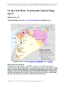
Syria Civil War Map: September 2014 (#14) (Premium)

There are newer versions of this map available. To see them, view all Syria updates.

Detailed map of fighting and territorial control in Syria's Civil War (Free Syrian Army and Nusra Front rebels, Kurdish groups, ISIS/ISIL/Islamic State and others), updated to September 2014.

Download PDF
buy

(Subscribe via Paypal to view all premium content online)

Our Syrian Civil War coverage continues with this updated situation map, showing changes to territorial control since our previous Syria map report in August. Government forces, the Islamic State (ISIS), and the allied rebels have all made territorial gains during the past weeks.

This map and article are exclusive premium content, available to paid subscribers or for individual purchase.
Buy now (US$9.99)

Premium map includes:

  • Up-to-date map of current territorial control in Syria, color-coded for the Assad government, rebel groups, Islamic State (ISIS) extremists, and Kurdish self-protection forces
  • Detailed indication of city-by-city control, highlighting key towns relevant to current events
  • Recent areas of fighting including Tabqa Airbase, Halfaya, Quneitra Province and more
  • Timeline of events since mid-August, including both territorial changes and major political happenings

MEMBERS CLICK HERE TO PROCEED TO ARTICLE AND MAP

NOT A MEMBER YET? SUBSCRIBE NOW!

Ukraine War Rebel Control Map: September 2014 (Premium)

There are newer versions of this map available. To see them, view all Ukraine updates.

Detailed map of pro-Russian rebel control in Ukraine's eastern provinces of Donetsk and Luhansk, claimed by the breakaway Donetsk People's Republic and Lugansk People's Republic. Updated to September 1, 2014

Download PDF
buy

(Subscribe via Paypal to access all premium content online)

Russia is now being accused of directly invading eastern Ukraine, and opposition control in the region has seen major changes since our last Ukraine war map update.

This is detailed map and timeline of pro-Russian territorial control in eastern Ukraine’s Donetsk and Luhansk regions, home to the claimed Donetsk People’s Republic, Lugansk People’s Republic, and Federation of Novorossiya. Updated to the start of September 2014.

This map report is exclusive premium content, available to paid subscribers or for individual purchase.
Buy now (US$9.99)

Premium map includes:

  • Detailed, updated map of Donetsk and Luhansk regions, showing both past and current rebel control
  • Indication of which districts and cities have had their administrations occupied by separatists
  • Timeline of changes to territorial control since July, and summary of major trends

MEMBERS CLICK HERE TO PROCEED TO ARTICLE AND MAP

NOT A MEMBER YET? SUBSCRIBE NOW!

Syria Civil War Map: August 2014 (#13)

There are newer versions of this map available. To see them, view all Syria updates.

Premium subscribers have already seen our new Syria map format, which shows full areas of control for each major faction in the civil war. Now, we present this month’s update free of charge for your convenience. 

To get many more Syrian Civil War map updates like this one, sign up now for a premium subscription!

Map of fighting and territorial control in Syria's Civil War (Free Syrian Army rebels, Kurdish groups, Al-Nusra Front, Islamic State (ISIS/ISIL) and others), updated for August 2014. Highlights recent locations of conflict and territorial control changes.
Territorial control in the Syrian Civil War as of August 2014. Map by Evan Centanni, starting from blank map by NordNordWest. License: CC BY-SA

Premium members click here to view this article in the ad-free members area.

Threats from All Sides
Since our last Syria map update in early July, the lines of control in the civil war have not changed drastically. However, fighting on all fronts has resulted in numerous small but important changes to the situation, as the Assad government is now facing serious challenges from both the newly rebranded Islamic State (formerly ISIS/ISIL) and a loose coalition of various other rebel groups (including both the Free Syrian Army and Al-Nusra).

Rebel Advances
Opposition forces made advances against the army in two parts of Hama province over the past month, beginning in mid-July with their capture of Rahjan in the province’s east. Before the end of the month, they had also advanced nearly to the city of Hama, by some accounts fully capturing Khitab and nearby towns. In early August, major fighting erupted in Arsal, a town across the border in Lebanon. Rebels recently driven out of nearby Syrian areas struggled with the Lebanese army over several days before eventually retreating.

Flag of Syria under the current governmentCountry Name:  
• Syria (English)
• Sūriyya/Sūryā (Arabic)
Official Name:  
• Syrian Arab Republic (English)
• al-Jumhūriyyah al-‘Arabīyah  as-Sūriyyah (Arabic)
Capital: Damascus

Rebel Setbacks
However, signs of a rift among the rebel coalition may be emerging. Similarly to how ISIS began carving out its own territory late last year, the rebel Al-Nusra Front last month declared its own “emirate” and seized the northwestern towns of Salqin, Harem, and Darkush from formerly allied rebel groups. The powerful Al-Nusra Front is an official affiliate of Al Qaeda, but has up to now cooperated and mixed freely with less extreme anti-government rebels. It remains to be seen whether recent events signal a permanent split.

The rebels, including Al-Nusra, have also suffered some defeats. Formerly the major power in Syria’s eastern Deir ez-Zor province, they have now been completely driven out, with the Islamic State last month replacing them in Deir ez-Zor city and driving them out of their last territories to the city’s northwest (the Islamic State’s main campaign for Deir ez-Zor province was covered in last month’s update).

Within Syria’s largest city of Aleppo, rebel fighters also were driven back from some of their positions by an early-July government advance.

Consolidating the “Caliphate”
Above all, the past month has seen a strengthening of the “Islamic State” group, formerly known as the Islamic State of Iraq and al-Sham (ISIS). After seizing much of neighboring Iraq in June, ISIS declared itself to be the Caliphate, a historical term for an empire of all Muslims, and shortened its name to “Islamic State”. Controlling the major Iraqi city of Mosul, it has used this newfound power to consolidate its territories in both countries.

Map of the Islamic State's control in Iraq as of August 2014
The Islamic State’s control in Iraq (click for premium article and map).

In Syria, the Islamic State has nearly completed its control of Raqqah province. Though it already held the capital, three key military bases in the province were still controlled by the Assad government. Two of those, known as Division 17 and Brigade 93, were seized by the Islamic State earlier this month, while the last, Tabqa Airbase, is now under siege. In neighboring Hasakah province, Islamic State fighters also captured a key government base, the 121st Artillery Regiment, even waging battles on the outskirts of Hasakah city and advancing nearly to Qamishli on the Turkish border. However, government forces also scored some victories, maintaining joint control of the city with Kurdish forces and at one point pushing the militants back towards their stronghold in Shadadi.

Islamic State Advances West
The Islamic State has also begun striking out west from its current territories in both the north and the south. In Aleppo province it has been very slowly taking back ground it lost to the rebel coalition in January, seizing the town of Akhtarin just last week. Meanwhile, it has also been pushing against the Kurdish enclave of Kobane (Ayn al-Arab) from both sides. More prominently, Islamic State forces last month boldly stormed the Sha’er gas field near Palmya, far from their established frontiers, though the government soon recaptured it.

But pockets of Islamic State control have been appearing even farther afield, possibly in connection with the group’s efforts to bring small rebel brigades over to its side. Some reports say the town of Deir Ful near Homs city is now in Islamic State hands, and the group briefly captured a neighborhood outside Damascus last month.

Don’t miss future updates to the Syria and Iraq control maps! Become a member now!

Graphic of the Syrian flag is in the public domain (source).

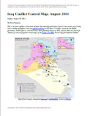
Iraq Conflict Control Map: August 2014 (Premium)

There are newer versions of this map available. To see them, view all Iraq updates.

Detailed map of territorial control in Iraq in August 2014, including cities and countryside held by the Islamic State (ISIS, ISIL) and the Kurdistan Peshmerga.

Download PDF
buy

(Subscribe via Paypal to view all premium content online)

This is the latest update to our series of maps documenting territorial control in the current war in Iraq, with a number of updates since the previous edition in late June. 

It includes control by the Maliki goverment, Kurdish forces, and the Islamic State (formerly known as ISIS), and has been re-styled to fit seamlessly with our popular control maps of the Syrian Civil War.

This map and article are exclusive premium content, available only to paid members or for individual purchase. Buy now (US$9.99)

Premium map includes:

  • Up-to-date map of current territorial control in Iraq, color-coded for the Maliki government, ISIS/Islamic State extremists, and Kurdish forces
  • Detailed indication of city-by-city control, highlighting key towns relevant to current events
  • Includes recent areas of fighting including Sinjar, Qaraqosh, Mosul Dam, Erbil province, and more
  • In-depth article summarizes changes since June, including ISIS’s declaration of an Islamic caliphate, with links to sources

MEMBERS CLICK HERE TO PROCEED TO ARTICLE AND MAP

NOT A MEMBER YET? SUBSCRIBE NOW!

War in Ukraine: Detailed Map of Rebel Control in Donetsk & Luhansk (Premium)

etailed map of rebel control in Ukraine's eastern provinces of Donetsk and Luhansk, claimed by the breakaway Donetsk People's Republic and Lugansk People's Republic. Updated to July 22, 2014

Download PDF
buy

(Subscribe via Paypal to view all premium content online)

All new, detailed map of rebel control in eastern Ukraine’s Donetsk and Luhansk regions, home to the claimed Donetsk People’s Republic, Lugansk People’s Republic, and Federation of Novorossiya. 

Since our last Ukraine update, pro-Russian rebels have captured much more territory in Donetsk and Luhansk regions, but also lost some of their early strongholds. 

This map report is exclusive premium content, available to paid subscribers or for individual purchase.
Buy now (US$9.99)

Premium map includes:

  • All new, detailed map of Donetsk and Luhansk regions, showing both past and current rebel control
  • Indication of which districts and cities have had their administrations occupied by separatists
  • Important locations of rebel military control marked
  • Article with chronology of events since April, and discussion of the meaning of “control”

MEMBERS CLICK HERE TO PROCEED TO ARTICLE AND MAP

NOT A MEMBER YET? SUBSCRIBE NOW!

Syria Civil War: Territorial Control Map #12.3 (Premium)

There are newer versions of this map available. To see them, view all Syria updates.

Detailed map of fighting and territorial control in Syria's Civil War (Free Syrian Army and Nusra Front rebels, Kurdish groups, ISIS/ISIL/Islamic State and others), updated to July 3, 2014.

Download PDF
buy

(Subscribe via Paypal to view all premium content online)

This is the Syria update you’ve been waiting for: our new map includes not only cities, but a full illustration of territorial control for each faction in the civil war. Also includes many updates to the situation since the last edition in April.

This map and article are exclusive premium content, available to paid subscribers or for individual purchase.
Buy now (US$9.99)

Premium map includes:

  • Up-to-date map of current territorial control in Syria, color-coded for the Assad government, rebel groups, ISIS/Islamic State extremists, and Kurdish self-protection forces
  • Detailed indication of city-by-city control, highlighting key towns relevant to current events
  • Includes recent areas of fighting including Deir ez-Zor, Abu Kamal, Mayadin, Khan Shaykhun, and many more
  • In-depth article summarizes changes since April, including ISIS’s declaration of an Islamic caliphate, with links to the sources of information

Members click here to proceed to article and map

Not a member yet? Subscribe Now!

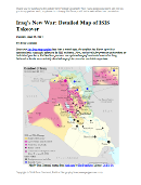
Iraq’s New War: Detailed Map of ISIS Takeover (Premium)

There are newer versions of this map available. To see them, view all Iraq updates.

Detailed map of territorial control in Iraq in June 2014, including cities and countryside held by the Islamic State of Iraq and al-Sham (ISIS, ISIL) and the Kurdistan Peshmerga.

Download PDF
buy

(Subscribe via Paypal to view all premium content online)

Since our last Iraq map update less than a month ago, the conflict has blown up with a spectacularly successful offensive by ISIS rebels. PolGeoNow presents here our updated map of territorial control in Iraq, more detailed and accurate than any of the maps available on news websites.

This map and article are exclusive premium content, available only to members or for individual purchase.

 Buy now (US$9.99).

 Premium map includes:

  • Territorial control in Iraq by city, color coded for government, ISIS, or Kurdistan Government
  • Detail of ISIS control and attempted control of small towns, military bases, and border crossings
  • Inset map with extra detail for Kirkuk province, where ISIS and Kurdish forces are facing off
  • Shading showing the estimated total area of ISIS control
  • Article summarizing events since May, explaining the information on the map, and providing in-line links to sources cited

Members click here to proceed to article and map

Not a member yet? Subscribe Now!

Palestine: West Bank and Gaza Reunited Under Transitional Government

(Keep up with changes to Palestine’s situation: view all Palestine updates.)

Map of the State of Palestine in the West Bank and Gaza Strip, including both its claimed borders (the Green Line) and zones of actual control (Areas A, B, and C from the Oslo Accords)
Control zones based on the Oslo Accords. Area A: Palestinian control; Area B: mixed Israeli-Palestinian control; Area C: full Israeli control. Map by Evan Centanni (sources: Natural Earth, B’Tselem, U.N. OCHA oPt).

Premium members click here to view this article in the ad-free members area. Not a member yet? Subscribe now!

By Evan Centanni

Unity Government
The partially-unrecognized State of Palestine is not only divided between Palestinian and Israel control – even the Palestinian-administered areas have been governed separately for several years now. However, this month rival parties Hamas and Fatah have finally come together to reunite the West Bank and Gaza Strip under a single Palestinian government.

Divided Country
The rift in control opened up in 2007, after religious militant group Hamas won a majority of seats in the 2006 Palestinian legislative elections. Hamas and Fatah, the current ruling party at the time, failed to form a stable unity government then, and the conflict between them escalated into a short civil war in the Gaza Strip. 

See Also: Is Palestine Really a Country?

The fighting ended with Hamas expelling Fatah’s administration from Gaza, while Fatah in turn refused to seat Hamas members to the government in Ramallah. This standoff has persisted for nearly seven years, with the West Bank and Gaza controlled separately by the two rival parties. Though both parties supported Palestine’s successful bid for recognition in the UN, the two regions have been administered completely separately since 2007.

Flag of the State of Palestine Country Name:  
• Palestine (English)
Filasṭīn (Arabic)
Official Name:  
• State of Palestine (English)
• Dawlat Filasṭin (Arabic)
Capital: 
• Jerusalem (claimed)
Ramallah (administrative)

Reunification
One week ago, Hamas and Fatah finally came together to form a Palestinian Authority (PA) government that includes both parties. This new administration will have jurisdiction over both the Gaza Strip and Palestinian-controlled areas of the West Bank, making it responsible for domestic affairs all across the claimed State of Palestine. Foreign relations (and relations with Israel) are handled instead by the Palestinian Liberation Organization (PLO), which has been around since before the PA was created in the 1990s by the Oslo Accords.

The current agreement also does not cover whether PA security forces will be allowed into Gaza, whose security has been handled directly by Hamas since 2007. So for the time being, the two areas may remain separate in at least that regard.

Palestine’s new unity administration is facing strong opposition from the Israeli government (which refuses to negotiate with Hamas), but has gained acceptance by much of the world. The UN, the European Union (EU), and China have all signaled their willingness to work with the new PA administration. Even the US has come on board, despite having rejected Hamas’s 2006 election victory. Because of its hardline ideology and ongoing violence against Israel, Hamas is classified as a terrorist organization by the US government, as well as by the EU.

Joining Treaties
These events come on the tail of another development in Palestine’s political status: its entry into 15 international treaties this April. The action was taken by Mahmoud Abbas, who serves as both the President of Palestine and chairman of the PLO. Palestine’s applications to these treaties have already been accepted by the UN (which considers Palestine to be a non-member “Observer State” like Vatican City), and most of them were set to go into effect in May.

Related:
Is Palestine Really a Country?
Which Countries Recognize Palestine as Independent?
Palestine Recognized as a Country by the UN

Flag of the State of Palestine is in the public domain (source).

Iraq: Updated Map of ISIS Control (Premium)

There are newer versions of this map available. To see them, view all Iraq updates.
 

Map of territorial control in Iraq in May 2014, including cities and countryside held by the Islamic State of Iraq and al-Sham (ISIS, ISIL) as well as areas administered by the Kurdistan Region. Includes detail of towns in flashpoint provinces of Anbar and Diyala

Download PDF
buy

(Subscribe via Paypal)

This is our first update to January’s map of Al Qaeda control in Iraq. The map has been expanded to show much more detail of the ongoing campaign of control by the Islamic State of Iraq and al-Sham (ISIS), now no longer an Al Qaeda affiliate.

This map and article are exclusive premium content, available only to members or for individual purchase. Buy now (US$9.99).

 Premium map includes:

  • Territorial control in Iraq by city, color coded for government, ISIS, or Kurdistan
  • Detail of ISIS control and attempted control in small towns, including in the eastern flashpoint province of Diyala
  • Inset map with extra detail for Anbar province, where ISIS controls the most populated territory
  • Indications of estimated ISIS control/influence in the countryside
  • Article summarizing events since January, explaining the information on the map, and providing in-line links to the sources of information

Members click here to proceed to article and map

Not a member yet? Subscribe Now!