Iraq Control Map & Report: April 2016 (Subscription)

SUBSCRIBERS CLICK HERE TO PROCEED TO ARTICLE AND MAP

There are newer versions of this map available. To see them, view all Iraq updates.

Research by Djordje Djukic. Map by onestopmap.com, Evan Centanni, and Djordje Djukic

Subscribe for full access to all conflict map reports!

Download PDF:
Buy now
New discounted price!

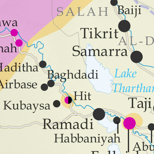
Detailed map of territorial control in Iraq's ongoing war as of April 14, 2016, including territory held by the so-called Islamic State (ISIS, ISIL), the Baghdad government, and the Kurdistan Peshmerga. Includes recent flashpoints including Ramadi, Hit, Bashir, and more.New: Improved map now includes terrain and major roads!

The past four months have seen two significant victories for Iraqi government forces over the so-called “Islamic State” (ISIS/ISIL), despite floundering attempts to retake the city of Mosul.
 
See all this and more on the latest update to PolGeoNow’s concise, professional map of control in Iraq’s civil war, including a timeline of changes since our previous Iraq map report in December 2015.

This map and report are professional subscriber content, available to paid members or for separate purchase. Download PDF (US$14.99) New discounted price!

Want to see before you buy? Check out our most recent FREE SAMPLE Iraq map report!

Exclusive map report includes:

Detailed map of territorial control in Iraq's ongoing war as of April 14, 2016, including territory held by the so-called Islamic State (ISIS, ISIL), the Baghdad government, and the Kurdistan Peshmerga. Includes recent flashpoints including Ramadi, Hit, Bashir, and more.
  • New since last time: Terrain shading and major highways included on map for geographic context
  • Up-to-date map of current territorial control in Iraq, color-coded for the Iraqi government, “Islamic State” (ISIS/ISIL) extremists, and Kurdistan’s Peshmerga forces
  • Detailed indication of town-by-town control, including provincial boundaries, all major cities, and many smaller ones
  • Markers for key areas of recent fighting such as Ramadi, Hit, Bashir, and more
  • Timeline of changes to the situation since December, compiled by our Iraq specialist, with links to sources 

Note: Republishing rights are not included with PDF purchases or basic subscriptions. If you need to use one of our maps in print or online, please contact service@polgeonow.com.

SUBSCRIBERS CLICK HERE TO PROCEED TO ARTICLE AND MAP

NON-MEMBERS: PURCHASE MAP REPORT

Not a member yet? Click here to learn about our professional subscription service!

Syrian Civil War Control Map: April 2016

There are newer versions of this map available. To see them, view all Syria updates.
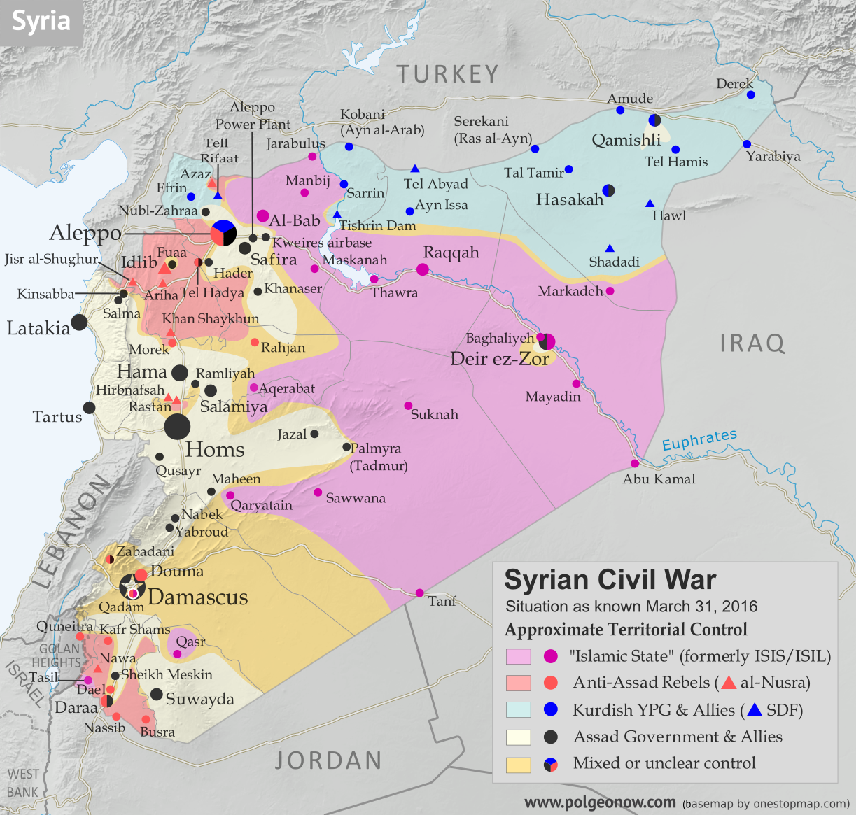
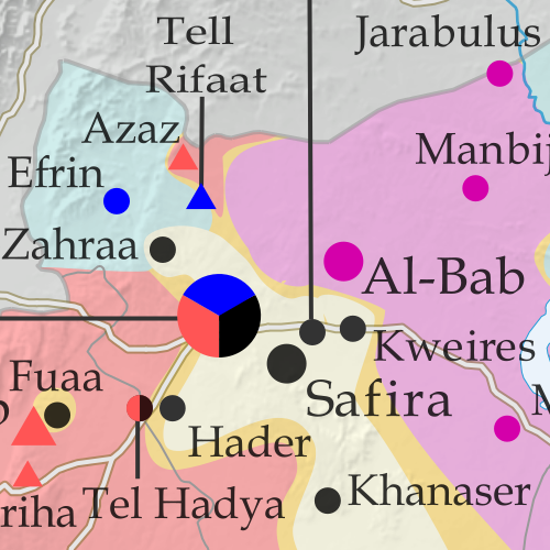
Map of fighting and territorial control in Syria's Civil War (Free Syrian Army rebels, Kurdish YPG, Syrian Democratic Forces (SDF), Al-Nusra Front, Islamic State (ISIS/ISIL), and others), updated for the beginning of April 2016. Now includes terrain and major roads (highways). Highlights recent locations of conflict and territorial control changes, including Palmyra, Qaryatayn, Deir Ez-Zor, and more. (Color blind accessible.)
Base map by Koen Adams of onestopmap.com, with territorial control by Evan Centanni and Djordje Djukic. All rights reserved.

Subscribers click here to view this article in the ad-free members area. Not a member yet? Learn about PolGeoNow subscriptions!

Timeline by Djordje Djukic

Recapture of Palmyra
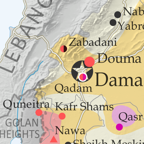
Since our previous Syria control map report in early March, the Syrian government of Bashar al-Assad has recaptured the historic city of Palmyra (known in modern Arabic as Tadmur) from the so-called “Islamic State” (IS, formerly known as ISIS/ISIL). The military has also pushed back against IS in Qaryatain, one of the group’s westernmost outposts, even as IS is showing an increasingly prominent presence in the southwestern corner of Syria near the Golan Heights. Meanwhile, fighting between government and anti-Assad rebel forces has continued, though at a relatively low level, since the implementation of the UN-brokered ceasefire.

Flag of Syria under the current governmentCountry Name:  
• Syria (English)
• Sūriyya/Sūryā (Arabic)
Official Name:  
• Syrian Arab Republic (English)
• al-Jumhūriyyah al-‘Arabīyah  as-Sūriyyah (Arabic)
Capital: Damascus

Note: Red triangles on the map represent towns where Jabhat al-Nusra (a.k.a. the Nusra Front) is thought to be near the top of the power hierarchy, even if it doesn’t exercise exclusive control. It remains the case that there is some amount of Nusra presence in almost every rebel-held area in Syria, but it is not always the dominant group.

Timeline of Events
The following is a timeline of changes to territorial control and other key events in Syria since our previous map update of March 9, 2016.

March 9, 2016
The army captured five villages east of the Khanaser-Aleppo Road. Meanwhile, the military advanced towards a town on the border between Latakia and Idlib provinces, during which they captured a mountaintop overlooking the town. However, later in the day, the rebels recaptured the hill.

March 10, 2016
Dozens of Russian airstrikes on Palmyra killed 32 IS fighters. The strikes were seen as a prelude to a major army offensive to capture the city.

March 15-17, 2016
Government forces captured a mountain in Deir Ezzor, as well as large parts of the Deir Ezzor-Mayadeen highway near the city, advancing to a nearby oil field.

March 17, 2016
The military made advances in the eastern part of Homs province, capturing a mountaintop near Qaryatain.

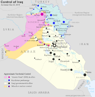
Map of Islamic State and Kurdish control in Iraq as of December 2015
“Islamic State” and Kurdish control in Iraq (click for full map)

March 19, 2016
The rebels captured two villages from IS north of Aleppo.

March 20, 2016
The army seized two or four positions in Latakia province.

March 21-24, 2016
On March 21, IS captured two towns, including Tasil, from rebels in Daraa province. Between March 23 and 24, IS captured another two towns and was contesting two more. Eventually, IS forces were repelled from the two contested towns, but surrounded one more on the border with Jordan.

March 26, 2016
The army advanced in an area of East Ghouta, in the eastern suburbs of Damascus.

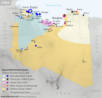
Map of control in Libya as of August 2015, including the so-called Islamic State (ISIS)
“Islamic State” (IS) control in Libya (click for full map)

March 27, 2016
The army captured the desert city of Palmyra, along with its famous 2,000-year-old ruins. Two large temples and a Roman triumphal archway that were part of the ruins had been destroyed by IS during its 10-month occupation of the city. However, it was confirmed that 80 percent of the Unesco World Heritage site was intact. Still, destruction and damage brought upon artifacts at the Palmyra museum were said to be shocking. During the battle for Palmyra, there were no civilian deaths, but 612 combatants were confirmed killed, including 417 IS fighters and 194 government soldiers and militiamen, as well as one Russian special forces soldier.

March 29, 2016
The army made advances around IS-held Qaryatayn, southeast of Homs, capturing several hills and effectively encircling the town.

March 29-30, 2016
Rebels captured two villages from IS north of Aleppo, while the SDF attempted to advance in the area of another village.

March 30-31, 2016
Rebels recaptured two hills and a checkpoint in Daraa province that they had lost recently to IS. However, the following day, IS reportedly captured a new village in Daraa province.

Graphic of the Syrian flag is in the public domain (source).

Syrian Civil War Control Map: March 2016 (Subscription)

MEMBERS CLICK HERE TO PROCEED TO ARTICLE AND MAP

There are newer versions of this map available. To see them, view all Syria updates.

Research by Djordje Djukic. Map by onestopmap.com, Evan Centanni, and Djordje Djukic

Subscribe for full access to all conflict map reports!

Download PDF:
Buy now
New discounted price!

Map of fighting and territorial control in Syria's Civil War (Free Syrian Army rebels, Kurdish YPG, Syrian Democratic Forces (SDF), Al-Nusra Front, Islamic State (ISIS/ISIL), and others), updated for March 2016. Now includes terrain and major roads (highways). Highlights recent locations of conflict and territorial control changes, such as Daraa, Khanaser, Tell Rifaat, Shadadi, the Aleppo Power Plant, and more.New: Improved map now includes terrain and major roads!
With Syria’s UN-brokered truce partially holding, government, Kurdish, and rebel forces alike have turned their attention to carving away territory from the so-called “Islamic State” (ISIS/ISIL). However, the rebels also sustained some losses to government forces prior to the ceasefire taking effect.
 
See all this and more on the latest update to PolGeoNow’s concise, professional Syrian Civil War control map, which includes a timeline of changes since our previous Syria map report in early February.

This map and report are professional subscriber content, available to paid members or for separate purchase. Download PDF (US$14.99) New discounted price!

Want to see before you buy? Check out our most recent FREE SAMPLE Syria map!

Exclusive map report includes:

Map of fighting and territorial control in Syria's Civil War (Free Syrian Army rebels, Kurdish YPG, Syrian Democratic Forces (SDF), Al-Nusra Front, Islamic State (ISIS/ISIL), and others), updated for March 2016. Now includes terrain and major roads (highways). Highlights recent locations of conflict and territorial control changes, such as Daraa, Khanaser, Tell Rifaat, Shadadi, the Aleppo Power Plant, and more.
  • New since last year: Terrain shading and major highways included on map for geographic context!
  • Up-to-date map of current territorial control in Syria, color-coded for the Assad government, rebel groups, “Islamic State” (ISIS/ISIL) extremists, and Kurdish/SDF forces. 
  • Special symbols indicate towns dominated by rebels of Al Qaeda affiliate Jabhat al-Nusra (the Nusra Front) and by multi-ethnic anti-ISIS Syrian Democratic Forces (SDF).
  • Detailed indication of city-by-city control, highlighting key towns and other locations important to current events.
  • Locations of recent fighting and military operations, including Daraa, Khanaser, Tell Rifaat, Shadadi, the Aleppo Power Plant, and more.
  • Detailed timeline of important events and changes to territorial control since February 10, 2016, compiled by our Syria-Iraq expert, with links to sources.

MEMBERS CLICK HERE TO PROCEED TO ARTICLE AND MAP

Not a member yet? Click here to learn more about our professional subscription service!

Map of Control in Yemen’s Civil War: February 2016 (Subscription)

MEMBERS CLICK HERE TO PROCEED TO ARTICLE AND MAP

There are newer versions of this map available. To see them, view all Yemen updates.

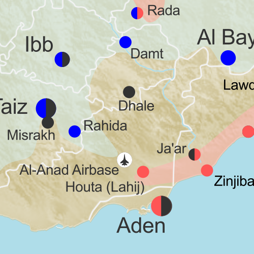
Map of territorial control in Yemen as of February 19, 2016, including territory held by the Houthi rebels and former president Saleh's forces, president-in-exile Hadi and his allies in the Saudi-led coalition and Southern Movement, Al Qaeda in the Arabian Peninsula (AQAP), and the so-called Islamic State (ISIS/ISIL). Includes recent areas of Al Qaeda takeovers and locations of other fighting, such as Shuqrah, Azzan, Habban, Ahwar, Misrakh, Fardat Nahm, and more.

Subscribe for full access to all conflict map reports!

Download PDF:
Buy now
New discounted price!

Timeline by Djordje Djukic, with additional reporting by Evan Centanni; map by Louis Martin-Vézian and Evan Centanni

Though it’s been less than three weeks since our last Yemen control map update, there have already been several changes to territorial control. Most notably, Al Qaeda in the Arabian Peninsula (AQAP) has rapidly expanded its territory, recapturing most of the towns it held from 2011 to 2012.

Meanwhile, the Saudi-led coalition supporting President Hadi has also made progress against the Houthi rebels over the past weeks.

See all this and more on the newest update to PolGeoNow’s Yemen territorial control map, which includes a timeline of changes and important events since our previous Yemen map report at the end of January.

This map and report are exclusive premium content, available to paid subscribers or for individual purchase. Download PDF (US$14.99) New discounted price!

Want to see before you buy? Check out our most recent FREE SAMPLE Yemen map report!

Exclusive map report includes:

Map of territorial control in Yemen as of February 19, 2016, including territory held by the Houthi rebels and former president Saleh's forces, president-in-exile Hadi and his allies in the Saudi-led coalition and Southern Movement, Al Qaeda in the Arabian Peninsula (AQAP), and the so-called Islamic State (ISIS/ISIL). Includes recent areas of Al Qaeda takeovers and locations of other fighting, such as Shuqrah, Azzan, Habban, Ahwar, Misrakh, Fardat Nahm, and more.
  • Up-to-date map of current territorial control in Yemen, color-coded for the pro-Hadi coalition, Houthi/Saleh forces, Al Qaeda in the Arabian Peninsula (AQAP), and “Islamic State” (ISIS/ISIL).
  • Color scheme recently updated for consistency with Syria, Iraq, and Libya map series
  • Detailed indication of town-by-town control, including provincial boundaries, all major cities, and many smaller ones
  • Markers for recent areas of Al Qaeda takeovers and locations of other fighting, such as Shuqrah, Azzan, Habban, Ahwar, Misrakh, Fardat Nahm, and more
  • Timeline of changes to the situation since January 31 2016, with links to sources

MEMBERS CLICK HERE TO PROCEED TO ARTICLE AND MAP

Not a member yet? Click here to learn more about our professional subscription service!

Map: Which Countries Recognize Palestine as Independent in 2016?

(Keep up with changes to Palestine’s situation: view all Palestine updates.)

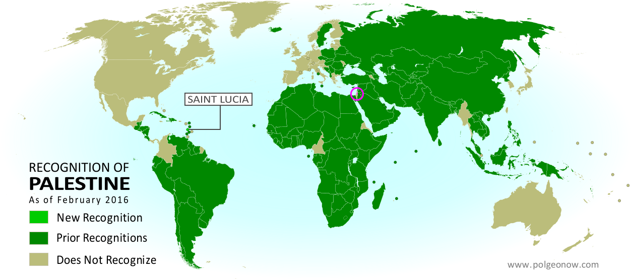
Map of countries that recognize the State of Palestine as an independent country, updated for February 2016 with recent addition Saint Lucia highlighted
Click to enlarge. Palestine in magenta (circled). Map by Evan Centanni, modified from public domain graphic (source).

Subscribers click here to view this article in the ad-free members area. Not a member yet? Learn about PolGeoNow subscriptions!

Article by Evan Centanni

Disputed Country

The Palestinian Liberation Organization (PLO) declared an independent State of Palestine in 1988, and continues to pursue its recognition as a country today. Though Palestine’s claimed territories are disputed and largely occupied by Israel, it has gathered recognition from more than two-thirds of the world’s countries, and is also treated as a country by the UN General Assembly, where it’s an “Observer State” but not a member.

Flag of Palestine Country Name:  
• Palestine (English)
Filasṭīn (Arabic)
Official Name:  
• State of Palestine (English)
• Dawlat Filasṭin (Arabic)
Capital: 
• Jerusalem (claimed)
Ramallah (administrative)

The number of individual countries recognizing Palestine has grown gradually over the past decades. Last June we reported that 135 U.N. member states (and one observer state) officially recognized Palestine, and since September the number is now 136 (about 70% of all UN members). Palestine is also recognized by the proclaimed government of Western Sahara, another disputed country that’s not formally recognized by the UN.

Saint Lucia Recognizes Palestine

Last September, the small Caribbean island country of Saint Lucia became the latest national government to recognize Palestine as independent. The formal acknowledgement came on September 14, 2015, when the two countries’ UN representatives signed an agreement in New York to establish diplomatic relations.

Saint Lucia is now one of about half the world’s countries whose government recognizes both Palestine and Israel as independent countries. All of the independent Caribbean countries except Cuba recognize Israel, and most also recognize Palestine, with the exception of Jamaica, the Bahamas, Saint Kitts and Nevis, Barbados, and Trinidad and Tobago.

Read More:
Is Palestine Really a Country?
Palestine Recognized as a Country by the UN
Map of Countries Recognizing Kosovo

Syrian Civil War Control Map: February 2016 (Subscription)

MEMBERS CLICK HERE TO PROCEED TO ARTICLE AND MAP

There are newer versions of this map available. To see them, view all Syria updates.

Research by Djordje Djukic. Map by onestopmap.com and Evan Centanni.

Subscribe for full access to all conflict map reports!

Download PDF:
Buy now
New discounted price!

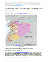
Map of fighting and territorial control in Syria's Civil War (Free Syrian Army rebels, Kurdish YPG, Syrian Democratic Forces (SDF), Al-Nusra Front, Islamic State (ISIS/ISIL), and others), updated for February 2016. Now includes terrain and major roads (highways). Highlights recent locations of conflict and territorial control changes, such as Menagh airbase, northern Aleppo, Salma, Rabia, Nubl, Baghaliya, Tishrin Dam, and more.New: Improved map now includes terrain and major roads!
As a UN-brokered truce approached, tables were beginning to turn in Syria, with the government’s Russian-backed offensive making major breakthroughs against rebel forces in Aleppo, Latakia, and elsewhere. 

Meanwhile, the so-called “Islamic State” (ISIS) continued to hold vast tracts of the country, while Kurdish-led forces gradually expanded their control in victories against ISIS and rebel fighters alike.

See all this and more on the newest update to PolGeoNow’s concise, professional Syrian Civil War control map, which includes a timeline of changes since our previous Syria map report in mid-December.

This map and report are professional subscriber content, available to paid members or for separate purchase. Download PDF (US$14.99) New discounted price!

Want to see before you buy? Check out our most recent FREE SAMPLE Syria map!

Exclusive map report includes:

Map of fighting and territorial control in Syria's Civil War (Free Syrian Army rebels, Kurdish YPG, Syrian Democratic Forces (SDF), Al-Nusra Front, Islamic State (ISIS/ISIL), and others), updated for February 2016. Now includes terrain and major roads (highways). Highlights recent locations of conflict and territorial control changes, such as Menagh airbase, northern Aleppo, Salma, Rabia, Nubl, Baghaliya, Tishrin Dam, and more.
  • New in this edition: Terrain shading and major highways included on map for geographic context!
  • Up-to-date map of current territorial control in Syria, color-coded for the Assad government, rebel groups, “Islamic State” (ISIS/ISIL) extremists, and Kurdish YPG forces. 
  • Special symbols indicate towns dominated by rebels of Al Qaeda affiliate Jabhat al-Nusra (the Nusra Front) and by multi-ethnic anti-ISIS Syrian Democratic Forces (SDF).
  • Detailed indication of city-by-city control, highlighting key towns and other locations important to current events.
  • Locations of recent fighting and military operations, including Menagh airbase, Aleppo, Salma, Rabia, Nubl, Baghaliya, Tishrin Dam, and more.
  • Detailed timeline of important events and changes to territorial control since December 9, 2015, compiled by our Syria-Iraq expert, with links to sources.

MEMBERS CLICK HERE TO PROCEED TO ARTICLE AND MAP

Not a member yet? Click here to learn more about our professional subscription service!

Yemen Civil War Control Map: January 2016 (Subscription)

MEMBERS CLICK HERE TO PROCEED TO ARTICLE AND MAP

There are newer versions of this map available. To see them, view all Yemen updates.

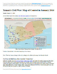
Map of territorial control in Yemen as of January 31, 2016, including territory held by the Houthi rebels and former president Saleh's forces, president-in-exile Hadi and his allies in the Saudi-led coalition and Southern Movement, Al Qaeda in the Arabian Peninsula (AQAP), and the so-called Islamic State (ISIS/ISIL). Includes recent areas of fighting, such as Aden, the Bab al-Mandeb Strait, Dhubab, Hanish Island, Harad, Maydee, Mukallah, and more.

Subscribe for full access to all conflict map reports!

Download PDF:
Buy now

Timeline by Djordje Djukic, with additional reporting by Evan Centanni; map by Louis Martin-Vézian and Evan Centanni

In the two months since our previous Yemen control map update, the Saudi-led coalition supporting President Hadi has opened new fronts against both the rival Houthis and Al Qaeda, using its naval forces to capture islands and seaports along Yemen’s coast while also advancing across the border from Saudi Arabia for the first time. 

Meanwhile, the so-called “Islamic State” organization (formerly ISIS/ISIL), based in Iraq and Syria, has for the first time been alleged to control territory in Yemen.

See all this and more on the newest update to PolGeoNow’s Yemen territorial control map, which includes a timeline of changes and important events since our previous Yemen map report in November.

This map and report are exclusive premium content, available to paid subscribers or for individual purchase. Download PDF (US$19.99)

Want to see before you buy? Check out our most recent FREE SAMPLE Yemen map report!

Exclusive map report includes:

  • Up-to-date map of current territorial control in Yemen, color-coded for the pro-Hadi coalition, Houthi/Saleh forces, Al Qaeda in the Arabian Peninsula (AQAP), and “Islamic State” (ISIS/ISIL).
  • Color scheme newly updated for consistency with Syria, Iraq, and Libya map series
  • Detailed indication of town-by-town control, including provincial boundaries, all major cities, and many smaller ones
  • Markers for key areas of recent fighting such as Aden, the Bab al-Mandeb Strait, Dhubab, Hanish Island, Harad, Maydee, Mukallah, and more
  • Timeline of changes to the situation since November 2015, with links to sources

MEMBERS CLICK HERE TO PROCEED TO ARTICLE AND MAP

Not a member yet? Click here to learn more about our professional subscription service!

War in Iraq: Map of “Islamic State” Control in December 2015 (Subscription)

MEMBERS CLICK HERE TO PROCEED TO ARTICLE AND MAP

There are newer versions of this map available. To see them, view all Iraq updates.

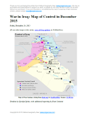
Detailed map of territorial control in Iraq as of December 23, 2015, including territory held by the so-called Islamic State (ISIS, ISIL), the Baghdad government, and the Kurdistan Peshmerga. Includes recent flashpoints including Ramadi, Baiji, Sinjar, and the Kirkuk-Daquq area.

Subscribe for full access to all conflict map reports!

   Download PDF:
Buy now

Research and timeline by Djordje Djukic; map and additional reporting by Evan Centanni

Though Iraq’s current war has been proceeding at a less-intense pace than Syria’s, there have been several important changes to territorial control in the past half a year, all involving the so-called “Islamic State” (ISIS) losing ground to the Iraqi government and Kurdistan’s Peshmerga force.

See all this and more on the newest update to PolGeoNow’s concise, professional-quality Iraq control map, which includes a timeline of changes since our previous Iraq map report in July.

This map and report are professional subscriber content, accessible to paid members or by separate purchase. Download PDF (US$19.99)

Want to see before you buy? Check out our most recent FREE SAMPLE Iraq map report!

Exclusive map report includes:

  • Up-to-date map of current territorial control in Iraq, color-coded for the Iraqi government, “Islamic State” (ISIS/ISIL) extremists, and Kurdistan’s Peshmerga forces
  • Detailed indication of town-by-town control, including provincial boundaries, all major cities, and many smaller ones
  • Markers for key areas of recent fighting such as Ramadi, Baiji, Sinjar, and more
  • Timeline of changes to the situation since July, compiled by our Iraq specialist, with links to sources 

Note: Republishing rights are not included with PDF purchases or basic subscriptions. If you need to use one of our maps in print or online, contact service@polgeonow.com.

    MEMBERS CLICK HERE TO PROCEED TO ARTICLE AND MAP

    Not a member yet? Click here to learn more about our professional subscription service!

    Map: Kazakhstan Joins WTO

    Premium members click here to view this article in the ad-free members area. Not a member yet? Learn about our subscription service!

    Map of World Trade Organization (WTO) member and observer countries, updated for December 2015 to include new member Kazakhstan
    Member and observer states of the World Trade Organization (WTO). Map by Evan Centanni, starting from public domain blank map (license: CC BY-NC-SA).

    Additional reporting by Caleb Centanni

    Kazakhstan Joins WTO
    On November 30, Kazakhstan officially became the 162nd member of the World Trade Organization (WTO), a global body founded in 1995 to promote the management and expansion of international trade. Kazakhstan was accepted by the organization in July, and membership was ratified by the Kazakh parliament on October 31 (membership takes effect 30 days after ratification). Kazakhstan is the second country to join the WTO in 2015, after Seychelles became a member in April.

    More: All PolGeoNow articles on WTO admissions since 2011

    Logo of the World Trade Organization (WTO) Organization Name:  
    • World Trade Organization (English)
    • Organisation mondiale du commerce (French)
    • Organización Mundial del Comercio (Spanish)
    Founded: 1994 in Marrakech, Morocco (commenced in 1995)
    Headquarters: Geneva, Switzerland
    Website: www.wto.org

    Kazakhstan is a landlocked former Soviet republic located mainly in Central Asia, though a small part of it is technically in Europe (depending on your definition). It’s the ninth-largest country in the world by area, and the biggest economic power in the Central Asia region, where several of the world’s few remaining non-WTO countries are located. Kazakhstan’s admission to the WTO comes after almost 20 years of negotiation and various economic reforms that made it more friendly to international business.

    Of the 195 UN-recognized countries in the world, 158 (about 81%) are members of the WTO. Another four members are not UN-recognized nations: the China-administered territories of Hong Kong and Macau, the European Union, and the disputed state of Taiwan, which participates under the name “Separate Customs Territory of Taiwan, Penghu, Kinmen and Matsu (Chinese Taipei)”.
     

    There are also 22 WTO “observers”, down from 23 now that Kazakhstan has become a full member. These observer countries are partially included in the organization, and have all applied for membership (except the Holy See administration of Vatican City, which does not plan to). There are only 15 UN-recognized countries that are neither members nor observers of the WTO.

    WTO logo is displayed without permission, based on fair use principles (source).

    Syrian Civil War Control Map: December 2015 (Subscription)

    There are newer versions of this map available. To see them, view all Syria updates.

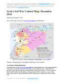
    Map of fighting and territorial control in Syria's Civil War (Free Syrian Army rebels, Kurdish YPG, Syrian Democratic Forces (SDF), Al-Nusra Front, Islamic State (ISIS/ISIL), and others), updated for December 2015. Highlights recent locations of conflict and territorial control changes, such as Kweires airbase, Hader, Kafrah, Delha, Deir Hanna, Sheikh Meskin, Hawl, and more.

    Subscribe for full access to all conflict map reports!

    Download PDF:
    Buy now

    Research by Djordje Djukic, with additional reporting by Evan Centanni

    The Syrian government’s newly Russian-backed offensive against rebels and the so-called “Islamic State” (IS, formerly ISIS) is beginning to pick up momentum. Meanwhile, Western European countries are increasingly becoming involved in the war on IS as well, with a new Western-backed, multi-ethnic ground coalition making significant gains of its own against the group.

    See all this and more on the newest update to PolGeoNow’s concise, professional-quality Syrian Civil War control map, which includes a timeline of changes since our previous Syria map report near the end of October.

    This map and report are professional subscriber content, available to paid members or for separate purchase. Download PDF (US$24.99)

    Want to see before you buy? Check out our most recent FREE SAMPLE Syria map!

    Exclusive map report includes:

    • Up-to-date map of current territorial control in Syria, color-coded for the Assad government, rebel groups, “Islamic State” (ISIS/ISIL) extremists, and Kurdish YPG forces. Special symbol indicates rebel-held towns dominated by Al Qaeda affiliate Jabhat al-Nusra (the Nusra Front).
    • New in this edition: Special symbol indicates towns held by multi-ethnic anti-ISIS Syrian Democratic Forces (SDF).
    • Detailed indication of city-by-city control, highlighting key towns and other locations important to current events.
    • Locations of recent fighting and military operations, including Kweires airbase, Hader, Kafrah, Delha, Deir Hanna, Sheikh Meskin, Hawl, and more.
    • Detailed timeline of important events and changes to territorial control since October 30, 2015, compiled by our Syria-Iraq expert, with links to sources.

    MEMBERS CLICK HERE TO PROCEED TO ARTICLE AND MAP

    Not a member yet? Click here to learn more about our professional subscription service!