Iraq Control Map & Report: September 2016

There are newer versions of this map available. To see them, view all Iraq updates.

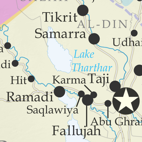
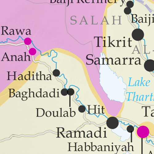
Detailed map of territorial control in Iraq as of September 5, 2016, including territory held by the so-called Islamic State (ISIS, ISIL), the Baghdad government, and the Kurdistan Peshmerga. Includes results of recent fighting around Qaiyarah (Qayyarah) south of Mosul. Color blind accessible.
Basemap by Koen Adams of onestopmap.com, with territorial control by Evan Centanni and Djordje Djukic. All rights reserved.

(Subscribers click here to view this article in the member area.)

Research and timeline by Djordje Djukic

Summary of Recent Events
After recapturing Ramadi from the so-called “Islamic State” (IS; formerly ISIS/ISIL), the Iraqi government and allies have set their sights on Mosul, the largest IS-controlled city, and until a few years ago the second largest city in Iraq (some sources say half or more of its population fled after the IS takeover in 2014). Since our last Iraq control map report at the end of June, the main change to territorial control has been the government capture of Qaiyarah, a town south of Mosul that’s still more or less surrounded by IS and Kurdish controlled ground.

See Also: Syrian Civil War Control Map: August 2016
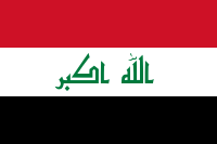
Flag of IraqCountry Name:  
• Iraq (English, Kurdish)
• al-‘Irāq (Arabic)
Official Name:  
• Republic of Iraq (English)
• Jumhūriyyat al-‘Irāq (Arabic)
Komara Iraqê (Kurdish)
Capital: Baghdad

Timeline of Changes in Territorial Control
The following is an outline of major events since PolGeoNow’s previous Iraq map update of June 30, 2016. The abbreviation “IS” refers to the organization calling itself “the Islamic State”, also known as ISIS or ISIL. The Peshmerga is the military of Iraqi Kurdistan.

June 29-July 12, 2016
Two weeks after the military started an advance towards the Qaiyarah airbase, they took control of a village 45 kilometers from the airfield on June 29. Subsequently, on July 9, the Iraqi army captured the Qaiyarah airbase, 60 kilometers south of Mosul. Three days later, the same forces linked up with government troops which had been advancing from Makhmour since March, after they captured a village on the Tigris riverbank north of Qaiyarah.

July 3, 2016
Reports said 292 people were killed by a suicide bomber detonating an explosive-filled minibus in the Karrada district of Baghdad.

July 7, 2016
IS suicide bombers attacked a Shiite shrine in a town between Samarra and Baquba, leaving 56 people dead and more than 70 wounded. The attackers fought their way through a market before reaching the gates of the Sayyid Muhammad bin Ali al-Hadi mausoleum, where they blew themselves up.

July 9, 2016
Iraqi security forces captured two villages north of Ramadi from IS.

July 18, 2016
The Iraqi Army launched an assault on the town of Qaiyarah. Meanwhile, Iraqi security forces captured a town in the western part of Anbar province.

August 2, 2016
Iraqi security forces seized two areas south of Mosul, in the area of Qaiyarah.

August 7, 2016
IS suicide bombers attacked a village 60 kilometers south of Mosul, killing 11 people, including six soldiers.

August 14-16, 2016
Kurdish forces took control of 12 villages near Mosul. During the advances, Kurdish Peshmerga forces reached a bridge connecting Erbil, Mosul, and Kirkuk. The Kurds managed to reach the western side of the bridge, thus securing a crossing over the Grand Zab river. The crossing over the river would make it possible for Kurdish forces to eventually advance on Mosul from a new front. Meanwhile, Iraqi security forces captured four villages in the Qaiyarah area.

August 23-25, 2016
Iraqi government forces attacked the center of Qaiyarah, fully capturing the town two days later. They claimed about 250 IS fighters were killed in the battle.

August 29, 2016
Five IS attackers, including a suicide bomber, killed 15 people at a wedding in a town west of Karbala (south of Baghdad, far outside of the IS control zone).

August 30, 2016
It was revealed that before retreating from the Qaiyarah airbase, IS had almost completely destroyed the facility. This was seen as possibly hindering any future attempt by Iraqi forces to retake Mosul, since the air base was intended to be used as a staging area for any future operations against the city.

August 31, 2016
Human Rights Watch accused Sunni pro-government militias of recruiting children into their ranks.

Graphic of the Iraqi flag is in the public domain (source).
Syrian Civil War Control Map & Report: August 2016 (Subscription)

SUBSCRIBERS CLICK HERE TO PROCEED TO ARTICLE AND MAP

There are newer versions of this map available. To see them, view all Syria updates.

Research by Djordje Djukic. Map by onestopmap.com, Evan Centanni, and Djordje Djukic

Subscribe for full access to all conflict map reports!


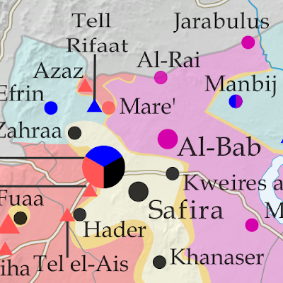
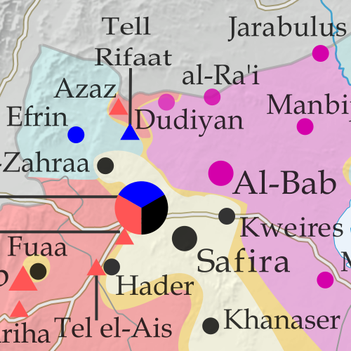
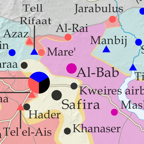
Map of fighting and territorial control in Syria's Civil War (Free Syrian Army rebels, Kurdish YPG, Syrian Democratic Forces (SDF), Al-Nusra Front, Islamic State (ISIS/ISIL), and others), updated for August 2016. Now includes terrain and major roads (highways). Includes recent locations of conflict and territorial control changes, such as Jarabulus, Manbij, Daraya, Hasakah, and more (color blind accessible). Syria’s war has seen several major territorial changes in the past month, with a Turkish military intervention bringing IS defeats even as the rival, Kurdish-led Syrian Democratic Forces have captured key territory from both IS and the Assad government. Meanwhile, the government has scored some major victories of its own against rebel forces.
 
See all this and more on the latest update to PolGeoNow’s concise, professional Syrian Civil War control map, which includes a timeline of changes since our previous Syria map report in late July, with sources cited.

This map and report are premium professional content, available to paid subscribers of the PolGeoNow Conflict Mapping Service.

Want to see before you subscribe? Check out our most recent FREE SAMPLE Syria map!

Exclusive report includes:

  • Up-to-date map of current territorial control in Syria, color-coded for the Assad government, rebel groups, “Islamic State” (ISIS/ISIL) fighters, and Kurdish/SDF forces. Color blind accessible.
  • Special symbols indicating towns dominated by rebels of the Nusra Front (now Jabhat Fateh al-Sham) and US-backed Syrian Democratic Forces (SDF).
  • Detailed indication of city-by-city control, including key towns and other locations important to current events.
  • Locations of recent fighting and military operations, including Jarabulus, Manbij, Daraya, Hasakah, and more.
  • Detailed timeline of important events and changes to territorial control since July 25, 2016, compiled by our Syria-Iraq expert, with links to sources.

SUBSCRIBERS CLICK HERE TO PROCEED TO ARTICLE AND MAP

Not signed up yet? Click here to learn more about our professional subscription service!

Can I purchase just this map?
This map and report are not available for automated purchase to non-subscribers. If you need access or republication rights for only this map report, contact service@polgeonow.com for options.

Yemen Control Map & Report: August 2016 (Subscription)

MEMBERS CLICK HERE TO PROCEED TO ARTICLE AND MAP

There are newer versions of this map available. To see them, view all Yemen updates.

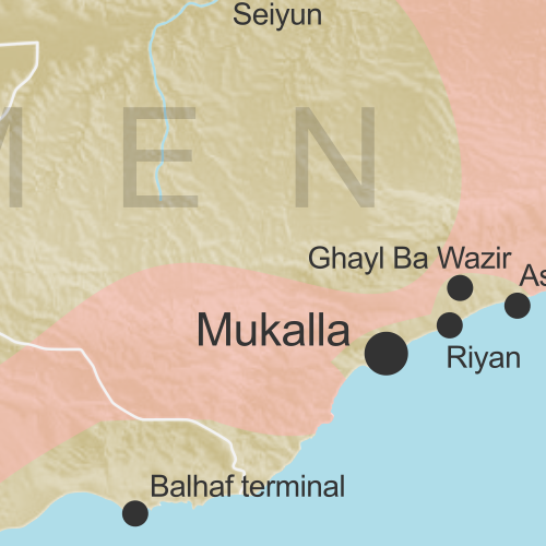
Map of territorial control in Yemen as of August 2, 2016, including territory held by the Houthi rebels and former president Saleh's forces, president-in-exile Hadi and his allies in the Saudi-led coalition and Southern Movement, Al Qaeda in the Arabian Peninsula (AQAP), and the so-called Islamic State (ISIS/ISIL). Includes recent locations of fighting, such as Taiz, Mukalla, Bayhan, Harad, and more.

Subscribe for full access to all conflict map reports!

Timeline by Djordje Djukic. Map by Louis Martin-Vézian, Evan Centanni, and Djordje Djukic.

In the three months since our previous Yemen map update, Houthi and pro-Hadi forces have continued to trade blows in the south and east, as well as along the border with Saudi Arabia. Meanwhile, Al Qaeda and the so-called “Islamic State” (ISIS/ISIL) have launched attacks in southern cities.


See all this and more on the newest update to PolGeoNow’s Yemen territorial control map, which includes a timeline of changes and important events since our previous Yemen map report in February.

This map and report are premium professional content, available to paid subscribers of the PolGeoNow Conflict Mapping Service.

Want to see before you buy? Check out our most recent FREE SAMPLE Yemen map report!

Exclusive report includes:

  • Up-to-date map of current territorial control in Yemen, color-coded for the pro-Hadi coalition, Houthi/Saleh forces, Al Qaeda in the Arabian Peninsula (AQAP), and the so-called “Islamic State” (ISIS/ISIL).
  • Color scheme now consistent with Syria, Iraq, and Libya map series
  • Detailed indication of town-by-town control, including provincial boundaries, all major cities, and many smaller ones
  • Markers for recent areas of fighting, including Taiz, Mukalla, Bayhan, Harad, and more
  • Timeline of changes to the situation since May 1, 2016, with links to sources

MEMBERS CLICK HERE TO PROCEED TO ARTICLE AND MAP

Not a member yet? Click here to learn more about our professional subscription service!

Can I purchase just this map?
This map and report are not available for automated purchase to non-subscribers. If you need access or republication rights for only this map report, contact service@polgeonow.com for options.

Map: Liberia and Afghanistan Join WTO

(Subscribers click here to view this article in the members area.)

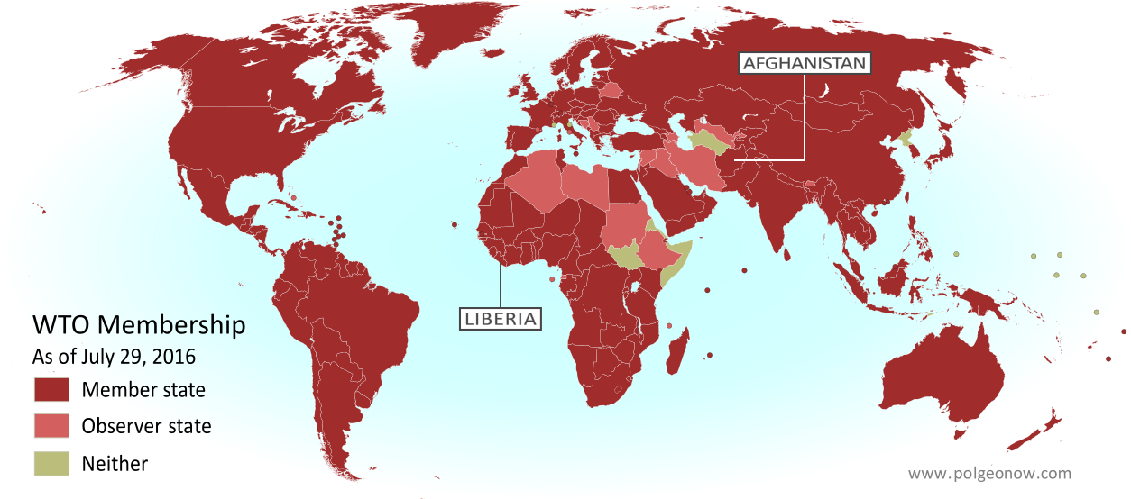
Map of World Trade Organization (WTO) member and observer countries, updated for August 2016 to include new members Liberia and Afghanistan (labeled). Color blind accessible.
Map by Evan Centanni, from public domain blank map.

Additional reporting by Caleb Centanni

Two New WTO Member Countries

This month two more countries are joining the World Trade Organization (WTO), a global body founded in 1995 to promote the management and expansion of international trade. Liberia officially became the WTO’s 163rd member on July 14, and Afghanistan joins the list as member number 164 on July 29. The last new member to join the WTO was Kazakhstan in November of last year.

Joining the WTO requires a country to sign onto a set of free trade treaties managed by the organization, and to change its laws to follow the WTO’s rules for free market trade. In return, each member country gets access to cheaper trade with all the other members, who aren’t allowed to play favorites when deciding whose imports to tax or not tax.

Logo of the World Trade Organization (WTO) Organization Name:  
• World Trade Organization (English)
• Organisation mondiale du commerce (French)
• Organización Mundial del Comercio (Spanish)
Founded: 1994 in Marrakech, Morocco (commenced in 1995)
Headquarters: Geneva, Switzerland
Website: www.wto.org

A diverse West African nation, Liberia declared independence in 1847, making it the oldest continuously independent country in Africa today. Liberia’s admission to the WTO comes after almost 10 years of negotiation, getting official approval to join in December 2015 and submitting its ratified acceptance of membership on June 14 of this year.

Afghanistan, located along the ancient Silk Road on the border of South and Central Asia, is about the 40th largest country in the world by both area and population. Afghanistan was also approved for membership last December, and submitted its ratified membership acceptance on June 29, after 11 years of negotiations.

How Many Countries are in the WTO?

Of the 195 UN-recognized countries in the world, 160 (82%) are members of the WTO. Another four members are not UN-recognized nations: China’s self-governed territories of Hong Kong and Macau, the European Union, and the disputed state of Taiwan, which participates under the name “Separate Customs Territory of Taiwan, Penghu, Kinmen and Matsu (Chinese Taipei)”.

There are also 20 WTO “observers”, down from 22 now that Liberia and Afghanistan have become full members. These countries are partially included in the organization, and have all applied for full membership (except the Holy See administration of Vatican City, which doesn’t plan to). There are only 15 UN-recognized countries that are neither members nor observers of the WTO.

Two countries, East Timor and Somalia, submitted membership applications last year, but don’t yet have WTO observer status.

More: View all articles on new WTO member countries since 2011

WTO logo is displayed without permission, based on fair use principles (source).

Syrian Civil War Control Map & Report: July 2016 (Subscription)

MEMBERS CLICK HERE TO PROCEED TO ARTICLE AND MAP

There are newer versions of this map available. To see them, view all Syria updates.

Research by Djordje Djukic. Map by onestopmap.com, Evan Centanni, and Djordje Djukic

Subscribe for full access to all conflict map reports!


Map of fighting and territorial control in Syria's Civil War (Free Syrian Army rebels, Kurdish YPG, Syrian Democratic Forces (SDF), Al-Nusra Front, Islamic State (ISIS/ISIL), and others), updated for July 2016. Now includes terrain and major roads (highways). Highlights recent locations of conflict and territorial control changes, such as Manbij, Abu Kamal (Al Bukamal), Aleppo, Daraya, Kinsabba and more (color blind accessible). The past month has seen territorial gains both for Syria’s Assad government and for rebel forces, while the so-called “Islamic State” (ISIS/ISIL) has mostly held its ground.
 
See all this and more on the latest update to PolGeoNow’s concise, professional Syrian Civil War control map, which includes a timeline of changes since our previous Syria map report in late June, with sources cited.

This map and report are premium professional content, available to paid subscribers of the PolGeoNow Conflict Mapping Service.

Want to see before you subscribe? Check out our most recent FREE SAMPLE Syria map!

Exclusive map report includes:

  • Up-to-date map of current territorial control in Syria, color-coded for the Assad government, rebel groups, “Islamic State” (ISIS/ISIL) fighters, and Kurdish/SDF forces (color blind accessible).
  • Special symbols indicating towns dominated by rebels of Al Qaeda affiliate Jabhat al-Nusra (the Nusra Front) and US-backed Syrian Democratic Forces (SDF).
  • Detailed indication of city-by-city control, highlighting key towns and other locations important to current events.
  • Locations of recent fighting and military operations, including Manbij, Abu Kamal (Al Bukamal), Daraya, Kinsabba, and more.
  • Detailed timeline of important events and changes to territorial control since June 26, 2016, compiled by our Syria-Iraq expert, with links to sources.

MEMBERS CLICK HERE TO PROCEED TO ARTICLE AND MAP

Not a member yet? Click here to learn more about our professional subscription service!

Can I purchase just this map?
This map and report are not available for automated purchase to non-subscribers. If you need access or republication rights for only this map report, contact service@polgeonow.com for options.

Iraq Control Map & Report: July 2016 (Subscription)

MEMBERS CLICK HERE TO PROCEED TO ARTICLE AND MAP

There are newer versions of this map available. To see them, view all Iraq updates.

Research by Djordje Djukic. Map by onestopmap.com, Evan Centanni, and Djordje Djukic

Subscribe for full access to all conflict map reports!


Detailed map of territorial control in Iraq as of June 30, 2016, including territory held by the so-called Islamic State (ISIS, ISIL), the Baghdad government, and the Kurdistan Peshmerga. Includes recent flashpoints such as Fallujah, Karma, Saqlawiyah, and Akashat. (color blind accessible) The Iraqi army and allies have driven the so-called “Islamic State” (ISIS/ISIL) out of Fallujah, its last stronghold in central Iraq, even as it continues to lose ground on other fronts.
 
See all this and more on the latest update to PolGeoNow’s concise, professional map of control in Iraq’s civil war, including a timeline of changes since our previous Iraq map report of May 2016.

This map and report are premium professional content, available to paid subscribers of the PolGeoNow Conflict Mapping Service.

Want to see before you subscribe? Check out our most recent FREE SAMPLE Iraq map report!

Exclusive map report includes:

  • Up-to-date map of current territorial control in Iraq, color-coded for the Iraqi government, “Islamic State” (ISIS/ISIL) extremists, and Kurdistan’s Peshmerga forces
  • Detailed indication of town-by-town control, including provincial boundaries, all major cities, and many smaller ones
  • Markers for key areas of recent fighting such as Fallujah, Karma, Saqlawiyah, and Akashat
  • Timeline of changes to the situation since mid-May, compiled by our Iraq specialist, with links to sources 
  • New since last year: Terrain shading and major highways included on map for geographic context

MEMBERS CLICK HERE TO PROCEED TO ARTICLE AND MAP

Not a member yet? Click here to learn more about our professional subscription service!

Can I purchase just this map?
This map and report are not available for automated purchase to non-subscribers. If you need access or republication rights for only this map report, contact service@polgeonow.com for options.

Syrian Civil War Control Map & Report: June 2016 (Subscription)

MEMBERS CLICK HERE TO PROCEED TO ARTICLE AND MAP

There are newer versions of this map available. To see them, view all Syria updates.

Research by Djordje Djukic. Map by onestopmap.com, Evan Centanni, and Djordje Djukic

Subscribe for full access to all conflict map reports!


Map of fighting and territorial control in Syria's Civil War (Free Syrian Army rebels, Kurdish YPG, Syrian Democratic Forces (SDF), Al-Nusra Front, Islamic State (ISIS/ISIL), and others), updated for June 2016. Now includes terrain and major roads (highways). Highlights recent locations of conflict and territorial control changes, such as Manbij, Mare, Tanf border crossing, Thawra/Tabqa, Arak, and more. A lot has happened in Syria in the past month, with major SDF and Syrian Army advances against the so-called “Islamic State” (ISIS/ISIL), as well as various smaller changes to rebel control.
 
See all this and more on the latest update to PolGeoNow’s concise, professional Syrian Civil War control map, which includes a timeline of changes since our previous Syria map report in mid-May.

This map and report are premium professional content, available to paid subscribers of the PolGeoNow Conflict Mapping Service.

Want to see before you subscribe? Check out our most recent FREE SAMPLE Syria map!

Exclusive map report includes:

  • Up-to-date map of current territorial control in Syria, color-coded for the Assad government, rebel groups, “Islamic State” (ISIS/ISIL) extremists, and Kurdish/SDF forces. 
  • Special symbols indicating towns dominated by rebels of Al Qaeda affiliate Jabhat al-Nusra (the Nusra Front) and US-backed Syrian Democratic Forces (SDF).
  • Detailed indication of city-by-city control, highlighting key towns and other locations important to current events.
  • Locations of recent fighting and military operations, including Manbij, Thawra (Tabqa), Mare, Tanf border crossing, Arak, and more.
  • Detailed timeline of important events and changes to territorial control since May 13, 2016, compiled by our Syria-Iraq expert, with links to sources.

MEMBERS CLICK HERE TO PROCEED TO ARTICLE AND MAP

Not a member yet? Click here to learn more about our professional subscription service!

Can I purchase just this map?
This map and report are not available for automated purchase to non-subscribers. If you need access or republication rights for only this map report, contact service@polgeonow.com for options.

Iraq Control Map & Report: May 2016 (Subscription)

MEMBERS CLICK HERE TO PROCEED TO ARTICLE AND MAP

There are newer versions of this map available. To see them, view all Iraq updates.

Research by Djordje Djukic. Map by onestopmap.com, Evan Centanni, and Djordje Djukic

Subscribe for full access to all conflict map reports!


Detailed map of territorial control in Iraq as of May 17, 2016, including territory held by the so-called Islamic State (ISIS, ISIL), the Baghdad government, and the Kurdistan Peshmerga. Includes recent flashpoints such as Rutbah, Doulab, Tuz Khurmatu, and more. The past month has seen several small victories of Iraqi government forces against the so-called “Islamic State” (ISIS/ISIL), as well as a handful of other notable territorial events.
 
See all this and more on the latest update to PolGeoNow’s concise, professional map of control in Iraq’s civil war, including a timeline of changes since our previous Iraq map report of April 2016.

This map and report are premium professional content, available to paid subscribers of the PolGeoNow Conflict Mapping Service.

Want to see before you subscribe? Check out our most recent FREE SAMPLE Iraq map report!

Exclusive map report includes:

  • New since last year: Terrain shading and major highways included on map for geographic context
  • Up-to-date map of current territorial control in Iraq, color-coded for the Iraqi government, “Islamic State” (ISIS/ISIL) extremists, and Kurdistan’s Peshmerga forces
  • Detailed indication of town-by-town control, including provincial boundaries, all major cities, and many smaller ones
  • Markers for key areas of recent fighting such as Rutbah, Doulab, Tuz Khurmatu, and more
  • Timeline of changes to the situation since mid-April, compiled by our Iraq specialist, with links to sources

MEMBERS CLICK HERE TO PROCEED TO ARTICLE AND MAP

Not a member yet? Click here to learn more about our professional subscription service!

Can I purchase just this map?
This map and report are not available for automated purchase to non-subscribers. If you need access or republication rights for only this map report, contact service@polgeonow.com for options.

Syrian Civil War Control Map & Report: May 2016 (Subscription)

MEMBERS CLICK HERE TO PROCEED TO ARTICLE AND MAP

There are newer versions of this map available. To see them, view all Syria updates.

Research by Djordje Djukic. Map by onestopmap.com, Evan Centanni, and Djordje Djukic

Subscribe for full access to all conflict map reports!


Map of fighting and territorial control in Syria's Civil War (Free Syrian Army rebels, Kurdish YPG, Syrian Democratic Forces (SDF), Al-Nusra Front, Islamic State (ISIS/ISIL), and others), updated for March 2016. Now includes terrain and major roads (highways). Highlights recent locations of conflict and territorial control changes, such as Daraa, Khanaser, Tell Rifaat, Shadadi, the Aleppo Power Plant, and more. The so-called “Islamic State” (ISIS/ISIL) has lost control of several towns in Syria over the past month and a half, but has also scored some victories. Meanwhile, a partial breakdown in the UN-brokered ceasefire has resulted in resumed fighting between government and rebel forces in the Aleppo area.
 
See all this and more on the latest update to PolGeoNow’s concise, professional Syrian Civil War control map, which includes a timeline of changes since our previous Syria map report at the end of March.

This map and report are premium professional content, available to paid subscribers of the PolGeoNow Conflict Mapping Service.

Want to see before you subscribe? Check out our most recent FREE SAMPLE Syria map!

Exclusive map report includes:

  • Up-to-date map of current territorial control in Syria, color-coded for the Assad government, rebel groups, “Islamic State” (ISIS/ISIL) extremists, and Kurdish/SDF forces. 
  • Special symbols indicating towns dominated by rebels of Al Qaeda affiliate Jabhat al-Nusra (the Nusra Front) and by multi-ethnic anti-ISIS Syrian Democratic Forces (SDF).
  • Detailed indication of city-by-city control, highlighting key towns and other locations important to current events.
  • Locations of recent fighting and military operations, including Qaryatain, Al-Rai, Shaer gas field, and more.
  • Detailed timeline of important events and changes to territorial control since March 31, 2016, compiled by our Syria-Iraq expert, with links to sources.

MEMBERS CLICK HERE TO PROCEED TO ARTICLE AND MAP

Not a member yet? Click here to learn more about our professional subscription service!

Can I purchase just this map?
This map and report are not available for automated purchase to non-subscribers. If you need access or republication rights for only this map report, contact service@polgeonow.com for options.

Yemen Control Map & Report: May 2016 (Subscription)

MEMBERS CLICK HERE TO PROCEED TO ARTICLE AND MAP

There are newer versions of this map available. To see them, view all Yemen updates.

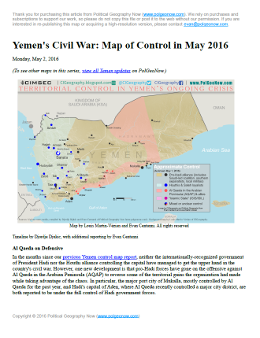
Map of territorial control in Yemen as of May 1, 2016, including territory held by the Houthi rebels and former president Saleh's forces, president-in-exile Hadi and his allies in the Saudi-led coalition and Southern Movement, Al Qaeda in the Arabian Peninsula (AQAP), and the so-called Islamic State (ISIS/ISIL). Includes recent locations of fighting, such as Taiz, Aden, Houta, Mukalla, and more.

Subscribe for full access to all conflict map reports!

Download PDF:
Buy now
New discounted price!

Timeline by Djordje Djukic. Map by Louis Martin-Vézian, Evan Centanni, and Djordje Djukic

In the months since our previous Yemen control map report, Al Qaeda has lost some of its most important territory in Yemen, including a major city it’s held for the past year. Fighting has also continued between the Hadi government and the Houthi alliance, despite attempts at a ceasefire. 


See all this and more on the newest update to PolGeoNow’s Yemen territorial control map, which includes a timeline of changes and important events since our previous Yemen map report in February.

This map and report are exclusive premium content, available to paid subscribers or for individual purchase. Download PDF (US$14.99) New discounted price!

Want to see before you buy? Check out our most recent FREE SAMPLE Yemen map report!

Exclusive report includes:

Map of territorial control in Yemen as of May 1, 2016, including territory held by the Houthi rebels and former president Saleh's forces, president-in-exile Hadi and his allies in the Saudi-led coalition and Southern Movement, Al Qaeda in the Arabian Peninsula (AQAP), and the so-called Islamic State (ISIS/ISIL). Includes recent locations of fighting, such as Taiz, Aden, Houta, Mukalla, and more.
  • Up-to-date map of current territorial control in Yemen, color-coded for the pro-Hadi coalition, Houthi/Saleh forces, Al Qaeda in the Arabian Peninsula (AQAP), and the so-called “Islamic State” (ISIS/ISIL).
  • Color scheme recently updated for consistency with Syria, Iraq, and Libya map series
  • Detailed indication of town-by-town control, including provincial boundaries, all major cities, and many smaller ones
  • Markers for recent areas of fighting, including Taiz, Mukalla, Harib, Ghayl Ba Wazir, and more
  • Timeline of changes to the situation since February 19, 2016, with links to sources

MEMBERS CLICK HERE TO PROCEED TO ARTICLE AND MAP

Not a member yet? Learn more about our professional subscription service!