Puerto Rico: 51st State of the U.S.?

[This article was written after Puerto Rico’s 2012 status referendum. In June 2017, Puerto Rico voted in another controversial referendum, again technically in favor of statehood. Most of this five-year-old article is still accurate after the 2017 vote. -Editor]

Earlier this month, papers reported that Puerto Rico had voted to become a state of the U.S. – but will it really happen? What does it take to become a state, anyway? Last time, we explained Puerto Rico’s current status – now for answers about the territory’s future….
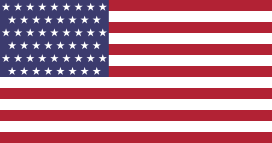
Flag of the United States with a new star added (total of 51 stars) for a hypothetical new state of Puerto Rico
A possible 51-star U.S. flag. Since each star on the flag represents one state, a new one would need to be added for Puerto Rico (public domain; source).

Why would Puerto Rico want to become a state?
Puerto Rico’s current situation leaves it disadvantaged compared to the states. It has its own constitution and government, but the laws establishing them are subject to approval by the U.S. Congress. And despite the fact that most federal taxes and other laws apply to Puerto Ricans, residents have no real representation in Congress and no say in the presidential election. (For more details, see What is Puerto Rico?)

Is statehood the only option?
No – in Puerto Rico’s November 6th referendum, voters had two other choices besides becoming a U.S. state:

1. Full Independence – This would mean cutting all territorial ties to the U.S. and becoming the world’s newest country. However, this option is unpopular in Puerto Rico, because locals are taught from a young age that independence wouldn’t be feasible (a questionable claim).

2. Sovereign Free Association – In fact, this option would also officially make Puerto Rico an independent country – but it would be allowed to keep U.S. military protection and some other government services on a voluntary basis. Micronesia, the Marshall Islands, and Palau currently have this status.

A fourth possible option – continuing as a U.S. territory but under modified terms – was controversially left off of the ballot.

What would a State of Puerto Rico look like?

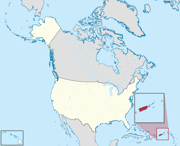
In terms of population, Puerto Rico’s 3.7 million people would make it a medium-sized state, with two senators and about five representatives in the U.S. Congress (and therefore about seven electoral votes for the president). Economically it would be the weakest of the states (though still stronger than most countries). But what it would lack in economic power, it would make up for in cultural and historical uniqueness, as the only state with a Spanish-speaking majority and the only state ever visited by Christopher Columbus. Geographically, it would be the third smallest of the states by area, and would contain both the new easternmost and the new southernmost points in the 51 states.
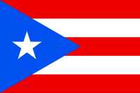
Flag of Puerto Rico Territory Name:  
• Puerto Rico (English, Spanish)
Official Name:  
• Commonwealth of Puerto Rico (English)
• Estado Libre Asociado de Puerto Rico (Spanish)
Capital: San Juan

How can a territory like Puerto Rico become a state?
The U.S. Constitution only specifies that new states can’t take territory from existing states without their permission, so the procedure is based largely on the Northwest Ordinance of 1787. That law set up the first organized American territory, in what’s now the Midwest, and defined the process for admitting new states.

To qualify for statehood, an area must have a population of at least 60,000 (no problem for Puerto Rico – there are over six times that many people just in the capital city). Then the U.S. Congress needs to pass an “enabling act” to get the ball rolling by authorizing the territory to draft a state constitution. Once it’s ready, the state is admitted through a majority vote in Congress and the President’s signature, just like any other law. That’s all.

Then Puerto Rico will become a state now, right?
Not so fast – it’s actually not clear whether the people of Puerto Rico really do want to become the 51st state. Here’s the story: the recent referendum first asked whether Puerto Rico should remain a U.S. territory like it is now, and 54% voted “no” – so far, so good. Then it asked a separate question on what the best option for change would be – on this question, 61% of the votes went for statehood (compared to 33% for free association and 6% for full independence). Statehood it is then, right?

Not quite. The meaning of the results is controversial, because many people left the second question blank, and if you include them, statehood only had 45% support. And even if you don’t count the blank votes, 61% of the people who chose change on the first question would still add up to less than 50% of the total voters. On top of all this, the territory’s pro-statehood governor was voted out on the same day, in favor of a candidate who supports the status quo. And it’s been suggested that even a real 50% wouldn’t be enough to fairly count as a mandate, since joining the union is basically irreversible (the last time any state tried leaving, lots of people died).

So, will it happen or not?

Probably not. In principle, President Obama has said he would support Puerto Rican statehood if the people clearly wanted it, and the opposing Republican Party wrote in their 2012 platform that they would support it too. But since the will of the people is anything but clear in this case, Congress reportedly has no plans to act on the referendum.

A statehood law admitting Puerto Rico might not pass so easily anyway: since the new state might end up voting blue, the Republicans in Congress could be reluctant to admit it after all. And in any case, the process would likely be very slow: the legislators have their hands full with other issues already, and adding a new state could lead to a long process of haggling over how to rearrange the population-based seats in the House of Representatives (they would have to either be added to or redistributed to make room for Puerto Rico).

Nevertheless, Puerto Rico’s pro-statehood movement is still giving it all they’ve got. The territory’s non-voting delegate to Congress, as well as the recently defeated governor, both have pushed forward in asking President Obama to get the process moving. And though it may seem like a lost cause in the short term, sources tell Political Geography Now that many Puerto Ricans are hoping statehood can at least be considered more seriously from now on.

Map of the whole U.S. plus Puerto Rico (red). Puerto Rico would be the southernmost and the easternmost state, and the third smallest. Map by Vrysxy (source; CC BY-SA)

What is Puerto Rico? Is it part of the United States?

In 2012 and 2017, Puerto Rico voted on whether to become a state of the US. But what exactly is Puerto Rico now? Is Puerto Rico part of the United States, and can its people vote in U.S. elections? Find all your answers here!

If Puerto Rico’s not a state, then what is it?

map of Puerto Rico's location relative to the U.S.
Location of Puerto Rico relative to the U.S.
Map by TUBS/Wikimedia Commons (source; CC BY-SA)

Puerto Rico is Spanish-speaking region made up of one big island and a few smaller islands in the Caribbean Sea. Since being taken from Spain in the Spanish-American War of 1898, it’s been an overseas territory of the United States (known in U.S. technical jargon as an “insular area“). Internationally, the island is sometimes treated informally as a separate nation, even sending its own team of athletes to the Olympics (See also: Which Countries Are and Aren’t in the Olympics?). However, it’s not an independent country, but a subject of the U.S. federal government.

So is Puerto Rico part of the U.S.?

Technically, Puerto Rico isn’t considered to be a part of the U.S. (though certain laws treat it as if it were). Instead, it belongs to the U.S. as an “unincorporated” territory. Unincorporated territories of the U.S. are places where the country’s constitution doesn’t apply by default, except for in the case of certain “fundamental rights” owed to all Americans. It’s also possible for a territory to be “incorporated” as part of the country, but this status is rare today.

Are Puerto Ricans Americans?

Yes – anyone born in Puerto Rico is automatically a U.S. citizen. They’re also citizens of Puerto Rico – but since this second citizenship “is not the national citizenship of an independent country or state,” they have to use U.S. passports to travel internationally. People born in Puerto Rico are considered “natural-born” American citizens, which qualifies them to run for president – but only after living in the U.S. proper for at least 14 years. They’re also eligible to serve in the U.S. military, and quite a few of them have risen to high ranks within it.

Flag of Puerto Rico Territory Name:  
• Puerto Rico (English, Spanish)
Official Name:  
• Commonwealth of Puerto Rico (English)
• Estado Libre Asociado de Puerto Rico (Spanish)
Capital: San Juan

Can Puerto Ricans vote in U.S. elections?

It’s complicated. Since Puerto Rico has no senators or representatives in the U.S. congress, residents of Puerto Rico aren’t able to vote for legislators. Similarly, since the president of the United States isn’t elected through a popular vote, but by electors from the states and the District of Columbia (D.C.), Puerto Rico residents are not able to vote for president in November.

But that’s not the end of the story: since all American citizens have the right to live anywhere they want in the U.S., a Puerto Rican who moves to one of the states can vote there. And many do – some even serve in congress as representatives of their new states. And it goes both ways…if an American from one of the states lives in Puerto Rico, they can’t vote for congress or president unless they’re still a legal resident of one of the states or D.C. (or if they’re in the military). Former residents of the states who live overseas would qualify for federal absentee voting, but in the voting laws Puerto Rico doesn’t qualify as “overseas”.

All that said, residents of Puerto Rico actually do have a bit of influence over the choice of U.S. president – the presidential primaries don’t require membership in the electoral college, so the Puerto Rican government is allowed to hold its own primary elections for the two major U.S. political parties. In March 2012, Puerto Rico chose Mitt Romney over Rick Santorum and several other Republican candidates.

Does Puerto Rico pay U.S. taxes?

Yes, residents of Puerto Rico are required to pay most types of U.S. federal taxes, and the territory contributes billions of dollars to the U.S. Treasury every year. However, most Puerto Rico residents who make all their money within the territory are exempt from the federal income tax, unless they work for the federal government. All Puerto Ricans still have to pay Social Security and Medicare taxes on their income, though they actually get significantly fewer benefits than residents of the 50 states do. Puerto Rico’s territorial government also levies its own taxes on residents of the island.

What kind of government does Puerto Rico have?

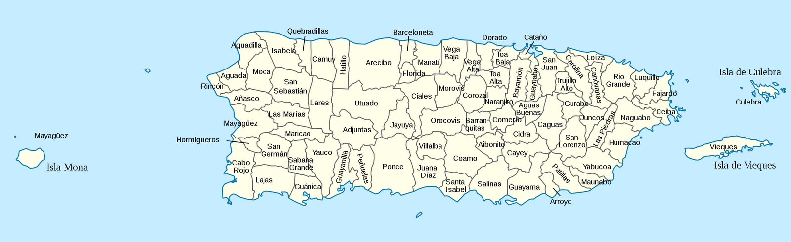
Map of the municipalities of Puerto Rico
Municipalities of Puerto Rico (click to enlarge).
Map by NordNordwest & Kmusser (source). License: CC BY-SA

Officially, Puerto Rico is a constitutional republic like each of the 50 states – however, as an “organized territory”, this government’s authority doesn’t come from the U.S. constitution. The U.S. Congress had to pass legislation specifically allowing Puerto Rico to write its own constitution (and to make Puerto Ricans U.S. citizens), and theoretically could take that privilege away again if it wanted. Because of this, there is still disagreement from the U.N. on whether Puerto Rico should be classified as a self-governing dependent territory or an old-fashioned colony.

Even though Puerto Rico is technically not a part of the U.S., it’s still treated for many purposes as if it were. Federal government offices have a major presence on the island, and its financial, postal, and telephone systems are integrated with the U.S. Although the territory has no voting representation in Congress, it does have a non-voting delegate to the House of Representatives, known as the Resident Commissioner of Puerto Rico.

Like the 50 states, Puerto Rico has its own elections, with a democratically chosen governor, senate, and house of representatives. Any American citizen can vote in Puerto Rico, as long as they’ve lived there for at least 30 days. Federal law also requires that former Puerto Rico residents living in other countries be allowed to vote by mail in Puerto Rican elections.

Part Two: Will Puerto Rico become the 51st State?

5 Countries You’ve Never Heard of (by Their Native Names)

Think you know your world geography? Maybe you know most or all of the world’s countries…by their English names. But in their own official languages, many nation-states are called something completely different. Maybe you remember España, Deutschland, or Nippon from your high school language class – but there are a lot more than that! See if you can guess these five….

Misr
Also known in casual speech as Masr, this country is considered heir to the ancient kingdom of Kemet.  Locals trade in pounds, but drive on the right side of the road. As a country, Misr ranks 127th in GDP per capita, but boasts the world’s 10th-largest active military. Bizarrely, its independence in 1922 was declared not by the nation’s own people, but by another country. One of the world’s oldest forms of Christianity is headquartered here, where it was founded by Saint Mark in the 1st century.

Location of Egypt on the globe

Egypt  (Arabic: Misr, Masr)
Kemet was Egypt’s native name under the ancient Pharaohs, its last fully independent rulers until 1922, when colonial master Britain unilaterally declared it a sovereign state. Although a majority of Egyptians are Muslim, about 10% are Coptic Orthodox Christians.

(Wikipedia: Egypt)

 Map by Martin23230 and Nableezy (source). License: CC BY-SA


Hrvatska
The kuna is legal tender in this land of a thousand islands, the biggest of which are Cres and Krk. The country’s legislature is known as the Sabor, and is currently led by Speaker Josip Leko. Hrvatska has a strong military industry, and its troops are currently serving in Afghanistan and Kosovo. Fertility rates are among the world’s lowest, and the country’s population is shrinking. The second largest city is Split (that’s its name), and on an alphabetical list of the world’s national capitals, Hrvatska’s is dead last.

Croatia  (Croatian: Hrvatska)
Though centered on the European mainland, Croatia’s coastline is lined by nearly 50 inhabited islands, plus hundreds more that are unpopulated. The country’s military contributes significantly to U.N. peacekeeping missions, and the national capital is Zagreb.

(Wikipedia: Croatia)

Shqipëria
Bujar Nishani is the president of this republic, which is divided into 12 qark and 36 rreth. Fifty-eight percent of the country’s labor force is engaged in agriculture, and its currency for trading is the lek. The majority language here is Shqip, and Islam is the largest religion, though by some estimates over 70% of the population are not even religious. The Lonely Planet travel guidebooks recommended Shqipëria as the No. 1 country to visit in 2011.

Albania  (Albanian: Shqipëria)
The Albanian language, also spoken in Kosovo, is very distinct from neighboring tongues. Islam became the dominant faith in Albania during its centuries of Ottoman rule, but the post-war communist regime banned all religion, declaring Albania the world’s first “atheist” nation.

(Wikipedia: Albania)

Bhārat
This country is currently facing one of the world’s deadliest ongoing communist insurgencies, and counts Surat, Pune, and Lucknow among its dozen most populous cities. The national anthem is Jana Gana Mana, but the “national song” is Vande Mataram. Field hockey is considered the national sport, though kho kho and gilli-danda are also popular. Bhārat hosts the world’s third-largest Muslim population, and long ago was the site of one of history’s oldest known civilizations.

India  (Hindi: Bhārat)
There are 13 cities of over two million people in India, and dozens more with over one million (I challenge you to name five). Meanwhile, a decades-old war simmers with the Maoist Naxalite rebels. India’s population exceeds 1.2 billion, of whom about 13% follow Islam.

(Wikipedia: India)

Map by Ssolbergj (source). License: CC BY-SA

Suomi
Although this country and its majority language share the same name, that name changes depending on where it is in your sentence: Suomi is her country, but She’s going to Suomessa. The five largest cities include Espoo, Turku, and Vantaa, and as of 2012 the president was Sauli Niinistö. Water covers ten percent of Suomen‘s surface area (not counting the sea), and the remaining land has been occupied by its both of its major neighbors. Suomi is considered one of the three least corrupt countries in the world.

Finland  (Finnish: Suomi)
The Finnish language, unrelated to most other European tongues, has over a dozen noun cases. Finland is covered with thousands of lakes, and for centuries was controlled by the Swedish and Russian empires. The country ranks highly in various measures for quality of living .

(Wikipedia: Finland)

So, how many did you guess right? Tell us on Twitter or Facebook!

(Except where otherwise specified, all maps are in the public domain.)

Syria Uprising Map: October 2012 (#7)

There are newer versions of this map available. To see them, view all Syria updates.

Syria’s civil war has raged on over the last two months, with neither side gaining the upper hand. Death and destruction has been enormous, and territorial changes few, though not none. Read on for the rundown.

Map of rebel activity and control in Syria's Civil War (Free Syrian Army, Kurdish groups, and others), updated for October 2012
Activity and cities held by rebels and other groups in Syria, updated for October 2012. Map by Evan Centanni, starting from this blank map by German Wikipedia user NordNordWest. License: CC BY-SA

Rebel Gains in North

Since our last Syria update in August, the broadest change to territorial control has been the rebels’ eastward expansion from Aleppo into ar-Raqqah province, a region that had previously seen little fighting. Most notably, the Tal Abyad border crossing fell out of government hands on September 19. Starting early this month, attempts by government forces to take back Tal Abyad spiraled into low-intensity border clashes between Turkish and Syrian government forces after Syrian shells began crossing into the other country.

Flag of Syria under the current governmentCountry Name:  
• Syria (English)
• Sūriyya/Sūryā (Arabic)
Official Name:  
• Syrian Arab Republic (English)
• al-Jumhūriyyah al-‘Arabīyah  as-Sūriyyah (Arabic)
Capital: Damascus

Meanwhile, as the city of Aleppo remains divided (map), rebel forces have slowly fought their way to modest gains in neighboring Idlib province. On August 12, the fighters secured a new stretch of border villages west of Armanaz, and on the 16th they seized Maarat al-Numan, a strategic town located on the highway between Damascus and Aleppo.

Southern & Eastern Regions
Fighting still rages in the Damascus area as well, and it is sometimes impossible to keep track of the constant back and forth between the government and rebels. However, as of last week Douma, the largest city outside of the capital, was reportedly under control of the Free Syrian Army. In the east, they also hold Mayadin, a major eastern town with a bridge over the Euphrates River.

Fighting has also begun to spill over into the neighboring country of Lebanon, whose current government is seen as supportive of the Syrian regime. The country is among the Middle East’s most diverse, and many groups have sided instead with Syria’s rebels.

Syria Map: Corrections & Additions
As the situation in Syria is rapidly changing, and journalists inside the country are few, it can sometimes be difficult to keep up with the changes. As a case in point, it turns out that the town of Ariha in Idlib province was taken back by the Syrian army a week before our August 2012 Syria update, though that map still indicated that it was rebel-held.

Two more towns have also been added to the map since last time: Zabadani northeast of Damascus was a key rebel stronghold early in the war before falling to the government, and since at least this August it is again largely controlled by the Free Syrian Army rebels. East of Aleppo, Manbij is one of the country’s largest rebel-administered towns, after government forces pulled out on July 19.

Graphic of Syrian flag is in the public domain (source).

Kosovo Recognized by Papua New Guinea (92/193)

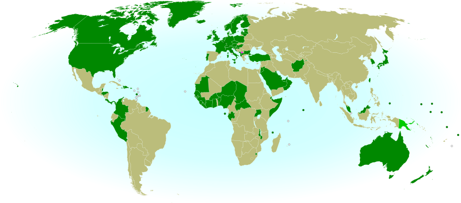
Map of countries that recognize the Republic of Kosovo as independent, updated for Papua New Guinea's recognition in October 2012
Countries recognizing the Republic of Kosovo in green, with the most recent, Papua New Guinea (lower right), in lighter green. Kosovo in magenta. Map by Evan Centanni, modified from public domain graphic (source).

Flag of the Republic of KosovoCountry Name:  
• Kosovo (English, Serbian)
• Kosova (Albanian)
Official Name:  
Republic of Kosovo (English)
Republika e Kosovës (Albanian)
Republika Kosovo (Serbian)
Capital: Priština

Kosovo Recognition Update
Southeastern Europe’s disputed Republic of Kosovo has been recognized by one more U.N. member country, four months after the last similar endorsement (See: Kosovo Recognized by Chad). The latest state to offer diplomatic recognition to Kosovo is Papua New Guinea, a Melanesian country located north of Australia, whose Prime Minister proclaimed its support on October 3. The Republic of Kosovo, which seceded from Serbia in 2008, is now officially considered independent by 92 U.N. member countries (48%) plus non-member Taiwan. It has not been admitted into the U.N. itself, due to objections from Serbia, Russia, and other countries which see its secession as invalid. For more on Kosovo’s special situation, see our first report on Kosovo from earlier this year.

Stay Updated: Check for more recent posts by viewing all Kosovo articles on Political Geography Now. 

Flag graphic by Cradel (source). License: CC BY-SA

Somalia: The Retreat of Al Shabaab

There are newer versions of this map available. To see them, view all Somalia articles on PolGeoNow. 

One year ago, Kenya and Ethiopia invaded Somalia to end the rule of Al Shabaab, an Al Qaeda allied extremist group which had taken over the southern half of the country. This map and article are your guide to the militants’ slow but steady retreat, culminating in last week’s capture of the port city of Kismayo.

Map of the retreat of Al Shabaab Islamist militants in Somalia since 2011, culminating in the October 2012 capture of the key port city of Kismayo. Shows successive stages of advance by Kenyan, Ethiopian, and local forces.
The retreat of the Al Shabaab Islamist militant group in Somalia since 2011. Original map by Evan Centanni. Incorporates elements from this blank map by Eric Gaba and this locator map by TheEmirr. (license: CC BY-SA).

State of Anarchy
Located at the tip of East Africa’s “Horn”, Somalia has been wracked by chaos and violence since the fall of its last effective national government in 1991. While the northern Somaliland and Puntland regions formed autonomous governments, central and southern Somalia were ruled for many years by a patchwork of local warlords.


In recent years, the southern regions have been united under the hardline Islamist group Al Shabaab, though the extremists have been losing ground since early last year. Kenya and Ethiopia joined the fight one year ago, and last week a coalition of allied forces finally captured the extremists’ last major urban stronghold, the port city of Kismayo.

The Players: Who’s Fighting in Somalia?

Flag of SomaliaCountry Name:  
Somalia (English)
Soomaaliya (Somali)
• aṣ-Ṣūmāl (Arabic)
Official Name:  
Federal Republic of Somalia (English)
Jamhuuriyadda Federaalka Soomaaliya (Somali)
Jumhūriyyat aṣ-Ṣūmāl al-Fideraaliya (Arabic) 
Capital: Mogadishu

Al ShabaabThis movement originated as the hardline youth wing of the Islamic Courts Union (ICU), which ruled southern and central Somalia briefly in 2006. The group is officially a wing of Al Qaeda, though their relationship with the terrorist network has sometimes been strained.

Transitional Federal Government (TFG) – The internationally recognized government of Somalia, though it has often been limited to governing parts of the Somali capital, Mogadishu. Units from the TFG’s Somali National Army (SNA) have played a supporting role in the advances against Al Shabaab.

Kenya Defense Forces (KDF) – The military of neighboring Kenya invaded southern Somalia in October 2011 as retaliation against alleged Al Shabaab attacks on Kenyan soil. The early Kenyan campaign, approved by the TFG, was titled Operation Linda Nchi (“Protect the Country” in Swahili), and was Kenya’s first major war as an independent country.

Ethiopian National Defense Force – Another neighbor of Somalia, Ethiopia has sent forces into Somalia more than once in the past. Ethiopian involvement is unpopular among the Somali people, who see it negatively as a foreign invader; still, it has low-key approval from the TFG, and has played a key role in beating back Al Shabaab.

African Union Mission in Somalia (AMISOM) – An international peacekeeping force originally sent to protect the TFG in Mogadishu, AMISOM has since actively fought to drive Al Shabaab out of the capital and beyond. The force is made up of soldiers from Uganda, Burundi, and Djibouti, and also recently absorbed the invading Kenyan forces under its mandate.

Ahlu Sunna Waljama’a (ASWJ) – A moderate Sufi Muslim militia which operates out of Guriel in central Somalia and Dolo in the south, the ASWJ was the first group to make major gains against Al Shabaab, and has fought alongside the Ethiopians after the invasion. ASWJ is backed by Ethiopia and allied with the TFG, though its relations with the latter are sometimes tense.

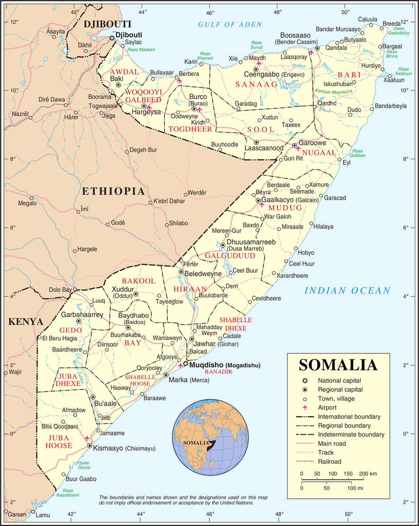
Complete map of Somalia (source)

Ras Kamboni – Named after the town at the far southwestern tip of Somalia where Islamists made a last stand against Ethiopia back in 2006, this splinter militia of the original Ras Kamboni Brigades has switched from being anti-Ethiopia to anti-Shabaab. Backed by Kenya, Ras Kamboni forces were the first to push the extremists back from the Kenyan border, and have continued making major contributions to the war effort.

Shabelle Valley Administration (SVA) – A would-be regional government for central Somalia, SVA forces fought alongside the Ethiopians, the ASWJ, and the TFG to liberate the city of Beledweyne. However, they have political disputes with the TFG and ASWJ, which also want control of the region.

The Events: Timeline of Al Shabaab’s Retreat

2011 Jan. –  Al Shabaab’s territory is at its greatest extent, after absorbing rival Islamic militia Hizbul Islam.

2011 Mar.-Apr. – ASWJ forces with Ethiopian and TFG support carve out a large area of territory near the Somali-Kenyan-Ethiopian border, taking regional capital Garbaharey near the end of April.

2011 Aug. 6 – Al Shabaab stages a major withdrawal from Mogadishu, the Somali capital, after suffering defeats at the hands of AMISOM. The militia’s forces will remain in the capital’s outskirts for many more months.

2011 Oct. 16-20 – Kenya launches a three-pronged invasion, entering through El Waq, Dhobley, and Ras Kamboni. ASWJ and the Ras Kamboni militia have already cleared the way, and the KDF initially extends their conquests only as far as Qoqani and Burgabo.

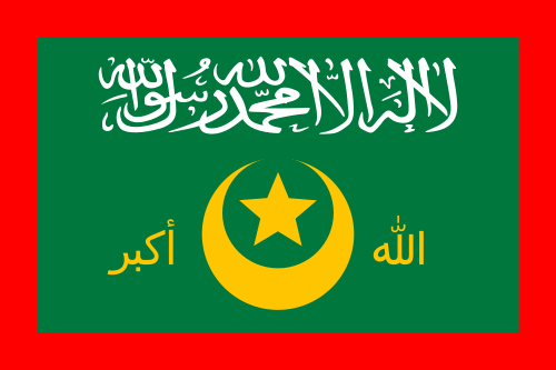
Flag of Al Qaeda, used as the war flag of Al Shabaab in Somalia.
The war flag of Al Shabaab is the banner of Al Qaeda, based on Muhammed’s Black Standard. Public domain graphic by Ingoman (source).

2011 Oct.-Dec. – Heavy rains leave Kenyan forces stuck in the mud, and time is spent defending from Al Shabaab’s guerilla attacks rather than advancing on the enemy. Meanwhile, Ethiopian troops begin crossing the border in large numbers.

2011 Dec. 31 – Ethiopian, ASWJ, TFG, and SVA forces capture Beledweyne, the largest city held by Al Shabaab in central Somalia.

2012 Feb. 9 – Al Shabaab publicly joins terrorist network Al Qaeda.

2012 Feb. 22 – Ethiopian and TFG troops seize Baidoa, a major city in the interior of southern Somalia which has been held by Al Shabaab since Jan. 2008.

2012 Mar. 16 – TFG and AMISOM forces expel Al Shabaab from their last remaining strongholds within Mogadishu.

2012 Mar. 22 – Hudur, a regional capital north of Baidoa, falls to TFG and Ethiopian forces.

2012 Mar. 26 – ASWJ and Ethiopian forces in central Somalia take El Bur, an important Shabaab base, but lose it again two months later.

Flag of Ahlu Sunnah Waljamaca (ASWJ), moderate Sufi Muslim militia in Somalia.
Flag of the ASWJ (source).

2012 May 25 – TFG and AMISOM troops capture Afgoye, a key town just outside Mogadishu.
 
2012 May 31 – Kenyan troops and Ras Kamboni finally capture Afmadow, a key town on the way to Kismayo, after originally hoping to take it during the first weeks of the invasion.

2012 July 6 –  KDF forces in Somalia are formally absorbed into AMISOM, technically ending the Kenyan invasion.

2012 Aug. 20 – The Transitional Federal Government reaches the end of its tenure, and is replaced by a new government in a limited election.

2012 Aug. 28 – Marka, Al Shabaab’s second most important port city, is secured by TFG and AMISOM forces moving west out of Mogadishu.

2012 Sep. 28 to Oct. 2 – TFG troops and Kenyan forces under AMISOM enter Kismayo, Al Shabaab’s last major urban stronghold and most important port city. The battle includes an amphibious invasion conducted by the Kenyan navy. After a few days of uncertainty, allied forces control the city.

Graphic of Somali flag is in the public domain (source).

Yemen Conflict Map: September 2012 (#4)

Since June, the Yemeni government has completed its campaign to free the south from Al Qaeda rule, but multiple rebel movements remain active. Keep reading for a summary of the current situation. (To see other maps in this series, view all Yemen updates.)

Map of current division in Yemen, including Al Qaeda or Ansar al-Sharia activity, Houthi rebel control, and the location of the Southern Movement insurgency. Update for September 2012.
Presence of rebel forces in Yemen as of September 2012. Ansar al-Sharia is part of Al-Qaeda in the Arabian Peninsula (AQAP). Map by Evan Centanni, using this blank map by NordNordWest/Wikipedia (license: CC BY-SA).

In our previous Yemen map update, we reported on the government’s June 2012 capture of most of Abyan province from Ansar al-Sharia, an armed group associated with Al Qaeda in the Arabian Peninsula (AQAP). After the fall of the militants’ two main “Islamic Emirates” in the towns of Jaar and Zinjibar, the U.S.-backed Yemeni army advanced east into neighboring Shabwah province; after about a week, the Islamists had fled Azzan, their primary stronghold in Shabwah.

At the time, Ansar al-Sharia was also known to control the Shabwah towns of Hawta, Rawdah, and Rudum, yet the militants appear to have since gone underground; Yemen’s government declared victory in the entire region, and no word has since filtered through of Islamist-controlled towns. However, what has become clear is that the extremists have not fled altogether, but are only keeping a lower profile. Reports have even emerged of a major Al Qaeda training camp in Abyan’s Mahfad district

Flag of YemenCountry Name:  
• Yemen (English)
• Al-Yaman (Arabic)
Official Name:  
• Republic of Yemen (English)
al-Jumhūriyyah al-Yamaniyyah (Arabic) 
Capital: Sana’a

Meanwhile, a certain amount of chaos continues in the rest of the country despite the political deal that largely calmed last year’s uprising. In the capital city of Sana’a, the transitional government of President Abd Rabbuh Mansur Al-Hadi faces periodic Al Qaeda terrorist attacks as well as insurrection from soldiers loyal to deposed president Ali Abdullah Saleh, the latter of whom have reportedly taken control of some government buildings.

South of the capital, there is still a simmering separatist insurgency in formerly independent southern Yemen, and in the north a large area is still controlled by the Al Houthi rebels. A Zaidi Shiite rebel group, the Houthis currently maintain an informal truce with the transitional government as they await an overdue national dialogue process. However, they sometimes clash with local militias who resent their territorial encroachment, as well as Salafist fighters, extremist Sunnis who consider the Zaidis to be heretics.  

Graphic of Yemeni flag is in the public domain (source).

Malawi’s Flag Change

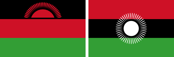
New and old flags of Malawi
Malawi’s original rising-sun flag (left) is being re-adopted, after being controversially replaced two years ago by the full-sun banner (right). Graphics are in the public domain (left source; right source).

Just two years after adopting a new flag, the southeast African country of Malawi is changing back to the old one. The original banner, in place from independence in 1964 until its replacement in 2010, was voted back in by the national parliament on May 28, 2012.

Flag of MalawiCountry Name:  
• Malawi (English)
• Malaŵi (Chichewa)
Official Name:  
• Republic of Malawi (English)
• Dziko la Malaŵi (Chichewa) 
Capital: Lilongwe

The independence flag, which displays a rising sun to represent the dawn of hope for Africa, was controversially replaced by President Bingu wa Mutharika two years ago. The colors were shuffled around to more closely match the Pan-African Flag, and the red rising sun was changed to a full white sun to symbolize the progress made by Malawi since independence.

When President Mutharika died last April, the Malawian government wasted little time in reverting the unpopular flag change. The move was supported by newly sworn-in President Joyce Banda, who had recently experienced a falling-out with Mutharika and started a new political party.

Although the flag change vote passed in parliament, it is still unclear whether it has passed officially into law via the required presidential signature. In any case though, the rising-sun flag appears to be widely in use again, being flown in the Olympics and displayed on many official websites (except for the main government homepage).

Independent Azawad No More: Northern Mali in Islamist Hands

There are newer versions of this map available. To see them, view all Mali maps.   

Since declaring the independence of Azawad in April, control by northern Mali’s MNLA rebels has been usurped by the hardline Islamists of Ansar Dine and MUJAO. The new regime, while still bitter enemies of the Malian government, does not claim independence. Presented here is a map and brief guide explaining the current situation.

Map of Islamist rebel control in northern Mali as of September 2012
Area held by Islamist rebel groups Ansar Dine and MUJWA in northern Mali. Map by Evan Centanni, modified from Wikimedia map by Orionist, using images by Carport and NordNordWest (source). License: CC BY-SA.

Separatists vs. Islamists
Last April, the Tuareg-dominated separatists of the National Movement for the Liberation of Azawad (MNLA) swept into victory in northern Mali, completing their control of the region and declaring independence as the State of Azawad. But their victory was won only with the support of Ansar Dine, an Islamist militia led by veteran Tuareg fighter Iyad Ag Ghaly. The MNLA and Ansar Dine then alternated between cooperation and conflict for months, with the Islamists grabbing ever more control of the region’s cities.

Tensions came to a head on June 26, when a second Islamist group, the Movement for Unity and Jihad in West Africa (MUJWA), violently expelled the MNLA from their capital city of Gao. By month’s end, Ansar Dine had fully pushed the MNLA out of key city Timbuktu, and two weeks later the separatists were driven from their last stronghold in the town of Ansongo. Then just this weekend, MUJWA again made news by seizing the town of Douentza from a formerly cooperative local militia.

Flag of MaliCountry Name:  
• Mali (English, French, Bambara)
Official Name:  
• Republic of Mali (English)
• République du Mali (French) 
• Mali ka Fasojamana (Bambara)
Capital: Bamako

Though northern Mali is still not controlled by the national government in Bamako, the Islamist militias do not seek independence. Instead, they pursue a vision of strict sharia law throughout Mali. Since these new rulers no longer consider Azawad a sovereign nation, its claim to independence has faded away.

Current Rebel Control
Ansar Dine and MUJWA together appear to hold all of the territory originally seized by the MNLA, with the line of control lying between the towns of Douentza and Sévaré. Bandiagara in the nearby Dogon region may have an army presence, but other towns such as Koro do not, and have seen rebel raids.

Administration is divided between the two Islamist militias, with Ansar Dine apparently controlling regional capitals Timbuktu and Kidal, and MUJWA controlling at least Gao (also a regional capital) and Douentza. Al Qaeda in the Islamic Maghreb (AQIM), a branch of the terrorist group, also maintains a strong presence in northern Mali. MUJWA is historically associated with AQIM, though Ansar Dine’s relationship to the organization is more tenuous.

Special thanks to Peter Tinti (@petertinti), who has provided invaluable commentary throughout the Mali conflict, and has repeatedly pointed me in the right direction in my research.

Note on Names:  
The acronym “MNLA” is based on the French, and is sometimes rendered “NMLA” to match the English. 
MUJWA is also known as “MOJWA” (from an alternate translation) or “MOJAO” (from the French). 
Ansar Dine is pronounced “an-SAR (uhd)-DEEN” and sometimes spelled “Ansar Eddine” or “Ansar ud-Dine”. 
AQIM is also known by its French acronym “AQMI”; its Arabic actually means “Al Qaeda in the Islamic West”.

Graphic of Malian flag is in the public domain (source).

Syrian Uprising Map: August 2012 (#6)

There are newer versions of this map available. To see them, view all Syria updates.

Political Geography Now presents the sixth update to our map of rebel control in Syria’s civil war. Since last month, battle has erupted in the country’s largest city, Kurds have formed a parallel government in northern towns, and more. Read on for a rundown of recent events.

Map of rebel control in Syria's Civil War (Free Syrian Army, Kurdish groups, and others), updated for August 2012
Activity and cities held by rebels and Kurdish groups in Syria, updated August 16, 2012. Map by Evan Centanni, starting from this blank map by German Wikipedia user NordNordWest. License: CC BY-SA

Battles for Damascus & Aleppo
Not long after our last Syria update, the anti-government Free Syrian Army moved into the capital city of Damascus for the first time, taking advantage of the chaos sown by their shocking assassination of the country’s defense minister and two other top security officials. But after claiming control of some neighborhoods for several days, the rebels were eventually driven back into the suburbs.

Yet even as fighters were expelled from Damascus, the Free Syrian Army began moving into Aleppo, Syria’s largest city. By the end of the month, the previously quiet northern metropolis was facing widespread rebel control in “an arc that [covered] eastern and southwestern districts”. Al Bab, one of Aleppo’s two largest satellite cities, also fell to rebel forces at the beginning of August.

Flag of Syria under the current governmentCountry Name:  
• Syria (English)
• Sūriyya/Sūryā (Arabic)
Official Name:  
• Syrian Arab Republic (English)
• al-Jumhūriyyah al-‘Arabīyah  as-Sūriyyah (Arabic)
Capital: Damascus

Rebels Capture Border Crossings
Meanwhile, the armed opposition also launched a takeover of several major crossings along the Syrian border. On the northern boundary between Syria and Turkey, rebels took over Bab Al-Hawa crossing in Idlib province and the Bab Al-Salam and Jarabulus crossings in Aleppo province (“bab” means “gate” in Arabic).

On the eastern border with Iraq, an Iraqi official at one point claimed Syrian rebels controlled all border crossings; however, they later appeared to hold only the Al Bukamal (Abu Kamal) crossing in Deir ez-Zor province.

Kurdish Control in North

Also in July, Kurds in the north began taking control of Kurdish-populated areas. Militias serving the allied Kurdish Democratic Union Party (PYD) and Kurdish National Council (KNC) have so far seized at least nine towns (full list with sources) and parts of Qamishli, as well as two districts of Aleppo city.

These groups’ goal to create a Kurdish autonomous region in the north has alarmed Turkey, which has been fighting Kurdish rebels north of the border for years. So which side of the Syrian civil war are the Kurdish groups on? For now, they oppose the government; but relations with the Arab-dominated Free Syrian Army are tense, and President al-Assad has been accused of intentionally handing over areas to the Kurdish militias in order to keep out Turkey and the other rebels. 

Country in Chaos 

Flag of Syria's Democratic Union Party (PYD), a Kurdish group which now controls many Kurd-populated towns in northern Syria
Flag of the PYD, flown in Kurdish-controlled towns (public domain)

Syria’s northern Idlib province still forms the core of rebel territory (with northern Aleppo province now added), where anti-Assad groups govern most of the countryside and hold major towns such as Saraqeb, Armanaz, and Ariha. However, Deir ez-Zor in the east is also emerging as a power center for the opposition, which now claims to control 90% of the province, including “at least half” of its main city. 

Meanwhile the Syrian National Council (SNC), an opposition umbrella group, has already established unofficial relations with many of the world’s countries, and official diplomatic relations with eight of them. Most of those only acknowledge the SNC as “a legitimate representative” of the Syrian people; but the rebels-turned-leaders of Libya go further, recognizing the Syrian opposition group as the country’s “sole legitimate government”. 

Meanwhile, the Syrian regime has been suspended from the Organization of Islamic Cooperation (OIC), a group including most of the world’s Muslim countries. In the Muslim world, international opposition to al-Assad’s Syrian government has been led by Saudi Arabia (a Sunni-majority country), while support has come mainly from Iran (a Shiite-majority country). Syria’s President Bashar al-Assad belongs to a minority Shiite sect (the Alawites), while the majority of Syrians, including most of the rebels, are Sunnis.

Graphic of Syrian flag is in the public domain (source).