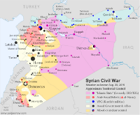
Syrian Civil War Control Map: December 2015 (Subscription)

There are newer versions of this map available. To see them, view all Syria updates.

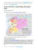
Map of fighting and territorial control in Syria's Civil War (Free Syrian Army rebels, Kurdish YPG, Syrian Democratic Forces (SDF), Al-Nusra Front, Islamic State (ISIS/ISIL), and others), updated for December 2015. Highlights recent locations of conflict and territorial control changes, such as Kweires airbase, Hader, Kafrah, Delha, Deir Hanna, Sheikh Meskin, Hawl, and more.

Subscribe for full access to all conflict map reports!

Download PDF:
Buy now

Research by Djordje Djukic, with additional reporting by Evan Centanni

The Syrian government’s newly Russian-backed offensive against rebels and the so-called “Islamic State” (IS, formerly ISIS) is beginning to pick up momentum. Meanwhile, Western European countries are increasingly becoming involved in the war on IS as well, with a new Western-backed, multi-ethnic ground coalition making significant gains of its own against the group.

See all this and more on the newest update to PolGeoNow’s concise, professional-quality Syrian Civil War control map, which includes a timeline of changes since our previous Syria map report near the end of October.

This map and report are professional subscriber content, available to paid members or for separate purchase. Download PDF (US$24.99)

Want to see before you buy? Check out our most recent FREE SAMPLE Syria map!

Exclusive map report includes:

  • Up-to-date map of current territorial control in Syria, color-coded for the Assad government, rebel groups, “Islamic State” (ISIS/ISIL) extremists, and Kurdish YPG forces. Special symbol indicates rebel-held towns dominated by Al Qaeda affiliate Jabhat al-Nusra (the Nusra Front).
  • New in this edition: Special symbol indicates towns held by multi-ethnic anti-ISIS Syrian Democratic Forces (SDF).
  • Detailed indication of city-by-city control, highlighting key towns and other locations important to current events.
  • Locations of recent fighting and military operations, including Kweires airbase, Hader, Kafrah, Delha, Deir Hanna, Sheikh Meskin, Hawl, and more.
  • Detailed timeline of important events and changes to territorial control since October 30, 2015, compiled by our Syria-Iraq expert, with links to sources.

MEMBERS CLICK HERE TO PROCEED TO ARTICLE AND MAP

Not a member yet? Click here to learn more about our professional subscription service!

Yemen’s Civil War: Map of Control in November 2015 (Subscription)

There are newer versions of this map available. To see them, view all Yemen updates.

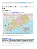
Map of territorial control in Yemen as of November 17, 2015, including territory held by the Houthi rebels and former president Saleh's forces, president-in-exile Hadi and his allies in the Saudi-led coalition and Southern Movement, and Al Qaeda in the Arabian Peninsula (AQAP). Includes recent areas of fighting, such as Taiz, Wadiah, Bayda, Marib, Mukayras, Mocha, Dhubab, and the Bab al-Mandeb Strait.

Subscribe for full access to all conflict map reports!

Download PDF:
Buy now

Timeline by Djordje Djukic, with additional reporting by Evan Centanni; map by Louis Martin-Vézian and Evan Centanni

Over the past month and a half, all sides in Yemen’s civil war have achieved territorial gains. The international coalition backing President Hadi – now including troops from Sudan, as well as Saudi Arabia, the UAE, and Qatar – has made gains against the Houthis, even as the Houthis have recaptured other areas. Meanwhile, Al Qaeda has taken advantage of the chaos to continue continued its gradual expansion of power.

See all this and more on the newest update to PolGeoNow’s Yemen territorial control map, which includes a timeline of changes and important events since our previous Yemen map report in September.

This map and report are exclusive premium content, available to paid subscribers or for individual purchase. Download PDF (US$19.99)

Want to see before you buy? Check out our most recent FREE SAMPLE Yemen map report!

Exclusive map report includes:

  • Up-to-date map of current territorial control in Yemen, color-coded for the pro-Hadi coalition, Houthi/Saleh forces, and Al Qaeda in the Arabian Peninsula (AQAP).
  • Detailed indication of town-by-town control, including provincial boundaries, all major cities, and many smaller ones
  • Markers for key areas of recent fighting such as Taiz, Marib, Bayda, Mukayras, the Bab al-Mandeb Strait, and more
  • Timeline of changes to the situation since late September, with links to sources

MEMBERS CLICK HERE TO PROCEED TO ARTICLE AND MAP

Not a member yet? Click here to learn more about our professional subscription service!

Syrian Civil War Control Map: October 2015 (Subscription)

There are newer versions of this map available. To see them, view all Syria updates.

Map of fighting and territorial control in Syria's Civil War (Free Syrian Army rebels, Kurdish YPG, Al-Nusra Front, Islamic State (ISIS/ISIL), and others), updated for late October 2015. Highlights recent locations of conflict and territorial control changes, such as Kweires airbase, Kafr Nabudah, Aleppo area, Hama province towns, and more.

Subscribe for full access to all conflict map reports!

Download PDF:
Buy now

Research by Djordje Djukic, with additional reporting by Evan Centanni

A month into Russia’s military intervention in Syria, the Assad government and Iranian troops have made a number of small advances against both the rebels and the so-called “Islamic State” (formerly ISIS/ISIL).

See all this and more on the newest update to PolGeoNow’s concise, professional-quality Syrian Civil War control map, which includes a timeline of changes since our previous Syria map report last month.

This map and report are professional subscriber content, available to paid members or for separate purchase. Download PDF (US$24.99)

Want to see before you buy? Check out our most recent FREE SAMPLE Syria map!

Exclusive map report includes:

  • Up-to-date map of current territorial control in Syria, color-coded for the Assad government, rebel groups, “Islamic State” (ISIS/ISIL) extremists, and Kurdish YPG forces. Special symbol indicates rebel-held towns dominated by Al Qaeda affiliate Jabhat al-Nusra (the Nusra Front).
  • Detailed indication of city-by-city control, highlighting key towns and other locations important to current events.
  • Locations of recent fighting and military operations, including Kweires airbase, Kafr Nabudah, the southern Aleppo countryside, northern Hama province, and more.
  • Detailed timeline of important events and changes to territorial control since September 14, 2015, compiled by our Syria-Iraq expert, with links to sources.

MEMBERS CLICK HERE TO PROCEED TO ARTICLE AND MAP

Not a member yet? Click here to learn more about our professional subscription service!

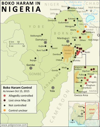
Map of Boko Haram/”Islamic State” Control in Nigeria: October 2015

(To see other maps in this series, view all Boko Haram updates on PolGeoNow.)

Detailed map of Boko Haram (Islamic State West Africa Province) territorial control in its war with Nigeria, marking each town reportedly under the group's control. Includes key recent locations, including Dikwa, Banki, the Sambisa Forest, and targeted areas on Lake Chad and the borders of Cameroon and Niger.
Map by Evan Centanni. All rights reserved.

(Subscribers click here to view this article in the member area) 

By Evan Centanni

The “Islamic State” in Nigeria
Northeastern Nigeria’s Boko Haram rebels, despite being pushed out of most of the territory they held last year, are still a major force in the region.

After becoming an official affiliate of Iraq and Syria’s so-called “Islamic State” (IS, a.k.a ISIS/ISIL) last March, they have now taken to calling themselves the Islamic State’s West Africa Province (ISWAP).

Status of Territorial Control
The goal of IS is to capture and hold territory, and Boko Haram still hangs on by a thread in that respect. Though the extent of their control has been blurry over the past six months (there is extremely little independent reporting from the region), military forces of Nigeria and neighboring countries have continued to announce the “recapture” of towns – an implicit acknowledgment that territory continues to be hotly contested.

Since this summer, the Nigerian government has stepped up aerial attacks against Boko Haram hideouts in the Sambisa Forest, but the result seems to have been a flood of fighters into nearby communities on border with Cameroon, while the forest remains an area of murky control.

Flag of NigeriaCountry Name:  
• Nigeria (English)*
Official Name:  
• Federal Republic of Nigeria (English)*
Capital: Abuja
*There are hundreds of local and regional languages in Nigeria, but only English has official status.

Chronology of Events
The following is a timeline of major events and changes to territorial control in northeastern Nigeria and neighboring countries since our previous update of May 28, 2015.

Note that Boko Haram launches deadly attacks on an almost daily basis across northeastern Nigeria, frequently on Cameroon’s side of the border, and occasionally in Niger and Chad as well. This timeline focuses on changes of territorial control, adding in selected items representing the biggest news and most significant cross-border incidents.

2015.06.14 Boko Haram fighters sacked the town of Babbangida, north of Yobe state capital Damataru.

2015.06.15 Boko Haram carried out a bombing with heavy casualties in N’Djamena, the capital city of Chad. An important Boko Haram leader would be captured in the city two weeks later.

2015.06.17-23 A deadly Boko Haram attack on Gueskérou, Niger was answered with a five-day long air and ground campaign by that country’s armed forces.

2015.07.01-02 Boko Haram killed almost 200 people in two days, in a wave of attacks across Borno state. As of last March, Boko Haram considers itself the West African branch of the Syria- and Iraq-based “Islamic State” (a.k.a. ISIS/ISIL). The July violence in Nigeria, targeted at non-extremist Muslims, coincided with an IS directive to increase attacks during the Muslim holy month of Ramadan.

2015.07.22 A village in the Hile-Alifa area of Cameroon was reportedly occupied by Boko Haram, two days after a brutal rebel attack on the nearby town of Kamouna.

2015.07.24 The Nigerian army said it recaptured Dikwa from Boko Haram, though the town had already been reported secured by Chadian forces in March.

2015.07.25 Boko Haram attacked the island of Médi Koura among the fragmented remains of Lake Chad, well within the borders of Chad itself. The attack would be followed by major military campaign and heavy fighting in nearby areas, as Chadian troops attempted to drive Boko Haram forces entirely out of the lake region.

2015.08.02 The Nigerian army said it rescued 178 prisoners from Boko Haram, most of them children and women. The 200 missing girls infamously kidnapped from Chibok in 2014 were not among them.

2015.08.21 An army source reported that troops had driven Boko Haram fighters out of Gudumbali.

2015.09.01 Nigerian government forces captured Gamboru-Ngala from Boko Haram. The twin towns had been secured by Chadian forces months earlier, but not protected from subsequent rebel incursions.

2015.09 In early September, Boko Haram fighters began attacking communities on the border with Cameroon after being flushed out of the Sambisa Forest by a heavy government bombing campaign. The attacks included the storming of a market in downtown Kirawa, a town known to have been under Boko Haram control in the past.

2015.09.19 A military spokesman said Nigerian troops had captured Jerre and Dipchari, on the road to Banki.

2015.09.20 A Nigerian newspaper reported that Boko Haram was operating a checkpoint on the road between Gwoza and Limankara, killing any travelers who did not have food to offer to the rebels.

Map of Boko Haram control in Nigeria in March 2015, and the multinational offensive with Cameroon, Chad, and Niger that drove the rebels back.
Multinational offensive against Boko Haram, Jan. to Mar. 2015

2015.09.22 Nigerian troops cleared Boko Haram fighters from camps in Jangurori and Bulatori, near Bama. In the process a high-level Boko Haram leader was captured.

2015.09.24 The Nigerian military said it seized Banki, on the border of Cameroon, with cooperation from the Cameroonian military. The next day, “at least 200” Boko Haram fighters allegedly surrendered to the government forces.

2015.09.23-25 Madagali, at the northern tip of Adamawa state, was reportedly abandoned by its population after three consecutive days of Boko Haram raids.

2015.10.07 The military claimed that over 100 Boko Haram fighters were killed in a failed attack on troops in Goniri, on the Borno-Yobe state line.

2014.10.08 An open letter from displaced residents to President Buhari said Boko Haram was in control of a number of villages east of Gwoza, including Ngoshe, Attagara, Kirawa, and Kughum.

2014.10.10 Dozens were killed in a Boko Haram attack on a fish market in Baga Sola, on Chad’s side of the border.

2015.10.14 The US announced it was sending 300 troops to Cameroon to assist in tracking down Boko Haram fighters.

Following this story? View all Boko Haram maps on PolGeoNow!

Timeline compiled with the help of the ACLED dataset (Raleigh, Clionadh, Andrew Linke, Håvard Hegre and Joakim Karlsen. 2010. Introducing ACLED-Armed Conflict Location and Event Data. Journal of Peace Research 47(5) 651-660.)

Graphic of the Nigerian flag is in the public domain (source).

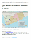
Yemen’s Civil War: Map of Control in September 2015 (Subscription)

There are newer versions of this map available. To see them, view all Yemen updates.

Map of territorial control in Yemen as of September 25, 2015, including territory held by the Houthi rebels and former president Saleh's forces, president-in-exile Hadi and his allies in the Saudi-led coalition and Southern Movement, and Al Qaeda in the Arabian Peninsula (AQAP). Includes recent areas of fighting, such as Aden, Ibb, Taiz, Bayda, Marib, Mukayras, and more.

Subscribe for full access to all conflict map reports!

Download PDF:
Buy now

Timeline by Djordje Djukic, with additional reporting by Evan Centanni; map by Louis Martin-Vézian and Evan Centanni

Forces loyal to Yemen’s exiled President Hadi, backed by troops from Saudi Arabia, the UAE, and now Qatar, have advanced rapidly against the Houthi rebels over the summer. However, with the offensive now losing momentum, battle lines are solidifying and groups such as Al Qaeda are moving to fill in the power vacuum left in the coalition’s wake.

See all this and more on the newest update to PolGeoNow’s Yemen territorial control map, which includes a timeline of changes and important events since our previous Yemen map report in August.

This map and report are exclusive premium content, available to paid subscribers or for individual purchase.
Download PDF (US$19.99)

Want to see before you buy? Check out our most recent FREE SAMPLE Yemen map report!

Exclusive map report includes:

  • Up-to-date map of current territorial control in Yemen, color-coded for the pro-Hadi coalition, Houthi/Saleh forces, and Al Qaeda in the Arabian Peninsula (AQAP).
  • Detailed indication of town-by-town control, including provincial boundaries, all major cities, and many smaller ones
  • Markers for key areas of recent fighting such as Marib, Aden, Ibb, Bayda, Mukayras, and more
  • Timeline of changes to the situation since mid-August, with links to sources

MEMBERS CLICK HERE TO PROCEED TO ARTICLE AND MAP

Not a member yet? Click here to learn more about our professional subscription service!

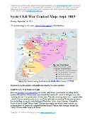
Syrian Civil War Control Map: September 2015 (Subscription)

There are newer versions of this map available. To see them, view all Syria updates.

Map of fighting and territorial control in Syria's Civil War (Free Syrian Army rebels, Kurdish YPG, Al-Nusra Front, Islamic State (ISIS/ISIL), and others), updated for September 2015. Highlights recent locations of conflict and territorial control changes, such as Abu Duhur airbase, Qadam district, Mansoura, Marea, and more.

Subscribe for full access to all conflict map reports!

Download PDF:
Buy now

Research by Djordje Djukic, with additional reporting by Evan Centanni

Anti-government rebels in Syria, including fighters from the Al Qaeda-affiliated Nusra Front, have further consolidated their control of Idlib province in the country’s northwest. Meanwhile, forces of the “Islamic State” are again occupying parts of the capital city, Damascus, even as they besiege several other locations in Syria.

See all this and more on the newest update to PolGeoNow’s concise, professional-quality Syrian Civil War control map, which includes a timeline of changes since our previous Syria map report last month.

This map and report are professional subscriber content, available to paid members or for separate purchase. Download PDF (US$19.99)

Want to see before you buy? Check out our most recent FREE SAMPLE Syria map!

Exclusive map report includes:

  • Up-to-date map of current territorial control in Syria, color-coded for the Assad government, rebel groups, “Islamic State” (ISIS/ISIL) extremists, and Kurdish YPG forces. Special symbol indicates rebel-held towns dominated by Al Qaeda affiliate Jabhat al-Nusra (the Nusra Front).
  • Detailed indication of city-by-city control, highlighting key towns and other locations important to current events.
  • Locations of recent fighting and military operations, including Abu Duhur airbase, Marea, Qadam district, Mansoura, and more.
  • Detailed timeline of important events and changes to territorial control since August 20, 2015, compiled by our Syria-Iraq expert, with links to sources.

MEMBERS CLICK HERE TO PROCEED TO ARTICLE AND MAP

Not a member yet? Click here to learn more about our professional subscription service!

War in Libya: Map of Control in August 2015

There are newer versions of this map available. To see them, view all Libya updates.

This is the first of a series of professional Libya control maps. Secure your access to future updates: sign up now for our conflict map subscription service!
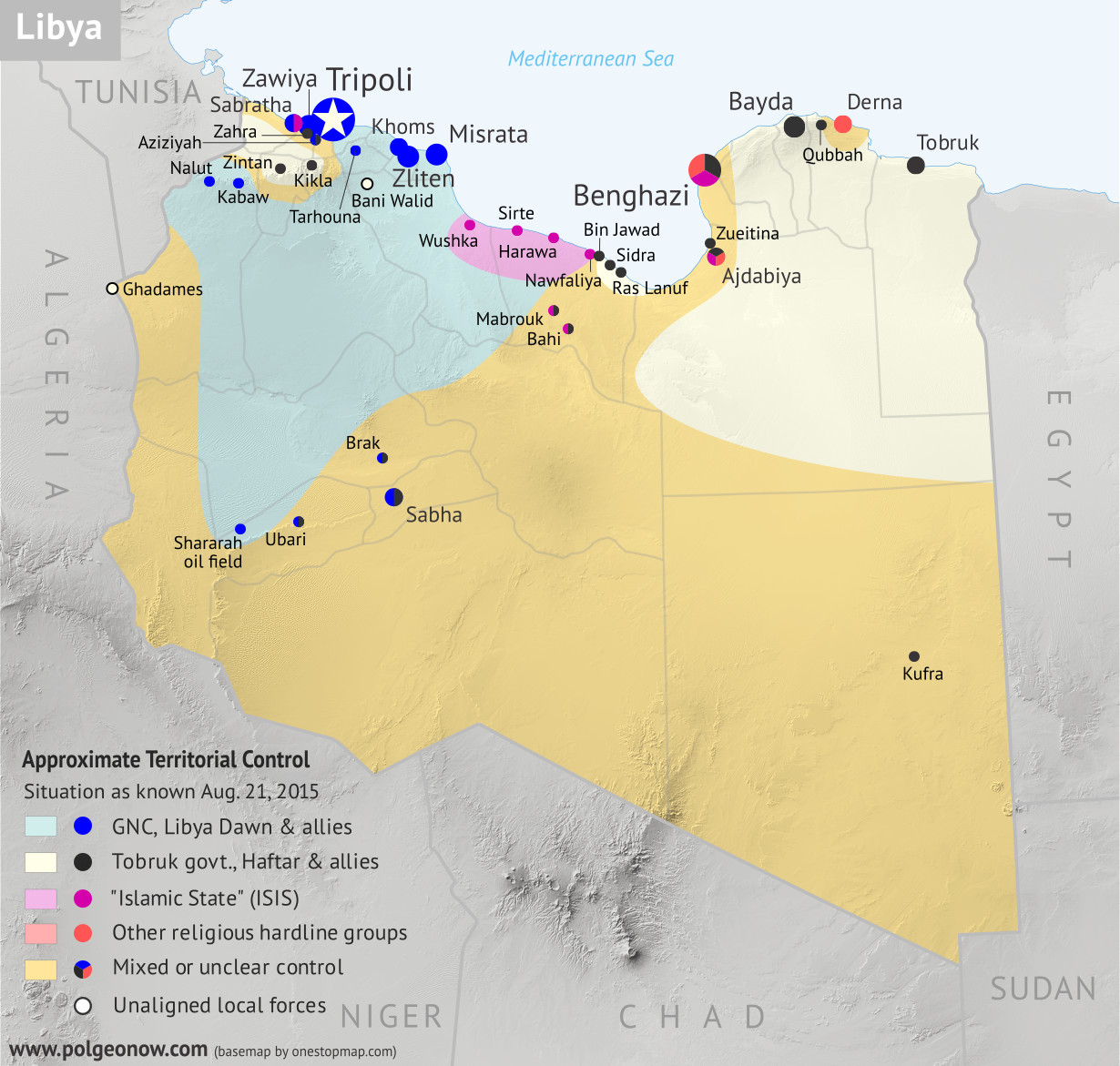
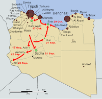
Libya control relief map: Shows detailed territorial control in Libya's civil war as of August 2015, including all major parties (Tobruk government, General Haftar's Operation Dignity forces, and Zintan militias; Tripoli GNC government, Libya Dawn, and Libya Shield Force; Shura Council of Benghazi Revolutionaries and other hardline Islamist groups; and the so-called Islamic State). Also file under: Map of Islamic State (ISIS) control in Libya.
Base map by Koen Adams of onestopmap.com, with territorial control by Evan Centanni. All rights reserved.

Subscribers click here to view this article in the ad-free members area. Not a member yet? Subscribe now! 

Background summary by Djordje Djukic; timeline by Evan Centanni and T.H.

Included in this free article:

  • Concise summary of events in Libya since the fall of Muammar Gaddafi in 2011
  • Detailed timeline of conflict, changes to territorial control, and political events since 2011, with each mentioned location illustrated on the map above

Map showing the final stage of Libya's first civil war (aka the Libyan Revolution) in 2011
The final stage of Libya’s first civil war

Historical Summary: From Revolution to Second Civil War
The Libyan Civil War started with opposition protests against the rule of Muammar Gaddafi, lasting from 15 February through 23 October 2011 and ending with the death of Gaddafi and the victory of pro-opposition forces.

Despite initial claims by opposition activist groups that 30,00050,000 people were killed, most of them civilians whose deaths were caused by Gaddafi’s forces, the estimates were afterwards reduced greatly. A later official estimate established that only 4,700 rebels and their supporters and a similar number of Gaddafi loyalists were killed. An additional 2,100 people were missing, and the number for civilian fatalities was not given, but was no longer claimed to be in the tens of thousands.

Following the end of the war, an interim government was formed in November 2011, and the first public elections took place in January of 2012. However, what followed was a country-wide breakdown of law and order as former rebel groups seized local power in individual places. Many of these groups refused to pledge allegiance to a unified military command, instead reporting to local military councils that became de facto local governments. The rival militias frequently clashed with each other over territory, while vigilante revenge killings and looting and robbery of the civilian population also took place. In addition, 7,000 people  accused of being Gaddafi supporters, mostly civilians (including women and children), remained imprisoned and were subjected to torture. A pro-Gaddafi armed group called the Green Resistance also sprung up conducting hit-and-run attacks against the former rebel groups.

Weapons proliferation also became an issue, with many former Gaddafi-era weapons stockpiles being plundered. This influx of weapons into private hands had effects ranging far beyond Libya’s borders, contributing to the strength of separatists who took over northern Mali in 2012, as well as the religious extremist fighters who soon usurped the separatist revolution. before being beaten back by a French intervention.

During this time, religious radicalism was on the rise in Libya, and on September 11, 2012, extremists attacked the US consulate in Benghazi, killing four Americans. Among the dead was the United States ambassador, Christopher Stevens, as well as two CIA agents.

On 23 December, 2013, the General National Congress (GNC), the legislative authority of Libya elected in July 2012, unilaterally extended its mandate by one year based on one interpretation of the 2011 Constitutional Declaration. Thus they refused to hold new elections that had been expected to happen in January 2014. Following this, public protests against the GNC took place, and General Khalif Haftar proclaimed the dissolution of the GNC. Discontent with the GNC stemmed from it allegedly being dominated by religious conservatives, suppression of inconvenient debates, imposition of gender segregation, and pushes for the introduction of Islamic law as the official basis for national law.

On the morning of 16 May, 2014, general Haftar’s forces attacked religious hard-line militias in and around Benghazi, ultimately sparking what some now call the Second Libyan Civil War. On 25 June, new legislative elections were held for the Council of Deputies (also known as the House of Representatives). Nationalists and liberals won the majority of the seats in the elections. However, a religious conservative block calling itself the new GNC, and made up of politicians who were on the loosing side of the elections, took advantage of support from a coalition of militias known as Libya Dawn to take control of Libya’s capital city of Tripoli. Subsesequently, the newly-elected Council of Deputies moved its seat of power to the eastern city of Tobruk and gained the backing of Haftar’s part of the Libyan National Army.

Over the following year, the GNC set up its power base in the western part of the country, controlling Tripoli, Misrata, Zliten and several other towns. The internationally-recognized Council of Deputies established itself in the east and south of the country, with its de facto capital in Tobruk and control over most of the country’s oil fields. Allied forces also controlled a string of towns in the mountains southwest of Tripoli. A force of Tuareg fighters reportedly allied with Libya Dawn took control of the southwestern sliver of Libya, while contesting the area’s largest town of Sabha with Tebu fighters aligned with the Tobruk government. Local forces took control of the former Gaddafi stronghold of Bani Walid, among unconfirmed allegations that the town’s new administration was made up of Gaddafi loyalists.

Map of the territorial control (Baghdad government, Islamic State/ISIS/ISIL, and Kurdistan peshmerga) in Iraq as of May 2015
Recent map of “Islamic State” control in Iraq, the organization’s home country

The Shura Council of Benghazi Revolutionaries, a coalition of radical religious militias, took control of the eastern Libyan town of Derna and continued contesting Benghazi with Haftar’s “Operation Dignity” forces. During this time, Libya also saw the entry of the so-called “Islamic State” (a.k.a ISIS), which also initially set itself up in Derna, but was pushed out by the Shura Council. It then took control of the north-central city of Sirte, Gaddafi’s hometown, and its surrounding area, after evicting GNC forces. Egypt and the United Arab Emirates conducted airstrikes on several occasions against both the GNC forces and IS fighters, in support of the Tobruk government, while Qatar and Turkey gave their support to the GNC.

Overall, between January 1, 2014, and July 21, 2015, one estimate said that 3,934 people had been killed in violence throughout the country. The multi-sided conflict continues today despite multiple attempts to strike a peace deal between the rival governments.

CHRONOLOGY OF EVENTS
The following is a detailed timeline of important events related to conflict, territorial control, and politics in Libya from 2011 to the present.

Part I: An Unstable Peace

2011.10.24 The former rebels of the National Transitional Council declared the Libyan Revolution complete, after defeating the forces of former national leader Muammar Gaddafi, receiving recognition from the UN as Libya’s legitimate government, and finally tracking down and killing Gaddafi himself. The civil war had lasted about eight months, resulted in thousands of deaths, and left the country in control of a patchwork of local militias.

2012.01.23-25 Local fighters took control of Bani Walid, once a Gaddafi stronghold, after a dispute with revolutionary government forces. A ceasefire deal recognized the local groups as the legitimate administration of the town.

2012.09.11 A pair of attacks in Benghazi , later attributed to the religious extremist group Ansar al-Sharia, killed the US ambassador and three other US personnel.

2012.10.24 Government forces and fighters from Misrata seized control of Bani Walid from local forces after a series of aggressions between rival militias from the two towns.

2013.06.08-15 Clashes erupted between pro-government forces and opposing groups in Benghazi.

2013.07-08  Government-appointed oil security chief Ibrahim Jathran went rogue, using his forces to seize control of the Ras Lanuf and Sidra oil export terminals while advocating for a decentralized government and eastern autonomy. At some point, the Zueitina oil terminal and Tobruk’s Hariga oil terminal also came under the control of Jathran’s rebels.

2013.10.10 Libya’s prime minister, Ali Zeidan, was briefly kidnapped, in what he afterwards called an attempted coup.

2013.10 By the end of October, Libya’s crucial oil industry had been brought nearly to a standstill, as a variety of opposition fighters and protesters from around the country blocked key infrastructure sites from operating.

2013.11.03 A collection of important officials unilaterally declared the formation of an autonomous government for eastern Libya, called Barqa in Arabic, or Cyrenaica by its traditional English name. The movement boasted the support of Ibrahim Jathran and his oil port blockade.

2013.11.21 Various militias, still operating in Tripoli since the revolution, agreed to leave the capital city and allow the government to assume control.

2014.01.18-29 During clashes in Sabha, fighters described as Gaddafi loyalists captured a military base before being driven out by government forces over a week later (ACLED).

2014.02.14 Major General Khalifa Haftar of the Libyan army declared the government “suspended” after the parliament’s religious conservative majority voted to make sharia the basis of national law, while also extending its own term another year. However, Haftar’s coup claim would be ignored by the government for the next several months. 
Flag of Libya (2011-present)Country Name:  
• Libya (English)
• Lībyā (Arabic)
Official Name:  
• State of Libya (English)
Dawlat Lībyā (Arabic) 
Capital: Tripoli (official); Tobruk (de facto HQ of UN-recognized government)

2014.03.11 Eastern separatists briefly took over the Sirte airport and a military base before government troops regained control (ACLED).

2014.03 Rebel leader Ibrahim Jathran attempted to sell a shipment of oil from one of the ports his Cyrenaican rebels controlled, only for the ship to be seized by US Navy forces near Cyprus and returned to the Libyan government. Meanwhile, the parliament ousted Prime Minister Ali Zeidan for failing to prevent the ship from leaving the rebel-held port, replacing him with Abdullah al-Thani.

2014.04.07 Jathran’s eastern rebels returned the Zueitina and Hariga (Tobruk) oil terminals to government hands as part of a political deal.

Part II: Return to War

2014.05.16-19 In what some describe as the beginning of Libya’s second civil war, rogue general Khalifa Haftar‘s “Libyan National Army” began what he called “Operation Dignity”, attacking several religiously conservative militias associated with the governing coalition in Tripoli. An attack in Benghazi was followed days later by the storming of the parliament in Tripoli. Meanwhile, a military base in the eastern city of Tobruk pledged its allegiance to Haftar’s army. In the following days, Haftar would gain the support of much of the military and about a third of the parliament.

2014.06.02 Renewed fighting broke out in Benghazi between Haftar’s forces and powerful religious militias nominally allied with the government in Tripoli. The struggle for control of the major eastern city would continue for over a year.

2014.06.03 Ahmed Maiteeq assumed the position of prime minister after a disputed parliamentary vote to oust al-Thani. Maiteeq was escorted into the office by the Libyan Central Shield, a religious conservative militia from Misrata, against the orders of al-Thani. Maiteeq would step down six days later after his election was ruled unconstitutional by Libya’s supreme court.

2014.06.25 In a UN-backed bid to de-escalate the political crisis, the parliament decided to call new elections, rather than follow through with its controversially extended term. Voter turnout was low, and the results would not be officially announced until nearly a month later.

2014.07.02 Ibrahim Jathran’s rebels returned the Ras Lanuf and Sidra oil terminals to the control of Prime Minister al-Thani’s government.

2014.07.13 With religious conservative candidates believed to have performed poorly in the June election, the Libyan Central Shield and an allied conservative militia launched “Operation Libya Dawn”, a battle for control of the Tripoli airport (held by the Haftar-alllied Zintan Brigades). The battle would continue for more than a month, while the conservative coalition would grow progressively larger, gain the support of the Muslim Brotherhood, and come to call itself “Libya Dawn” after the name of its inaugural mission.

2014.07.21 The results of the June election were announced, giving secular delegates a majority over the religiously-oriented coalition that had dominated the previous parliament.

2014.07.31 The Shura Council of Benghazi Revolutionaries, a new coalition of hardline religious militias including Ansar al-Sharia, the group linked to the 2012 US embassy attack, reportedly took control of most of Benghazi from Haftar’s forces. This came a day after Ansar al-Sharia declared Benghazi to be an “Islamic emirate” (a traditional word for a Muslim principality). The group was also said to control of the nearby town of Ajdabiya.

2014.08.04 The newly-elected parliament convened for the first time. Because of ongoing battles in Tripoli and Bengazi, the new government instead met in the far-eastern city of Tobruk, a stronghold of General Haftar. The new government would come to be permanently based out of Tobruk and nearby Bayda. The parliament would at one point be based aboard a rented ferry docked at Tobruk’s port, while the number of representatives in attendance would decline to just 115 out of 200 members by September.

2014.08.13 The new Libyan parliament voted to revoke official sponsorship from all regional militias, including both sides involved in the battle for the Tripoli airport.

2014.08.19-20 The western towns of Nalut and Kabaw, followed by Tarhouna, rejected the authority of the new eastern-based parliament, declaring their support for the Libya Dawn forces besieging Tripoli’s airport. Representatives from major western towns including Misrata, Khoms, and Zliten also expressed opposition to the new parliament.

2014.08.23 Despite enduring airstrikes of mysterious origin, Libya Dawn forces attained full control of the Tripoli airport, after more than a month of on-and-off fighting that virtually destroyed the facility. A day later, they reportedly controlled the entire city of Tripoli, where they called for the previous, conservative-dominated parliament, known as the General National Congress (GNC), to return to power.

2014.09.01 A week later, the GNC parliament had partially reconvened in Tripoli with the support of Libya Dawn, and appointed its own prime minister, Omar al-Hassi. Hassi would be a direct rival to Abdullah al-Thani, who had been once again chosen to lead by the new parliament in Tobruk. The Haftar-backed parliament in Tobruk remained the UN-recognized government of Libya, while the competing parliament in Tripoli would have the support of militias controlling much of the country.

Map of the territorial control (Assad government, Islamic State/ISIS/ISIL, rebel, and Kurdish) in the Syrian Civil War as of August 2015
Map of IS Control in Syria, Aug. 2015
(click for subscriber article and map).

2014.10.06 A hardline religious militia, in control of the eastern city of Derna, pledged allegiance to the “Islamic State” group of Iraq and Syria. An “Islamic emirate” had already been declared in the town the previous month.

2014.10.29 Pro-Tobruk forces claimed to be in control of most of Benghazi, after weeks of renewed heavy fighting (ACLED).

2014.11.05-07 Libya Dawn-backed Tuareg fighters, with help from Misrata, captured the Shararah oil field in southwestern Libya from pro-Tobruk militias (ACLED).

2014.11.22 Haftar-backed fighters from the Tebu ethnic group drove Libya Dawn out of southern Libya’s Ubari region (ACLED). However, fighting would flare up again the next year between pro-Tobruk Tebu fighters and pro-Tripoli Tuareg militias.

2014.11.23 Tobruk-aligned fighters from Zintan reportedly captured the western mountain town of Kikla after more than a month of battles against other regional militias associated with Libya Dawn (ACLED).

2014.12.13 Omar al-Hassi’s Tripoli-based government backed a new Libya Dawn operation to capture the Ras Lanuf and Sidra oil terminals from Ibrahim Jathran’s militias, now allied with the al-Thani government in Tobruk.

2014.12.08-10 Forces of General Haftar’s Libyan National Army (LNA) captured two towns west of Zawiya, but Libya Dawn soon pushed them back again (ACLED).

2014.12.19 A Libya Dawn-oriented Misratan militia seized Brak airbase (but not the rest of the town), located in southern Libya (ACLED).

Part III: The War in 2015

2015.01.07 The “Islamic State” organization (IS) based in Iraq and Syria officially established a branch in Libya, after one militia in Derna declared allegiance to IS in October (ACLED).

2015.01.10 UN-backed negotiations to be held in Geneva regarding the conflict in Libya were announced to include representatives from the Tripoli parliament and the allied Libya Dawn militias as well as General Haftar’s Operation Dignity forces.

2015.01.16 Libya Dawn (GNC) declared a ceasefire with Tobruk-aligned forces in the lead-up to peace talks in Geneva the following week.

2015.01.22 Forces allied with General Haftar and the Tobruk government seized the central bank in Benghazi.

2015.01.24 Ansar al-Sharia leader Mohamed al-Zahawi was killed in Benghazi clashes.

2015.01.27 IS-affiliated gunmen attacked the Corinthia Hotel in Tripoli; fighters loyal to the GNC Tripoli government fought back against the gunmen.

2015.02.04 An oil field in Mabrouk, one of Libya’s largest, was stormed by alleged IS militants.

2015.02.08 IS-aligned fighters claimed to have captured Nawfaliya, a town near Sidra oil terminal, in fighting with Libya Dawn forces. Over the next few months, control the town would apparently go back and forth between the two groups (ACLED).

2015.02.11 UN-backed peace talks were held in Ghadames, with the aim of forming a unified government between the General National Congress of Tripoli and the Tobruk-based House of Representatives.

2015.02.11-13 Fighters claiming to be IS members moved into the city of Sirte, seizing parts of the city without resistance (ACLED).

2015.02.20 IS-affiliated militants detonated car bombs in Qubbah, in what was believed to be retaliation to airstrikes by the Egyptian military on nearby IS-controlled Derna.

2015.03.02 The Tobruk parliament appointed General Haftar the official commander of the Libyan armed forces.

2015.03.03 The Mabrouk and Bahi oil fields were reported seized by religious extremist fighters, possibly from IS.

2015.03.06 Representatives from Tobruk and Tripoli met in Morocco for another round of UN-brokered peace talks, with additional sessions planned in Algeria and Belgium.

2015.03.11 It was reported that fighters from Haftar’s pro-Tobruk army had captured several towns just south and west of Tripoli (ACLED).

2015.03.24 Islamic State militants attacked government soldiers in Sirte and Benghazi, killing fighters loyal to both the Tripoli government and the internationally recognized government in Tobruk.

2015.03.27 Libya Dawn fighters loyal to the GNC government in Tripoli reportedly withdrew from positions near Ras Lanuf and Sidra oil ports, which they had been trying to capture from the Tobruk-aligned oil security forces. They initially claimed to still be in control of nearby Bin Jawad, but the Tobruk government was soon reported to have retaken the town after Libya Dawn fighters withdrew.

2015.04.01 Libya Dawn aircraft reportedly bombed an airport in Zintan.

2015.04.05 Pro-Tobruk forces claimed control of western town of Aziziyah, after two days of clashes with Libya Dawn militias (ACLED).

2015.04.12 Unidentified militants attacked South Korea’s embassy in Tripoli.

2015.04.13 IS-affiliated militants attacked the Moroccan embassy in Tripoli.

2015.04.18 Libya Dawn forces in two suburbs of Tripoli confronted General Haftar sympathizers there.

2015.04.22 Libya Dawn militias withdrew from the town of Zahra, near Tripoli, after clashes with Haftar’s LNA forces (ACLED).

2015.05.29 IS militants seized the airport in Sirte (Ghardabiya Airbase).

2014.05.31 IS fighters reportedly took control of Hawara town near Sirte after local leaders surrendered to a week-long siege (ACLED).

2015.06.09 IS fighters captured a power station in Sirte, virtually completing their control of the town (ACLED).

2015.06.09-11 The forces of IS were pushed out of Derna after a falling-out with other hardline religious militias.

2015.07.05 Hardline militia Ansar al Sharia captured a neighborhood in Benghazi from Haftar’s Tobruk-aligned Operation Dignity forces.

2015.07.12 IS fighters captured Wushka village in a push towards Libya Dawn-dominated Misrata (ACLED).

2015.07.27 A spokesperson for the Tobruk government claimed that “all the oil fields” in Libya were under the control of his government’s military. No specific information was given on the Mabrouk and Bahi fields, which were captured by likely IS fighters in March.

2015.07.31 Shura Council forces in Derna forced IS fighters out of an area just south of Derna.

2015.08.01 Fighting was reported between the Tobruk-loyal military and IS forces in Ajdabiya (ACLED).

2015.08.08-09 Shura Council religious hardliners from Derna – reportedly with air support from the Tobruk-based military – battled with IS fighters just south of the city (ACLED).

2015.08.13 Sudanese rebels groups from that country’s Darfur region were alleged to be fighting on the side of General Haftar in Kufra (ACLED).

2015.08.10-15 A local group in Sirte, cheered on by ultraconservative religious leaders, rose up against IS control of the city, leading to several days of fighting (ACLED).

2015.08.14-15 IS forces claimed to have captured an army post in Benghazi, but were repelled the next day by Haftar’s army (ACLED).

Following this story? View all Libya maps on PolGeoNow.

Graphic of Libyan flag is in the public domain (source).

Syrian Civil War Control Map: August 2015 (Subscription)

There are newer versions of this map available. To see them, view all Syria updates.

Map of fighting and territorial control in Syria's Civil War (Free Syrian Army rebels, Kurdish YPG, Al-Nusra Front, Islamic State (ISIS/ISIL), and others), updated for August 2015. Highlights recent locations of conflict and territorial control changes, such as Ayn Issa, Sarrin, Hasakah, Mansour, Frikka, Elbeyli, Qaryatain, and more.

Download PDF:
Buy now

(Subscribe via Paypal to view all premium content online)

Research by Djordje Djukic, with additional reporting by Evan Centanni

Since the end of June, the borders of the so-called “Islamic State” (IS) have changed significantly in Syria, with Kurdish advances from the north and IS pushes into the country’s west. Meanwhile, rebels continue to struggle with the Assad government for dominance over the country’s remaining territory.

See all this and more on the newest update to PolGeoNow’s professional Syrian Civil War control map, which includes a timeline of changes since our previous Syria map report at the end of June.

This map and report are professional subscriber content, available to paid members or for separate purchase. Download PDF (US$19.99)

Want to see before you buy? Check out our most recent FREE SAMPLE Syria map!

Exclusive map report includes:

  • Up-to-date map of current territorial control in Syria, color-coded for the Assad government, rebel groups, “Islamic State” (ISIS/ISIL) extremists, and Kurdish YPG forces. Special symbol indicates rebel-held towns dominated by Al Qaeda affiliate Jabhat al-Nusra (the Nusra Front).
  • Detailed indication of city-by-city control, highlighting key towns and other locations relevant to current events.
  • Locations of recent fighting and military operations, including Ayn Issa, Sarrin, Hasakah, Mansour, Frikka, Elbeyli, Qaryatain, and others
  • Detailed timeline of important events and changes to territorial control since June 29, 2015, compiled by our Syria-Iraq expert, with links to sources.

MEMBERS CLICK HERE TO PROCEED TO ARTICLE AND MAP

Not a member yet? Click here to learn more about our professional subscription service!

Yemen’s Civil War: Map of Control in August 2015 (Subscription)

There are newer versions of this map available. To see them, view all Yemen updates.

Map of territorial control in Yemen as of August 14, 2015, during Saudi Arabia's military intervention, including territory held by the Houthi rebels and former president Saleh's forces, president-in-exile Hadi and the Southern Movement, and Al Qaeda in the Arabian Peninsula (AQAP). Includes recent areas of fighting, such as Houta, Al-Anad Airbase, Dhale, Ibb, Ataq, and more.

Download PDF:
Buy now

(Subscribe via Paypal to view all premium content online)

Timeline by Djordje Djukic, with additional reporting by Evan Centanni; map by Louis Martin-Vézian and Evan Centanni

Yemen’s Houthi revolutionary government, despite support from Iran, is rapidly losing ground against the fighters aligned to President Hadi, and supporting forces from Saudi Arabia and the United Arab Emirates. 

A long list of towns have changed hands just within the last two weeks, and Al Qaeda is on the move as well. See all this and more on the newest update to PolGeoNow’s Yemen territorial control map, which includes a timeline of changes since our previous Yemen map report in July.

This map and report are exclusive premium content, available to paid subscribers or for individual purchase.
Download PDF (US$14.99)

Want to see before you buy? Check out our most recent FREE SAMPLE Yemen map report!

Exclusive map report includes:

  • Up-to-date map of current territorial control in Yemen, color-coded for the Hadi coalition, Houthi/Saleh forces, and Al Qaeda in the Arabian Peninsula (AQAP).
  • Detailed indication of town-by-town control, including provincial boundaries, all major cities, and many smaller ones
  • Markers for key areas of recent fighting such as Houta, Al-Anad Airbase, Utmah, Ibb, Rabat, Lawdar, Bayda, Ataq, and more
  • Timeline of changes to the situation since the end of July, with links to sources

MEMBERS CLICK HERE TO PROCEED TO ARTICLE AND MAP

NOT A MEMBER YET? SUBSCRIBE NOW!

Yemen’s Civil War: Map of Control in July 2015 (Subscription)

There are newer versions of this map available. To see them, view all Yemen updates.

Map of territorial control in Yemen as of July 29, 2015, during Saudi Arabia's military intervention, including territory held by the Houthi rebels and former president Saleh's forces, president-in-exile Hadi and the Southern Movement, and Al Qaeda in the Arabian Peninsula (AQAP). Includes recent areas of fighting, such as Aden, Sabr, Al-Anad Airbase, Wadiah crossing, Marib, and more.

Download PDF:
Buy now

(Subscribe via Paypal to view all premium content online)

Timeline by Djordje Djukic, with additional reporting by Evan Centanni; map by Louis Martin-Vézian and Evan Centanni

In the past month, Yemen’s Saudi-backed resistance forces have finally begun making inroads against the Houthis, capturing a major southern city while also extending their control to the northern border with Saudi Arabia.

See all this and more on the newest update to PolGeoNow’s Yemen territorial control map, which includes a timeline of changes since our previous Yemen map report in June.

This map and report are exclusive premium content, available to paid subscribers or for individual purchase.
Download PDF (US$14.99)

Want to see before you buy? Check out our most recent FREE SAMPLE Yemen map report!

Exclusive map report includes:

  • Up-to-date map of current territorial control in Yemen, color-coded for the Hadi government, Houthi/Saleh forces, and Al Qaeda in the Arabian Peninsula (AQAP).
  • Detailed indication of town-by-town control, including provincial boundaries, all major cities, and many smaller ones
  • Markers for key areas of recent fighting such as Aden, Al-Anad, Sabr, Marib, Wadiah border crossing, and more
  • Timeline of changes to the situation since July, compiled by our Yemen specialist, with links to sources

MEMBERS CLICK HERE TO PROCEED TO ARTICLE AND MAP

NOT A MEMBER YET? SUBSCRIBE NOW!