Syrian Civil War Map & Timeline: SDF Captures Raqqah – October 2017 (Subscription)

SUBSCRIBERS CLICK HERE TO PROCEED TO ARTICLE AND MAP

There are newer versions of this map available. To see them, view all Syria updates.
Research by Djordje Djukic. Map by onestopmap.com, Evan Centanni, and Djordje Djukic

Subscribe for full access to all conflict map reports!


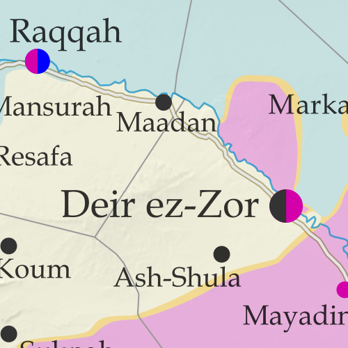
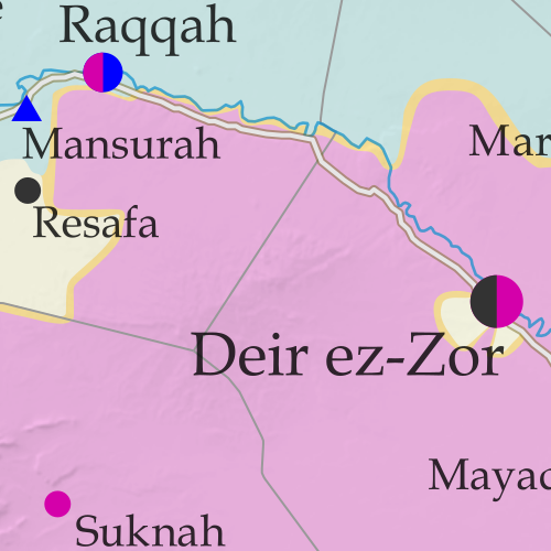
Map of Syrian Civil War (Syria control map): Fighting and territorial control in Syria in October 2017 (Free Syrian Army rebels, Kurdish YPG, Syrian Democratic Forces (SDF), Jabhat Fateh al-Sham / Hayat Tahrir al-Sham (Al-Nusra Front), Islamic State (ISIS/ISIL), and others). Includes Russia-Turkey-Iran agreed de-escalation zones and US deconfliction zone, plus recent locations of conflict and territorial control changes, such as Deir ez-Zor, Maadan, As Suwar, Aqerabat, and more. Colorblind accessible. In the past month, the so-called “Islamic State” (IS; formerly ISIS/ISIL) has lost its former capital city and other key sites to the US-backed Syrian Democratic Forces (SDF), even as government troops have advanced against it in Deir ez-Zor, Hama, and Homs provinces.

See all this and more on the latest update to PolGeoNow’s concise, professional Syrian Civil War control map, which includes a timeline of changes since our previous Syria map report in September, with sources cited.

This map and report are premium content, available to paid subscribers of the PolGeoNow Conflict Mapping Service.

Want to see before you subscribe? Check out our most recent FREE SAMPLE Syria map!

Exclusive map report includes:

  • Up-to-date illustration of current territorial control in Syria, color-coded for the Assad government, rebel groups, “Islamic State” (ISIS/ISIL) fighters, and Kurdish/SDF forces. Colorblind accessible.
  • Markers showing the approximate locations of Russian-Turkish-Iranian “de-escalation zones” and the one known US “deconfliction zone”.
  • Special symbols indicating towns dominated by rebels of the former Al Qaeda Nusra Front (now Hayat Tahrir al-Sham) and US-backed Syrian Democratic Forces (SDF).
  • Detailed indication of city-by-city control, including key towns and other locations important to current events.
  • Locations of recent fighting and other important events, including Raqqah, Deir ez-Zor, Mayadin (Mayadeen), As Suwar, the Al Omar oil field, and more.
  • Detailed timeline of important events and changes to territorial control since September 27, 2017, compiled by our Syria-Iraq expert, with links to sources.

SUBSCRIBERS CLICK HERE TO PROCEED TO ARTICLE AND MAP

Not signed up yet? Click here to learn more about our professional subscription service!

Can I purchase just this map?
This map and report are not available for automated purchase to non-subscribers. If you need access or republication rights for only this map report, contact service@polgeonow.com for options.

Iraq Control Map & Timeline: Government Takes Kirkuk from Kurdistan – October 2017

There are newer versions of this map available. To see them, view all Iraq updates.

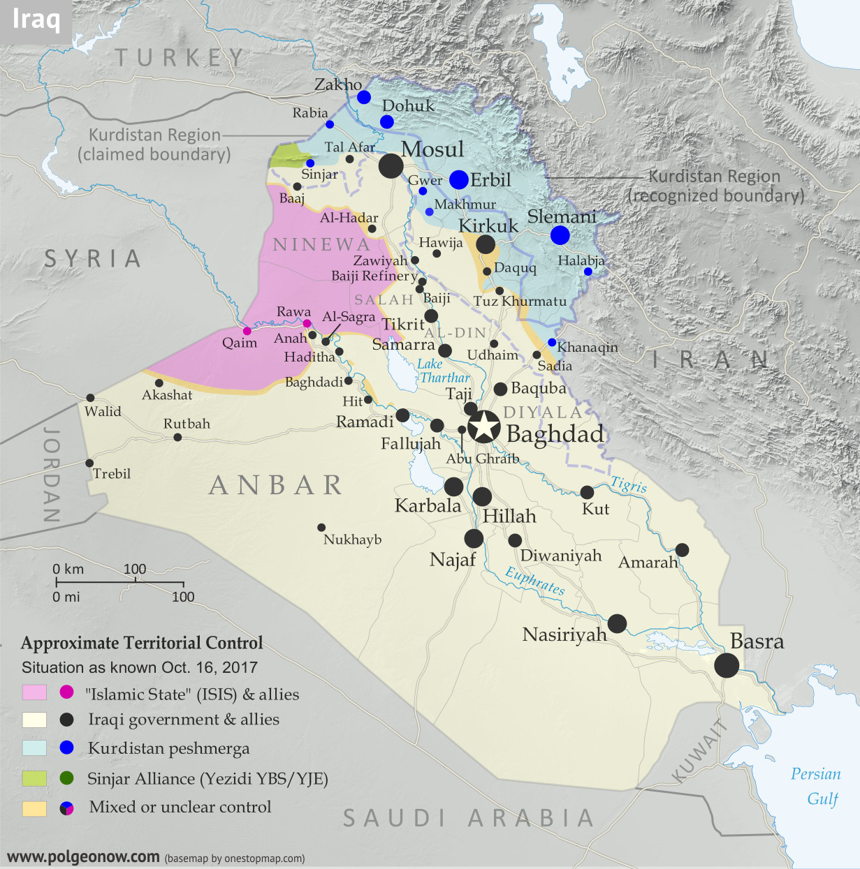
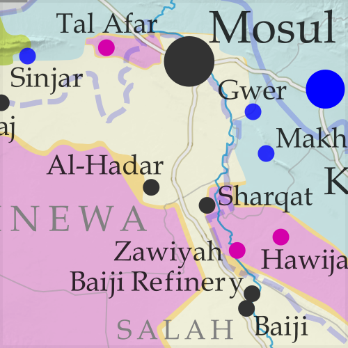
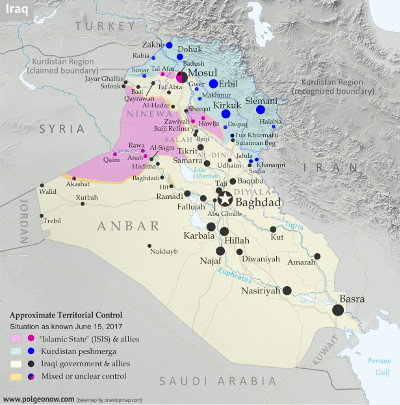
Detailed map of territorial control in Iraq as of October 16, 2017 after the recapture of Hawija and Tal Afar and government seizure of Kirkuk. including territory held by the so-called Islamic State (ISIS, ISIL), the Baghdad government, the Kurdistan Peshmerga, and the Yezidi Sinjar Alliance (YBS and YJE). Colorblind accessible.
Basemap by Koen Adams of onestopmap.com, with territorial control by Evan Centanni and Djordje Djukic. All rights reserved.

(Subscribers click here to view this article in the member area)

Timeline by Djordje Djukic

Summary of Events
Since our previous Iraq control map update in late July, there have been big changes to territorial control in Iraq, all involving expansions of control for the Iraqi military and its close allies (mainly police and Iran-backed militias): The so-called “Islamic State” (IS; formerly ISIS/ISIL) has been driven out of its Tal Afar and Hawija enclaves, and the disputed city of Kirkuk has been retaken from Kurdish forces in response to the controversial Kurdistan independence referendum. Iraqi government forces have also begun to chip away at the remaining swath of IS territory in the countryside of Anbar province, capturing the town of Anah on the road to the Syrian border.

In addition to the elimination of the fully-surrounded IS enclaves in Tal Afar and Hawija, the government recapture of those two areas also means that, for the first time since at least 2014, Iraqi Kurdistan doesn’t share any “borders” with IS territory.

See Also: Syrian Civil War Control Map – September 2017

Flag of IraqCountry Name:  
• Iraq (English, Kurdish)
• al-‘Irāq (Arabic)
Official Name:  
• Republic of Iraq (English)
• Jumhūriyyat al-‘Irāq (Arabic)
Komara Iraqê (Kurdish)
Capital: Baghdad

Timeline of Changes in Territorial Control
The following is an outline of territorial control changes and other major events since PolGeoNow’s previous Iraq map update of July 30, 2017. The abbreviation “IS” refers to the organization calling itself the “Islamic State”, also known as ISIS or ISIL. The Peshmerga are the military forces of self-governed Iraqi Kurdistan.

August 7, 2017
The pro-government Iraqi Shiite militia known as the Popular Mobilization Units (PMU) was attacked by IS close to the border with Syria in the Akashat area. Between 40 and 68 Shiite militiamen were killed in the attack. The militia accused the US-led coalition of hitting its positions with artillery bombardment from across the border. The coalition denied this.

August 15, 2017
The Iraqi military began conducting airstrikes against IS positions in the Tal Afar area, one of two remaining IS-controlled enclaves bordering Kurdistan Peshmerga territory, in preparation for a ground assault.

August 15-17, 2017
A Kurdish delegation to Baghdad refused to postpone Iraqi Kurdistan’s independence referendum, planned for September 25, as it met with Iraq’s Prime Minister and the embassies of the United States, Iran, and Turkey. The next day, the Turkish Foreign Minister and a presidential spokesman voiced strong opposition to the planned referendum, with the minister warning that the move could lead to civil war. On August 17, the Kurdish delegation said Kurdistan could delay the vote on independence “for a short time” if the Iraqi government, under an internationally-backed framework, promised to set another date for the referendum. Later, a senior Kurdish official said the region would consider the possibility of a postponement in return for financial and political concessions from the Iraqi government.

August 20-23, 2017
The Iraqi military launched a ground offensive against IS-held Tal Afar, capturing several villages east, southwest, and northwest of the town. Overall, 10 villages were reported seized by a combination of Iraqi Army, police, and PMU units on the first day of the offensive. On August 22, Iraqi forces breached Tal Afar’s city limits from the south and east, capturing three neighborhoods and more than 70 percent of a fourth one by the next day. By this time, government forces had also taken control of 15 villages around the town.

August 25, 2017
Iraqi forces reached Tal Afar’s city center.

August 27, 2017
Iraqi government troops captured Tal Afar, with IS fighters pushed out to a small town 11 kilometers northwest of the city, where they were making their last stand.

August 30-31, 2017
Fighting in the town near Tal Afar was reported to be “multiple times worse” than the battle for Mosul, as Iraqi forces faced fierce IS resistance in house-by-house fighting. The next day, the Iraqi Prime Minister declared victory over IS in Tal Afar and the whole of Ninewa (Nineveh) province, although pockets of IS resistance remained in the town. Overall, 115 Iraqi soldiers were killed and 679 wounded during the Tal Afar offensive, while Iraq claimed 2,000 IS fighters were killed. In contrast, the US reported only 1,000 to 1,200 IS fighters killed.

September 14, 2017
Some 84 people were killed and 93 wounded, including at least seven Iranian pilgrims, in a double IS attack on a restaurant and a security checkpoint near Nasiriyah in Iraq’s south. The three or four attackers, who were all also killed, were reportedly dressed as pro-government Shiite militiamen.

September 16, 2017

Control in Syria, late September 2017

The Iraqi military launched an operation against IS in the Akashat area, near the southern part of the Syrian border. Soon afterwards, the region was secured.

September 19-21, 2017
The Iraqi military launched an operation towards IS-held Anah in Anbar province. Two days later, security forces captured Anah.

September 21, 2017
The Iraqi Army attacked the Hawija pocket of IS territory, the last remaining IS enclave bordering Kurdish-held territory, capturing 11 villages.

September 23-24, 2017
Iraqi forces captured two more villages in the Hawija district, including Zawiyah. The next day, the first phase of the Hawija offensive was declared concluded.

September 25-27, 2017
Iraqi Kurdistan voted in a controversial referendum on independence from Iraq. The results were announced two days later, with 92.7% voting in favor of independence. Some 72% percent of the Kurdish region’s 8.4 million strong population voted. The region’s government did not immediately declare independence, promising instead to begin negotiations with Iraq’s central government in Baghdad.

In response to the vote, Baghdad threatened to close Kurdish airspace, while Turkey was considering shutting down its border with the region and imposing a trade ban. The Iraqi Prime Minister appeared to rule out military action, even though some Iraqi leaders warned of this, particularly in regards to Kirkuk, and Iraq’s parliament approved the use of force as part of a resolution condemning the referendum.

Kurdistan Referendum Coverage: For more information, check out PolGeoNow’s article on the results and consequences of the Kurdistan referendum, and follow us on Twitter for news on how the situation is continuing to play out.

September 29-October 3, 2017
Iraqi security forces launched the second phase of their offensive in the Hawija area, quickly capturing 70 square kilometers of territory west of Hawija town. By October 2, 45 villages were captured, and on the same day, Iraqi security forces seized another five villages and an airbase in a new assault. More areas were captured on October 3.

October 4-6, 2017
The final assault on Hawija was launched, with Iraqi security forces entering the town’s outskirts. The next day, Iraqi troops captured Hawija, though fighting continued in a pocket of IS territory north and east of the town. It was reported that over the previous three or four days, 1,000 IS fighters had surrendered in the area. On October 6, Iraqi security forces cleared the whole Hawija district of IS and linked up with nearby Kurdish Peshmerga forces after capturing the last 20 villages in the area.

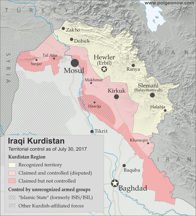
Map of Iraq and Kurdistan's place within it, published in advance of the 2017 Iraqi Kurdistan independence referendum. Includes disputed territories and territorial control as of July 30, 2017. Colorblind accessible.

October 13, 2017
Thousands of Kurdish Peshmerga troops were sent to reinforce the Kurdish-held city of Kirkuk, amid a standoff with Iraqi troops over Kurdistan’s controversial independence referendum. Kirkuk is a territory long disputed between the Kurdistan region and Iraq’s central government. Kurdistan took control of the city after it got cut off from from the rest of Iraq during the IS takeover of 2014.

The rise in tensions came after Iraqi forces took several positions near Kirkuk, including a base west of the city that had been abandoned by Kurdish fighters. An unnamed Iraqi general stated they were advancing to retake positions that were captured by the Kurds in June 2014. By nightfall, fears of an imminent battle for Kirkuk dissipated.

October 16, 2017
Iraqi government forces launched an operation to capture the province of Kirkuk and its capital from Kurdish Peshmerga forces. Government troops quickly captured several positions south of the city, including Kirkuk’s industrial district, two major oil fields and a military airbase near the city.

A Peshmerga spokesman claimed Iraqi troops “burnt houses and killed many” in an assault on the Daquq and Tuz Khurmatu areas south of the city. Two people were confirmed killed during the day in artillery shelling in Tuz Khurmatu. Later in the day, Iraqi security forces entered and seized Kirkuk city with little resistance after a surprise withdrawal by the Peshmerga. Tens of thousands of civilians also fled the city towards Kurdish-held areas.

Meanwhile, two Turkish soldiers were killed by an improvised explosive device elsewhere in northern Iraq. The Turkish military maintains a presence in western Peshmerga territory as part of efforts to combat IS, generally with the consent of Kurdistan’s government but against the will of Baghdad. Turkish forces also sometimes launch strikes on Kurdish rebels from Turkey who take shelter on the Iraqi side of the border.

Graphic of the Iraqi flag is in the public domain (source).

Syrian Civil War Map & Timeline: Siege of Deir ez-Zor Broken – September 2017 (Subscription)

SUBSCRIBERS CLICK HERE TO PROCEED TO ARTICLE AND MAP

There are newer versions of this map available. To see them, view all Syria updates.

Research by Djordje Djukic. Map by onestopmap.com, Evan Centanni, and Djordje Djukic

Subscribe for full access to all conflict map reports!


Map of Syrian Civil War (Syria control map): Fighting and territorial control in Syria in September 2017 (Free Syrian Army rebels, Kurdish YPG, Syrian Democratic Forces (SDF), Jabhat Fateh al-Sham / Hayat Tahrir al-Sham (Al-Nusra Front), Islamic State (ISIS/ISIL), and others). Includes Russia-Turkey-Iran agreed de-escalation zones and US deconfliction zone, plus recent locations of conflict and territorial control changes, such as Deir ez-Zor, Maadan, As Suwar, Aqerabat, and more. Colorblind accessible. In the past month, the territory of the so-called “Islamic State” (IS; formerly ISIS/ISIL) has continued to shrink rapidly, with the Russia-backed Assad government and the US-backed Syrian Democratic Forces (SDF) both rushing to secure Deir ez-Zor province in Syria’s east.

See all this and more on the latest update to PolGeoNow’s concise, professional Syrian Civil War control map, which includes a timeline of changes since our previous Syria map report in August, with sources cited.

This map and report are premium content, available to paid subscribers of the PolGeoNow Conflict Mapping Service.

Want to see before you subscribe? Check out our most recent FREE SAMPLE Syria map!

Exclusive map report includes:

  • Up-to-date illustration of current territorial control in Syria, color-coded for the Assad government, rebel groups, “Islamic State” (ISIS/ISIL) fighters, and Kurdish/SDF forces. Colorblind accessible.
  • Markers showing the approximate locations of Russian-Turkish-Iranian “de-escalation zones” and the one known US “deconfliction zone”.
  • Special symbols indicating towns dominated by rebels of the former Al Qaeda Nusra Front (now Hayat Tahrir al-Sham) and US-backed Syrian Democratic Forces (SDF).
  • Detailed indication of city-by-city control, including key towns and other locations important to current events.
  • Locations of recent fighting and other important events, including Deir ez-Zor, Maadan, As Suwar, Aqerabat, and more.
  • Detailed timeline of important events and changes to territorial control since August 28, 2017, compiled by our Syria-Iraq expert, with links to sources.

SUBSCRIBERS CLICK HERE TO PROCEED TO ARTICLE AND MAP

Not signed up yet? Click here to learn more about our professional subscription service!

Can I purchase just this map?
This map and report are not available for automated purchase to non-subscribers. If you need access or republication rights for only this map report, contact service@polgeonow.com for options.

Kurdistan Votes to Leave Iraq: What Happens Next?

This article is part of our Referendum 2017 coverage, spotlighting controversial independence votes in two of the world’s autonomous regions: Kurdistan voted yesterday on independence from Iraq, and Catalonia will vote this Sunday on leaving Spain. 

Map of Iraq and Kurdistan's place within it, published in advance of the 2017 Iraqi Kurdistan independence referendum. Includes disputed territories and territorial control as of July 30, 2017. Colorblind accessible.

Residents of Iraqi Kurdistan voted Monday in a controversial referendum on whether to declare independence from Iraq, with preliminary results showing almost 92% in favor of separation. We’re still waiting for (hopefully) detailed official results so we can map out how different districts voted. But in the meantime, let’s answer some of the big questions:

Will Kurdistan become independent now?

The Kurdistan region’s government considers this vote official and “binding”, in contrast to an informal 2005 referendum, even though the Iraqi federal government in Baghdad considers it completely illegal. But it was never intended to trigger an automatic declaration of independence.

Instead, Kurdistan leader Masoud Barzani has promised to use a “YES” vote as leverage to negotiate independence with Iraqi government. So far, no date has been set for Kurdistan’s declaration of independence, and it could still be years away.

What if Iraq never agrees to let Kurdistan be independent?

When asked in an interview this June, Barzani said “It’s too early to say that“. But he did rule out violent means, or any end to cooperation in fighting the so-called “Islamic State” (IS; formerly ISIS/ISIL). If Kurdistan’s government eventually feels it’s reached the end of the road in negotiations with the Baghdad, it could choose to declare independence unilaterally – that is, without anyone else’s approval. But the international community rarely rewards that kind of independence declaration, and at best Kurdistan would become the next Kosovo, recognized by half the world but rejected by the other, and blocked from membership in major organizations like the UN. 

Which countries would recognize Kurdistan’s independence?

If Kurdistan successfully reaches an agreement with Baghdad before declaring independence, like South Sudan did in 2011, it will probably be recognized by almost all the world’s countries. But if it declares independence unilaterally, its prospects aren’t so good. 

Flag of Iraqi Kurdistan Unofficial Name:
• Iraqi Kurdistan (English) 
• Başûrî Kurdistan (Sorani Kurdish)
Başûrê Kurdistanê (Kurmanji Kurdish)
Kurdistān al-‘Irāq (Arabic)
Full Official Name:  
• Kurdistan Region (English)
• Herêmî Kurdistan (Sorani Kurdish)
Herêma Kurdistanê (Kurmanji Kurdish
• Iqlīm Kurdistān (Arabic)
Capital: Erbil (Hewlêr)
Status: Federal Region of Iraq

The Iraqi government and neighboring countries Iran, Turkey, and Syria all strongly opposed Kurdistan even having this referendum, and would be even more livid at an outright declaration of independence. Major world powers have been more lukewarm: The US and Germany opposed the timing of the referendum, but might be sympathetic to eventual independence, while Russia and France have declined to take sides at all.

There is one country that gave its full support to the referendum, and would be most likely to recognize an independent Kurdistan: Israel. As a country that also sees itself as the best hope for protecting a persecuted ethnic group, Israel has a lot in common with Kurdistan. Because of that, Israeli leaders would be happy to have an ally in the region who’s not friendly with Iran and doesn’t share brotherly relations with the Arab Middle Eastern countries (Kurdistan’s people are mostly Muslim, but not Arab).

But isn’t Kurdistan a great candidate for independence?

Iraqi Kurdistan is often held up as an example of an aspiring country that would actually be more stable and democratic than the existing countries in the Middle East. And that may be true: Iraqi Kurdistan has been a lot more stable lately than Iraq, Syria, or Yemen, and it’s probably more democratic than most of the countries surrounding it. But it’s not that simple: the Kurdistan Regional Government has its fair share of problems too, dominated by one political party built around a family dynasty, led by a president whose term expired two years ago, and often accused of corruption. 

Meanwhile, many outside observers worry that Kurdish independence would destabilize the region, leading to violence as neighboring countries oppose the change and Kurdish minorities in those countries become emboldened. On the other hand, many feel that the Kurds, long persecuted by other countries’ governments, deserve a country of their own regardless of the risks. And scary predictions about the future often don’t come to pass.

PolGeoNow neither supports nor opposes Kurdistan’s independence. As always, we’re just here to report what happens.

Still, the people of Kurdistan really do want independence, right?

Detailed map of territorial control in Iraq as of July 30, 2017 after the end of the Battle of Mosul, including territory held by the so-called Islamic State (ISIS, ISIL), the Baghdad government, the Kurdistan Peshmerga, and the Yezidi Sinjar Alliance (YBS and YJE). Colorblind accessible.
Full map of territorial control in Iraq (July 30, 2017)

Though 92% is surprisingly high (a poll last month found 25% planning to vote “NO”), it seems that most Kurds in Iraq do want an independent country. Although the second-largest party in Kurdistan’s parliament opposed the timing of the referendum, it supports independence in principle and decided not to the boycott the vote. 

Of course, not everyone in Kurdistan is a Kurd. The region is also home to many Turkmen, Arab, and Assyrian people (these are language-based cultural groupings; in terms of religion, Kurds, Arabs, and Turkmens are all mostly Sunni Muslims, with some Shiites and local minority religious groups, while Assyrians are mostly Christians). 

Many Arabs, who form the majority in Iraq as a whole, opposed the vote, especially in disputed territories like Kirkuk. But others supported it, having more faith in the Kurdistan government than Iraq’s. Turkmens and Assyrians were similarly split, with minority political parties representing them coming down on both sides of the debate.

Stay tuned to PolGeoNow and the PolGeoNow Twitter feed for more updates on Kurdistan, plus Catalonia’s upcoming referendum on independence from Spain! Click here to view all Referendum 2017 articles.

Graphic of the Kurdistan flag is in the public domain (source).

Referendum 2017: Iraqi Kurdistan Map

Two of the world’s autonomous regions are about to vote in controversial independence referendums. Iraqi Kurdistan decides on independence from Iraq this Monday, and on October 1 Catalonia plans to vote on leaving Spain. PolGeoNow will be covering these events with a series of articles, but in the meantime we couldn’t wait to share our new Iraqi Kurdistan map with you!

Map of Iraq and Kurdistan's place within it, published in advance of the 2017 Iraqi Kurdistan independence referendum. Includes disputed territories and territorial control as of July 30, 2017. Colorblind accessible.
Graphic by Evan Centanni and Djordje Djukic, incorporating base map by Koen Adams of onestopmap.com. All rights reserved.

Iraqi Kurdistan Independence Referendum

The Kurdistan Region of Iraq (Iraqi Kurdistan for short) is just part of the traditional homeland of the Kurds, the Middle East’s fourth-largest ethnic group after Arabs, Persians, and Turks.

Many Kurds also live in Turkey, Syria, and Iran. But Iraqi Kurdistan is where they have the most legal rights, governing themselves in what’s internationally recognized as an autonomous region within Iraq.

But all’s not well in Kurdistan-Iraq relations. Iraqi Kurds suffered through horrific violence and persecution in the 1980s and 90s, and now the region’s top politician has staked his reputation on separating Kurdistan from Iraq permanently.

Despite angry objections from Iraq’s federal government in Baghdad, as well as from neighboring countries Iran, Turkey, and Syria, the Kurdistan Regional Government (KRG) is going through with an independence vote this Monday, September 25. A “yes” vote in the referendum – which is almost guaranteed – doesn’t mean Kurdistan will immediately declare independence. But it will be seen as a serious step toward the region separating itself from Iraq once and for all.

Making matters more tense, the referendum is happening even in areas that Iraq’s federal government doesn’t consider part of the autonomous region at all –  Kurdistan has claimed these territories for years, and its military took over some of them after being cut off from the rest of Iraq by the so-called “Islamic State” (ISIS/ISIL) in 2014. But there’s not much Baghdad can do about it. The past three years have proven Kurdistan’s military to more effective than Iraq’s own, and after being left to fend for itself so long, the region is practically independent already.

Stay tuned to PolGeoNow for continuing coverage of both the Kurdistan and Catalonia referendums, and don’t forget to follow us on Twitter for more updates as events unfold!

Syrian Civil War Map & Timeline – August 2017 (Subscription)

SUBSCRIBERS CLICK HERE TO PROCEED TO ARTICLE AND MAP

There are newer versions of this map available. To see them, view all Syria updates.

Research by Djordje Djukic. Map by onestopmap.com, Evan Centanni, and Djordje Djukic

Subscribe for full access to all conflict map reports!


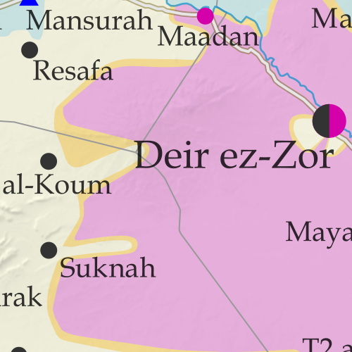
Map of Syrian Civil War (Syria control map): Fighting and territorial control in Syria in August 2017 (Free Syrian Army rebels, Kurdish YPG, Syrian Democratic Forces (SDF), Jabhat Fateh al-Sham / Hayat Tahrir al-Sham (Al-Nusra Front), Islamic State (ISIS/ISIL), and others). Includes Russia-Turkey-Iran agreed de-escalation zones and US deconfliction zone, plus recent locations of conflict and territorial control changes, such as Raqqah, Maadan, Suknah, al-Koum, and more. Colorblind accessible.In the past month, the so-called “Islamic State” (ISIS/ISIL) has lost vast swaths of territory in the center of Syria to government forces, leaving the western end of its main territory completely surrounded. Meanwhile, Syrian and Lebanese forces have cleared out ISIS and hardline rebel forces who controlled areas along both sides of the border with Lebanon.

See all this and more on the latest update to PolGeoNow’s concise, professional Syrian Civil War control map, which includes a timeline of changes since our previous Syria map report in July, with sources cited.

This map and report are premium content, available to paid subscribers of the PolGeoNow Conflict Mapping Service.

Want to see before you subscribe? Check out our most recent FREE SAMPLE Syria map!

Exclusive map report includes:

  • Up-to-date illustration of current territorial control in Syria, color-coded for the Assad government, rebel groups, “Islamic State” (ISIS/ISIL) fighters, and Kurdish/SDF forces. Colorblind accessible.
  • Markers showing the approximate locations of Russian-Turkish-Iranian “de-escalation zones” and the one known US “deconfliction zone”.
  • Special symbols indicating towns dominated by rebels of the former Nusra Front (now Hayat Tahrir al-Sham) and US-backed Syrian Democratic Forces (SDF).
  • Detailed indication of city-by-city control, including key towns and other locations important to current events.
  • Locations of recent fighting and other important events, including Raqqah, Maadan, Suknah, al-Koum, and more.
  • Detailed timeline of important events and changes to territorial control since July 21, 2017, compiled by our Syria-Iraq expert, with links to sources.

SUBSCRIBERS CLICK HERE TO PROCEED TO ARTICLE AND MAP

Not signed up yet? Click here to learn more about our professional subscription service!

Can I purchase just this map?
This map and report are not available for automated purchase to non-subscribers. If you need access or republication rights for only this map report, contact service@polgeonow.com for options.

Yemen Control Map & Report: August 2017 (Subscription)

SUBSCRIBERS CLICK HERE TO PROCEED TO ARTICLE AND MAP

Map of what is happening in Yemen as of May 21, 2017, including territorial control for the unrecognized Houthi government and former president Saleh's forces, president-in-exile Hadi and his allies in the Saudi-led coalition and Southern Movement, Al Qaeda in the Arabian Peninsula (AQAP), and the so-called Islamic State (ISIS/ISIL). Includes recent locations of fighting, including Azzan, Habban, Maydee, Nihm, and more.

Subscribe for full access to all conflict map reports!

Timeline by Djordje Djukic. Map by Louis Martin-Vézian, Evan Centanni, and Djordje Djukic.

In the past three months, fighting in Yemen has continued, with small changes of territorial control along the front lines between Yemen’s two rival governments. Meanwhile, a US-assisted campaign against Al Qaeda in the Arabian Peninsula (AQAP) has removed some of the group’s last remaining towns from its control.


See all this and more on the newest update to PolGeoNow’s Yemen territorial control map, which includes a timeline of changes and important events since our previous Yemen map report in late February.

This map and report are premium professional content, available to paid subscribers of the PolGeoNow Conflict Mapping Service.

Want to see before you buy? Check out our most recent FREE SAMPLE Yemen map report!

Exclusive report includes:

  • Up-to-date map of current territorial control in Yemen, color-coded for the pro-Hadi coalition, Houthi/Saleh forces, Al Qaeda in the Arabian Peninsula (AQAP), and the so-called “Islamic State” (ISIS/ISIL).
  • Detailed indication of town-by-town control, including provincial boundaries, all major cities, and many smaller ones
  • Markers for recent areas of fighting, including Azzan, Habban, Maydee, Nihm, and more
  • Timeline of changes to the situation since May 18, 2017, with links to sources

SUBSCRIBERS CLICK HERE TO PROCEED TO ARTICLE AND MAP

Not a member yet? Click here to learn more about our professional subscription service!

Can I purchase just this map?
This map and report are not available for automated purchase to non-subscribers. If you need access or republication rights for only this map report, contact service@polgeonow.com for options.

Iraq Control Map & Timeline: “Islamic State” Loses Mosul – July 2017 (Subscription)

SUBSCRIBERS CLICK HERE TO PROCEED TO ARTICLE AND MAP

There are newer versions of this map available. To see them, view all Iraq updates.

Research by Djordje Djukic. Map by onestopmap.com, Evan Centanni, and Djordje Djukic

Subscribe for full access to all conflict map reports!


Detailed map of territorial control in Iraq as of July 30, 2017 after the end of the Battle of Mosul, including territory held by the so-called Islamic State (ISIS, ISIL), the Baghdad government, the Kurdistan Peshmerga, and the Yezidi Sinjar Alliance (YBS and YJE). Colorblind accessible.
In the past month, Iraqi government forces and allies have completed their recapture of Mosul, the third biggest city in Iraq and the largest urban center ever controlled by the so-called “Islamic State” (IS; formerly ISIS/ISIL) in any country.

See all this and more on the latest update to PolGeoNow’s concise, professional map of control in Iraq’s civil war, including a timeline of changes since our previous Iraq map report of June 2017.

This map and report are premium professional content, available to paid subscribers of the PolGeoNow Conflict Mapping Service.

Want to see before you subscribe? Check out our most recent FREE SAMPLE Iraq map report!

Exclusive report includes:

  • Up-to-date map of current territorial control in Iraq, color-coded for the Iraqi government, “Islamic State” (ISIS/ISIL) fighters, and Kurdistan’s Peshmerga forces. Colorblind accessible.
  • New: Separate color for Yezidi militias of the “Sinjar Alliance”, who control their own territory near the Syrian border.
  • Detailed indication of town-by-town control, including all major cities and many smaller ones, as well as terrain, major roads, and provincial boundaries
  • Timeline of changes to the situation since mid-June, compiled by our Iraq-Syria specialist, with links to sources

SUBSCRIBERS CLICK HERE TO PROCEED TO ARTICLE AND MAP

Not signed up yet? Click here to learn more about our professional subscription service!

Can I purchase just this map?
This map and report are not available for automated purchase to non-subscribers. If you need access or republication rights for only this map report, contact service@polgeonow.com for options.

Syrian Civil War Map & Timeline: “Islamic State” Capital Surrounded – July 2017 (Subscription)

SUBSCRIBERS CLICK HERE TO PROCEED TO ARTICLE AND MAP

There are newer versions of this map available. To see them, view all Syria updates.

Research by Djordje Djukic. Map by onestopmap.com, Evan Centanni, and Djordje Djukic

Subscribe for full access to all conflict map reports!


Map of Syrian Civil War (Syria control map): Fighting and territorial control in Syria in July 2017 (Free Syrian Army rebels, Kurdish YPG, Syrian Democratic Forces (SDF), Jabhat Fateh al-Sham / Hayat Tahrir al-Sham (Al-Nusra Front), Islamic State (ISIS/ISIL), and others). Includes Russia-Turkey-Iran agreed de-escalation zones and US deconfliction zone, plus recent locations of conflict and territorial control changes, such as Raqqah, Resafa, Ithriya, al-Hamima, Qasr, and more. Colorblind accessible.In the past month, the so-called “Islamic State” (ISIS/ISIL) has continued losing ground, with its capital city of Raqqah now completely surrounded by US-backed fighters. Meanwhile, southern Syria has seen rebel defeats at the hands of government forces, but also a ceasefire backed by both the US and Russia.

See all this and more on the latest update to PolGeoNow’s concise, professional Syrian Civil War control map, which includes a timeline of changes since our previous Syria map report in June, with sources cited.

This map and report are premium content, available to paid subscribers of the PolGeoNow Conflict Mapping Service.

Want to see before you subscribe? Check out our most recent FREE SAMPLE Syria map!

Exclusive map report includes:

  • Up-to-date illustration of current territorial control in Syria, color-coded for the Assad government, rebel groups, “Islamic State” (ISIS/ISIL) fighters, and Kurdish/SDF forces. Colorblind accessible.
  • Markers showing the approximate locations of Russian-Turkish-Iranian “de-escalation zones” and the one known US “deconfliction zone”.
  • Special symbols indicating towns dominated by rebels of the former Nusra Front (now Hayat Tahrir al-Sham) and US-backed Syrian Democratic Forces (SDF).
  • Detailed indication of city-by-city control, including key towns and other locations important to current events.
  • Locations of recent fighting and other important events, including Raqqah, Resafa, Ithriya, al-Hamima, Qasr, and more.
  • Detailed timeline of important events and changes to territorial control since June 21, 2017, compiled by our Syria-Iraq expert, with links to sources.

SUBSCRIBERS CLICK HERE TO PROCEED TO ARTICLE AND MAP

Not signed up yet? Click here to learn more about our professional subscription service!

Can I purchase just this map?
This map and report are not available for automated purchase to non-subscribers. If you need access or republication rights for only this map report, contact service@polgeonow.com for options.

Syrian Civil War Map & Timeline: Kurds Enter “Islamic State” Capital – June 2017

There are newer versions of this map available. To see them, view all Syria updates.

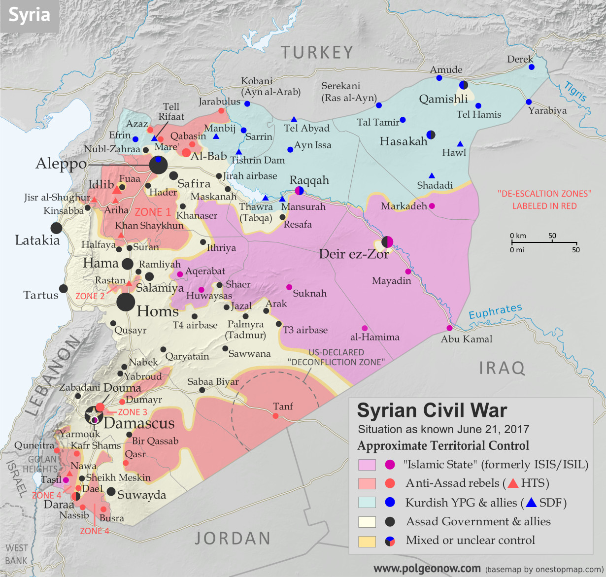
Map of Syrian Civil War (Syria control map): Fighting and territorial control in Syria in June 2017 (Free Syrian Army rebels, Kurdish YPG, Syrian Democratic Forces (SDF), Jabhat Fateh al-Sham / Hayat Tahrir al-Sham (Al-Nusra Front), Islamic State (ISIS/ISIL), and others). Includes Russia-Turkey-Iran agreed de-escalation zones and US deconfliction zone. Includes recent locations of conflict and territorial control changes, such as Raqqah, Maskanah, Arak, Tanf, Sabaa Biyar, Bir Qassab, and more. Colorblind accessible.
Base map by Koen Adams of onestopmap.com, with territorial control by Evan Centanni and Djordje Djukic.
All rights reserved.

(Subscribers click here to view this article in the member area.)

Timeline by Djordje Djukic

Syria: Where Things Stand Now

In the four weeks since our previous Syrian Civil War map report, the US-backed, Kurdish-led Syrian Democratic Forces (SDF) have advanced all the way into Raqqah, capital city of the so-called “Islamic State” (IS; formerly ISIS/ISIL). Meanwhile, Syrian government forces have also been pushing hard against IS, nearing Raqqah themselves, while making even more major advances in the southern desert. Clashes between rebels and government forces have also continued across Syria’s south, even as the US enforces a rebel safe zone around its base in Tanf.

Political geography milestones in the last month include the Syrian government’s reestablishment of a border with Iraq (entirely controled IS, Kurdish forces, and rebels since 2015); Syrian rebels’ loss of their last border with IS, near Tanf; and the first time in a year that the government has controlled any of Raqqah province.

Flag of Syria under the current governmentCountry Name:  
• Syria (English)
• Sūriyya/Sūryā (Arabic)
Official Name:  
• Syrian Arab Republic (English)
• al-Jumhūriyyah al-‘Arabīyah  as-Sūriyyah (Arabic)
Capital: Damascus

Note: Red triangles on the map represent towns where rebel group Hayat Tahrir al-Sham (HTS) – formerly known as Al Qaeda affiliate Jabhat al-Nusra (a.k.a. the Nusra Front), and later Jabhat Fateh al-Sham (JFS) – is thought to be in a dominant position among rebel forces, even if it doesn’t exercise exclusive control. This organization has some presence in almost every rebel-held area in Syria.

Timeline of Events
The following is a timeline of changes to territorial control and other key events in Syria since our previous map update of May 25, 2017. Sources are provided as in-line links.

May 26, 2017
The Syrian Army seized a village three kilometers west of IS-held Maskanah, between Aleppo and Raqqah.

May 27, 2017
Government forces captured 13 villages along the eastern bank of a lake in Aleppo province, coming within 1.5 kilometers of the western entrance to Maskanah. Meanwhile, the army captured a town south of Sawwana, in the southern desert.

May 28, 2017
The army captured a village on Maskanah’s northern flank.

May 29, 2017
The last batch of rebels and family members left the Barzeh neighborhood of Damascus, leaving it entirely under government control.

May 30, 2017
The army advanced against US-backed rebels southeast of Sawwana.

May 30-31, 2017
The Kurdish-led, US-backed Syrian Democratic Forces (SDF) advanced to within three kilometers of IS capital Raqqah, reaching the city’s northern entrance. The next day, the SDF besieged the town of Mansurah and one more village between Thawra and Raqqah, after capturing several nearby villages.

May 31, 2017
Rebels broke through pro-government militias’ first line of defense near a government-held junction in the Sabaa Biyar area (west of Tanf in the southern desert). However, the rebel advance on the junction was subsequently halted by Russian airstrikes. Meanwhile, the army launched an offensive towards IS-held Aqerabat east of Hama, reportedly capturing several villages.

June 2, 2017
The SDF launched an assault on the besieged IS-held town of Mansurah, just west of Raqqah, capturing it later in the day.

June 2-4, 2017
The Syrian Army seized over a dozen villages south and southwest of Maskanah, cutting off IS’s main supply route between Maskanah and Raqqah. The next day, Maskanah was surrounded, and on June 4 it was captured by government troops. The army also secured its own main supply route to and from Khanaser. These advances brought the army to Raqqah’s provincial border.

June 3, 2017

The army made advances against rebels north of Hama. This was followed by a rebel counterattack attempting to regain control of the lost positions. The army also made a push towards IS-held Arak and Suknah, in the southern desert near Palmyra, capturing several hilltops along the highway.

June 3-4, 2017
Government forces hit rebel-held parts of Daraa city with air and artillery strikes following a rebel attack on government positions in the city’s Manshiyah district. At least 31 fighters on both sides were killed in the fighting, with the fatalities divided nearly evenly between the two sides. Meanwhile, IS made advances against government forces near the eastern city of Deir ez-Zor, capturing a roundabout south of the city. Fighting continued for control of two hilltops near the southern city’s entrance.

June 4-5, 2017
The SDF seized a dam near Raqqah. The next day, it proceeded to capture six villages north and northwest of the city, tightening the siege of the IS capital. In all, over the previous week, the SDF had taken control of about 350 square kilometers from IS.

June 5-6, 2017
Government forces reportedly seized several positions east of Salamiya.

June 6, 2017
The US-led coalition conducted airstrikes against a force of 60 pro-government fighters who entered the US-declared “deconfliction zone” centered on the rebel-held town of Tanf, near the Iraqi and Jordanian borders. Two self-propelled howitzers and a self-propelled anti-aircraft gun were destroyed, while a tank was damaged. Pro-government sources reported two soldiers were killed, while other reports said between 10 and 32 government troops died in the attack. Despite the strikes, the pro-government forces remained in place within the zone.

Meanwhile, government forces took control of a hill in the eastern countryside of Damascus, near Dumayr. Elsewhere, government troops captured six villages on the provincial border of Aleppo and Raqqah while attempting to link up with the SDF near Thawra. Two of the villages were on Raqqah’s side of the boundary, marking the first time in a year that the Syrian Army had entered the province.

June 6-17, 2017
The SDF started its assault on the IS capital city of Raqqah. The US-backed forces attacked the al-Mashlab district on the city’s eastern edge, as well as a military base around one kilometer north of the city center. The next day, the SDF captured a village and the ruins of a more than 1,000-year-old fortress west of Raqqah, reaching the city’s western outskirts.

By June 13, the military base and four neighborhoods were captured by the SDF, including al-Mashlab, Romaniah, al-Sinaa and Hattin. Additionally, the SDF seized parts of the western Jazrah suburb and all or at least half of the western al-Sabahia district. In the first eleven days of the battle, 117 civilians were killed in US-led coalition airstrikes and SDF artillery shelling, while between 142 and 312 IS fighters, as well as at least 15 SDF fighters, also died.

June 7, 2017
In the southern desert, the army seized several hills around Arak, as well as reportedly an area 25 kilometers east of Sawwana. Meanwhile, the SDF captured a village west of Thawra.

June 8, 2017
The Syrian Army captured a hilltop from rebels southeast of Damascus, while the US-led coalition bombed government forces once again near the Iraqi border, destroying two technical fighting vehicles. The US also shot down a pro-government drone that was bombing rebel forces near Tanf. Meanwhile, the army advanced further southeast of Palmyra against IS, while IS withdrew from 20 villages west of Raqqah ahead of a government advance into the area. Elsewhere, government troops reportedly captured a town in the besieged rebel-held East Ghouta pocket, in the eastern suburbs of Damascus.

Iraq: Map of IS and Kurdish Control in June 2017

June 9, 2017
Pro-government forces reached the Iraqi border for the first time since 2015, after going around Tanf and positioning themselves around 70 kilometers northeast of the border crossing. The Syrian Army reportedly met the Iraqi Army on the border. Meanwhile, rebels counter-attacked in the area they had lost the previous day southeast of Damascus, and managed to advance. Elsewhere, pro-government forces captured an area southeast of Palmyra, reaching a strategic crossroad.

June 11, 2017
The army reached the outskirts of Arak and advanced towards Suknah, a remote desert town on the way from Palmyra to Deir ez-Zor. Meanwhile, Jordanian border guards shot and killed five people who were approaching the border from the Tanf area in Syria. The targeted people’s vehicles were also destroyed. The pro-Syrian government Al-Masdar News reported that the five dead were “Free Syrian Army” (FSA) rebels who were trying to avoid government forces. Elsewhere, rebel infighting erupted in the northern town of Al-Bab, leaving between 27 and 31 rebels dead or wounded.

June 12, 2017
The army advanced in Daraa city, capturing 25 to 50 percent of the rebel-held Daraa Refugee Camp neighborhood amid vicious fighting. Meanwhile, pro-government forces advanced to a second location along the border with Iraq.

June 13, 2017

The Syrian Army advanced against IS in the desert west of Raqqah, capturing nine villages and reaching the Ithriya-Thawra highway. This left government forces about 40 kilometers from besieging the remaining IS-held villages in the southeast of Aleppo province, as well as some in Raqqah province. The advance would relieve IS pressure on the government’s main supply route for Aleppo, which runs through Ithriya and Khanaser. Meanwhile, an army attack on the IS-held T3 airbase was repelled, but government forces still reportedly managed to advance in a nearby area.

Elsewhere, the SDF attacked and captured several mountain positions overlooking a rebel-held town on the provincial border of Idlib and Aleppo. A subsequent rebel counterattack regained all lost positions, but as the rebels advanced they were ambushed by the SDF, suffering heavy casualties. Some 36 rebels were killed in the fighting; it was initially reported that 19 SDF fighters had also died, but later reports confirmed that only one YPG fighter from the SDF was killed (the YPG is a Kurdish “self-defense” militia that makes up the biggest member force of the SDF).

June 14, 2017
The US deployed its HIMARS missile system near the southern town of Tanf.

June 14-15, 2017
East of Palmyra, the army captured Arak, including its oil fields, as well as the T3 airbase, advancing towards Suknah. The next day, its forces were within 25 kilometers of the town.

June 14-19, 2017
Southwest of Thawra, the Syrian Army seized an oil field, while the SDF captured several villages. Two days later, the army once again advanced, taking control of more villages and oil fields. On June 17, the army captured 14 villages and hills in the area, closing in on the IS stronghold of Resafa and its nearby road junction. Concurrently, the SDF seized two villages south of Raqqah.

The next day, the Syrian Army and the SDF were in a race to reach Resafa, with the SDF capturing a district north of the town, while the army managed to reach Resafa’s outskirts. The army alleged that the US-led coalition downed a Syrian fighter plane bombing IS positions near Resafa. According to the coalition, Syrian government forces attacked an SDF-held town south of Thawra, driving the SDF from the town, after which a coalition show of force stopped the initial government advance towards it. But later, the coalition said, a Syrian Air Force fighter jet dropped bombs near SDF fighters, after which it was shot down by the coalition.

In response to the downing of the Syrian jet, Russia announced that all aircraft from the US-led coalition would be “tracked…and treated as targets” any time they crossed west of the Euphrates River. The US military said it was repositioning its planes for safety, and Australia suspended air missions in Syria.

On June 19, Resafa was captured by the Syrian Army, while the SDF seized the closest village north of the town, about four kilometers away.

June 16-18, 2017
Government forces captured a hill east of Salamiya. Two days later, the army captured four villages north of Aqerabat.

June 17, 2017
A 48-hour ceasefire was declared by the army in southwestern Syria’s Daraa city.

June 18, 2017
Reportedly for the first time since 2015, the Syrian Army and Iraqi government forces met on the border of the two countries, following advances by Iraqi forces against IS. Meanwhile, the rebels captured about half of a town in the southern countryside of Hama province, but subsequently withdrew due to heavy airstrikes and artillery shelling.

June 19, 2017

The SDF captured the al-Baitara district of Raqqah city.

June 20, 2017
Following the conclusion of the ceasefire in Daraa, government forces resumed their attacks on rebel-held areas of the city, managing to push into some, as well as to advance in Daraa’s western outskirts. Their capture of a former air defence base there apparently split rebel territory in the region in two, but later in the day the rebels recaptured the base.

Elsewhere, the army attacked the rebel-held Bir Qassab area, about 75 kilometers southeast of Damascus, and captured it. The same day, the US-led coalition shot down a second Syrian government-affiliated drone that was just outside the Tanf “deconfliction zone”, but within firing range of the coalition base. Meanwhile, the SDF captured an area on the southern outskirts of Raqqah, coming close to fully surrounding the city.

June 21, 2017
Recently-elected French president Emmanuel Macron stated that he saw no legitimate successor to Syrian President Bashar al-Assad and that France no longer considered his removal a pre-condition to resolving the conflict in Syria. According to him, the priority was “a complete fight against all the terrorist groups” and to ensure that Syria does not become a “failed state”. Meanwhile, the Syrian Army reportedly advanced against the rebels in two areas of Damascus’s eastern outskirts.

The same day, Turkey reportedly sent a large number of troops into Syria near Azaz to reinforce rebels in the area. Observers speculated that their purpose was to assist rebels in capturing the SDF-held town of Tell Rifaat. (Turkey considers the SDF’s leading YPG militia to be a branch of the Kurdish PKK rebel group that operates in Turkish territory.)

Graphic of the Syrian flag is in the public domain (source).