The Gambia Changes Its Name Back

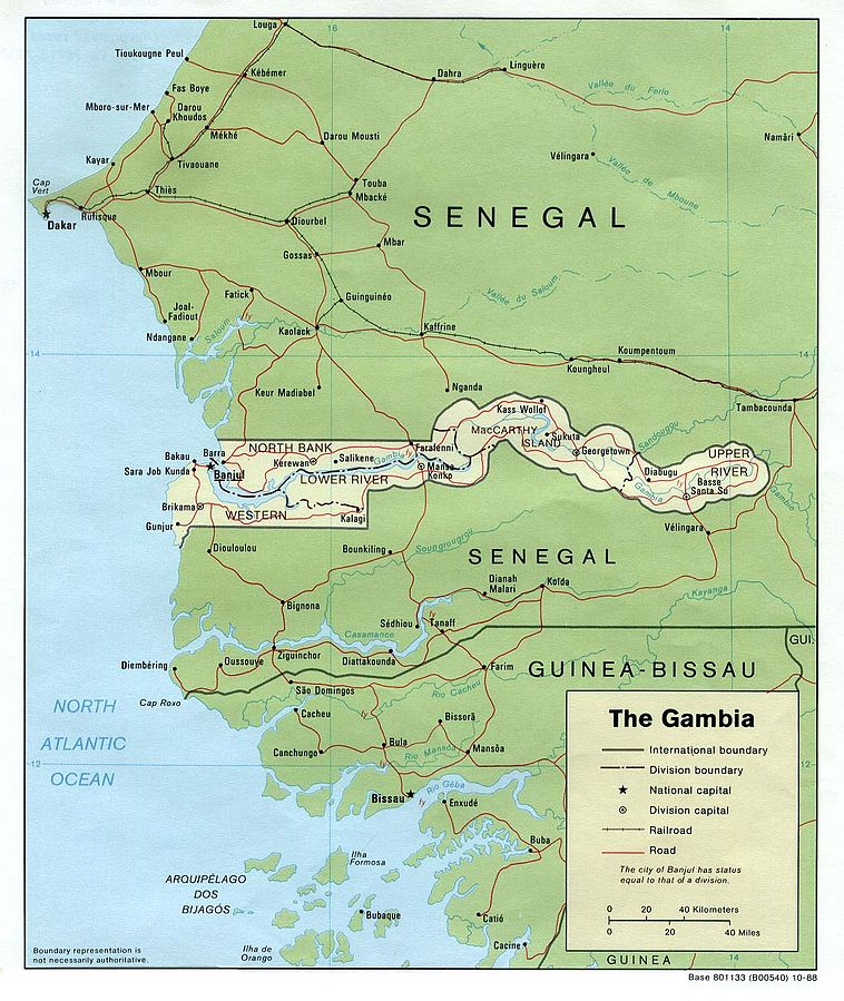
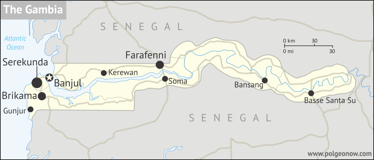
Map of the Gambia: towns, roads, borders, and rivers, with scale shown.
Map by Evan Centanni. Contact for usage rights.

Gambia Name Change Reversal

Last year we reported on how the Gambia, a tiny country located along the banks of a river in West Africa, had changed its official name at the UN. The country’s maverick dictator had decided in 2015 to switch from “Republic of The Gambia” to “Islamic Republic of The Gambia”.

Learn More: The Gambia’s 2015-2016 Name Change

Then, this January, the country’s longtime president stepped down. He had unexpectedly conceded defeat in a late-2016 election, though in the end it still took the threat of an invasion by neighboring countries to force him out. Within 10 days, the new president had already declared a reversal of the name change.
Flag of the Gambia Country Short Name:  
• The Gambia
Official Name:  
• Republic of the Gambia
Capital: Banjul

Name Change Registered with UN and ISO

Since most of the world’s countries, including the Gambia, are part of the United Nations (UN), it’s expected that if a country’s name changes, the change will be filed with the administrative offices of the UN. This lets world organizations and other countries know they should start using the new name.

Unlike the Gambia’s first name change, which was declared in 2015 but not formally registered until months into 2016, this year’s reversal all happened pretty fast. About a month and a half after the president’s announcement about the rollback, the change was already being distributed to users of ISO 3166, the international standard list of countries and country codes used by organizations and companies all around the world.

That meant the name had already been changed in the UN’s official name database too – ISO bases its country names on official UN usage – though PolGeoNow hasn’t been able to determine exactly when the UN change was made.

Name Changed in Other Languages

Unlike some countries that have only changed their name for foreign language speakers, English is actually the official language of the Gambia. The UN, on the other hand, has six official languages, so the name change reversal also took effect in each of those:

Language Before After
English the Islamic Republic of the Gambia the Republic of the Gambia
French la République islamique de Gambie la République de Gambie
Spanish la República Islámica de Gambia la República de Gambia
Russian Исламская Республика Гамбия Республика Гамбия
Chinese 冈比亚伊斯兰共和国 冈比亚共和国
Arabic  جمهورية غامبيا الإسلامية جمهورية غامبيا

Islam in the Gambia

Even though the country’s earlier name change made it sound like the Islamic religion would be playing a larger role in the government, that didn’t ever really happen. Ninety percent of Gambians are Muslims, and there’s not complete separation between church and state in the country, but the Gambian constitution does protect freedom of religion. In the year and a half since the country was first declared an “Islamic republic” and when the name was changed back, there wasn’t much indication that anything had actually changed.

How Often Do Countries Change Their Names?

Out of the world’s nearly 200 countries, there’s an average of about one official country name change each year, most of them involving adjustments to the country’s full name or preferred English name. The Gambia is the first UN-recognized country to change its name in 2017, while 2016 also saw a slightly different kind of name change for the Czech Republic. (Editor’s Note: As we reported later, the unrecognized, self-proclaimed Nagorno-Karabakh Republic also changed its name, in February 2017.)

Before the Gambia’s original “Islamic Republic” announcement in 2015, no countries had changed their names since Cape Verde in 2013. That African island country changed its preferred English name at the UN to Cabo Verde, the same as its native Portuguese-language name; the same year, war-torn Libya had clarified its new long-form name as “State of Libya”. The year before, Somalia’s 2012 constitution changed the country’s full name to the Federal Republic of Somalia, and a new Hungarian constitution traded “Republic of Hungary” for just “Hungary”.

More substantial changes to countries’ names, not just involving translation decisions or adjustments to full names, are much less common. The best recent examples are Yugoslavia’s name change to “Serbia and Montenegro” in 2003, Western Samoa’s change to just “Samoa” in 1997, and Zaire’s reversion to its previous name of “Democratic Republic of the Congo”, also in 1997.

Click here to see all articles on country name changes!

Graphic of the flag of the Gambia is in the public domain (source).
Libya Control Map & Timeline – April 2017 (Subscription)

SUBSCRIBERS CLICK HERE TO PROCEED TO ARTICLE AND MAP

There are newer versions of this map available. To see them, view all Libya updates.

Research by Djordje Djukic, with Evan Centanni. Map by onestopmap.com and Evan Centanni.

Subscribe for full access to all conflict map reports!

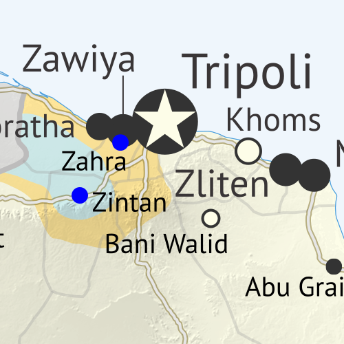
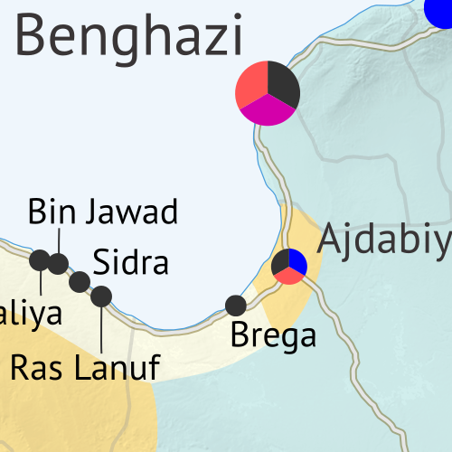
Libya control map: Shows detailed territorial control in Libya's civil war as of April 2017, including all major parties (Government of National Accord (GNA); Tobruk House of Representatives, General Haftar's Libyan National Army (LNA), Zintan militias, Petroleum Facilities Guard (PFG); Tripoli GNC government, Libya Dawn, and Libya Shield Force; Shura Council of Benghazi Revolutionaries and other hardline Islamist groups; and National Salvation Government). Now includes terrain and major roads. Colorblind accessible. After driving so-called “Islamic State” (ISIS/ISIL) fighters out of their last stronghold in Libya, clashes have gradually increased between the country’s two rival governments, even as the eastern government has continued its unilateral campaign against religious hardliners, and a new “neutral” military force has emerged with ties to the ousted leader of the previous western government.
 
See all this and more on the latest update to PolGeoNow’s concise, professional Libyan Civil War control map, which comes with a timeline of changes since our December 2016 Libya map report.

This map and report are premium content available to paid subscribers of the PolGeoNow Conflict Mapping Service.

Want to see before you subscribe? Check out our most recent FREE SAMPLE Libya map!

Exclusive report includes:

  • Up-to-date map of current territorial control in Libya, color-coded for the UN-backed Government of National Accord (GNA), the rival Tobruk parliament and Khalifa Haftar’s Libyan National Army (LNA), religious hardline groups, and other actors such as the Toubou people of the southern desert.
  • Detailed indication of city-by-city control, including key towns and other locations important to current events.
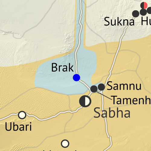
  • Locations of recent fighting and military operations, including Benghazi, Sidra oil port, the Brak and Tamenhint airbases, and more.
  • Detailed timeline of important events and changes to territorial control since December 6, 2016, with all sources cited.

SUBSCRIBERS CLICK HERE TO PROCEED TO ARTICLE AND MAP

Not signed up yet? Click here to learn more about our professional subscription service!

Can I purchase just this map?
This map and report are not available for automated purchase to non-subscribers. If you need access or republication rights for only this map report, contact service@polgeonow.com for options.

Morocco Joins African Union; CAR Un-suspended (Map)

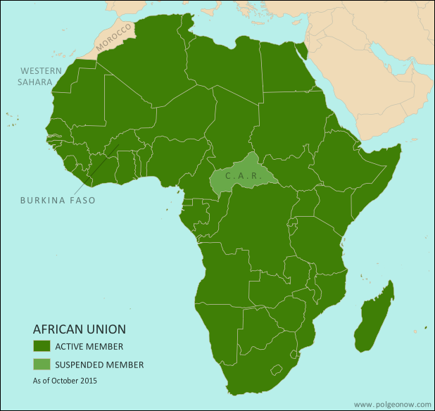
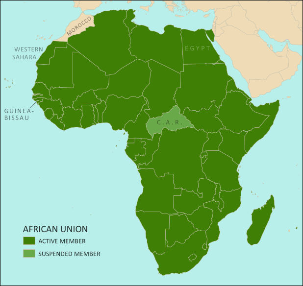
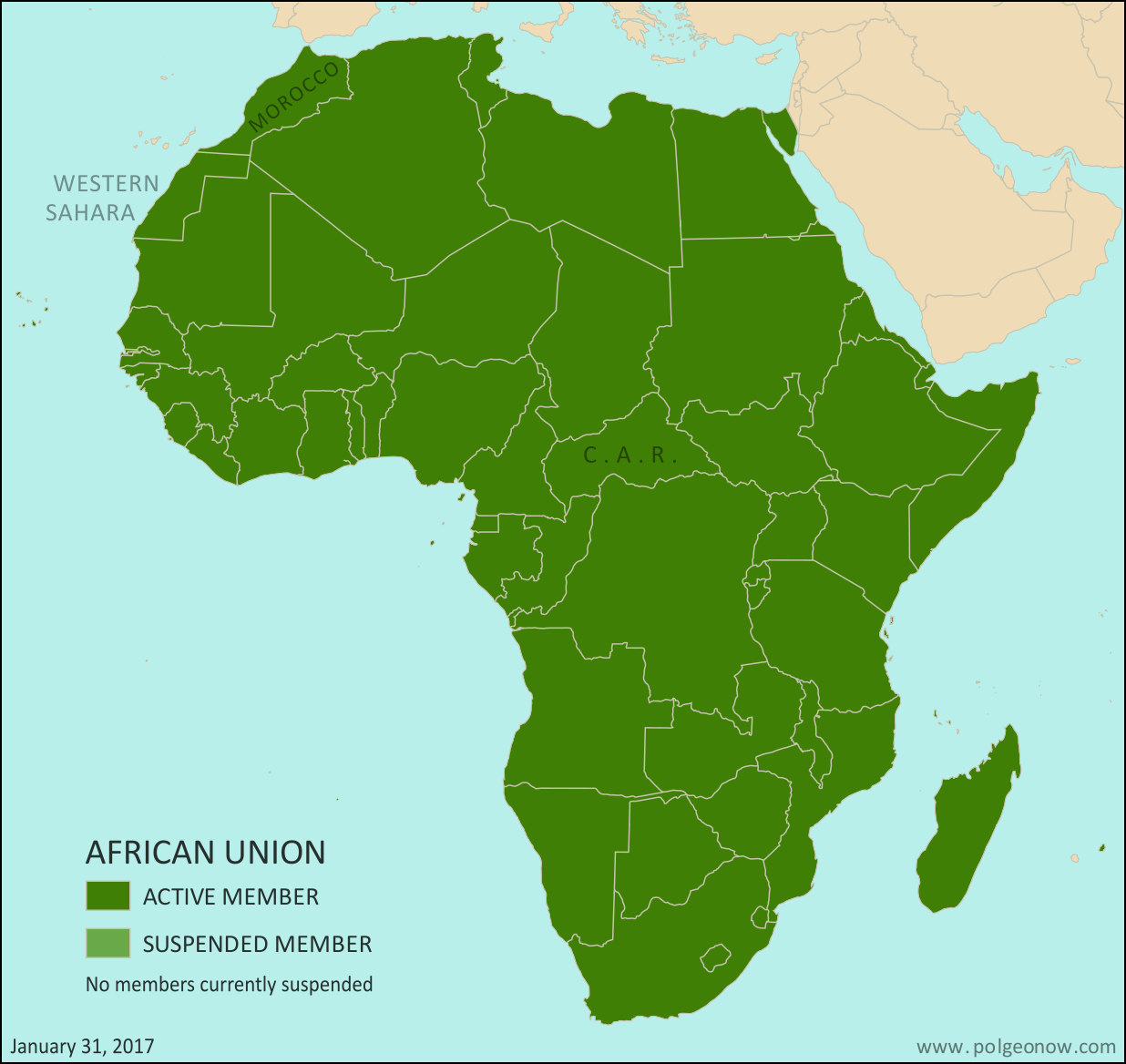
African Union: Map of Africa showing which countries are in the African Union, including active and suspended member countries, updated for the January 2017 admission of Morocco as a member, as well as the April 2016 lifting of the Central African Republic's (CAR) suspension (colorblind accessible).
Map by Evan Centanni, from this blank map by Eric Gaba. License: CC BY-SA

(Subscribers click here to view this article in the members area.)

Article by Evan Centanni

Morocco Rejoins AU after Long Absence

The North African country of Morocco became the 55th member of the African Union (AU) this week, after member countries voted to let it back into the organization after 33 years on its own. Morocco withdrew from the Organisation for African Unity (OAU), an earlier version of the AU, in 1984. The AU now includes every independent country in Africa, not counting the unrecognized breakaway state of Somaliland. The last country to join was South Sudan, which became a member three weeks after declaring independence in July 2011.

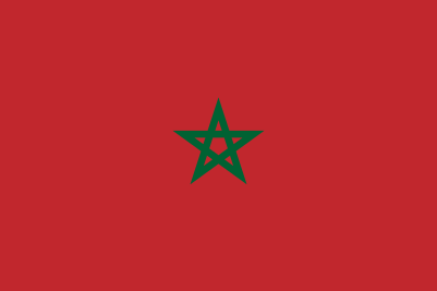
Moroccan flagCountry Name:  
• Morocco (English)
• al-Maghrib (Arabic)
• Lmaɣrib (Berber)
Official Name:  
• Kingdom of Morocco (English)
• al-Mamlakah al-Maghribiyah (Arabic)
• Tageldit n Lmaɣrib (Berber)
Capital: Rabat

Why Morocco Withdrew from the African Union

Morocco’s hasty departure from the OAU three decades ago was a protest move, after the organization voted to let disputed Western Sahara become a member. Western Sahara is mostly controlled by Morocco, which absorbed it into the Moroccan kingdom after Spanish colonial forces withdrew in the 1970s.

But Morocco’s move was controversial, and the international community has never fully accepted it. Meanwhile, the local Polisario Front has considered Western Sahara an independent country since 1976 (formally known as the Sahrawi Arab Democratic Republic, or SADR).

Bringing Morocco Back Into the Fold

Reports suggest Morocco may hope that being part of the AU will help it end the SADR’s independence claims. Meanwhile the Polisario government, which represents Western Sahara in the AU, hopes for the opposite, arguing that membership in the organization will limit Morocco’s ability to play by its own rules.

A total of nine AU member countries, including South Africa, voted against Morocco’s readmission. Zimbabwe, Namibia, Mozambique, Botswana, and Algeria were also reportedly among the dissenters. Africans sometimes see Moroccan control of Western Sahara as a kind of continued colonialism, and several of the opposing countries are ones where freedom from European-imposed power systems didn’t come easily. A total of 39 countries voted in favor of letting Morocco back in, but with the understanding that Western Sahara would also remain a member.

(Editor’s note: The African Union has 54 members, not counting Morocco; our understanding is that six of them abstained from voting on the decision, or were absent.)

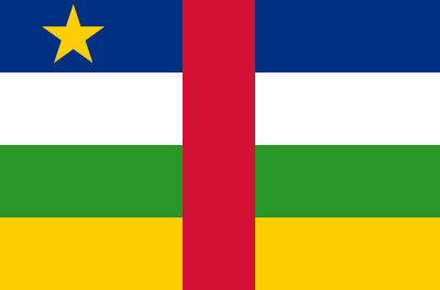
Flag of the Central African RepublicCountry Name:  
• Central African Republic (English)
• Centrafrique (French)
• Bêafrîka (Sango)
Official Name:  
• Central African Republic (English)
• République centrafricaine (French)
• Ködörösêse tî Bêafrîka (Sango)
Capital: Bangui

Central African Republic Suspension Lifted

Another change to the African Union map came in April 2016, when the Central African Republic (CAR) was reinstated as an active member of the organization after a three-year suspension. The CAR was suspended in 2013 after a rebel takeover of its capital, followed by the installation of a weak compromise government.

Though chaos and violence still continues in the country, the AU cited “the successful completion of the transition process and the restoration of normal constitutional order” when re-activating the country’s membership last year, referring to a new presidential election conducted in February. African Union rules don’t require countries to be democratic, but any unconstitutional change of government results in a quick suspension.

Haiti: The Country That DIDN’T Join the AU

In May of last year, news spread that the Caribbean island country of Haiti was about to join the African Union as a full member. Haiti has close cultural ties to Africa, since most of its population is descended from West Africans brought to the Caribbean as slaves. As the second country in the Americas to win independence, soon after the United States, it’s sometimes seen as a symbol of African liberation from colonialism.

By last year, the country already had an observer seat at the AU, but would have been the first member country without any territory on the African continent. Only one problem: Despite making its way into major, reputable news outlets, the story turned out to be untrue. Within days, the African Union issued a statement confirming that the reports were false, and that Haiti was not on track to ever become an AU member. The press release clarified that according to the organization’s founding rules, “only African States can join the African Union“. 

Graphics of the Moroccan flag and the Central African flag are in the public domain.

Map: Which Countries are in the African Union?

This map and explainer will be updated whenever there’s a change in AU membership, including suspensions and reinstatements. News about each change will be published in separate articles, which you can find listed below, or by viewing all African Union content on PolGeoNow.

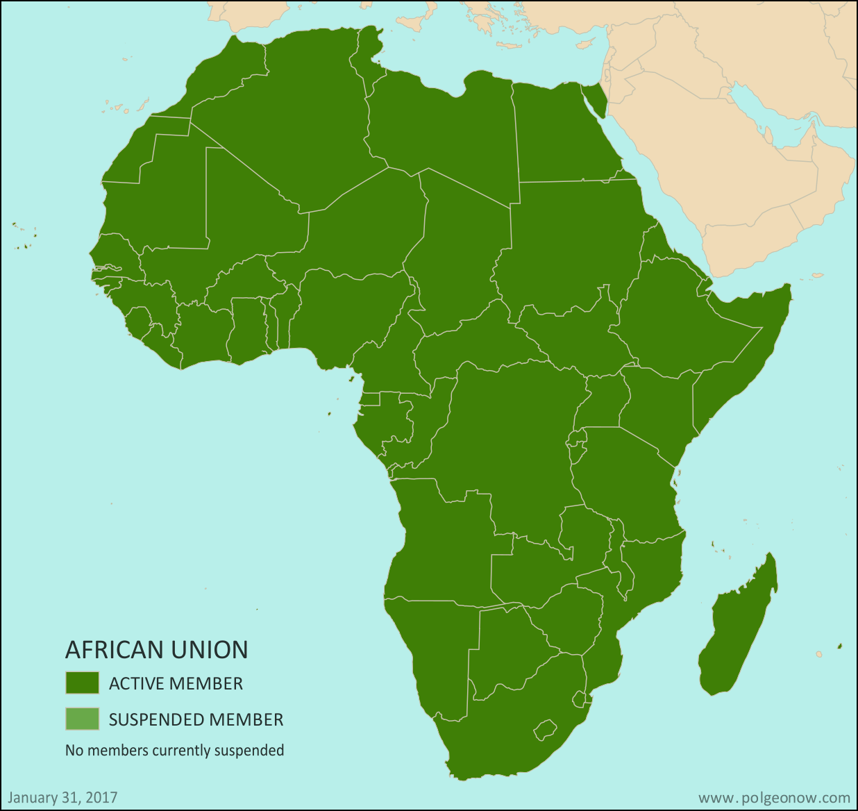
African Union members map: Map of Africa, showing which countries are in the African Union (AU) (colorblind accessible).
Map by Evan Centanni, from this blank map by Eric Gaba. License: CC BY-SA

(Subscribers click here to view this article in the members area.)

Article by Evan Centanni

What is the African Union?

Formed launched in 2002 as a replacement for the earlier Organization of African Unity (OAU), the AU is an intergovernmental organization that works on increasing cooperation, stability, and development within the continent of Africa. The organization is headquartered in Addis Ababa, Ethiopia. (Ethiopia is the only African country that the European empires never colonized, and is also the second most populous country in Africa.)

Flag of the African Union (AU)Organization Name:  
• African Union (English)
• al-Āthḥād al-’Āfrīqī (Arabic)
• Union africaine (French)
• União Africana (Portuguese)
• Unión Africana (Spanish)
• Umoja wa Afrika (Swahili)
Launched: 2002 in Durban, South Africa
Headquarters: Addis Ababa, Ethiopia
Website: www.au.int

Compared to the neighboring European Union (EU), the AU is only a loose forum for cooperation between its member countries. AU members do not have an integrated economic system, union-wide laws, or shared foreign policy, though further integration is a goal for the future.

After the readmission of Morocco, the African Union now includes every UN-recognized country in Africa. The parts of Africa not represented in the AU are a few groups of offshore islands controlled by European countries, as well the small Spanish enclaves in North Africa. The breakaway Republic of Somaliland is not a member, but is considered by the AU to be part of member-state Somalia.

Changes to African Union Membership

Political Geography Now has reported on all changes to the African Union members map, including suspensions and reinstatements, since 2013. The news articles for each of these changes, with maps pointing out the countries involved, are listed here:

Map of Africa showing active and suspended members of the African Union (AU). Updated for the January 2017 admission of Morocco and the April 2016 lifting of the Central African Republic's suspension (colorblind accessible).Morocco Joins African Union; CAR Un-suspended (Map)
The North African kingdom of Morocco joined the AU in January 2017, 33 years after withdrawing from an earlier version of the organization. The Central African Republic’s suspension was lifted in April 2016.

Full map and article

Map of Africa showing active and suspended members of the African Union (AU). Updated for the September 2015 suspension and reinstatement of Burkina Faso (colorblind accessible).African Union Suspends Burkina Faso, Then Reinstates it Again
In September 2015, the West African country of Burkina Faso was suspended from the AU after a military coup, but quickly reinstated to active membership when the coup leaders backed down.

Full map and article

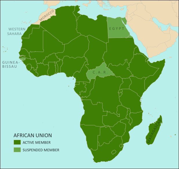
Map of Africa showing active and suspended members of the African Union (AU). Updated for the June 2014 reinstatement of suspended members Egypt and Guinea Bissau (colorblind accessible).African Union Reinstates Egypt and Guinea Bissau
North Africa’s Egypt and West Africa’s Guinea Bissau both had their AU suspensions lifted in June 2014, after each held new elections to replace a coup-installed government.

Full map and article

Map of Africa showing active and suspended members of the African Union (AU). Updated for the January 2014 reinstatement of suspended member Madagascar (colorblind accessible).Madagascar Un-suspended from African Union 
The African island country of Madagascar ended its five-year suspension from the AU in January 2014, after a coup-installed military government was replaced with a newly elected president.

Full map and article

Map of Africa showing active and suspended members of the African Union (AU). Updated for the July 2013 suspension of Egypt (colorblind accessible).Egypt Suspended from African Union 
The North African country of Egypt, one of Africa’s largest, was suspended from the AU in July 2013 after a military coup.

Full map and article

Low-resolution graphic of the African Union flag is displayed under fair use principles (source).

Libya’s “Islamic State” Loses Last City: Dec. 2016 Control Map & Timeline (Subscription)

SUBSCRIBERS CLICK HERE TO PROCEED TO ARTICLE AND MAP

There are newer versions of this map available. To see them, view all Libya updates.

Research by Djordje Djukic, with Evan Centanni. Map by onestopmap.com and Evan Centanni.

Subscribe for full access to all conflict map reports!

Libya control map: Shows detailed territorial control in Libya's civil war as of December 2016, including all major parties (Government of National Accord (GNA); Tobruk House of Representatives, General Haftar's Libyan National Army, Zintan militias, Petroleum Facilities Guard (PFG); Tripoli GNC government, Libya Dawn, and Libya Shield Force; Shura Council of Benghazi Revolutionaries and other hardline Islamist groups; and National Salvation Government). Also file under: Map of Islamic State (ISIS or ISIL) control in Libya. Now includes terrain and major roads. Colorblind accessible. In the past three months, a lot has changed in Libya, including the expulsion of the so-called “Islamic State” (ISIS/ISIL) from its last territory in North Africa. Meanwhile, Libya now has three competing governments, and key oil ports have changed hands.
 
See all this and more on the latest update to PolGeoNow’s concise, professional Libyan Civil War control map, which comes with a timeline of changes since our September 2016 Libya map report.

This map and report are premium content available to paid subscribers of the PolGeoNow Conflict Mapping Service.

Want to see before you subscribe? Check out our most recent FREE SAMPLE Libya map!

Exclusive report includes:

  • Up-to-date map of current territorial control in Libya, color-coded for the UN-backed Government of National Accord (GNA), the rival Tobruk parliament (supported by General Haftar’s Libyan National Army), religious hardline groups, and other actors such as the revived “National Salvation Government” and unaligned local councils.
  • Detailed indication of city-by-city control, including key towns and other locations important to current events.
  • Locations of recent fighting and military operations, including Sirte, Sidra, Ras Lanuf, Brega, and more.
  • Detailed timeline of important events and changes to territorial control since September 6, 2016, with all sources cited.
  • New since last year: Major roads are marked on the map for reference

SUBSCRIBERS CLICK HERE TO PROCEED TO ARTICLE AND MAP

Not signed up yet? Click here to learn more about our professional subscription service!

Can I purchase just this map?
This map and report are not available for automated purchase to non-subscribers. If you need access or republication rights for only this map report, contact service@polgeonow.com for options.

The Gambia’s Name Change

(Subscribers click here to view this article in the members area.)

US government map of the Gambia (source)

The Gambia Changes Official Name
If you read our review of world political geography changes in 2015, you might remember a brief note on the official name of the Gambia, a tiny country located along the banks of a river in West Africa. Last December, the Gambia’s maverick dictator decided to declare the country an “Islamic republic”, a designation that can have various meanings and is used by four other countries in the world.

At the time, at least one regional news source claimed that the country’s official name had indeed been changed from “Republic of The Gambia” to “Islamic Republic of The Gambia”. But for a country’s name to be formally changed, its government normally has to pass a law or at least issue some kind of proclamation, and at the time it wasn’t clear whether that had actually  happened.

Flag of the Gambia Country Name:  
• The Gambia
Official Name:  
• Islamic Republic of the Gambia
Capital: Banjul

New Name Registered with UN and ISO
Since most of the world’s countries, including the Gambia, are part of the United Nations (UN), it’s expected that if the country’s name changes, the change will be filed with the administrative offices of the UN so world organizations and other countries will know to start using the new one.

And earlier this year, that finally happened, with the UN updating its terminology database to show that the Gambia’s official long-form English name had been changed to “the Islamic Republic of the Gambia”.

This confirmed the name change, and soon led to the same modification being made to ISO 3166, the international standard list of countries and country codes that’s used by organizations and companies all around the world.

How Often Do Countries Change Their Names?
Out of the world’s nearly 200 countries, there’s an average of about one official country name change each year, most of them involving changes to the country’s full name or preferred English name. Besides the Gambia, no countries changed their names in 2014 or 2015, with the last country to do so being Cape Verde in late 2013. That African island country changed its preferred English name at the UN to Cabo Verde, the same as its native Portuguese-language name; the same year, war-torn Libya clarified its new long-form name as “State of Libya”. The year before, Somalia’s 2012 constitution changed the country’s full name to the Federal Republic of Somalia, and a new Hungarian constitution traded “Republic of Hungary” for just “Hungary”.

More substantial changes to countries’ names, involving more than just translation decisions or adjustments to full names, are much less common. The best recent examples are Yugoslavia’s name change to “Serbia and Montenegro” in 2003, Western Samoa’s change to just “Samoa” in 1997, and Zaire’s reversion to its previous name of “Democratic Republic of the Congo”, also in 1997.

Name Changed in Other Languages
Unlike some countries that have only changed their name for foreign language speakers, English is actually the official language of the Gambia. The UN, on the other hand, has six official languages, so the country’s new name also had to be translated and made official in each of those languages:

Language Before After
English the Republic of the Gambia the Islamic Republic of the Gambia
French la République de Gambie la République islamique de Gambie
Spanish la República de Gambia la República Islámica de Gambia
Russian Республика Гамбия Исламская Республика Гамбия
Chinese 冈比亚共和国 冈比亚伊斯兰共和国
Arabic جمهورية غامبيا جمهورية غامبيا الإسلامية

Islam in the Gambia
Although the country’s name change might seem to suggest that the Islamic religion will be playing a larger role in the government, this doesn’t seem to be the case. Ninety percent of Gambians are Muslims, and there is not complete separation between church and state. But the Gambian constitution does protect freedom of religion, and there’s little sign anything is changing in that area.

Graphic of the flag of the Gambia is in the public domain (source).
The Fall of Libya’s “Islamic State”: Sept. 2016 Control Map & Timeline (Subscription)

SUBSCRIBERS CLICK HERE TO PROCEED TO ARTICLE AND MAP

This is the second of a pair of Libya map reports, the first one chronicling the major political realignment that occurred in Libya between March and May of 2016. 

There are newer versions of this map available. To see them, view all Libya updates.

Research by Djordje Djukic. Map by onestopmap.com and Evan Centanni

Subscribe for full access to all conflict map reports!

Libya control map: Shows detailed territorial control in Libya's civil war as of September 2016, including all major parties (Government of National Accord (GNA), Tobruk House of Representatives, General Haftar's Libyan National Army, Zintan militias, Petroleum Facilities Guard (PFG); Tripoli GNC government, Libya Dawn, and Libya Shield Force; Shura Council of Benghazi Revolutionaries and other hardline Islamist groups; and the so-called Islamic State (ISIS/ISIL)). Also file under: Map of Islamic State (ISIS or ISIL) control in Libya. Now includes terrain and major roads. Color blind accessible. The past four months have seen a drastic reduction in “Islamic State” (ISIS/ISIL) control in Libya, with the group now barely holding any territory in the country. Meanwhile, the struggle continues between Libya’s two rival governments, as well as other religious hardline militias.
 
See all this and more on the latest update to PolGeoNow’s concise, professional Libyan Civil War control map, which comes with a timeline of changes since our May 2016 Libya map report.

This map and report are premium professional content, available to paid subscribers of the PolGeoNow Conflict Mapping Service.

Want to see before you subscribe? Check out our most recent FREE SAMPLE Libya map!

Exclusive report includes:

  • Up-to-date map of current territorial control in Libya, color-coded for the UN-backed Government of National Accord (GNA), the rival Tobruk parliament (supported by General Haftar’s Libyan National Army), “Islamic State” (ISIS/ISIL) fighters, and other religious hardline groups. 
  • Detailed indication of city-by-city control, including key towns and other locations important to current events.
  • Locations of recent fighting and military operations, including Sirte, Ajdabiya, Abu Grain, Bin Jawad, Harawa, and more.
  • Detailed timeline of important events and changes to territorial control since May 10, 2016, with all sources cited.
  • New since last year: Major roads are marked on the map for reference

SUBSCRIBERS CLICK HERE TO PROCEED TO ARTICLE AND MAP

Not signed up yet? Click here to learn more about our professional subscription service!

Can I purchase just this map?
This map and report are not available for automated purchase to non-subscribers. If you need access or republication rights for only this map report, contact service@polgeonow.com for options.

Libya’s Political Realignment: May 2016 Control Map & Timeline

This is the first of a pair of Libya map reports, with the second spotlighting the retreat of “Islamic State” forces from May to September. The second report, with a more up-to-date map, is available to members of our conflict map subscription service. 

There are newer versions of this map available. To see them, view all Libya updates.

Libya control map: Shows detailed territorial control in Libya's civil war as of May 2016, reflecting the political realignment after UN peace deal, including all major parties (Government of National Accord (GNA), Tobruk House of Representatives, General Haftar's Libyan National Army, Zintan militias, Petroleum Facilities Guard (PFG); Tripoli GNC government, Libya Dawn, and Libya Shield Force; Shura Council of Benghazi Revolutionaries and other hardline Islamist groups; and the so-called Islamic State (ISIS/ISIL)). Also file under: Map of Islamic State (ISIS or ISIL) control in Libya. Now includes terrain and major roads. Color blind accessible.
Base map by Koen Adams of onestopmap.com, with territorial control by Evan Centanni. All rights reserved.

(Subscribers click here to view this article in the member area)

Timeline by Djordje Djukic, with additional reporting by Evan Centanni

Drastic Political Shift
Starting soon after our last Libya control map report in March, the structure of Libya’s divided control and rival governments underwent a massive realignment, with international recognition essentially switching from one side of the country to the other, and some key fighting forces switching sides as well.

Last year, the country was already divided between two rival governments, the controversial General National Congress (GNC) in the capital city of Tripoli and the more internationally-recognized House of Representatives in the eastern city of Tobruk (with forces of the so-called “Islamic State”, formerly ISIS/ISIL, holding territory in between).

In an effort to unite the two governments, a UN-backed peace deal created a new “Government of National Accord” (GNA), which last March dramatically sailed into Tripoli from Tunisia to take over the reigns. Within a few weeks, the old GNC government had yielded to GNA authority, and most of the GNC-associated Libya Dawn militias agreed to support the new government too (at least for the time being). However, the GNA failed to secure an endorsement from the legislature in Tobruk, limiting the new government’s power in the east to support from the maverick Petroleum Facilities Guard (PFG) along the central coast.

The result is that most international recognition has shifted to the new Tripoli government, whose military is largely made up of the same forces that were loyal to the controversial GNC, while Tobruk’s formerly recognized government and army are now the defiant rivals.

For the full history of the current civil war since the fall of dictator Muammar Gaddafi in 2011, including the origins of the country’s competing governments, see our detailed Libya background article and timeline from August 2015.

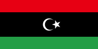
Flag of Libya (2011-present)Country Name:  
• Libya (English)
• Lībyā (Arabic)
Official Name:  
• State of Libya (English)
Dawlat Lībyā (Arabic) 
Capital: Tripoli

Timeline of Events
The following is a detailed timeline of major political events and changes to territorial control since our previous Libya control map of March 2016.

March 16-17, 2016
The European Union agreed on sanctions against three Libyan officials – including the president of the Tripoli-based General National Congress (GNC) – who were opposed to the new UN-backed unity government, the Government of National Accord (GNA). The designated prime minister of the GNA said he expected to move to Tripoli from the neighboring country of Tunisia within days.

March 31, 2016
The dissolution of the GNC government started, with its officials, under pressure from former allies, leaving Tripoli and going back to their home cities. Members of the Presidential Council of the GNA sailed into Tripoli the same day. Subsequently, 10 cities formerly under the control of the GNC pledged their support for the GNA. Following this, GNA support continued to spread further in the west and south of the country, while in the east support for the GNA remained uncertain.

However, the Petroleum Facilities Guard (PFG) under Ibrahim Jathran, in control of eastern oil ports including Sidra, Ras Lanuf, and Brega, did pledge its allegiance to the GNA.

April 5-6, 2016
The GNC-affiliated “National Salvation Government” in Tripoli disbanded and ceded authority to the Presidential Council. The next day, the State Supreme Council elected its president and first deputy. By this time, GNA Prime Minister Fayez al-Serraj was in control of Libya’s central bank and national oil company as well.

Read More: Foreign Policy magazine tells the story of the GNA’s whirlwind rise to power

April 17-19, 2016
The Tobruk-loyal “Libyan National Army” (LNA) organization captured the University of Benghazi, the Al-Hawari cement factory and two nearby cemeteries from religious hardline militias in Benghazi, as well as the Al-Quwarsha area of Benghazi’s district.

April 20, 2016
Forces of the so-called “Islamic State” (IS, formerly ISIS/ISIL) withdrew from positions on the outskirts of Derna, cementing the control of the Mujahideen Shura Council (MSC), a rival religious hardline group, over the town. The LNA also claimed to have taken control of IS’s abandoned positions.

Map of the territorial control (Assad government, Islamic State/ISIS/ISIL, rebel, SDF, and Kurdish) in the Syrian Civil War as of April 2016
Map of IS Control in Syria, April 2016
(click for free article and map)

April 27, 2016
IS ambushed a convoy reportedly consisting of GNA fighters and British and Italian soldiers. The attack reportedly left some Italian marines dead or wounded.

April 29, 2016
As of the end of April, the Tobruk-based House of Representatives, the previous internationally-recognised Libyan parliament, had not yet given its support to the new GNA government in Tripoli. Major sticking points were Tripoli’s disdain for LNA star general Khalifa Haftar, as well as a procedural requirement for the GNA government to present itself in person before the House (meanwhile, GNA leaders were still holed up in an old navy base in Tripoli despite the proclaimed support of many militias in the city).

Also by late April, the GNA had gained the loyalty of several important government ministries.

May 5, 2016
As GNA forces were preparing an offensive to recapture Sirte from IS forces, IS launched a pre-emptive attack. In the offensive, IS claimed to have captured several villages, including Abu Grain, Baghla, and Abu Najaym.

May 10, 2016
A military faction in the eastern city of Ajdabiya declared that it did not support the Tobruk-based LNA.

Timeline continued in subscriber article:
The Fall of Libya’s “Islamic State”: Sept. 2016 Control Map & Timeline

Graphic of the Libyan flag is in the public domain (source).
Map: Liberia and Afghanistan Join WTO

(Subscribers click here to view this article in the members area.)

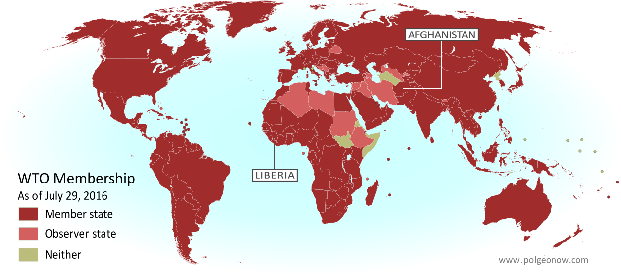
Map of World Trade Organization (WTO) member and observer countries, updated for August 2016 to include new members Liberia and Afghanistan (labeled). Color blind accessible.
Map by Evan Centanni, from public domain blank map.

Additional reporting by Caleb Centanni

Two New WTO Member Countries

This month two more countries are joining the World Trade Organization (WTO), a global body founded in 1995 to promote the management and expansion of international trade. Liberia officially became the WTO’s 163rd member on July 14, and Afghanistan joins the list as member number 164 on July 29. The last new member to join the WTO was Kazakhstan in November of last year.

Joining the WTO requires a country to sign onto a set of free trade treaties managed by the organization, and to change its laws to follow the WTO’s rules for free market trade. In return, each member country gets access to cheaper trade with all the other members, who aren’t allowed to play favorites when deciding whose imports to tax or not tax.

Logo of the World Trade Organization (WTO) Organization Name:  
• World Trade Organization (English)
• Organisation mondiale du commerce (French)
• Organización Mundial del Comercio (Spanish)
Founded: 1994 in Marrakech, Morocco (commenced in 1995)
Headquarters: Geneva, Switzerland
Website: www.wto.org

A diverse West African nation, Liberia declared independence in 1847, making it the oldest continuously independent country in Africa today. Liberia’s admission to the WTO comes after almost 10 years of negotiation, getting official approval to join in December 2015 and submitting its ratified acceptance of membership on June 14 of this year.

Afghanistan, located along the ancient Silk Road on the border of South and Central Asia, is about the 40th largest country in the world by both area and population. Afghanistan was also approved for membership last December, and submitted its ratified membership acceptance on June 29, after 11 years of negotiations.

How Many Countries are in the WTO?

Of the 195 UN-recognized countries in the world, 160 (82%) are members of the WTO. Another four members are not UN-recognized nations: China’s self-governed territories of Hong Kong and Macau, the European Union, and the disputed state of Taiwan, which participates under the name “Separate Customs Territory of Taiwan, Penghu, Kinmen and Matsu (Chinese Taipei)”.

There are also 20 WTO “observers”, down from 22 now that Liberia and Afghanistan have become full members. These countries are partially included in the organization, and have all applied for full membership (except the Holy See administration of Vatican City, which doesn’t plan to). There are only 15 UN-recognized countries that are neither members nor observers of the WTO.

Two countries, East Timor and Somalia, submitted membership applications last year, but don’t yet have WTO observer status.

More: View all articles on new WTO member countries since 2011

WTO logo is displayed without permission, based on fair use principles (source).

Libya Control Map & Report: March 2016 (Subscription)

MEMBERS CLICK HERE TO PROCEED TO ARTICLE AND MAP

There are newer versions of this map available. To see them, view all Libya updates.

Map by onestopmap.com and Evan Centanni

Subscribe for full access to all conflict map reports!

New: No Paypal account required! Just click “Pay using your credit or debit card.”

Download PDF:
Buy now

Libya control map: Shows detailed territorial control in Libya's civil war as of March 2016, including all major parties (Tobruk government, General Haftar's Operation Dignity forces, and Zintan militias; Tripoli GNC government, Libya Dawn, and Libya Shield Force; Shura Council of Benghazi Revolutionaries and other hardline Islamist groups; and the so-called Islamic State (ISIS/ISIL)). Also file under: Map of Islamic State (ISIS) control in Libya. Now includes terrain and major roads. Color blind accessible. Despite hopes that a UN-backed unity deal might bring Libya’s two rival governments back together, fighting in continues against the so-called “Islamic State” (ISIS/ISIL) and other religious hardline groups. Though most of the major cities have stayed in the same hands since last summer, there have still been several important changes to territorial control.
 
See all this and more on the latest update to PolGeoNow’s concise, professional Libyan Civil War control map, which comes with a timeline of changes since our previous Libya map report last August.

This map and report are professional subscriber content, available to paid members or for separate purchase. Download PDF (US$9.99)

Want to see before you buy? Check out our most recent FREE SAMPLE Libya map!

Exclusive Libya map report includes:

Libya control map: Shows detailed territorial control in Libya's civil war as of February 2016, including all major parties (Tobruk government, General Haftar's Operation Dignity forces, and Zintan militias; Tripoli GNC government, Libya Dawn, and Libya Shield Force; Shura Council of Benghazi Revolutionaries and other hardline Islamist groups; and the so-called Islamic State (ISIS/ISIL)). Also file under: Map of Islamic State (ISIS) control in Libya. Now includes terrain and major roads. Color blind accessible.
  • Up-to-date map of current territorial control in Libya, color-coded for the internationally-recognized Tobruk government (supported by General Haftar’s Operation Dignity), the rival Tripoli-based GNC government (supported by the Libya Dawn militias), “Islamic State” (ISIS/ISIL) extremists, and other religious hardline groups. 
  • Detailed indication of city-by-city control, highlighting key towns and other locations important to current events.
  • Locations of recent fighting and military operations, including Benghazi, Ajdabiya, Janzur, Bin Jawad, and more.
  • Detailed timeline of important events and changes to territorial control since August 21, 2015, with all sources cited.
  • New in this edition: Major roads are marked on the map for reference

MEMBERS CLICK HERE TO PROCEED TO ARTICLE AND MAP

Not a member yet? Click here to learn more about our professional subscription service!